Meet Manuel Mendoza Hurtado, a visiting PhD Researcher from University of Cordoba

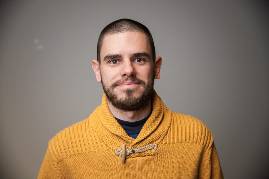
We are excited to introduce Manuel Mendoza Hurtado, a PhD Researcher from the University of Cordoba. Manuel visits the Digital Geography Lab this spring to collaborate with Academy Researcher Olle Järv on the BORDERSPACE project. Check out our mini-interview with Manuel to learn more.

A profile photo of Manuel Mendoza Hurtado
Photo by Susan Heikkinen


Who are you and what is your role at your home university?

I am Manuel Mendoza Hurtado, a PhD Researcher in the Computational Intelligence and Bioinformatics research group at the Department of Computer Science and Numerical Analysis, University of Cordoba, Spain. I am currently on my last PhD year. I got my Master’s degree in Telematics and Telecommunication networks from the University of Malaga. It was very interesting to learn about mobile networks and telecommunications. My research interests are supervised learning, multi-label classification and dealing with imbalance problems. Currently, I am focused on mobility patterns identification with the use of mobile devices using a machine learning approach as part of my PhD.

Please briefly introduce your research topic.

My PhD thesis “Identification of mobility patterns using advanced artificial intelligence techniques applied to mobile phone data” studies different approaches to identify home and work locations for the users and how could we make use of their mobility patterns to improve public transport planning. I have been working with a multi-source dataset from the city of Milan, with Call Detail Records using classification algorithms to detect home and work locations. Continue reading “Meet Manuel Mendoza Hurtado, a visiting PhD Researcher from University of Cordoba”

Big data, big changes: Project MOBICON in the Canary Islands for a workshop and presentations

The Canary Islands are a biodiversity, geodiversity and tourism hotspot, boasting one of the most visited national parks in Europe (Teide in Tenerife). Tourism is the backbone of the local economy, but the growing masses of visitors put an unsustainable strain on the islands’ beautiful nature.

A collage of six photos: three of them of workshops and lecture halls, three from nature.

The islands are also acutely impacted by climate change and other megatrends including aging of population in Europe or digitalisation changing work life. On top of the traditional tourists, the islands are now receiving masses of long-term visitors seeking warm wintering grounds on the islands.  

These factors make the Canary Islands an interesting study area for the MOBICON project, where we study changes in nature visitation and their impacts on biodiversity conservation as well as the applicability of mobile big data sources for extracting visitor information.  

We (team Mobicon: Aina, Matti, Tatu and Tuuli) visited the islands of Gran Canaria and Tenerife in March 2024 for establishing collaboration with local universities and to collect research data through stakeholder discussions. Some highlights of the trip below.

Continue reading “Big data, big changes: Project MOBICON in the Canary Islands for a workshop and presentations”

Changes in nature visitation and the potential of mobile big data for visitor monitoring – Report from an expert workshop out now!

Aina Brias Guinart introducing a workshop task to the participants.

The importance of natural areas for recreation and conservation alike is critical, yet we often don’t know how many people visit them and why. Such information is necessary for the management and development of natural areas, which is why research by our lab and others have considered mobile big data sources (think data from mobile phones, social media etc.) as a way to monitor outdoor recreation. Yet, translating scientific research into actionable information for management is not straightforward – is it even wise? What kind of information do managers of natural areas need? What sort of changes do they managers see, how do these affect their information needs, and what sort of larger trends drive these changes? 

Researchers in project Mobicon called together experts from Finnish nature organizations to reflect on these questions in September 2023. The aim of the workshop was to collect expert opinions related to the changes in the recreational use of nature, the monitoring needs related to the changing visitations, and to discuss the possibilities of various new data sources to meet managerial information needs. 

This workshop was the first of a series repeated in March 2024 in the Canary Islands. We have now released a report on the outcome of the Helsinki workshop. Check it out! 

In English: https://doi.org/10.31885/2024.030501 

Suomeksi: https://doi.org/10.31885/2024.030502 

If you wish to cite the reports, you may use:

Toivonen, T., Brias Guinart, A., Eklund, J., Hästbacka, M., Leppämäki, T. and Torkko, J. (2023). Potential of mobile big data for visitor monitoring: Report of the MOBICON workshop held in Helsinki 28.9.2023. Helsinki: Digital Geography Lab, University of Helsinki. doi:10.31885/2024.030501

– – – – –

The Digital Geography Lab is an interdisciplinary research team focusing on spatial Big Data analytics for fair and sustainable societies at the University of Helsinki.

Meet Xiao Cai, a visiting MSc student from University of Tartu

We are happy to introduce Xiao Cai, a geoinformatics MSc student from the University of Tartu. Xiao is visiting the Digital Geography Lab this spring, from February to May 2024, to study the influence of road environments on cyclists’ route choices in Helsinki and finalize his thesis. We had a mini-interview with Xiao to learn more about his previous and future research.

Xiao Cai presenting his research


Who are you, and what is your role at your home university? 

My name is Xiao Cai, with a mixed academic background of urban planning, geoinformatics, and artificial intelligence (AI). I am currently doing a master’s program in Geoinformatics at the University of Tartu and expect to graduate in June this year.

Please introduce your research topic.

I am a big fan of urban informatics with a dedicated focus on AI approaches to uncovering urban mobility mechanisms using emerging geospatial big data. I was exposed to AI methodologies in 2022 by taking a machine learning course, but since then I have been highly motivated to leverage this powerful technique in urban mobility analyses. Up to now, I produced two papers in this regard – the one is to mine the hidden spatiotemporal characteristics of bike-sharing travel patterns using the k-means++ clustering algorithm, and the other one is to examine the non-linear associations of built environments with demographic-specific bike-sharing usage using the gradient boosting decision tree algorithm. In the near future, I would like to explore more possibilities of using AI methodologies (machine learning or neural networks) to understand the hidden patterns of population dynamics and potential causes. I am also looking forward to exploring more big mobility data (e.g., mobile phone data, smartcard data, e-scooter data, taxi data, etc.) as I am always excited when working with data.

Continue reading “Meet Xiao Cai, a visiting MSc student from University of Tartu”

Meet Matti Hästbacka, a Doctoral Researcher in the MOBICON project

We are excited to introduce Matti Hästbacka! 🙂 Matti works as a Doctoral Researcher in the MOBICON project (Mobile Big Data for Understanding People in Nature). Check out our mini-interview with Matti to learn more about his research and interests.

Matti's profile photo


Who are you and what is your position at the University?

My name is Matti Hästbacka, and I’m a Doctoral Researcher in the MOBICON project (Mobile Big Data for Understanding People in Nature) at the Digital Geography Lab. In my thesis, I employ mobile big data and novel methods to understand the changing carbon footprint of nature-based tourism.

In what kind of positions have you worked prior to joining University?

I graduated with an MSc in Geography from the same department where I’m currently working. In my MSc studies, I majored in Geoinformatics, but I tried to make the most of academic freedom throughout my studies, and ended up studying a lot of different things, ranging from Natural Language Processing and statistics to Latin American studies. To me, the ability to study a wide variety of courses has been the best part of my studies so far. In my MSc thesis, I used Flickr data and spatial analysis coupled with computer vision methods to understand the importance of nature for tourists visiting the Canary Islands.

At the same time, I’ve been working in the Emergency Medical Services field as a planner.

Continue reading “Meet Matti Hästbacka, a Doctoral Researcher in the MOBICON project”

Meet Kofoworola Modupe Osunkoya, a visiting PhD Researcher from Tallinn University of Technology

We are excited to introduce Kofoworola Modupe Osunkoya, a visiting PhD Researcher from the Urban Spatial Analytics research group at Tallinn University of Technology (TalTech). Modupe is visiting us at the Digital Geography Lab from November 2023 to June 2024 to study urban vitality through social media activity. Check out our mini-interview with Modupe to learn more about her research and interests.

Kofoworola Modupe OsunkoyaWho are you, and what is your role at your home university?

I am Kofoworola Modupe Osunkoya, a PhD Researcher in the Future Smart City project, Urban Spatial Analytics research group at the Department of Architecture and Urban Studies, Tallinn University of Technology, Estonia. I am also an Urban Spatial Analyst with vast experience in planning, designing, and executing sustainable urban mobility.

I obtained two (2) Master’s degrees: Urbanism and Strategic Planning from Katholieke Universiteit Leuven (KU Leuven), Belgium, and Transportation Science from Hasselt University, Belgium. My current focus within the Future Smart City project revolves around exploring ‘smart’ urbanity, new mobility concepts, and the development of sustainable urban futures.

Specifically, my role in the project entails investigating “New Urban Design and Analysis Methods for Transforming Mobility and Urban Morphology.” My research interests lie at the intersection of New Urbanism, Transport Planning, and Urban Planning, where I am passionate about advancing innovative approaches to address contemporary urban challenges.

Please introduce your research topic.

My PhD thesis “Re-discovering Urban Vitality Measurement for Cities in Digital Transition” studies urban vitality in digitalizing cities, its tradition, current and potential measuring methods, and how (big) data can be applied to better recognize vital areas and support their emergence via urban planning and governance. I have combined multi-sourced data, such as mobile phone and traditional data (socio-economic, mixed-uses, population), to analyze the vital urban places and changes over time and space in Tallinn, Estonia.

Continue reading “Meet Kofoworola Modupe Osunkoya, a visiting PhD Researcher from Tallinn University of Technology”

Sharing our Lab Handbook

Research groups are the basic unit of research in many research fields in universities. At the University of Helsinki alone we have hundreds of research groups. Still, almost all groups invent their everyday practices from scratch.

A couple of weeks ago, we at Digital Geographic Lab organized again our yearly development day. There, we decided to share some of our practices publicly in the form of a lab handbook. So here comes:

Digital Geography Lab Handbook 2024 (note: updated 20.2.2024)

The practices have been developed over the years through suggestions of many past and present lab members.

We hope that sharing them will be useful to some other research labs/groups, or those just starting their own group ❤️

– – –

The Digital Geography Lab is an interdisciplinary research team focusing on spatial Big Data analytics for fair and sustainable societies at the University of Helsinki.


GREENTRAVEL project well represented at the People and Planet Conference in Lahti

After kicking off the GREENTRAVEL project (“Greener Urban Travel Environments for Everyone: From Measured Wellbeing Impacts to Big Data Analytics”) in 2023, the project team is in full speed with advancing various project activities and working towards attaining first project results. Some of these will be presented at the People and Planet – from Theory to Solutions Conference, which takes place on 13–15 February 2024 in Lahti, Finland. The GREENTRAVEL project team will participate at the conference in various ways.

🟡 Doctoral Researcher Robert Klein will be giving an oral presentation in the session “Transformation towards healthy and sustainable mobility” on Wed Feb 14, 13:00. In his study “Capturing seasonality in urban travel environment greenery throughout Europe”, he demonstrates how accounting for seasonal variation can influence which cities can be deemed more green or less green.

🟡 Technical expert Roope Heinonen will be presenting a poster on his recent advancements with the Green Paths 2.0 tool, which helps users to find healthier routes and displays environmental exposure along the way. The new version focuses on making the tool more widely applicable in different cities and for new kinds of exposure. The poster presentation takes place on Wed Feb 14, 14:20-15:20, and posters will be visible throughout the whole conference. See the poster below!

🟡 Postdoctoral Researcher Silviya Korpilo will be hosting a discussion session in a world café setting on Wed Feb 14, 16:30-17:15. There, all interested conference attendees can join in to get familiar with and discuss about ongoing research in the newly established Finnish Nature and Health Research Network (LuontoTerVe).

Continue reading “GREENTRAVEL project well represented at the People and Planet Conference in Lahti”

URBANAGE project closing

Authors: Tuuli Toivonen, Christoph Fink, Elias Willberg

For the past 2.5 years, the Digital Geography Lab has participated in the international H2020 consortium URBANAGE that is coming to its end now in January 2024.

Europe’s rapidly aging population and the rise of disruptive technology in urban planning were at the pivot point of the URBANAGE project. Urban planning needs to better take into account the needs of a growing older population, and advances in technologies make more evidence-based urban policy come into reach. The project focused on how Digital Urban Twin technology could be used to assist planning for age-friendly cities. It was carried out at three pilot sites across the European Union, namely the cities of Helsinki and Santander, and the region of Flanders. The main partners in Helsinki were Forum Virium Helsinki and the University of Helsinki. Postdoctoral researcher Christoph Fink has been our key researcher in the project, while Elias Willberg worked in more targeted tasks.

The project informed its research in a co-creation effort that aimed to learn from lived experience. Most relevantly, we inquired what factors are important for improving the accessibility and mobility of older adults in future cities. The project then developed a dashboard to collect spatial information on the age friendliness and to expand and advance the toolbox planners need for improved solutions, for example with accessibility or green comfort in mind.

The Digital Geography Lab contributed to the project in a variety of ways. Our biggest contribution was to explore the mobility environment of older people at the scale of urban areas. We employed both a conceptual and an analytical perspective, and critically examined the role of technology in doing so.

In one of our studies, we empirically examined the impact of winter conditions on older adults’ mobility landscapes. We produced valuable information for age-sensitive routing, and challenged the simplicity of the “15-minute city” concept, suggesting to better consider the varying realities of urban residents (Willberg, Fink & Toivonen, 2023).

Continue reading “URBANAGE project closing”

Meet Ashish Shete, a new Technical Assistant in the GREENTRAVEL project

We are happy to introduce Ashish Shete! 🙂 Ashish joined the Digital Geography Lab in December 2023 to work as a Technical Assistant in the GREENTRAVEL project. Check out our mini-interview with Ashish to learn more about him and his research.

Ashish in a snowy forest

Who are you, and what is your role at the University?

I am Ashish Shete, and I have recently relocated to Finland from Pune, India. Since mid-December 2023, I work as a Technical Assistant at the Digital Geography Lab, University of Helsinki. My current role involves contributing to the GREENTRAVEL project, which focuses on studying urban travel environments’ greenery from diverse perspectives. Specifically, my task is to design and develop the VR setup for this project. This setup will help creating controlled environment to analyse effects of green travel environments on people and the relevance of various greenery features, also considering the seasonal variations.

In what kind of positions have you worked prior to joining University?

I have over a decade of experience in Visualization and CAD software development. My expertise spans software development in domains such as shipping, oil-field exploration, and BIM. I have crafted immersive experiences like 3D visualizations, walk-throughs and animation while working in collaborative settings within both multinational corporations and startup environments. I hold a master’s degree in automotive engineering. Continue reading “Meet Ashish Shete, a new Technical Assistant in the GREENTRAVEL project”