
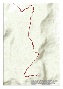
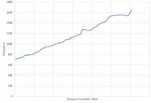
The fourth day was the most demanding but possibly also the most rewarding day so far. We hiked to the top of Mount Kasigau – it took 8 hours and we climbed approximately 900 meters to an altitude of 1600 m. The route itself was 12 km in total, although it did feel like a lot more.
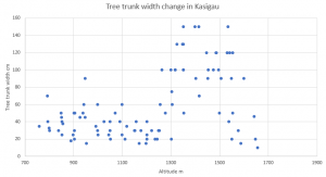
During the hike, we observed the changing environmental conditions and vegetation along the increasing altitude. The task of the day was to stop once every 50 m (in altitude) to map the vegetation type, soil moisture and human influence. From vegetation we estimated the height and diameter of the tallest tree, presence of Dracaena trees, succulent plants, ferns and epiphyte moss. Two groups also tested a hypsometer which is used to measure the height of a tree.
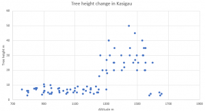
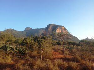
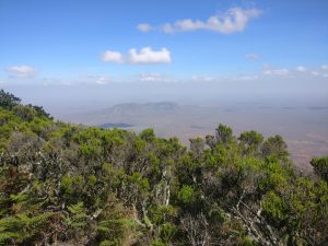
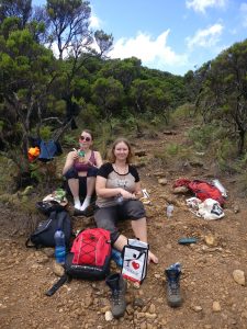
The changes in environmental conditions were clear when climbing to the top of Kasigau. At the bottom of the mountain, the vegetation was rather dry woodland with several trees scattered around. Quite soon the vegetation got drier and the trees scarcer. This is the beginning of the dry season, so the top soil was rather dry and there were no signs of fern, moss or Dracaena trees. However, succulent plants were quite common as they can manage in much drier conditions than the other plants that we observed. In about 1000 meters the vegetation quite suddenly changed to greener and denser and the trees got smaller and more bush-like. This type of vegetation continued up to the ridge which we reached in about 1300 meters. The beginning of the ridge also offered a good mid-way resting point and a chance to eat something.
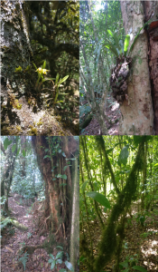
The narrow ridge continued south-west rising very slowly. Midway through the ridge the vegetation started to look more and more like a forest. The trees started getting taller with Dracaena trees in between. There was also a slow change towards cloud forest which is visible for example from epiphytic moss, taller trees and wider tree trunks. These started showing up at an altitude of 1200 meters. Ferns started showing up only quite high up, in about 1400 meters. The cloud forest continued until almost to the top where the vegetation got drier again. The trees became smaller and changed to conifers which surrounded our final stop and lunch place.
After a late lunch and well-earned rest, the only thing to do was return to the bus the same way as we came. This was at times challenging due to very steep and litter covered slopes but in 3 hours everyone had managed to get back to the bus and we returned back to the station enjoying the