
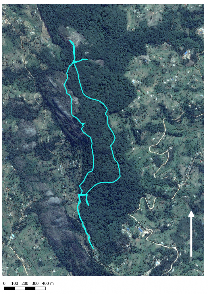
Today was the last of our three hiking/forest days and the location was none less than the famous Ngangao mist forest. Most of our university’s geography students may have heard at some gis-courses about the research done at Ngangao and possibly have seen aerial pictures taken by our university’s research groups. The forest is located about 10 km from Wundanyi and is one of the considerably well preserved indigenous forests in the area with about 124 hectars of indigenous forest (Pellikka 2009). After hearing so much about the area it was really interesting to actually experience and see it ourselves.
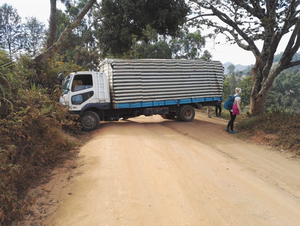
This time we didn’t have any spesific assignment for the trip and we focused just to enjoy the forest and the environment. We confronted minor setbacks on our way to the forest when a truck was stuck sideways on the way of our bus so we had to walk from a bit further away than planned. Also our course assistant Petra had to leave to the station early because of a foot injury. Other than those the trip was a success and because of the extra walk from the bus we actually got to see some monkeys hanging on the trees on the way. The terrain was also quite a lot easier than at Vuria or Kasigau and the weather in the shady rainforest was nice and cool so the day was really relaxing and a nice ending to our forest hikes in the area.
Of course we weren’t totally idle and we learned a lot about the species and the situation in the forest from our own professor of biology Jouko Rikkinen, stations research assistant Darius who knows everything about the local flora and also from the forest rangers who lead us around the forest. The chancellor of the university of Helsinki, Kaarle Hämeri, who joined our fellowship after the TAITAGIS kickoff, also shared some of his knowledge about the athmospherical phenomena.
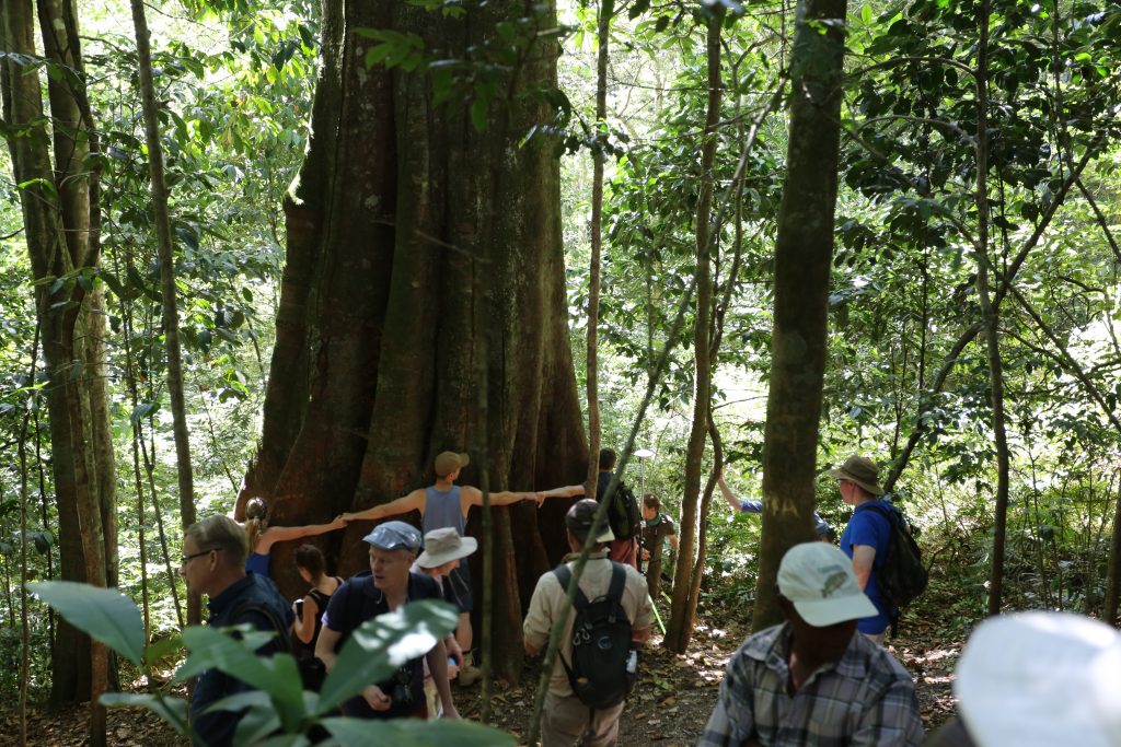
Our first stop was at the biggest and propably also oldest tree in the forest (in the picture) which was about 6 geographers and one geologist in diameter. Next we continued through the forest exploring also the exotic pine areas where the indigenous forest has been totally perished. Near the other end of the forest we had lunch at an open rock, again with a spectacular view with mount Kilimanjaro in the distance.
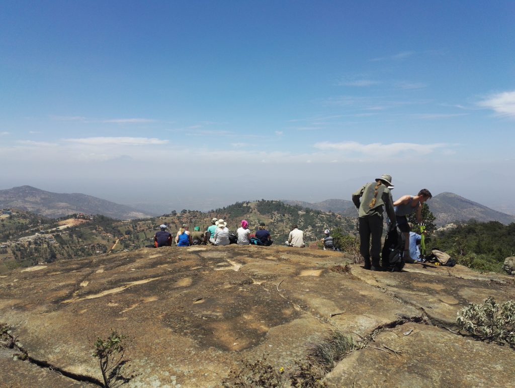
Kilimanjaro can be seen on the left (Photo: Niklas Sädekoski)
After lunch we went to check out some of our university’s research equipment in the forest (rainfall collectors, moss moisture collectors and iButton Hygrochron temperature and humidity loggers for example). From there on we walked back through the forest to the bus, occasionally stopping to wonder the great trees and plants in the forest. After we had been driving away from the forest for a while our research assistant Mwadime shouted to stop the bus and noted that ”We have left our chancellor behind!!”. Fortunately this was not the case, the chancellor apparently just had some extra energy left and had decided to run back to the station. When we arrived to the station, the chancellor was already waiting for us (to our defence, the mountain roads weren’t in very good condition!).
The rest of the day we spent relaxing in the station saunaing(??) and preparing for tomorrows safari trip!

-Niklas & Hanna
Sources:
Pellikka, Petri & Lötjönen, Milla & Siljander, Mika & Lens, Luc. (2009). Airborne remote sensing of spatiotemporal change (1955–2004) in indigenous and exotic forest cover in the Taita Hills, Kenya. International Journal of Applied Earth Observation and Geoinformation. 11. 221-232.