Place-based Knowledge: Perspectives from Literary and Cultural Studies, Keele University, 14 Feb

On Wednesday 14 February 2024 I virtually visited Keele University to present a paper on place-based knowledge from the perspective of literary and cultural studies.

The paper draws in part developed in The Narrative Turn in Urban Planning, in particular the section on narrative mapping and PPGIS, and Narrative in Urban Planning (with Jens Gurr and Martin Buchenau), in particular the section on polyphony.

Thanks for everyone at Keele for the lively discussion! Special thanks to Ceri Morgan, who has done brilliant work on (among other things) Montreal in literature, for inviting me!

Abstract below

Place-based Knowledge: Perspectives from Literary and Cultural Studies

Place-based information is of crucial importance for policymaking, urban planning, and regional management. With the increase of digitalized practices and geographic information systems, place-based information tends to be increasingly stored as quantitative data points on a digitized map. But how to move from place-based information to meaningful place-based knowledge? Knowledge that is qualitative rather than quantitative, relational and dynamic rather than individuated or static in meaning? In this paper, I argue that such a shift can be accommodated with the help of approaches from literary and cultural studies. Key concepts in this respect are metaphor, plot, and the idea of interrelational space. Central for a qualitative and humanities-informed approach to place-based knowledge is a view in which personal and communal experiences take shape not as easily quantifiable data points, but rather within a storified interaction of personal and communal trajectories, recognizable plotlines, and relationships between different locations (including imaginary, past or future locations).

Digital Cities and the Digital Humanities

In sunny Oslo for the first conference of the Digital Humanities in the Nordic Countries, with a wide range of approaches to the digitalising humanities. I’ll present today (15.3.) on narrative approaches to public participation geographic information systems (PPGIS) in urban planning, a paper co-authored with Maarita Kahila, Jenni Kuoppa, and Marketta Kyttä. One of the key arguments is that digital humanities should also comprise humanities approaches to the digitalising society, not only digital approaches to humanities sources. A second argument is that a more integrated and more narrative use of PPGIS could open up experiential knowledge – with considerable consequences for the legitimacy claims of current planning practices.

Very interested to see to what extent the digital humanities live up to (mixed) expectations. What to make of Franco Moretti’s statement that the “digital humanities” mean “nothing”? How to integrate a sense of closeness to “distant reading” (Moretti, again)? And what can digital humanities add to urban studies and digital cities? I haven’t managed to get my hands on Benjamin Fraser’s Digital Cities, but it would appear some answers to the challenges of the “urban geo-humanities” could be found there.

The full program of the conference Digital Humanities in the Nordic Countries can be found here. The abstract of our paper below:


Narrative Approaches to the Digitalization of Participatory Urban Planning:

Bringing Plot and Metaphor to PPGIS methods

Lieven Ameel

University of Tampere, Finland

Maarit Kahila, Jenni Kuoppa, Marketta Kyttä

Aalto University, Finland


The last decades have seen a distinct “narrative” turn in urban planning practices and theory (Ameel 2016, Sandercock 2010). At the same time, planning has become increasingly reliant on digitalization in the way it carries out the participation of citizens. In planning practices, digitalization appears as a set of various instruments that can be understood as ecosystem of digital tools (Wallin et al 2010; Saad-Sulonen 2014). Amongst the most established methodologies developed to communicate with local participants and to gather information as part of participatory planning are public participation geographic information systems (PPGIS) (e.g. Brown & Kyttä 2013). These methods tend to result in a wide range of place-related information, often structured in the form of stories. The digitalization of planning processes, and the view of planning as a form of “persuasive story-telling” (Throgmorton 1996) have resulted in a number of challenges. How to aggregate the data gathered through PPGIS into meaning-making knowledge that can have effective impact on planning and policy? How to develop PPGIS that incorporate and activate story-telling mechanisms? In our paper, we will examine the potential of narrative approaches from literary and narrative studies for developing new methodological frameworks for digital participatory planning practices. The relevance of this paper lies not only in its interdisciplinarity, but also in the way it addresses key questions concerning the status of different kinds of knowledge (experiential and “soft” knowledge, in particular), as well as, more implicitly, the issues of democracy and inclusion in planning and policy.

We will focus on two specific concepts from literary and narratives studies: plot and metaphor; i.e. the causal chain of events that drives narrative, and the rhetorical tropes used to describe these changes. These concepts could further enrich the analysis and development of PPGIS in two distinct ways. First, by providing a framework with which to systematically evaluate the material gathered in PPGIS methods, drawing on a long expertise within narrative studies in analysing narrative topographies. And second, by offering new narrative approaches with which PPGIS methods could be developed in ways that strengthen the narrative characteristics of both the methods themselves, the responses given, and the way these feed into the overall planning practices in a particular project. This includes reconsidering the questions asked and responses elicited in PPGIS, as well as linking responses to broader narrative frames and the way in which metaphorical language (city as “body”; district as “oasis”) is used to describe a planning area.

We will examine narrative approaches in the context of PPGIS in two specific case study: “Enjustess” (http://www.syke.fi/projects/enjustess) and “Hanko of Memories and dreams” (http://maptionnaire.com/en/393/). The first case, which studied the use and management of aquatic environments in the Helsinki region, could be considered as a more traditional approach to PPGIS. In the case of Hanko, the traditional PPGIS was enlarged and participants were invited to provide information in a variety of forms: written texts, structured answers, and audio material (using PPGIS methods including an innovative media-installation) as well as photographs.

Sources

Ameel, Lieven (2016) (forthcoming): “Emplotting urban regeneration: Narrative strategies in the case of Kalasatama, Helsinki.” In Rajaniemi, Juho (ed.) DATUTOP.

Attili, Giovanni (2003): “Beyond the Flatlands. Digital Ethnographies in the Planning Field.” In Sandercock, Leonie & Attili, Giovanni (eds.): Multimedia Explorations in Urban Policy and Planning: Beyond the Flatlands. Springer, Dordrecht, 39-56.

Brown, G., & Kyttä, Marketta (2013). ”Key issues and research priorities for public participation GIS (PPGIS) for land use planning: A synthesis based on empirical research.” Applied Geography 46 (1), 122-136.

Saad-Sulonen, Joanna (2014): Combining Participations. Expanding the Locus of Participatory E-Planning by Combining Participatory Approaches in the Design of Digital Technology and in Urban Planning. Espoo: Aalto University Publication Series.

https://aaltodoc.aalto.fi/bitstream/handle/123456789/13352/isbn9789526055435.pdf?sequence=1

Sandercock, Leonie. (2010): “From the campfire to the computer: An epistemology of multiplicity and the story turn in planning.” In Sandercock Leonie & Attilli (eds.): Multimedia Explorations in Urban Policy and Planning: Beyond the Flatlands, Giovanni, Springer, Heidelberg, 17-37.

Throgmorton, James A. (1996): Planning as persuasive storytelling: The rhetorical construction of Chicago’s electric future. University of Chicago Press, Chicago.

Wallin et al (2010):Digital Tools in Participatory Planning. Espoo: Centre for Urban and Regional Studies Publications.
https://aaltodoc.aalto.fi/bitstream/handle/123456789/4832/isbn9789526032603.pdf?sequence=1


New Spatial Humanities

Fascinating series at Indiana University Press: The Spatial Humanities.

“The spatial humanities is a new interdisciplinary field resulting from the recent surge of scholarly interest in space. It prospects a ground upon which humanities scholars can collaborate with investigators engaged in scientific and quantitatively-oriented research. This spatial turn invites an initiative focused on geographic and conceptual space and is poised to exploit an assortment of technologies, especially in the area of the digital humanities. Framed by perspectives drawn from Geographic Information Science, and attentive to cutting-edge developments in data mining, the geo-semantic Web, and the visual display of cultural data, the agenda of the spatial humanities includes the pursuit of theory, methods, case studies, applied technology, broad narratives, persuasive strategies, and the bridging of research fields.

Seems the “spatial turn” has not run out of steam, indeed.

The series fits in particularly well within the larger conglomeration of publications working with space and the humanities, such as Palgrave’s series on Geocriticism and Spatial Literary Studies and recently appeared journals such as Literary Geographies and Cultural Urban Studies. Exciting to be part of a dynamic and multidisciplinary field of study!

Update: and just as I ponder the return of the spatial turn, I bump into this:

cfp for the “spatial turn/return” at the ACLA, Harvard, 17-20.3.2016.

“With the theme “Spatial Turn/Return,” we hope to explore space in its multiple, simultaneous, and plural manifestations–histories of practices and encounters of/with/in space and the theoretical and aesthetic articulations, disillusioned and empowering, that are constructed and mobilized around space. We also welcome papers that explore the many ways in which works of literature and popular culture reflect changing perceptions and definitions of space.”

GIS & Cultural Mapping for Preserving, Developing and Reconnecting the City

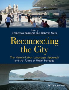
Getting acquainted with a rich collection of articles on the historical urban landscape, its preservation and development: Francesco Bandarin’s and Ron van Oers’s (eds.) Reconnecting the City. The Historic Urban Landscape Approach and the Future of Urban Heritage (2014).

reconnecting

(source: wiley.com)

The importance of a rigorous cultural mapping to understand the city’s many layers of meaning is one of the things rightly foregrounded in this volume.

And an interesting (and rare) warning about using GIS: GIS-based mapping “is useful for coordinating visual data and capturing the visual morphology of the city, but has its limitations when recording the urban experience” according to Julian Smith who has a few critical words for “modernist assumptions about mapping and documentation” in this volume (p. 224). Food for thought for the emerging GIS-enthusiasm in literary studies (see my earlier post here).

From the little I’ve seen of the volume so far, nevertheless, there are some points of view I would’ve like to see more of in a book like this. One is the potential of literary sources for a cultural or narrative mapping of place. A second one is the importance of resilient, everyday practices that give meaning to place, and that are so hard to pinpoint in urban heritage discourse. How to preserve and foster everyday spontaneity, in its many forms? And is preservation even desirable? One of the things that came up in the work I conducted with Sirpa Tani on parkour (see here), in particular in our article “Parkour: Creating Loose Spaces?”.

In view of this second comment, I’m increasingly looking forward to reading the upcoming book by Oliver Mould (a fellow parkour researcher), which promises a counter-narrative to the creative city discourse in the form of new interest in forms of urban subversion.

Geocritical Explorations, GIS-based literary analysis at MLA 2015

At the 130th Annual Convention of the Modern Language Association, Vancouver, a special session entitled “Geocritical Explorations inside the Text” will be organized, with several abstracts dealing with GIS-based literary analysis.

http://moacir.com/talks/mla-15-geocritical-explorations-inside-the-text/abstracts/

vancouverlogo

Following up on recent geogricitical explorations such as the collected volumes Geocritical Explorations and the volume Literary Cartographies, both edited by Robert Tally.  with some articles on city literature.

Recent applications of geographical technologies in literature include Gregory & Cooper’s article on GIS and Victorian literature and culture (2013).

[update] All feeding into what could be called the larger field of geohumanities, the advent of which is briefly touched upon here by Tim Cresswell.

Reminds me I have to take this volume off the shelf and start re-reading: GeoHumanities. Art, History, Text at the Edge of Place (Michael Dear et al. 2011).