Väiski defended his PhD thesis – Grant McKenzie as opponent

Tuomas Väisänen aka “Väiski” successfully defended his PhD thesis last Friday!

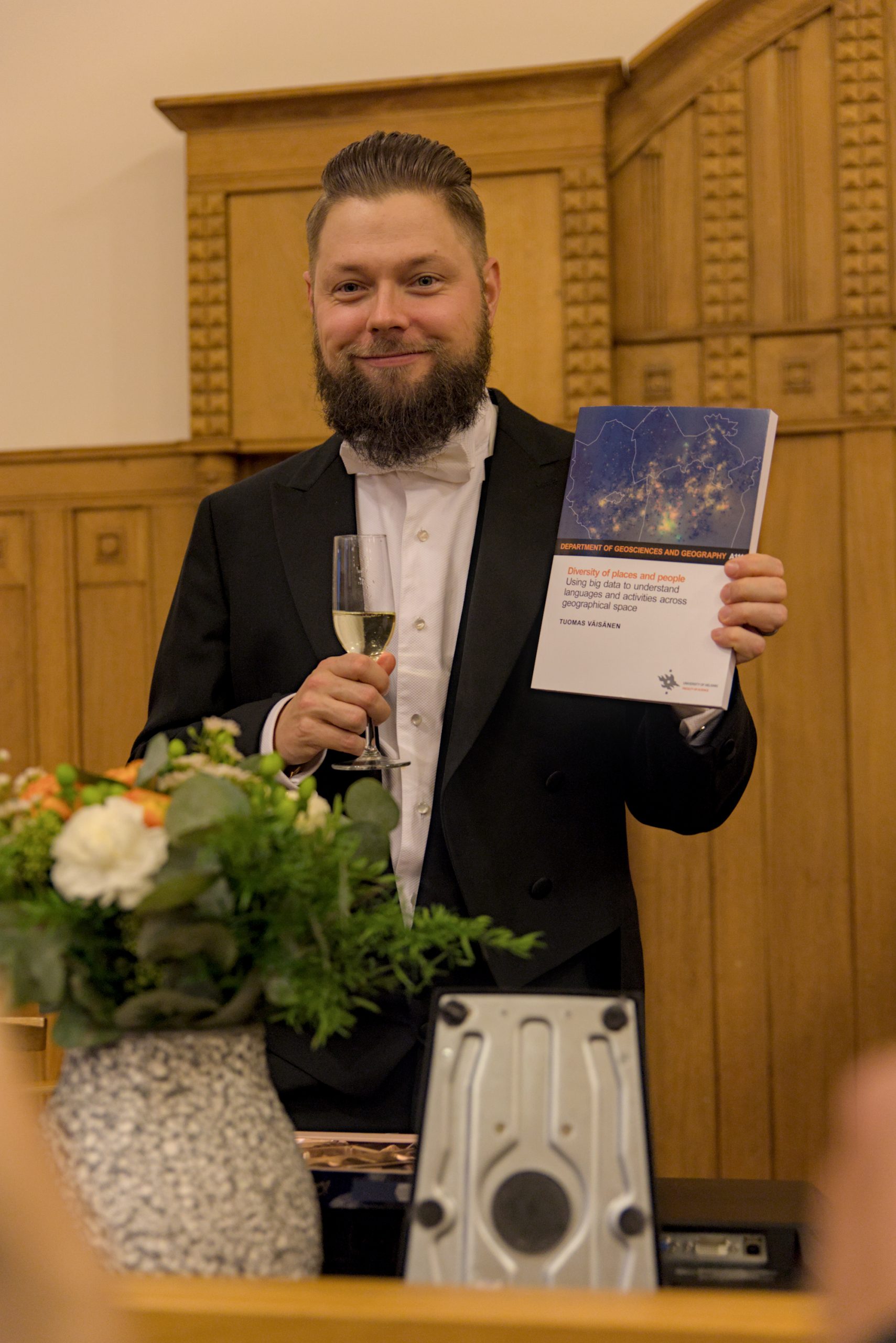
The defence took place on the Friday 10th of November 2023 with Grant McKenzie, Associate Professor of Spatial Data Science from McGill University, Canada as the opponent.

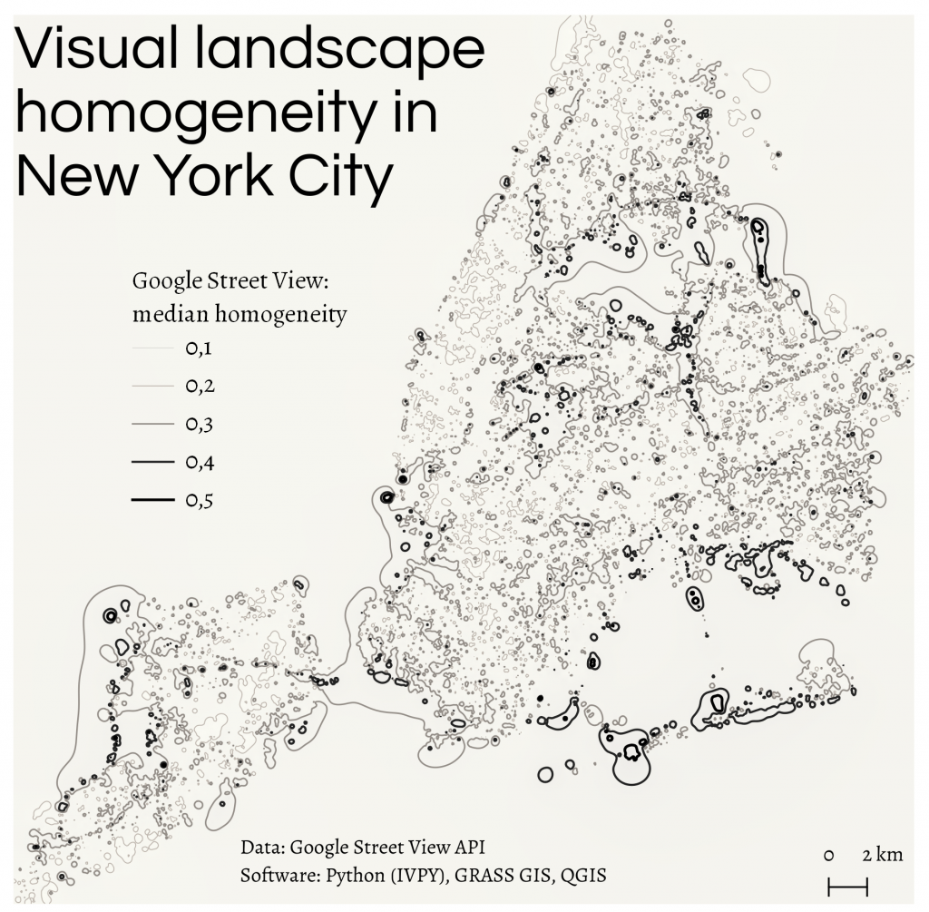
See Väiski’s thesis “Diversity of places and people: Using big data to understand languages and activities across geographical space” here.

Earlier in the week, we had the privilege of hosting the opponent McKenzie at our premises and getting to know each other and our respective research groups’ works better, which sparked many new ideas.

The event-packed week culminated with Väiski’s defence and his lovely Karonkka party that followed in the evening.

Finally, after a long and exciting week, our happy new doctor was sent to home with celebrations to enjoy his wonderful achievement.

Hooray & hugs to Väiski! 🥳🤗

And many thanks also to the opponent McKenzie for visiting us and acting as the excellent counterpart for Väiski! 🤗

Continue reading “Väiski defended his PhD thesis – Grant McKenzie as opponent”

Tuomas Väisänen aka Väiski defending his PhD 10 November at noon!

Tuomas Väisänen will defend his PhD thesis titled

“Diversity of places and people: Using big data to understand languages and activities across geographical space”

Time: Friday 10th November, 12 o’clock noon
Place: the Festive hall (Juhlasali) of Language Center (Kielikeskus), University of Helsinki.

Stream: https://video.helsinki.fi/unitube/live-stream.html?room=l13

Associate professor Grant McKenzie from McGill University will act as the opponent and professor Tuuli Toivonen as custos.

The thesis is available in Helda https://helda.helsinki.fi/items/3b464817-3408-414b-9670-f417fce5a6f0


Also:

**********************************************************************************************

Tuomas’s opponent associate professor Grant McKenzie will give a talk with the title

“Place, Privacy, and Mobility: Navigating the Intersection of Location Science and Human Dynamics”

Time: Wednesday 8th November 10-12
Place: University of Helsinki, Kumpula Campus, Exactum B123

Register for the stream link: https://forms.gle/xJh8r2zjsCSRWFZH7

**********************************************************************************************

You are most welcome to both events!

November comes. Looking back on #30DayMapChallenge 2022

#30DayMapChallenge was started in 2019 on Twitter by Topi Tjukanov. This daily mapmaking challenge takes place each November, bringing together people passionate about mapping science and art. Maps can be found on Twitter and other platforms using the #30DayMapChallenge hashtag. While the DGL is preparing for the new season in 2023, we suggest checking out the maps that the lab members made almost a year ago.

Day 1, Points. 

Commuting in the Greater Region of Luxembourg: tweets posted alongside railways and roads. Author: Oleksandr Karasov

Day 2, Lines.

Interpolated homogeneity in the Google Street View landscape depictions. Author: Oleksandr Karasov

Continue reading “November comes. Looking back on #30DayMapChallenge 2022”

GREENTRAVEL project in full swing!

We are having exciting times at the Digital Geography Lab! 2023 marks the start of the European Research Council -funded project “Greener Urban Travel Environments for Everyone: From measured wellbeing impacts to Big Data analytics” (GREENTRAVEL) – the biggest and longest research project of the lab to date. After months of planning and recruitments, we are happy to announce that the GREENTRAVEL project team is complete, and the project is running at full speed.

The transdisciplinary GREENTRAVEL project runs until 2027 and has a budget of 1.98 million euros. The project focuses on studying the greenery of urban travel environments from various perspectives. More specifically, the project has set out to produce a novel understanding of the quality, availability and wellbeing impacts of green urban travel environments. Moreover, it will produce knowledge on how equally green exposure during travel and related wellbeing impacts are available to urban populations. Ultimately, the project will provide approaches and analysis on where to add greenery to advance equity. The project is led by professor Tuuli Toivonen.

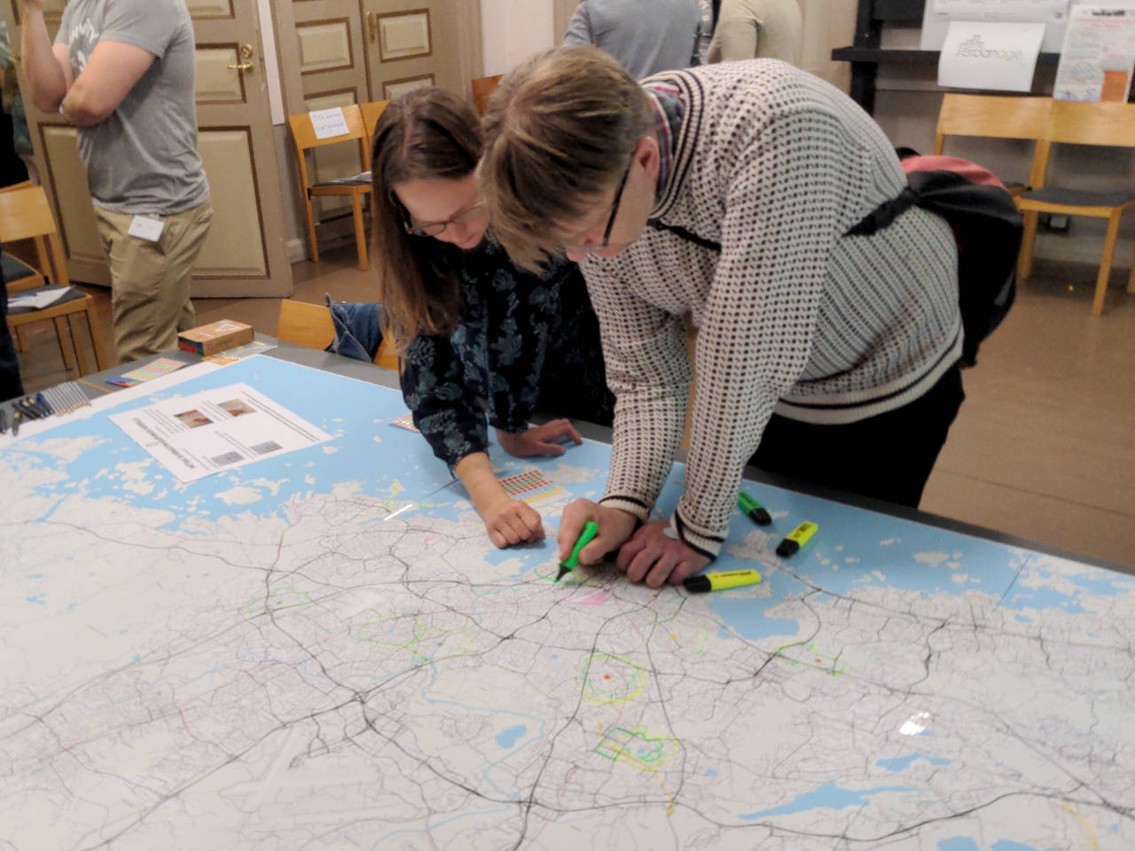
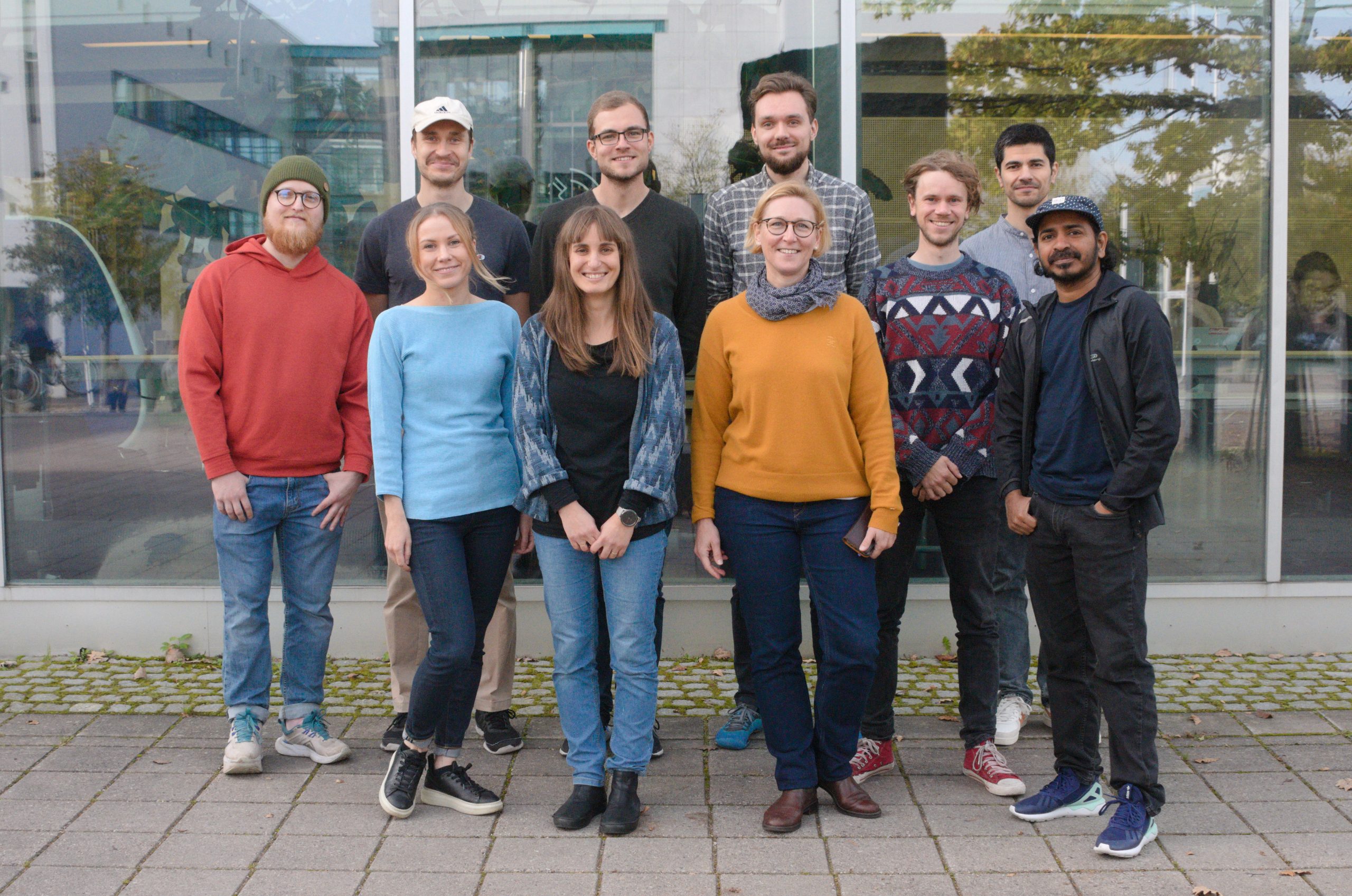
The GREENTRAVEL project team. Photo by Christoph Fink.

Continue reading “GREENTRAVEL project in full swing!”

URBANAGE workshop as part of the European Researchers’ Night

Last week, the Digital Geography Lab organised a workshop for the European Researchers’ Night (Tutkijöiden Yö), one of only five to be hosted by the University of Helsinki’s evening programme at the Helsinki Observatory in the city centre.

At our workshop, we engaged visitors with concepts around urban accessibility, such as multimodal travel times in the Helsinki metropolitan area, one’s personal 15-minute city, and mobility justice between different groups of residents and between different neighbourhoods.

Two visitors lean over a large map (1.5 x 3.5 metres) of the Helsinki metropolitan area, drawing the area covered by 15 minutes walking around an important location to their lives
Two visitors explore how large their personal 15-minute neighbourhood (around a place important to their lives) is.

Together with a fantastic team of students, we prepared three interactive tasks for the visitors of the event, that targeted the general public, and was met with ample interest.

At one station, visitors were asked to locate a place important in their everyday lives on a large printed map, and mark it with a small sticker. Next, they would draw their estimate of how far they would reach around this point within 15 minutes, walking. For the next step, we prepared a piece of string that we measured and cut to represent the exact distance an average healthy adult would walk in those 15 minutes. Laying it along the streets and paths in the map, the visitor could then draw the area they can reach precisely into the map, adding to the personal accounts of numerous other visitors before them. Finally, we asked visitors to reflect whether or not the identified area contained all services they needed to access in their everyday lives, such as grocers, libraries, pharmacies, and public transport stops.

Continue reading “URBANAGE workshop as part of the European Researchers’ Night”

Miksi Vallilanlaakso jätettiin vaille omaa ratikkapysäkkiä?

Note for our international audience: This post deals with public transportation connections around our campus in Kumpula / Helsinki. As the matter is local, we publish this post in Finnish only.

Otimme hiljattain kantaa uuden Kalasatama-Pasila ratikan pysäkkisijoitteluun Vallilanlaaksossa.

Tausta:

  • Helsinkiin on valmistumassa uusi poikittainen raitiotielinja Kalasatamasta-Pasilaan, jota parhaillaan rakennettaan. Linja ohittaa myös Kumpulan kampuksen.
  • Kumpulan kampuksen saavutettavuudesta on keskustelu siitä lähtien, kun kampus valmistui vuosituhannen alusta. Myös me tutkimme jo 13 vuotta sitten Kumpulan kampuksen saavutettavuutta. Tuloksia julkaistiin esimerkiksi raportissa Solmukohta vai pussinperä? – Kumpulan kampus pääkaupunkiseudun joukkoliikenneverkossa
  • Nykyisellä suunnitelmalla, uuden raitiotielinjan varrella on 14 pysäkkiä noin 250 metrin välein.
  • Vallillanlaaksossa kampuksemme kohdalla pysäkkien välinen etäisyys on kuitenkin yli 1 km. Se on pisin etäisyys Helsingissä raitiotielle ilman pysäkkiä (tilanne ennen uuden pikaratikan käynnistymistä lokakuussa 2023).
  • Keskeinen argumentti julkisessa keskustelussa on ollut, että lisäpysäkki hidastaa ratikkaa “liikaa” ja että “puistossa ei ole ketään”.
  • Argumentoimme, että
    • Pysäkittömyys jättää merkittävän määrän potentiaalisia raitiotien käyttäjiä huomiotta niin Kumpulan kampuksella, kuin Vallilanlaaksoa ympäröivillä kasvavilla asuinalueilla. Myös viheralueen käyttäjät ja esimerkiksi Valillanlaakson jalkapallokenttien käyttäjät tarvitsisivat mielestämme pysäkkiä.
    • Kalliin raitiotielinjan suunnittelu ensisijaisesti kulkuneuvon nopeuden näkökulmasta on yksipuolista suunnittelua. Joukkoliikenteen tavoitteena on palvella kulkijoita myös reitin varrella, mahdollistaen lyhyet ja laadukkaat pysäkkimatkat.
  • Olemme koonneet alle:
    • Alkuperäisen kannanottomme Helsingin Sanomissa 21.8.2023
    • Helsingin liikenne- ja katusuunnittelupäällikkö Reetta Putkosen vastineen 23.8.2023
    • Oman aikaisemmin julkaisemattoman vastineemme Reetta Putkosen kirjoitukseen

Continue reading “Miksi Vallilanlaakso jätettiin vaille omaa ratikkapysäkkiä?”

The MOBI-TWIN project kick-started!

Mobi-Twin logo


What is it about

The Horizon Europe funded MOBI-TWIN – Twin transition and changing patterns of spatial mobility: a regional approach – sets out to redefine regional attractiveness in the context of significant global transition processes such as the green and digital transition. The project aims to analyze the changing drivers of spatial mobility and examine the effects of twin transitions on regional attractiveness and human (im)mobility.

The twin transition presents both opportunities and challenges for regions across Europe. As certain areas become more alluring due to the emerging prospects brought forth by the green and digital revolution, others risk being left behind. By utilising advanced information and computer modeling techniques, MOBI-TWIN seeks to comprehensively understand the impact of these changes on different regions of Europe and develop innovative policies that promote balance and inclusivity by harnessing the positive effects of Twin Transition.

A primary focus of MOBI-TWIN is to unravel the underlying factors that influence individuals’ decisions to relocate and how these factors may evolve in response to global changes. By analyzing various types of moves, including permanent relocations, commuting patterns, and temporary stays, the project aims to gain insights into the intricate dynamics and implications for different European regions.

How we do it

Taking a step further, MOBI-TWIN employs a specialised computer model to simulate the potential outcomes of people’s mobility in the face of the Twin Transition. This includes assessing the potential influx of individuals into specific locations, the types of jobs they may acquire, and the subsequent impact on regional populations, social structures, welfare system, and labour markets. By leveraging these findings, MOBI-TWIN aims to propose policies that harness the positive aspects of these changes and maximise the benefits for different areas. Of particular importance is the examination of how the disruptions caused by the COVID-19 pandemic and Brexit have affected freedom of movement between EU regions.

Continue reading “The MOBI-TWIN project kick-started!”

Travel Time Matrix 2023 for Helsinki Metropolitan Area is out

We have published the Travel Time Matrix 2023 for the Helsinki Metropolitan Area

What’s new?

  • Updated travel times for Walking, Cycling, Public Transport and Private Car based on 2023 situation
  • More variation within travel modes (e.g., slow, average and fast walking) to reflect different life realities
  • A new computation framework that allows us to easily produce travel time matrices for other cities

The dataset extends the history of travel time matrices from the region produced by the Digital Geography Lab (since 2016, before that ‘Accessibility Research Group’). This also marks the 10-year anniversary of the first travel time matrix, published in 2013. Matrices were also published in 2015 and 2018.

Read more about the data and download it

https://www.helsinki.fi/fi/tutkimusryhmat/digital-geography-lab/paakaupunkiseudun-matka-aikamatriisi-2023

DOI:10.5281/zenodo.7907548

Continue reading “Travel Time Matrix 2023 for Helsinki Metropolitan Area is out”

Workshop on changes on nature visitation and the potential of Mobile Big Data for visitor monitoring

How will nature-based tourism change in Finland in the upcoming years? What will be the implications for nature conservation and visitor management? What is the potential of Mobile Big Data for visitor monitoring?

If you would like to discuss more about these topics, join us on 28th September in Porthania Urbarium. The event is organized by the University of Helsinki’s Digital Geography Lab.

Find more information below in Finnish.

Työpaja luontovierailujen muutoksista ja massadatan kävijäseurantapotentiaalista

Aika: Torstaina 28.9.2023, klo 9.45–16.30

Paikka: Porthania Urbarium, Yliopistonkatu 3, Helsinki

Ilmoittautumislomake: https://elomake.helsinki.fi/lomakkeet/125029/lomakkeet.html

Työpaja on kohdennettu virkistys- ja suojelualueiden parissa työskenteleville, erityisesti kävijäseurantatietoa kerääville tai tarvitseville asiantuntijoille. Tavoitteena on kartoittaa asiantuntijanäkemyksiä seuraavista teemoista:

  • Havaitut ja tulevat muutokset luontovierailuissa (kävijämäärissä, -profiileissa, aktiviteeteissä ym.)
  • Kävijäseurannan nykyiset ja tulevat tietotarpeet
  • Massadatalähteiden käyttö kävijämuutosten seurannassa: mahdollisuudet ja esteet

Työpajan tavoitteena on tuottaa kansainvälisesti kiinnostavaa tieteellistä tietoa luontovierailujen muutoksista ja niiden seurannan keinoista. Työpajassa saadun ymmärryksen ja laajemman tutkimuksen perusteella tuotetaan myös tieteeseen perustuvia suosituksia, joilla kävijäseurantaa voidaan jatkossa kehittää.

Continue reading “Workshop on changes on nature visitation and the potential of Mobile Big Data for visitor monitoring”