Down by the Water. Interdisciplinary symposium on the role of water transit points in past societies. Helsinki, 6-8 November 2019
Abstracts
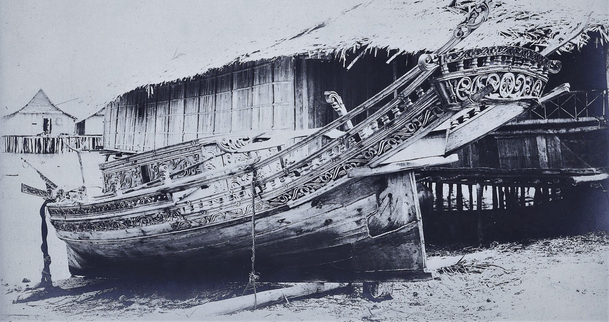
Maritime mimesis in Polynesia, complex creative epistemologies (Joanna Tonge)
jotonge4@gmail.com University of Southampton/independent
This paper considers the European ship as a vessel of meaning through an investigation of Oceanic creative expression during the 18th and 19th centuries. Through the analysis of Polynesian and Melanesian-European encounter contexts, questions of cultural and artistic classification and identity are brought into focus. Whether a focus on European maritime motifs in indigenous artistic practice across Oceania is a useful lens for analysis is investigated within this historical period of increasing global entanglement and cosmopolitan Oceanic experience. This research aims to add to the validation of a historicity for Polynesian and Oceanic peoples more generally, exploring cultural dynamism in the 18th and 19th centuries through case studies which include; ritual complexes at Rapa Nui, a Fijian nose flute and Melanesian Kanak Bamboos. While some Oceanic objects such as the Kanak Bamboos are better understood as narrative memorialisation, others such as the mimetic ship structures created in Rapa Nui center on performance as access to the power inherent in complex material forms. These case studies thus offer in depth analysis of the materiality of objects and materialisation of identities they coproduce.
Knowledge on the Water: the case of technological transfers in the Western Indian port towns (Dr. Sara Keller)
sara.keller@uni-erfurt.de, Max Weber Centre, University of Erfurt, Germany
Safe, fast, reliable: the Arabian Sea corridor linking the Persian Gulf to Western India appeared for millennia as an attractive route and an advantageous alternative to the uncertain Central Asian roads. This busy maritime option built a long-lasting bond between Indian subcontinent and Middle East -and, beyond it, the Mediterranean world. Not just merchandises crossed the sea: Ships also transported knowledge, believes and aesthetics. Thus, Western Indian port towns have been the witnesses, and the early expression, of their plural overseas. The paper proposed to explore the architectural landscape of the port towns from Kutch to Konkan as a rich visual scenery, reflecting the wide range of intangible data that was transmitted on the salty water.
The presentation focuses on technological transfer in architecture, and how particular building techniques were introduced in India via the ports towns of Gujarat. How did water transport knowledge and how did water transit points facilitated their incorporation? As a matryoshka doll effect, the paper will address the question of water technology: How did the maritime connection facilitate the introduction in Gujarat of the “tankā”, a (drinking) water management system? Essential clues to address this issue are given by the survey and documentation of the underground brick cisterns of the port town of Bharuch (16th century onwards).
This overall study questions the vision of the ocean as an empty space between vibrant market places, fostered lands and civilizational hubs. It rather proposes to consider the movements of the sea as resonating waves and data transmitters.
Down by the water: evidence of Sino-Foreign Maritime Exchange at Liu Chia Harbour, Taicang (Sarah WARD)
sarahward@dlmu.edu.cn, Visiting Professor of Maritime Archaeology, History and Culture, Centre for Maritime History and Culture Research, Dalian Maritime University (China)
China, the largest country in the East Asian maritime realm, has a long history of seafaring stretching back more than two millennia; its coastal ports and harbours used as transit points since ancient times. This long history brings with it more than 2,000 years of Sino-Foreign maritime exchange; of goods, ideas, knowledge, people, culture and community. A tradition, which during the height of China’s maritime power in the Ming Dynasty (1368-1644 AD), was dramatically altered by the expansionist foreign policy of Emperor Yong Le. Like every Chinese ruler for more than 1,000 years, Yong Le aspired to incorporate foreign polities into a system of hierarchical and tributary relationships that centred on the Ming Court. His was an exceptional yet traditional extension of Chinese military might and power, an unorthodox use of maritime resources within a very old structure, and which culminated in Zheng He’s seven voyages to the ‘Western Ocean’.
This paper will consider evidence the confluence of human activity at Taicang’s Liu Chia Harbour, the staging post for the Zheng He’s fleet. Located in a river-sea transit zone, between Nanjing (the then capital) and the East China Sea, at the convergence of the Yangtze and Liuhe Rivers, Liu Chia’s unique geographical characteristics created a nodal point for shipboard and coastal communities, the impact of which can still be felt today.
The Port of Uraga, William Adams, and Japan’s Sovereignty (T. Michael Perrin, MPhil Maritime Archaeology (Oxon)
Until the opening of Japan in the mid-nineteenth century, Uraga had been a port with both commercial and military significance on a domestic level arguably for the duration of the Edo period (1603-1868). It’s international importance, however, lies in the initial years of the period (1603-1638), with considerable documentation showing a flourishing trade with Spain. Never before or after had a European superpower traded with eastern Japan until the nation industrialised during the Meiji period (1868-1912).
The intent of this research is to shed light on a period in Japanese maritime history that has remained overlooked to a large extent for over four hundred years with regards to the circumstances of its development and further growth, despite its overwhelming importance, using both archival and archaeological evidence from both Europe as well as Japan. This evidence suggests that the establishment of Uraga as a commercial and later diplomatic choke point with Spain was initiated and managed by William Adams under the auspices of Tokugawa Ieyasu, and that subsequent utilisation of the port as a point of controlled entry to Edo bay was the convention domestically as well until the end of the Edo period. With this trade, we see that the normal colonial relations Europe had over Asian ports had no hold on Japan. On the contrary, this paper puts forth the idea that Japan was successful at staving off such attempts due to Adams’ intercedence, producing a pattern of entanglement with the West that lasts to this day.
The Mekong: seasonal migrations and the making of the Angkor Empire (Veronica Walker-Vadillo, Helsinki Collegium for Advanced Studies)
Since the discovery of the Angkor civilization on the shorelines of the Tonle Sap Lake, it has been assumed that rivers played an important role in the establishment of this polity. However, rivers and the communities that exploited their resources have largely been ignored in previous academic research, which has seen stronger focus on land remains. This has resulted in a biased interpretation of the data, favouring approaches that recognise Angkor as a mainly agrarian state. While the role of agriculture is certainly of great importance, novel research conducted during my doctoral studies suggests that the presence of semi-nomadic fishing communities played a key role in the establishment of Angkor, and that strategies of cost signalling were implemented by the kings to exert their influence over these semi-nomadic communities. Their importance for the state lied in their role in capturing fish during the short fishing season, which coincided with the rice harvest, a time when the majority of Angkor’s man-power was tied to the land. These fishing communities had to travel hundreds of kilometres annually to the Tonle Sap Lake following fish migration patterns, while at the same time land-based communities travelled to the lake to obtain the fish needed to produce prahok, a fermented fish paste that is at the heart of Khmer cuisine. This gathering provided opportunities for human interaction and likely acted as a conduit for culture dispersal and knowledge transfer.
This paper seeks to analyse how ecological pressure affected the relationship between the Angkorian state and semi-nomadic fishing communities. It is expected that by understanding the ways in which the kings of Angkor tried to guarantee the annual return of semi-nomadic fishing communities into the Tonle Sap, we can gain a new perspective on how regional polities incorporated peripheral communities into their state projects.
Past Southeast Asian « sea people »: connecting cultures and environments through waterways (Dr Bérénice Bellina (CNRS, National Centre for Scientific Research, France)
In Southeast Asia are specialized groups sometimes referred to as “sea nomads” or “sea gypsies”. Ethnographic and ethno-historic sources described them either as groups politically perfectly integrated groups raiding, trading, guarding sea lanes for the benefit of trading polities they were affiliated to, or as volatile/incontrollable groups involved in piracy. Despite their evident social, economic and political importance in past Southeast Asian geopolitics, very few historians and archaeologists attempted integrating these “aquatic” people in their restitutions. An omission partly resulting from archaeologists’ assumption that these groups leave no material evidence due to the considerable amount of time they spend on boats as well as to the material culture their nomadic life would have prevented to develop.
Several of these groups still exist along the Thai-Malay peninsula, a piece of land acting as a bridge between the Indian Ocean and the South China Sea. There, rivers cross and connect various landscapes and specialized social groups. Since 2005, the French Archaeological Mission in Peninsula Thailand-Myanmar studies the co-evolution of these various groups and their environment in relation to the region’s involvement in trade. It unraveled aspects the organization along these waterways plotting meeting/collecting points as well as the emergence of early sea nomads who acted as trading intermediary along these waterways. To restitute a more comprehensive view of these groups’ past activities as well as to determine their still largely poorly known cultural role at a regional level, the archaeological project works at developing new methods and interpretative frameworks.
Water resources and cultural patterns in dry and Mongolian Inner Asia (Michal Schwarz)
schwarz@phil.muni.cz, Department of Vietnamese Studies, Masaryk University, Brno, Czech Republic
The aim of this paper is to show that theoretical framework of the conference can also be applied to extremely dry Inner Asia like Mongolian Gobi or especially the Tarim Basin, where ancient inhabitants of oasis cities along the glacier rivers and villages near mountain streams moved under similar circumstances like population in the delta of Mekong. Even if the water was not used as a basic form of transport, the distribution of water resources and dependently the market network and linguistic exchange in Xinjiang were analogous to lowlands of Southeast Asia. The paper will also focus on local conditions like: historical migrations after local climate changes, rivers allowing to cross the Taklamakan Desert, ancient technology of underground canals and importance of smaller springs and lakes in most dry sections of trade routes. Mongolian hydronyms also often have meaning for better orientation and survival (c.f. death of local guides of Sven Hedin when they did not found water). For more complete picture, the spirit worship near almost every spring must be taken into consideration together with Inner Asian springs of Yellow River, where Mongols, Tibetans and emperor of China gave regular offerings to the spirits, because this river was important for the economy and political stability of North China.
River as the backbone of the world: a horizontal world tree of the Selkups (Olga Kazakevich)
kazakevich@olga@gmail.com, Reseach Computing Centre, Lomonosov Moscow State University; Institute of Linguistics, Russian Academy of Sciences
Traditional life of Selkups is organized along rivers, in accordance with rivers. Selkups use the rivers as roads for their boats and as food (fish) sources. There are two Selkup words designating rivers: the first one – qo:ltɨ – is used for the biggest river of the territory (‘Ob’, ‘Taz’, or ‘Yenisei’ depending on the local group of Selkups), the second one – kɨ – designates all the other rivers, tributaries of the main, Big river. Rivers are main landmarks for space orientation: one can move takkɨ ‘down the river’, nænnæ ‘up the river’ (these words do not coincide with the vertical ‘up’ and ‘down’), karræ ‘down from the bank to the river’, konnæ ‘up to the bank from the river’. As Selkup Big rivers flow from south to north, takkɨ also means ‘to the North’ and nænnæ ‘to the South’. The Big river builds a sort of a backbone of the Selkup world. It was Ekaterina Prokofieva who first suggested that the traditional Selkup world view contained not only a vertical world structure, but also a more ancient horizontal one, where the Big river was an analogue of the world tree (Prokofieva 1976: 112-113). Down the river in the North, the land of the dead lies and up the river the ancestral homeland of the Selkups is situated. The land of ordinary Selkups is in the middle flow. The rivercentric world view is characteristic not only of Selkup language and folklore, but also of the language and folklore of their nearest neighbours and marriage partners Kets, as well as of some other Siberian peoples.
The fishermen community in the lower Ebro (1775-1850) (Toni Cartes Reverté)
toni.cartes@gmail.com, independent researcher, Museu de la Mar de l’Ebre
During the kingdom of Charles the third of Borbon, a kind of peace treaty was made with the countries of the North of Africa. Due to that, the pirates attacks ended, and it started a movement of people from the riverside to the coast. Although this situation is the same in the whole eastern Spain, it had a significant impact in the area of Tortosa.
The creation of four new towns on the coast of the area (l’Ametlla de Mar, l’Ampolla, Sant Carles de la Ràpita and Cases d’Alcanar) supposed the adaption of the river fishering systems to the sea. That adaptation includes the vessels architecture, the fishery techniques and trading systems. Although the most important part of the fishermen came from Tortosa, the arrival of people from other fishing ports creates an interesting vocabulary that has been alive until today, and the appearance of new fishering techniques.
Molecular Archaeoparasitology – tracing people by their worms (Dr Patrik G Flammer) Department of Zoology, University of Oxford, patrik.flammer@zoo.ox.ac.uk
Throughout history, humans have been afflicted by parasitic worms, and parasite eggs have been found in a variety of archaeological deposits. In the majority of cases, parasitic infections have a very low impact on the individual’s health and thus do not interfere with daily life. Therefore, enteric parasites are suitable as proxy for human behaviour. To complement traditional microscopic diagnostics we have developed a suite of molecular tools that offer a new insight into parasite infections and distributions. They also allow reliable, highly specific diagnosis and provide additional information on the genetic diversity of parasites over space and time. The developed methods use parasites to interrogate issues related to hygiene, diet and socio-economic characters. The application of these methods will be discussed in the context of a sample set from various European countries with special focus on the major medieval trade port of Lübeck, Germany, exploring the impact of extensive connectivity on parasite diversity and spread. These new approaches will be widely applicable, contributing a novel perspective that can be integrated within a variety of historical and archaeological studies.
Submerged Lands, Navigable Waters, and Jurisdiction as a Technology of Spatial Governance in the United States (Daniel Margolies)
History Department, Virginia Wesleyan University, dmargolies@vwu.edu
This paper reframes United States imperial and legal history through the issue of jurisdiction over submerged lands beneath navigable waters. It explores submerged lands as historically contingent spatial regimes and jurisdictional articulations developed to further control and governance in the formative nineteenth century era of inland territorial United States empire. It then explores how a well-established legal framework for U.S. submerged lands was disrupted by the emergent spaces of the state carved jurisdictionally in newly conceptualized offshore submerged lands. Strategies for control over inland and offshore submerged lands beneath navigable waters guided evolving United States conceptions of the recapitulation of state sovereignty in a bifurcated system of sovereignty. Similar jurisdictional solutions clarified unique United States approaches to resource ownership and extraction of submerged land subsoil minerals and underlay later global ambitions for imperial rule in oceanic spaces. The regional struggles to delimit federal dominium (ownership) and imperium (sovereignty) in the submerged lands of the marginal seas formed key aspects of the postwar U.S. imperial system both internally and internationally. This paper considers the emergent issues of offshore submerged land in the context of gnarled sovereigntist politics greasing the expansion of U.S. imperial reach into newly conceived subsoil regimes in oceanic spaces. The submerged lands issue underscored the links between the early history of U.S. jurisdictional state spaces and the revolutionary spatial enclosure of oceanic submerged lands catalyzed by the United States.
“Dark Ages” Revisited. A View from harbour technology (Chiara Maria Mauro)
cmauro@ucm.es, Haifa Center for Mediterranean History and Department of Maritime Civilizations, University of Haifa
Analysing the period between the collapse of the Bronze Age civilisations and the society based on poleis that emerges from the earliest Greek historical sources is extremely complex. In spite of the fact that these centuries have been traditionally thought of as “Dark Ages”, nowadays this concept has been drastically challenged; indeed, archaeological evidence allows to sustain that this was a period of lively contacts between different Eastern Mediterranean populations. The aim of this contribution is, then, to strengthen this new understanding of the “Dark Ages” by underlining the continuity in terms of harbour technology. Phenomena of architectural survivals will be underlined; at the same time, possible major changes will also be considered.
Firstly, we will analyse Bronze Age and Early Iron Age harbours on the Eastern Mediterranean coasts in order to see what did they look like and what kinds of structures did they present; secondly, the attention will be moved to Early Greek harbours to identify possible elements of continuity (and discontinuity) in harbour architecture and technology. We will focus on determining what were the harbour elements that survived to the collapse of the Bronze Age civilisations, or that were assimilated by the Greeks through direct contacts with other neighbouring cultures (mainly Phoenician and Egyptian); and what were the harbour elements that did not seem to have been adopted in Early Greek harbours.
Finding the way to the ocean (Katherine Bolaños, k.bolanos@uniandes.edu.co Universidad de los Andes, Colombia. Ricardo Palacio, ricardo.palacio@caroycuervo.gov.co)
In Northwest-Amazonia, groups having different subsistence patterns, hunting and gathering on the one hand, and those having a more horticulture, fishers of sedentary orientation on the other, have held long-lasting (though socially unbalanced) socio-economic relations which have left evident traces on synchronic linguistic expressions, and cultural practices of genetically unrelated languages and culturally diverse peoples. These contact relations have occurred profoundly through water points, so much so that even in shared cultural related and mythological origin stories, waterways become points of reference for spiritual achievement. An example of this is a shared story among peoples who inhabited an area spanning from northern Putumayo and Chibiriquete (tributaries of the Caquetá), to the Guaviare (tributary of the Orinoco), where specific waterways will lead to a spiritual forest gate which once opened, guided the physical path to the ocean.
In this talk we aim to present a reconstruction of the history of migration and displacement of the Tinigua people, evaluating the linguistic and cultural impact of waterways as points of contact (both, hostile contact and of fraternal alliances) between hunter-gathering, forest-oriented, semi-nomadic groups (like the tinigua people), and riverine, sedentary, horticulturers. Although the tinigua people seemed to have moved through land, crossing horticulturers’ territory, while seeking to station for periods along lakes, waterpasses were of great importance as contact scenarios in their history of migration, leaving traces on spiritual waterways shared by other groups; sacred important waterpaths that led to the ocean, for example, were obligatorily shared by inhabitants of these lands, regardless of their type of contact relation. The crossing through these waterpaths left linguistic traces (toponyms, and some shared linguistic structures) and mythological shared traces among the groups involved in this past contact. We will end this talk with a discussion addressing these cultural and linguistic impact that can be recuperated from a historic reconstruction of water and land migration of the tinigua ethnic group.
Cosmology, Cartography, and Change: Water in Ancient Mexican Life and Thought (Kathryn M. Hudson, University at Buffalo, khudson@buffalo.edu. John S. Henderson, Cornell University, jsh6@cornell.edu)
Depictions of water are common in ancient Mexican imagery before and after the Spanish invasion. These representations encoded physiographic information about landscapes inhabited by people and cosmological knowledge of realms populated by supernatural beings and forces; they constitute a regionally-distinctive and water-based cartographic production. Changes in how water is represented under Spanish Colonial rule reflect shifting understandings of the universe, but aspects of an indigenous Mesoamerican worldview are apparent despite the successes of conversion.
As expected, imagery in precolumbian documents emphasized symbolic and cosmological meanings of water, whereas post-invasion documents produced by indigenous artists increasingly featured European cartographic interests in bodies of water. Differences in the subject matter of surviving documents complicate the comparison, but it is clear that representations of water have precolumbian antecedents and that Colonial period water imagery continued to reflect Mesoamerican cosmological understandings.
This paper considers precolumbian symbolic uses of water to identify historical and mythic places, to characterize supernatural beings and locations in ways that situate them within physical and supernatural realms, and to explore human interactions with water and its symbolics. It also identifies precolumbian cosmological references in the water imagery of Colonial period maps, notably the continued use of common stylistic conventions for representing water and the celestial realm. These continuities can be understood as dimensions of the hybrid belief systems that emerged in Colonial Mexico and as reflections of the persistent importance of water in indigenous conceptualizations of identity and place; they also reflect cultural transit points in a changing cultural landscape.
The Amur river system as a source and route of language spreads (Juha Janhunen)
asiemajeure@yahoo.com, University of Helsinki
The paper discusses the role of the Amur river system, including the Sungari and Ussuri basins, in the ethnic and linguistic history of Manchuria and Siberia. Apart from the secondary colonial languages (Russian and Chinese), the languages historically spoken in this region belong to the Amuric (Nivkh-Nivghng), Tungusic (Ewenki-Neghidal, Nanai-Ulcha-Orok, Udeghe-Oroch, Jurchen-Manchu) and Mongolic (Dagur) families. By using data from linguistic taxonomy, lexical contacts, and toponymy, it can be shown that the languages have moved along the Sungari, Ussuri and Amur river basins mainly from south to north, resulting in a series of successive linguistic expansions from Central Manchuria to Siberia, the North Pacific coast, and Sakhalin. The Middle Amur, including the Zeya basin, once formed the linguistic homeland of the Ewenic branch of Tungusic, from which the Ewenic languages spread mainly to the north (Ewenki, Ewen), but also to the east (Neghidal) and south (Orochen, Solon). Also, the modern languages along the Lower Amur (Nanai, Ulcha, Nivkh) have arrived in their positions relatively recently. The most important mechanism of linguistic spread has been language shift, by which the local populations have repeatedly adopted a new language expanding from the south.
Olesya Khanina, TBA
Modelling Movement across the Divide (Stephanie Blankshein)
PhD Candidate, University of Southampton, Centre for Maritime Archaeology, s.blankshein@soton.ac.uk
Islands and archipelagos have long fascinated the human race. Often viewed as bounded and isolated, given the right conditions, their true narratives can be far more complex. Such is case with the Outer Hebrides of Scotland, where a robust Neolithic record evidences varying degrees of movement which would have transcended not only a range of temporal and spatial scales but also environments. As movement itself leaves little archaeological trace, innovative methodologies are required that can cope with the transience of movement as well as its different milieus. This paper thus presents such a methodology.
Using a least-cost approach, established for terrestrial movement and adapted to seafaring, a more holistic digital analysis was developed that allows for movement to be modelled through both land and sea and transit points between them identified within the maritime landscape. Whilst the modelled pathways highlight the varying trajectories of Neolithic movement that would have occurred in response to a temporally and spatially constrained environment, they conversely reveal a strong continuity of practice and significance of place which together engender a complex network of movement and connectivity around the archipelago and beyond.
Barriers and pathways structuring the spatial pattern of linguistic variation (Rantanen Timo) tjrant@utu.fi, Department of Geography and Geology, University of Turku, Finland
Geographical distance is a common factor separating speaker populations and shaping the spatial pattern of linguistic variation. Pure geographical distance may, however, only be a coarse estimation of the true landscape connectivity between areas as various landscape features, both natural and anthropogenic, may either promote or limit the actual connectivity. Here we study which landscape features have played a role in shaping the spatial pattern of linguistic variation of the Finnish language. We studied this question with a ca. 100 years old dialect data of Finnish, and with seven landscape features, which we classified into three groups based on the possible human influence in these. First group consists physical landscape features: watersheds, eskers and end moraines and hilliness. The second group has features to which human has had some effect: waterways and land cover. While water bodies are largely part of physical landscape, the waterways are considered as partly human-made constructions as they refer to certain established connections between different water bodies. The features in the third group are purely human-made: the road network in the 16th century and historical borders. Travel speeds were determined for different landscape variables from which we calculated the fastest routes between each pair of municipal centroids. The relative roles of different landscape features on the spatial patterns of linguistic variation was studied with a statistical causal modelling approach. In our presentation, we will discuss our findings in the context of earlier views for example about the roles of waterways in human mobility.
The Extension of Waterways: Roman Urbanism and Communications (312 BCE – 511 CE) (Ray Laurence)
Macquarie University (Sydney, Australia), ray.laurence@mq.edu.au
Rome was the first riverine metropolis. The long-term impact of Rome in Europe was to create a whole series of riverine cities (e.g. Bordeaux, Trier, Milan, Lyon, Paris, London) with the additional connectivities associated with long distance road building from for example the river Po to the Danube, as well as other road connections between cities and the confluence of rivers. This paper will draw on extensive epigraphic evidence to reveal the possibility for re-configuring the Roman Empire in Europe as a system of roads and waterways. Attention will also be paid to the development of places and place-names derived from riverine structures, bridges, confluences, etc. and to pay attention to the development of ritual sites at these locations. In addition, the relationship between urban settlement densities and rivers will be explored. The sum of these parts of the paper addresses the Roman approach to the development of rivers through road building, what may be described as a creation or alteration of geography for long term human existence.
Border cities of the Euphrates River on the Parthian-Roman Mesopotamia (Giacomo Tabita)
giacomo.tabita77@gmail.com, Phd – Independent researcher
During the 1st-3rd centuries AD the Euphrates’s River was the so-called “Limes” of the late Roman Empire understood as a dynamic geo-political and cultural border with both military and trading function, where the interfaced cultural areas were defined by the coexistence, interaction and conflict of several ideologies which are at the basis of the fights between Romans and Parthians aiming to the control of the territories on the Middle-Euphrates’s area. Rome occupied Dura Europos (Syria) during the AD 165 obtaining the control on the Euphrates area and during the AD 194-195 and AD 197-199 Septimius Severus enlarged the extension of the areas controlled by Rome, overlapping on the limit of the Euphrates, therefore determining the Parthian giving ground on the Middle Euphrates. The strategic advantage obtained by the Romans allowed them also to build the fortified post of Kifrin, seen from a political and military point of view as a means to enforce and to advance the eastern frontier of the empire on the pre-existent settlement. As a very impressive pattern of human activities in rivers, the Euphrates’ river offers an historical point of view as an ancient frontier and a transit points with a meaningful chronological perspective. With this interdisciplinary approach, the archaeological research on this area can demonstrate the intricate connection between water spaces and humans during the Roman-Parthian period in Central Mesopotamia.
From Verona to Innsbruck – Raetic Epigraphic Documents as Landmarks of Waterway Transit in the Central Alps (Corinna Salomon)
Institut für Sprachwissenschaft, Universität Wien, corinna.salomon@univie.ac.at
Among the diverse alphabetic writing cultures which flourished in Northern Italy in the second half of the 1st millennium BC, the Raetic one stands out by its evident association with water transit routes. Raetic documents in the Alpine areas of the Trentino, South and North Tyrol are dotted around the major river valleys of Adige, Eisack, Sill and Inn. Ancient historiography indicates the presence of Raetic tribes in a large area between Verona, Feltre, Innsbruck and Bodensee, but the alphabet never reached beyond the main waterways into the Raetic area. Raetic writing is predominantly, maybe even exclusively cultic; burnt-offerings sites and conspicuous buildings in settlements dominate among the find places.
My talk will explore the question of what the distribution and nature of Raetic inscription finds can tell us about the ways in which the tribes who inhabited the Central Alps interacted with the cultures of Italy along the waterways. Were pre-Roman routes of Alpine transit the same ones as those used in Roman (and modern) times? How extensively were they used? Who travelled, why, and how? Do the statistics of inscription finds agree with those of different types of uninscribed imports? Are the major centres of Raetic literacy, the sanctuaries which appear to have propagated writing, associated with major trade routes, or did the alphabet make its way along the river valleys independently of trade relations? What part did the multilingual centre Verona by the Adige play for the spread of writing to the north?
Wending the Watery Ways, Mask in Hand: Waterways and the Travel Routes of the Technitai of Dionysus (Mali Skotheim)
The Warburg Institute, mali.skotheim@gmail.com
Trans-regional networks of festival travel were characteristic of the Roman period, as festivals attracted competitors from across the Empire. The Technitai of Dionysus, the organization of actors, poets, and musicians, even adopted the epithet “much-traveled” (περιπολιστικός). A relief from Aphrodisias references this reality by depicting an actor in his traveling cloak, mask in hand. The Technitai relied on water routes, both sea paths and riverways, in order to move quickly from festival to festival. Festival calendars in the Greek world had to be sensitive to the travel requirements of the performers, which included scheduling festivals during times when the sea was open for travel, and allowances were even made for competitors in case of shipwreck. This is one example of the way in which the natural environment shaped cultural activities and religious celebrations in the Greco-Roman world. In this paper, I offer a reconstruction of the travel routes of the Technitai of Dionysus, based on epigraphical evidence, including an inscribed letter from Hadrian found at Alexandria Troas which attempted to standardize the Greek festival calendar, laying out specific travel times between the major festivals, which may be compared to known water and land routes. I argue that the reliance of the Technitai of Dionysus on water travel increased during the Roman imperial period, and that proximity to waterways was an important factor in determining the feasibility of a city hosting dramatic and musical festivals. This is in contrast to local athletic festivals, which relied more on local participation.
Orientation in nature. Cardinal points and spatial adverbs in Saami and Khanty (Merja Salo)
merja.salo@helsinki.fi, Department of Finnish, Finno-Ugrian and Scandinavian Studies, University of Helsinki
In the Northern Finno-Ugric languages the orientation in nature is usually expressed with fixed bearings such as sea cost or upriver / downriver, e.g. the Saamis and Khanties have been much dependent on the flow direction of rivers or the location of the shore of the river or the seaside.
The same term can in Saami languages mean different points of the compass, which is connected to the fact that the rivers in Scandinavia flow from the mountains to the sea turning approximately 180 degrees from South Norway to the Kola peninsula, e.g.: lulli ‘south; east’, oarji ‘west; south’, davvi ‘north; west’, nuorta ‘east; north’, the first meaning applies for Saami speakers in Norway and Finland, the second one for Saami speakers in Sweden. The word davvin is frequently used by fishermen meaning being outdoors, in the fjord or on the open sea. Etymologically it means ‘deep’.
In the Khanty languages, there occurs an interesting pair of adverbs covering a wide range of meanings: vŭti ‘to the shore (looking from a boat); away from the fire;’ and nik ‘to the shore (from the dry land down to the water); to an open place; to the fire’. Each Khanty language has several terms referring to the cardinal points, e.g. in Shuryshkar Khanty: ovǝs ‘north’, nim mŭv ‘northern land; the land of the down river’; mŏrti mŭv ‘south; southern land’, nŭm pelǝk ‘south’; kev ‘west; the Ural mountains; stone’; xătǝL omǝsti pelǝk ‘west; the side of sunset’; xăLa mŭv pelǝk ‘east’; xătǝL etti pelǝk ‘east; the side of sunrise’; xăLevǝt pelǝk ‘east; morning’.