
We have now published online our first set of research outputs – web maps about geographical accessibility of official sports facilities now available for the city of Jyväskylä.
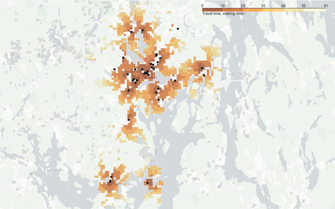
One of the aims in YLLI-project (Equality in suburban physical activity environments) is to analyse the geographical accessibility of sport facilities. Maps of geographical accessibility (travel times) for official and built sports facilities are now available for the city of Jyväskylä in the YLLI project’s web pages. The maps show the travel-time based potential accessibility of different types of sport facilities. The calculations have been carried out separately for four different travel modes: walking, cycling, via public transportation, and driving (private car). The sport facilities are retrieved from Lipas database during spring 2021.
Next we will publish maps for the city of Helsinki.
More information: Marisofia Nurmi & Petteri Muukkonen (marisofia.nurmi@helsinki.fi, petteri.muukkonen@helsinki.fi)