When we think of earthquakes, the first thing that comes to mind is the shaking of the ground. However, there’s more to this movement than just the back-and-forth or up-and-down motion. Ground rotational motion, the twisting and tilting of the Earth’s surface locally, plays a crucial role in understanding and preparing for seismic events.
Daily Life Examples of Rotational Motion
To make the concept of rotational motion more relatable, let’s look at some everyday examples:
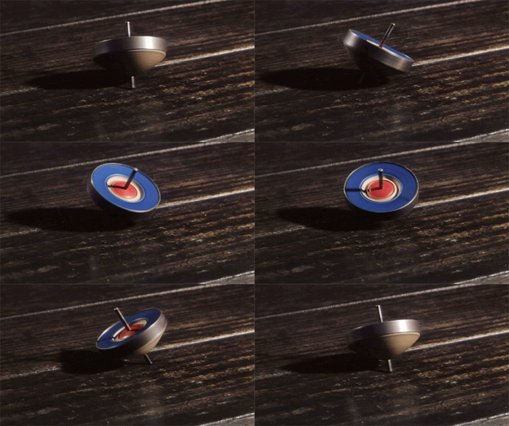
- Spinning Top: Just like a spinning top that wobbles as it slows down, the ground can twist and turn during an earthquake.
- Dizzy Dance Moves: Ever tried spinning around in circles for fun? The dizzy feeling you get is a small-scale version of what happens during rotational ground motion, minus the risk of knocking over a building.


Everyday examples of the rotational motion.
These everyday activities help us visualize how the ground might move during an earthquake. Now, let’s delve deeper into what ground rotational motion is and why it’s important.
Breaking Down Ground Motion: Translation, Rotation, and the Dance of the Earth
Ground rotational motion refers to the local rotation of the ground around about the vertical and horizontal axes (we nerds call them torsion and tilt or rocking motions!). Dream about standing on a giant turntable that starts to spin; you would experience rotational motion. Similarly, during an earthquake, different parts of the ground can move in circular or twisting patterns.
Assume that you’re standing in an open field during an earthquake. Now, let’s break down what happens to the ground beneath you:
- Translation Motion:
Imagine someone gives you a gentle push from the north. You’ll feel yourself moving southward. This movement, where the ground shifts back and forth in one direction, is translation motion. It’s like someone gently nudging you in a straight line. Similarly, another person can give you a gentle push from the east that makes you feel yourself moving westward.
- Rotation Motion:
Now, let’s say another person starts spinning you around in a circle while you’re still being pushed from the north and east. You’re not just moving south and west anymore; you’re also spinning around. This spinning motion, where the ground twists and turns, is rotation motion. It’s like being on a spinning merry-go-round while still feeling the push from the north and east.
How do you like it so far? Doesn’t it feel like that you are in an amusement park? You already have a couple of friends pushing and spinning you in different directions. So, it doesn’t hurt to have another pushing friend! Now, let’s add another dimension:
- Up-and-Down Motion:
While all this is happening, imagine someone else starts lifting you up and down. So not only are you being pushed south, spun around, but you’re also bobbing up and down. This up-and-down motion completes the trio of translational motions, adding depth to the movement.
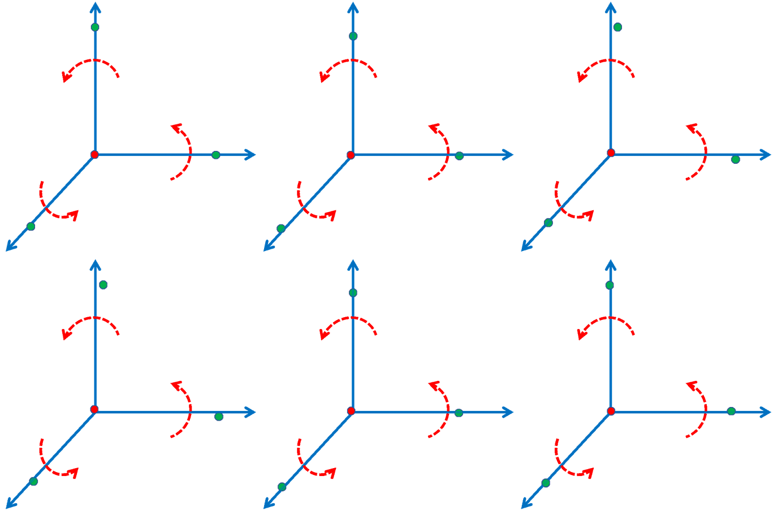
So, in summary, during an earthquake, the ground can move in six different ways simultaneously: it can shift back and forth, left and right, and rise and fall (up-and-down). These three motions are called translational motion. The other three components of ground motion are rotations about the three perpendicular axes. These six motions together make up the complex movement of the ground, and understanding each component is crucial preparing for seismic events.

Decomposition of the ground motion to three translational and three rotational components
Why Is It Even Important?
- Seismology
In seismology, understanding rotational motion helps in improving models of earthquake behavior. These models are used to predict how different types of ground movement, including both translational (back-and-forth) and rotational (twisting) motions, affect the Earth’s surface. By incorporating rotational motion into these models, scientists can gain a more complete understanding of ground shaking, leading to better predictions and preparedness for future earthquakes.
- Engineering
For engineers, especially those designing buildings, bridges, and other infrastructure, knowing how structures respond to rotational motion can lead to better designs that are more resistant to earthquakes. Additionally, assessing the impact of rotational forces helps in evaluating the safety and stability of existing structures (watch this https://www.usgs.gov/media/videos/shaking-atwood-building-anchorage-alaska).
Measuring Ground Rotational Motion
Measuring rotational motion is challenging, but several techniques have been developed. These techniques can be divided into two main categories: rotational sensors and array-derived rotational motion.
- Rotational Sensors
Rotational sensors directly measure the twisting and turning of the ground. These include gyroscopes, ring laser gyroscopes, and fiber optic gyroscopes, which detect and measure rotational movements during seismic events. These sensors provide critical data that helps in understanding the complexities of ground motion. Think of them as the seismologist’s version of a ballerina’s sense of balance—except way more precise and without the tutu.
- Array-Derived Rotational Motion
The array technique for estimation of rotational motion involves using an array of seismometers (instruments that measure ground translational motion) to infer rotational motion. By strategically placing multiple seismometers in a pattern, scientists can analyze the data from these instruments to calculate the rotational components of ground motion.
How Array Technique Works
Imagine placing several seismometers in a grid. Each seismometer records the motion of the ground at its specific location. By comparing the differences in the signals recorded by each seismometer, researchers can derive how the ground beneath the array rotates. This method is highly effective because it uses widely accessible existing technology.
Rotational Motion in Helsinki
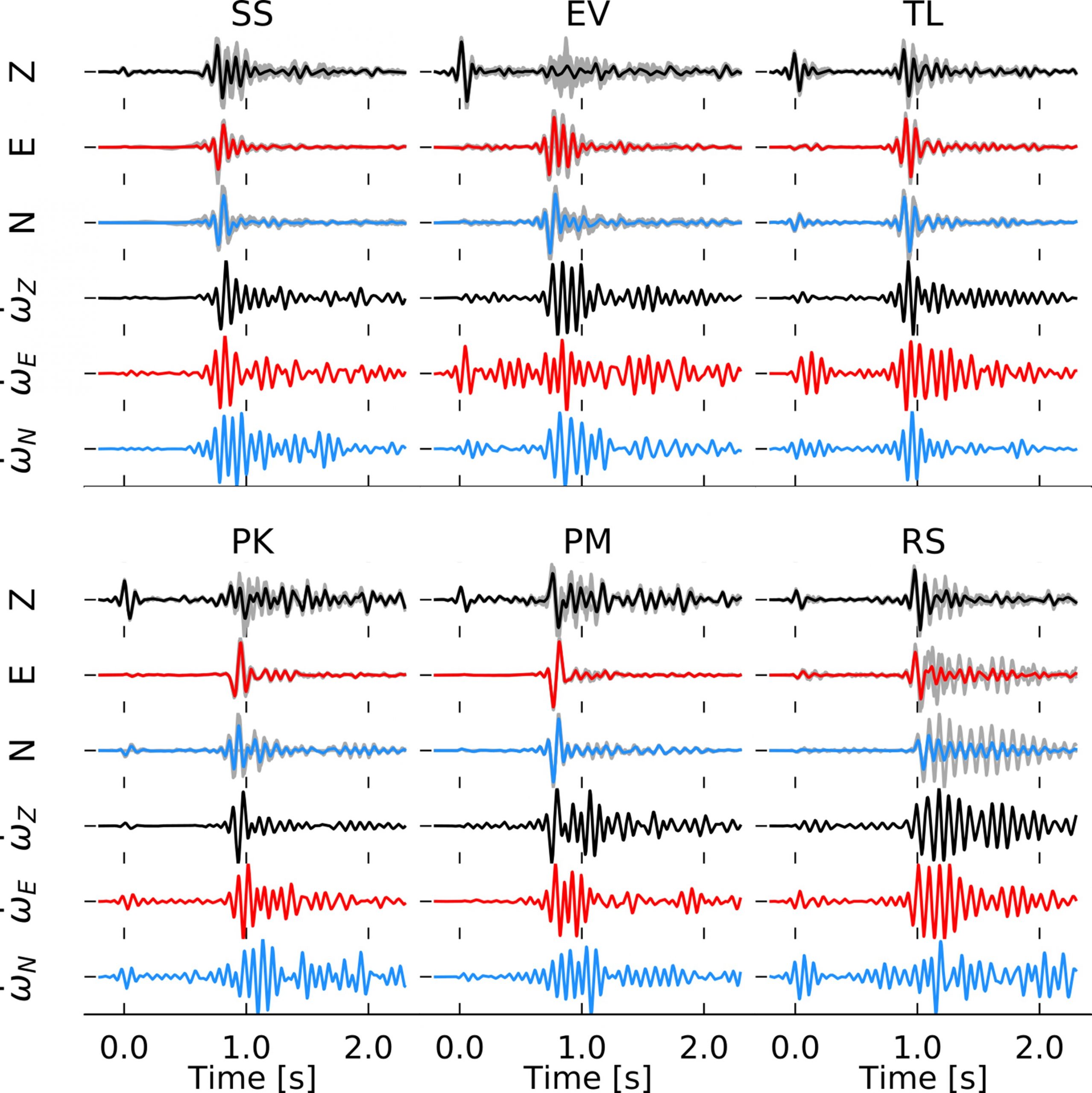
Here at the Institute of Seismology, University of Helsinki, we estimate the array-derived rotational motions about the vertical and horizontal axes for almost 500 small-magnitude seismic events that were induced by the 2018 stimulation of the Espoo/Helsinki geothermal reservoir. We process data from the six geophone arrays that were installed in the Helsinki metropolitan area. Despite the small magnitude of the earthquakes, we obtained clean rotational motion records showing the applicability of the array technique for estimating rotational motions caused by such small-magnitude earthquakes.

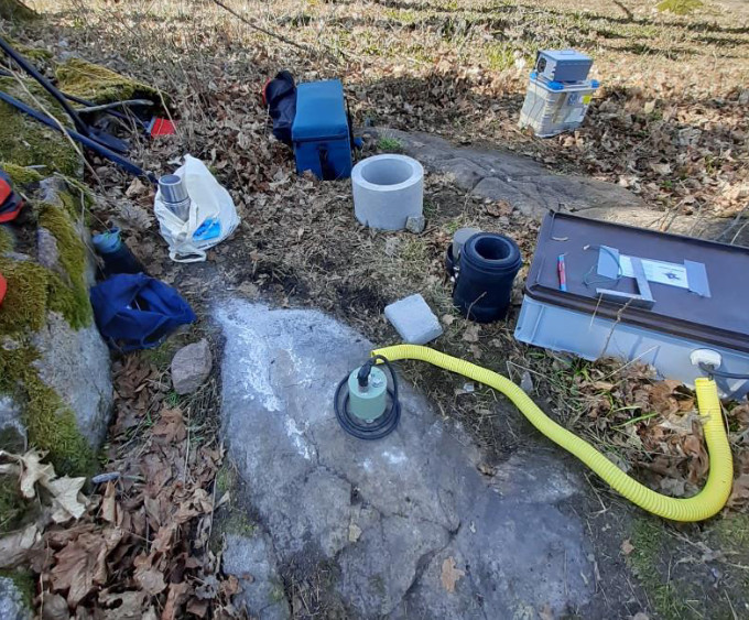
The arrays of geophones used for recording translational motions from the seismicity induced by the 2018 stimulation of the Espoo/Helsinki geothermal reservoir (read more https://doi.org/10.1785/0220190253)

Some sample array-derived rotational motion timeseries obtained from the translational motion records (read more https://doi.org/10.1029/2020GL090403)
Amir Sadeghi-Bagherabadi, university researcher

