Hike to Mt. Kasigau


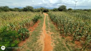
Today was finally the day that we faced the challenges of Mt. Kasigau. Our morning started very early at 6 o’clock when we had breakfast and after that we stepped on the bus and started the drive towards Kasigau. The road to Kasigau was quite bumpy but we got to see some cool stuff along the way. For a large part of the drive we drove through one of the largest sisal estates in the world. Sisal belongs to the agave genus and it has a wide range of uses. The most common way of using sisal is rope and twine. Along the way we also got see some more giraffes and this time they were a lot closer and there was quite many.

Sisal estate along the drive to Kasigau.
Giraffes on the way to Kasigau.

We got the bottom of Kasigau at 9:20 and we geared up and got ourselves mentally ready for the challenge. We were told beforehand that the hike was going to be tough, so the atmosphere was somewhat tense at the beginning. But as we got further from the start the mood changed to happy and relaxed which made the experience a lot more fun. From the start it was clear that this was going to be more tricky than usual. We got into the forest and started to hike our way up the slopes of Kasigau. The rainy season has been really prolonged this year which meant that the trail we were using was covered by plants and trees in some places. Our guide had his work cut out for him because he had to chop down a lot of plants for us to be able to go through. Slopes of Kasigau were at places very steep and slippery which meant that we really had to be careful and climb slowly. Luckily the forests had a lot of trees and roots to offer which made climbing easier.  Along the way we saw again interesting plants, trees, and insects. But the most common sight was spiders, they were everywhere in all shapes and sizes. Most of them were quite small but some were really big and looked quite intimidating.

One of the biggest spiders we saw on the way up.
Some large insects were also found on the way up.

As we got further and further, we really had to push each other and give support for everyone so we would make the summit. As we got closer to the summit the ground started to level a bit. This was a nice little break from all the climbing as we got to walk on some flat for a change. And it turned out that it was nice to have a flat part before we started the most steep and dangerous climb towards the summit. The ground at this last section was really wet and muddy from all the moisture from the clouds and rain which meant that using trees and roots as support was essential. After the steep part ground started to level out which meant that the peak was close. Finally, we reached the highest peak of Mt. Kasigau after of about 4,5-5 hours of climbing. At the summit there was quite thick cloud cover which made seeing the views pretty difficult. Also the plants were higher than usual at this time of the year which made it tricky to see all the way down.

Foggy trails near the summit.
Steep slopes of Kasigau.

We took a nice long rest at the summit and enjoyed some snacks to give us fuel for the long way down. We started at about 600 meters above sea level and the summit was roughly around 1600 meters above sea level. We climbed about a 1000 meters up which was felt in everyone’s legs. After the long rest we got up and started heading down. We took a different route down which quite a bit easier but still steep and slippery in places so careful and calm descending was the way. Along the descent we got to a much better viewpoint which gave us a wide perspective of the vastness of surrounding flat areas. On the way our guide also told us some interesting facts about the trenches built on the mountain during WWI by the British.

View from the viewpoint on the way down.

We got down from the mountain safely and nobody was hurt which was a success. During the final parts of the descent, we met some local women who do some traditional weaving of basket from the sisal fibre. We got some nice basket from the women which cheered the groups mood. Our bus driver also hopped on a bike to get the bus to us which meant that we could rest our tired legs for a good time. The bus arrived we all quickly hopped on and started our way back to the station in Wundanyi. We got the station at around 20:15-20:30 and all of us were exhausted but the completion of the hike was really rewarding.

Meeting rangers and looking for lions

Ready to take on the day

On Thursday the 18th of January, after having breakfast at the station we headed to the same hotel, Taita Hills Safari Resort & Spa, where we had joined the company staff party the previous Saturday. There we met with a group of rangers from Taita Hills Wildlife Sanctuary, inside which the hotel is located, and LUMO Community Wildlife Conservancy, which we had also already visited previously.

The meeting commenced with a round of introductions and Petri donating a copy of the poster about the land cover changes in THWS. Then Enrico gave a short presentation on his work on the utilization of citizen science and social media data in conservation. After that, we began the exercise of the day. Us students split into three groups (Big 5, mammals excl. Big 5, and birds) and took turns asking the rangers to locate the areas within the reserves where it is most likely to find these groups of animals. The rangers marked their answers on a map with grid cells.

For the second part of the exercise, one of the students co-leading the exercise, Tuomas, presented his findings from going through social media data in regards to species richness hot spots in THWS and LUMO. The groups then presented this second set of maps to the rangers and allowed them to compare the findings to their previous answers to see whether they agreed with the data. There was overlap with the rangers’ answers and the data gathered by Tuomas. Interacting with the rangers was a unique opportunity and hearing all their impressive knowledge was insightful.

Listening intently

After a successful conservation exercise with the rangers, we had a buffet lunch at the hotel. We were spoiled for choice among all the delicious food options, including dessert, and there was surely not one person that left the buffet with room for any more food. Following the lunch, it was time to head back into the sanctuary for another game drive. We heard there had been sightings of lions and giraffes inside the sanctuary so the general mood in the bus was full of excitement.

Who could say no to dessert?
Eager as a weaver for the safari

On the way to Lion’s Rock, we saw some animals that we had already seen like elephants, kongoni and baboons. We took our time circling around the rock but there was no sign of lions anywhere. A guide from a passing vehicle told us the lions had been seen in the area the same morning but they appeared to have moved elsewhere already. Feeling slightly defeated, our mood was soon lifted once again when we spotted three giraffes. It was something everyone had been looking forward to. We sat in the bus and observed these tall and elegant creatures as they munched on some leaves.

A kongoni (Alcelaphus buselaphus) posing in front of a nice scenic view of Taita Hills
Finally! A Masai giraffe (Giraffa tippelskirchi) on the horizon

During the drive we also saw some large birds of prey, including the lappet-faced vulture, Africa’s largest such bird, and a magnificent tawny eagle from only a few meters away. Additionally, as we were just about to exit the sanctuary, a black-necked spitting cobra crossed the road right in front of our vehicle. In the end, while we didn’t manage to find the lions this time, it was still another very educational and fulfilling day full of adventures in Taita.

Tawny eagle (Aquila rapax)
Slithering away

Maktau farm

Today we continued studying plant and environment monitoring methods. Eight o’clock in the morning the bus left the research station and head to the Maktau village located East from Taita hills. In Maktau we got familiar with farm land owned by Mwadime  (the foreman of the station) and his family. The farm represented typical agriculture land of the region, but it was also  interesting test field of many combinations of  diverse plant species and measuring loggers. The most common plant was maize, but there were also cowbeans, peanuts, watermelons, cassavas, passion fruits and papayas just to mention some. Also bees, chickens and goats were part of the farming goods.

The road through to the maize field
Eddy covariance and solar panels
Beehive
Watermelon

Our job was to measure different variables that may indicate condition of maizes (also cowbeans and some hays). These variables were height of the plant, chlorophyll value, temperature of leafs and soil, and stomatal conductance. Stomatal conductance measures the openness of leaf pores, which indicates amount of drought. Stomatal conductance was measured with machine called porometer.

Chlorophyll measuring
Effective team work

We work very effectively with two teams. The first team located the numbered test plants and measured the heights. Second team took other measurements and one person took notes. At some point we noticed that clouds in the skyline were momentarily moved revealing snowy slopes of mt. Kilimanjaro. It was nice to see the highest peak of Africa even from distance.

mt. Kilimanjaro

After measurements Mwadime’s family offered us meal and we returned to the base camp. At evening we decided to have movie night and watch (probably the best) Disney classic ”The Lion King”. Despite problems with wifi connection, we managed to enjoy about the first half of this timeless story. Hopefully we can watch the rest some other night.


Environmental sensing activities at Kishenyi fields


For the past few days, we have been studying human-nature interactions. So, today we have shifted our focus more to the environment. This morning  (19.1.2024) we had our first brief introduction lecture on environmental sensing techniques by Ashfak Mahmud. We came to learn about soil health assessment and monitoring, conducting ground-based measurements using a field spectrometer, indoor and outdoor soil and leaf spectral measurement protocols and also got to know more about the instruments for environmental sensing activities- spectroradiometer and accessories. It is really interesting to know that by comparing and analyzing spectral measurements we can monitor soil and vegetation health. After the lecture, we left for Kishenyi. We did two types of activities at the field sites:

  1. Outdoor spectral measurement of maize leaf
  2. Soil sampling

Outdoor spectral measurement of maize leaf

To take the measurements, we went to the test field sites of the REACT project. There we took spectral measurements of maize leaves using a spectroradiometer, leaf clip, white reference and android PDA. First, we took the reflectance measurement of the white reference and then we took the the measurements of the target leaves. We didn’t need any external light source as the leaf clip has its own source of light!

Spectroradiometer and the leaf clip
Leaf spectral measurement

Soil sampling

Firstly, we selected sites for the soil samples and by using push probes and hammer probes, samples were taken out. We had sieved the samples before lebelling them.


Sieving the soil samplesWe also tracked the location of those sites by using the GPS device. After coming back to the station, we took the measurements of soil spectra in the laboratory room using the spectroradiometer. The room was completely dark and we tried to ensure that no other light source was present there as it can hamper the actual result.

It was a suceessful day with lots of learnings and hand on exercise experiences!


More agriculture and transect walking

Today (16.1.2024), we continued group discussions with local farmers, but this time in the lowlands town called Maktau, where we were able to see how farming practices differ from those used in highland areas. Our interviewing skills were once again tested as we tried to maintain smooth conversations. All groups had meaningful and rewarding discussions with the farmers about agriculture. Additionally, we shared a lot of information with each others about our daily lives and environmental conditions in Kenya and Finland. Because of that, it turned out to be one of the most instructive activities on this course.

Our group discussions were taken place in a nicely colourfull church.

After the rewarding group discussions, we implemented the familiar exercise of transect walking near the interview location, but this time we had 16 different observing points. In terms of elevation, today’s route was very flat, with minimal environmental changes between the various observing points.

Landscapes during the transect walk.

After completing our agriculture-related exercises, we headed to Mwatate, where we met a group of local women who handcraft beautiful baskets from sisal and sell them locally as well as to Germany. After chatting and making some purchases, we headed back to the research station.

Some beautiful baskets they had.

At the end of the day we had a nice little pizza party for one of our teachers who left the next day to go back to Finland.

Agriculture, transect walk and focus group discussion in Kishenyi

This morning  (15.1.2024) we had our first brief introduction lecture to sustainable agriculture. We learnt more about such terms as agroecology, climate-smart agriculture and regenerative agriculture. Agriculture accounts for 29% of GDP in developing countries and is the source of employment for about 65% of the population.  Here in Taita area the source of employment in agriculture is about 70%. That is something that we have been able to observe already in the first days in Taita, but today we really had a great opportunity to learn a lot more about agriculture. Agriculture is a significant cause of climate change responsible for 10-12% of human-generated greenhouse gas emissions. As agriculture and climate change are big topics in Taita we went to see farms firsthand and had rewarding conversations about agriculture itself with local farmers. 

Delicious lunch in Kishenyi

How were the local farms in Kishenyi?  

After the lecture we met our dear driver (captain) Ruben who drove us once again safely to our destination which was a local farmhouse in Kishenyi area. In the farm we could observe surroundings and once again learn a lot about agriculture from Mwadime. We started the visit in farm from valley where was also University of Helsinki´s meteorological measurement devices. From the valley we walked uphill. While walking we did an exercise called transect walking. Down from the valley until up to the upmost fields we had seven different observing points. In those observation points we wrote down notes about different interest points  – such as plants they planted, animals, housing, watering systems and also people. The transect walk was a chance to observe both physical and human geographical aspects of the area. The best thing about visiting farms was getting to meet farmers who were so kind and welcoming. They gave us plenty of new knowledge and sugarcanes! 

Goat in Kishenyi

Interactions with local farmers  

After the transect walk we headed to Ngache Dairy Farmers Co-operative Society LTD house.  There we met more farmers with whom we had focus groups discussions. Focus group discussion is one of the qualitative methods used in human geographical research. Conversations that we had with locals were organized in four groups. We got to test our skills interviewing people and leading conversations. Surprisingly hardest things interviewing people were:  

  1. Understanding each other’s properly  
    1. Accent 
    2. Speaking with low tone  
    3. Cultural differences  
    4. Speaking in English which is not mother language of participants 
  2. Not being able to answer all Finnish agriculture related questions since we are geographers, not agroscientist  
  3. Quiet moments  

Best things interviewing people were:  

  1. Learning a lot about agriculture, daily life of farmers, Kenyan agriculture markets and policies and culture and habits itself in Taita.  
  2. Possibility to connect new knowledge to former studies and give them spatial view 
  3. Unique possibility to interact with locals and unite people from different backgrounds  

After the interviews we had a delicious lunch all together in the yard. Big thanks to our chefs!  

Coffee  

After lunch we were invited to see coffee plantations nearby. We learned that Taita was a leading coffee producer until the coffee production and market went down. We also happened to meet a farmer who let us see his farm and animals. After all, we saw a drip irrigation system that a local farmer set up in his field. They were all so welcoming, and it was heartwarming to see how they were so happy to share their knowledge with us. 

Learning more about coffee plantations


Footballing and sunset hiking

Today was a day full of physical exercise! The morning began with a good breakfast, as we were going to need all the energy for our football match against the local team. As we started to walk towards the field, our team was getting a bit nervous… But nevertheless, we were ready to play! Fortunately, the weather was cloudy at first, so we weren’t baking in the sun, although it was still quite warm for us.

The football match was played in good spirits, and the atmosphere was phenomenal! Each team was scoring one goal after another, and the game ended in a tie. Then was the nerve-racking time for penalty shots, as five players from each team tried their best to score the winning goals. And would you believe it, our team won! Although sweaty and exhausted, we were extremely happy and most importantly had fun.

The winning team!

In the afternoon after lunch we ventured for a walk to the peak of Yale (also called Iyale) mountain, which stands at 2 100 meters above sea level. The plan was to climb to the top to see the sunset, and then walk back in the dark. The walk started from the east side of the Yale forest and proceeded into the thick vegetation. Some parts of the forest had once been agricultural fields, and some of the benches were still visible. We also saw a really big fern.

A big fern

The climb was a bit challenging at times, as the slopes were quite steep and the rocks and roots were slippery. The journey got a bit scary even, as the paths went occasionally very near the steep cliffs. But that didn’t stop us! We were actually an hour ahead of the schedule, and had a good time hanging around at the top, watching the sun set behind the cloudy mountains. We were a bit worried the big rainclouds would cover the sunset completely, but luckily they moved just enough for us to see a glimpse of the setting sun.

A beautiful sunset regardless of the clouds
Some even dared to hangout at the edge of the cliff

As the sun went down, we started our descent from the top. After a while, all we could see were the lights we had and the path they illuminated, and we had to be careful not to slip down the difficult parts of the path. In the end, we all made it safely back to the bus that was waiting for us, and we even got to admire the amazing stars twinkling above us.

Shining headlights coming down the hill

Conservation geography, safari & Dirlandaa

On the third day it was an early morning for the Taita field course, as we had an exciting safari day ahead of us! Our bus, named as Toyota Predator, started for LUMO Community Wildlife Sanctuary southwest of Taita Hills.


LUMO Sanctuary is a community organized conservation established in early 2000s’ by three local livestock ranches, with current members around 7000. Parts of the LUMO sanctuary are strictly for conservation and part for also livestock management, making the area an interesting site for studying conservation, livestock management and dynamics between them. Over time LUMO area has been transitioning from grassland and shrubland to grassland and barren land due to overgrazing. Studies in land cover changes had been compiled into a poster, which was presented to station manager Joseph.

We had a chance to hear from Joseph and LUMO rangers on dynamics between wildlife and cattle grazing, as well as other local livelihoods. There has been recent conflict between human-raised rogue elephants and the locals, with some of the elephants cracking open the house roofs and snacking on peoples’ pantries, with candy being the favoured snack. Because of the prolonged rain season, normally dry savannah was lush and green.

In the field we were show thermite mounds and how they study them. There are two types of termites, which you can identify by the type of mound they build. The termite mounds are easy to spot in the landscape by their colour and size.

For lunch we headed up to Lions Bluff in Tsavo. The views where breath taking and the food delicious. We highly enjoyed our stay but after the lunch we were eager to see more wildlife. Because of the greenery the animals are spread out, and the grass is much taller, which makes spotting them difficult. We saw Eland, Imapala, Grant’s gazelle, thompson’s gazelle, hartebeest, gnu, ground squirrel, slender mongoose, zebra, elephants, lesser kudu, ostriches, and many kinds of birds.

After a long safari day, we headed to a local wildlife lodge, with the intentions of grabbing quick refreshments before heading back to the station. Arriving at Taita Hills resort & spa, we we’re met with blaring music, resort employees dancing around dressed as santa clauses and DJ hyping up the crowd: we had crashed the resort staffs’ post-christmas party. With Taita research station held in high regard amongst the locals, we were invited to join the party as guests. Free refreshments were served, and we had the chance to enjoy the entertainment and mingle with the staff. As we were met with open hospitality, we wished to also give something in return. As the sun was setting over Lumo Community Wildlife Conservancy, the familiar tunes of 70’s hit song by Kai Hyttinen rang out above the savannah. With many a Dirlandaa danced amongst us geographers, this one had to be one of the most legendary ones. As the staff joined in on our dancing line snaking through the tables, an unforgettable moment was shared, and we danced our way to the sunset.

Ngangao – A Unique Indigenous Cloud Forest


Our first full day in Taita was all about forests. We started the day by visiting the Kenya Forest Service that have a tree nursery near the research station. At the nursery they grow seedlings until they are ready to be planted elsewhere. Some of the tree species are native and they will be planted to forests like Ngangao to revive the native tree habitats. Other species are sold to farmers for additional income.

Locating ourselves in Ngangao.

After the tree nursery visit we headed to Ngangao, a rainforest located a short but exciting car ride from the station. Due to heavy rain some of the streets were in quite bad condition, full of pits and ravines. We were accompanied by great local guides from the Community Forest Association and the Kenya Forest Service. Ngangao is one of the few indigenous forests in Taita and it is home to many native and even endemic species. It is also a global biodiversity hot spot but under heavy pressure of human activity. Ngangao rain forest is managed by the Community Forest Association. The idea of the association is to bring together local people to take care of the forest. As the forest is often only seen as a cost and its animals a disturbance for farming, The Community Forest Association works towards increasing knowledge about the forest, for example as a water provider. It’s also important for sustaining biodiversity and mitigating climate change. Getting local people invested allows them to feel more connected with the forest and eager to take part in conservation efforts.

Inside a giant tree.
The wide canopy of the mother tree.

Even though our guide had told us that Ngangao was also home to several snake species we bravely entered the forest. Waiting for us were bright green leaves in various shapes, crazy coloured mushrooms, towering tree trunks, mysterious insects and spiraling epiphytes tightly squeezing the wood under them. One of the highlights was meeting mother nature herself, the mother tree. The mother tree, a 45 meter and 300-year-old Newtonia buchananii, is the tallest tree in Ngangao. It has a canopy of 42 meters and a trunk that took 7 of us to encircle. After hugging our newfound mother, we continued with our journey that was halted as we encountered another force of nature, pouring tropical rain. The rainy season this year has been exceptionally long and some of us were not prepared for this shower. Soaked from head to toe we waited for the rain to pass which luckily didn’t take long. We once again headed forward with the forest now smelling fresh and misty. Other memorable moments were the beautiful views from the top of the mountains and the shield shaped rocks that give the name Ngangao, two shield, to this beautiful forest area. Tired but happy after our 10 km hike our driver safely returned us to the Taita station. In the evening we again enjoyed a delicious evening meal and the warmth of the sauna.

One of the endemic species, Impatiens teitensis.
Mysterious insect.
Views towards west and Saghasa. On the slopes you can see typical terrace farming.

Long Journey to Taita

Welcome to our Taita Field Course blog site! Here we’ll write about our adventures on Taita field course 2024 in Kenya.

Our journey started on Wednesday when our flights took off at 7 am from Helsinki-Vantaa airport. After long hours on two separate planes, we arrived in Nairobi in the night’s dark.  At the airport, our drivers Ken and Ruben were waiting for us and welcomed us with open arms and drove us to our hotel where we spent the night.

The next morning we started our day with the hotel breakfast and greeted those who had arrived in Nairobi before us. When we had eaten our stomachs full we were introduced to the bus we’ll be using for the next two weeks also known as “Toyota Predator”.  With cheerful spirits we lifted our bags on the roof of the bus and started our drive towards Taita.

Our group ready for take-off towards Taita

Unfortunately, our drive didn’t have the best start when the leading vehicle of the professors broke down before we even got out of Nairobi. But things weren’t that bad, because after a short wait at the local supermarket, Petri and Enrico joint our party bus and we could continue the great  migration towards Taita hills.

Loading the professors bags

The trip went by quickly when admiring the changing landscape as we drove along the highway. The chaotic traffic took some time to get used to, but after a short while we realized there is nothing to worry as our driver knew what he was doing. Along the way you could spot countless vendors selling all sorts of stuff to drivers passing by and you didn’t even need to get out of the car as they came to your window with their goods.

At the halfway point we stopped for lunch to a sikhi temple where they served us a delicious meal. The temple was a beauty and we were glad to donate some funds as a thank you for the food and service.

Sikhi Temple served us well

Rest of the journey went smoothly while enjoying the savannah of Tsavo National Park.  We spotted a lot of wildlife including elephants, zebras and different antelope species.

Dumbo

We arrived to Taita research station just before dark and were greeted by the amazing staff members of the station. As we marveled the magnificent views of the new Petrihouse, delicious smell of freshly cooked meal reached our noses. We enjoyed the meal and called the day.