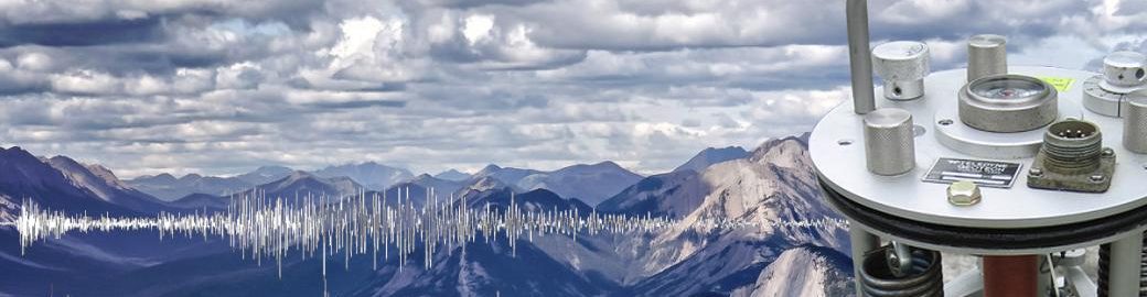
Finland’s first seismograph began operating in Helsinki a hundred years ago. It is a milestone worth noticing and a long time for humans.
However, one hundred years is a brief time to collect evidence of earthquakes. In many regions, no strong earthquake has occurred in over a century, and even in regions with recent large earthquakes, a century is too brief to properly assess the long-term seismic hazard of the region. Although seismologists generally do not work on geological timescales spanning up to millions to billions of years, their work does include extending the series of earthquake observations as far back in the past as possible and forward into the future.
Earthquakes in the distant past can be investigated by using non-instrumental seismological methods. The likelihood of a strong earthquake occurring goes up the longer the time of observation is. The price of looking very far back, however, is an increase in uncertainty about the earthquake size – but there are ways of using available evidence to model sizes of earthquakes in the past.
Before measuring devices became common, the impacts of earthquakes could be observed directly by the naked eye. Especially after earthquakes caused damage, people have written documents about the event for authorities and other contemporaries, and sometimes also for scientific purposes. The most reliable of these reports are from eyewitness accounts. In the best cases, detailed written records have survived to modern times and been found by researchers. Through modern research methods, the seismic history of a target location showing how often strong earthquakes have occurred and how those earthquakes have impacted society over the centuries, or a couple of millennia in some parts of the world, can be extracted.
The geological traces left by strong earthquakes in the natural environment can go back to at least ten thousand years ago. The suddenness and violence of the earthquake remains as displacement movements, subsidence or rise of the ground compared to the environment, old landslides, and ancient water paths in the soil. The location and timing of these traces adds information about the frequency of strong earthquakes. Searching the landscape for evidence of large earthquakes is called paleoseismology.
The Fennoscandian Shield in Northern Europe has ancient bedrock and is seismically relatively quiet. There are written records of earthquake effects as far north as Lapland for almost three centuries and in the south for a slightly longer time. At the end of the last Ice Age, the retreat of the ice mass changed the stress conditions of the earth’s crust, causing strong earthquakes associated with several southwest-northeast trending fault escarpments in northern Fennoscandia. They have been dated to about 9–11 thousand years ago.
In the 2000s, high-resolution LiDAR (Light Detection and Ranging)-images, trenching, and seismic reflection campaigns have advanced paleoseismology in Fennoscandia. Traces of paleoearthquakes have been identified in lake sediments in the south. It has been proposed that paleoseismicity had three maxima in the Finnish territory around 10-12 thousand years ago, 5-7 thousand years ago, and 1.5-3 thousand years ago. The highest magnitude earthquakes, likely around Mw7 and above, were associated with the oldest earthquakes, and lower magnitudes (around Mw6) with the younger events (https://doi.org/10.1016/j.tecto.2019.228227). Traces of strong earthquakes 700–4000 years ago have been reported from the Stuoragurra postglacial fault in northern Norway(https://doi.org/10.1017/9781108779906.015). What is special is their size range – up to magnitude 7 – which challenges the old notion that the strongest earthquakes occurred relatively shortly after the Ice Age.
Knowing the seismicity of the past is critical in assessing the seismic risk in the near future. Because we cannot predict exactly when and where an earthquake will occur, probabilites must be used. The usual way of talking about seismic risk is that an earthquake of a given size or a given ground motion occurs in a target area with a given probability in 30 or 50 years. This 30-to-50-year period is related to construction and engineering building codes, and the hazard maps are aimed at ensuring that appropriate seismic building codes are used so that strong ground movements do not damage buildings and society’s infrastructure.
Seismologists therefore have at their disposal a catalog of instrumental measurements from the last 100 years or so, and usually a longer period of non-instrumental observations. Combined, these give seismologists the best data available for working with engineers to plan for the strong earthquakes that will inevitably occur in the future.
Päivi Mäntyniemi, University Researcher