Mount Vuria, beers and a skull cave

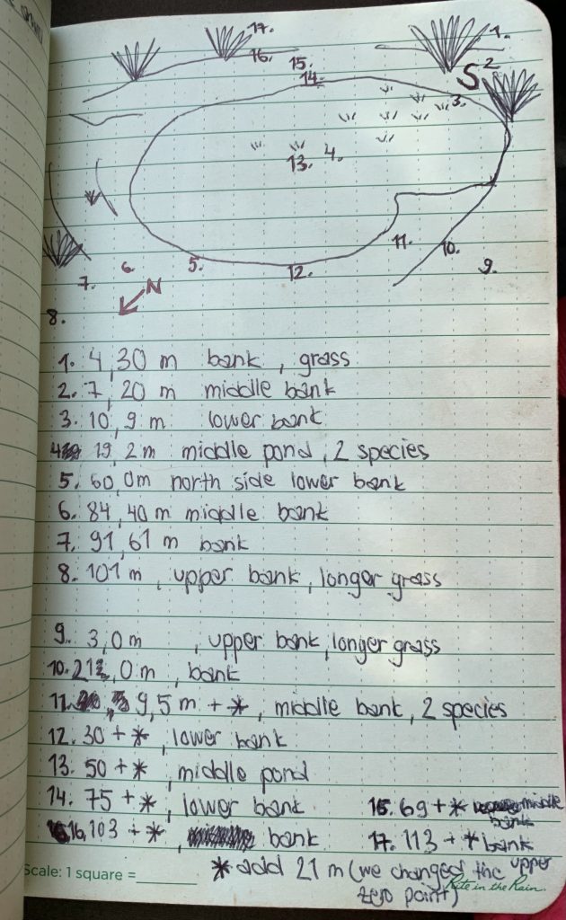
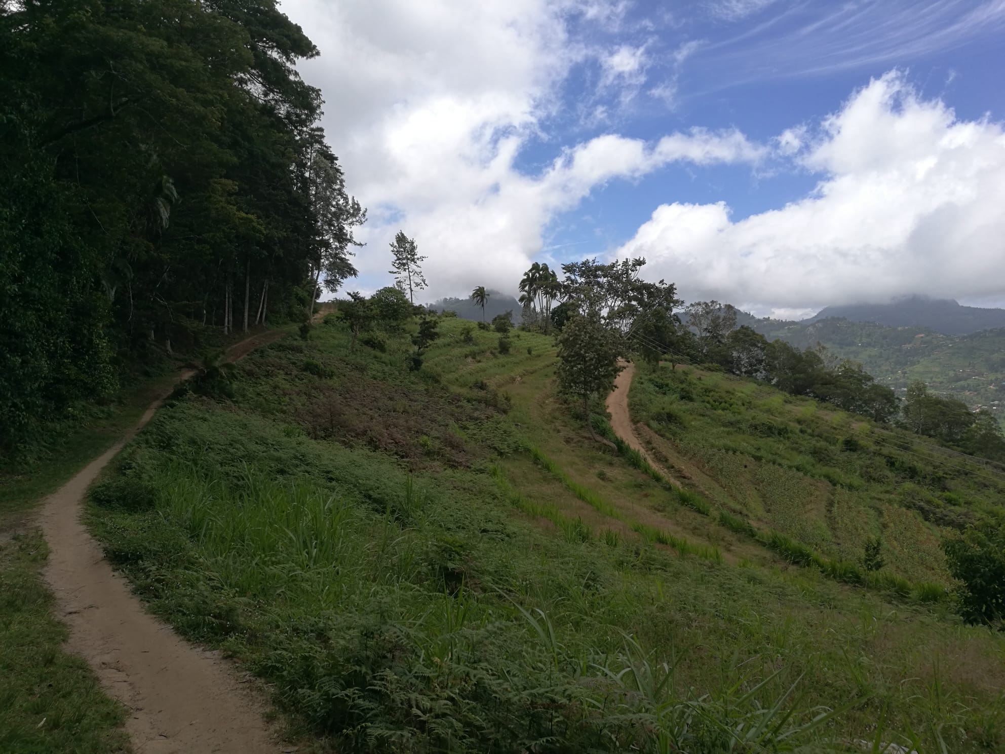
Saturday morning we got up to hike mount Vuria the highest peak in the Taita Hills at 2,228 meters. At first we were all worried this hike was supposed to be much harder than the previous one and at the start of the hike the sun was beating down on us. However in the end we found it much easier as the area got moister and colder as we were climbing and we took lots of breaks.

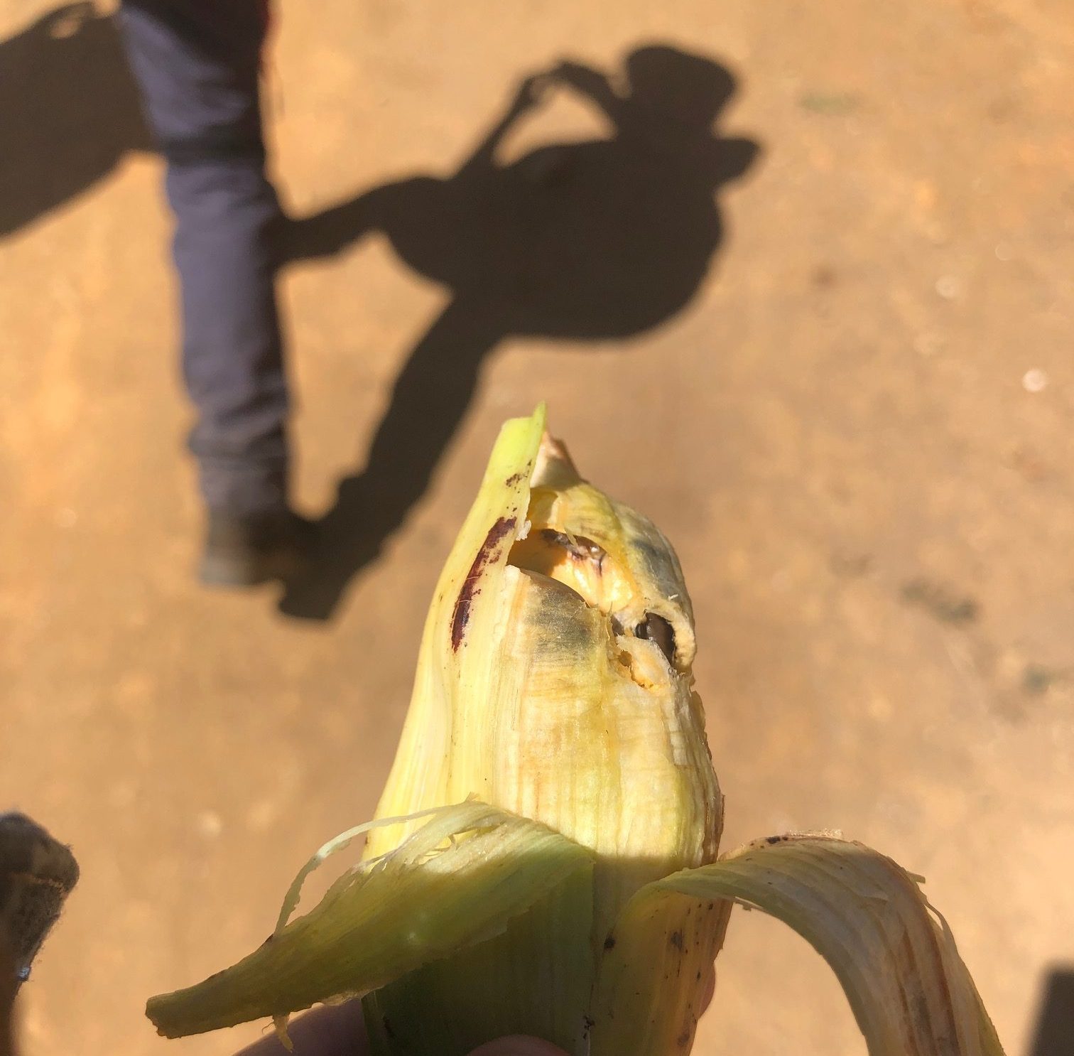
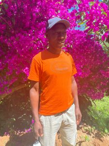
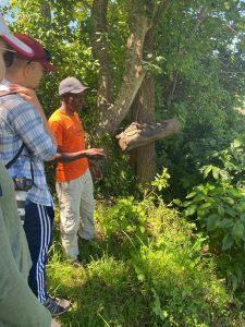
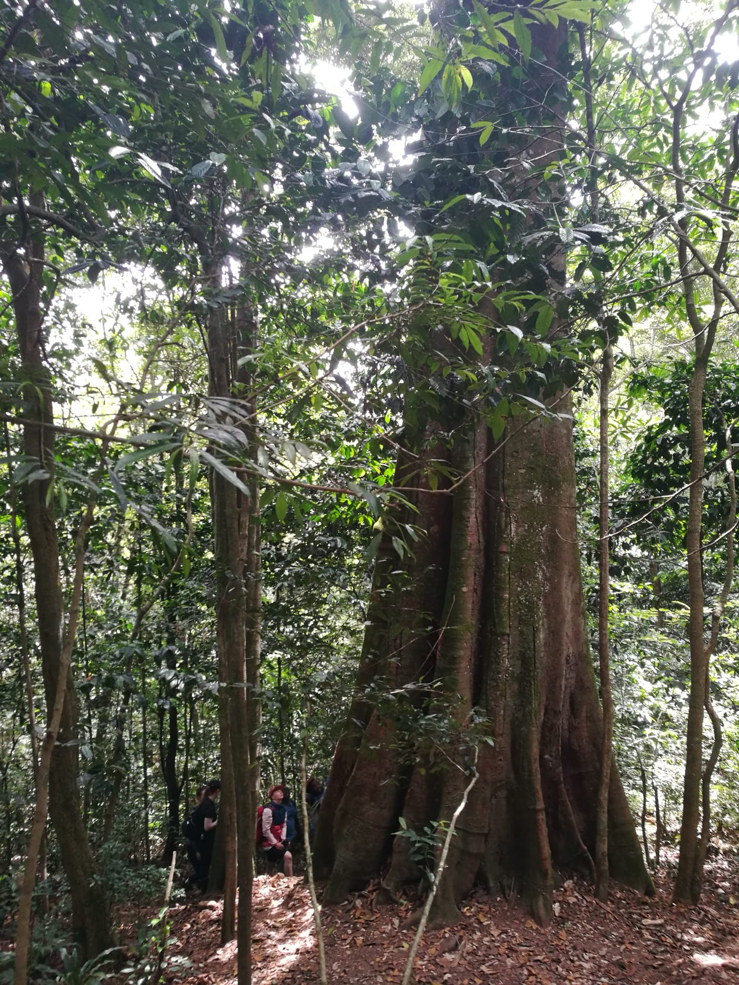
On the way up, Mwadime, one of the station members provided lots of information about the surrounding plants and culture. He taught us about how the local farms are split between all children after the parents’ death, meaning that the farmland an individual owns decreases after each generation. This has led to farmers buying and expanding their land into the lowlands. Addtionally we were taught about some of the human wildlife conflicts with the local monkeys trying to steal farm food, meaning the farmers have to stay up all night to protect their crop. During the trek we also learnt about the tree species in the area with 95% of the valley being exotic trees such as eucalyptus, avocado and cyprus trees. Whilst walking we found a wild ancient banana species, which Mwadime mentioned that in times of famine, these wild banana species could become an important source of food.

An ancient banana species we found

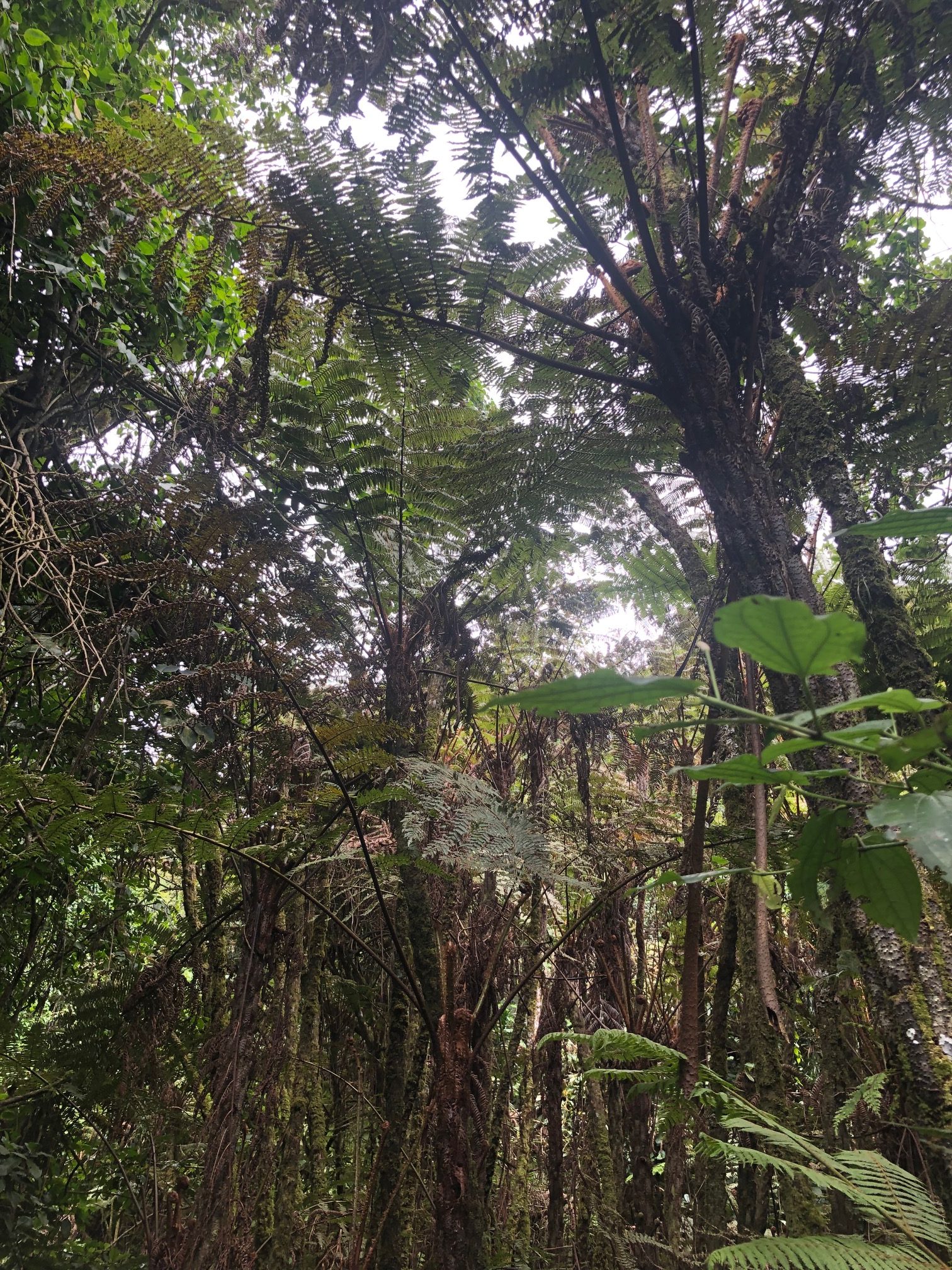
Further into our trek, we started to enter the forest where the climate became cooler and our our trek got easier for a while, apart from being yelled at by some disgruntled goats along the way. Later on, we came across a fern tree forest, which was something I previously wasn’t aware of even existed, but as we continued the forest provided a new issues, mainly that it seemed like every tree was trying to trip us up.

The fern tree forest, we encountered during our hike

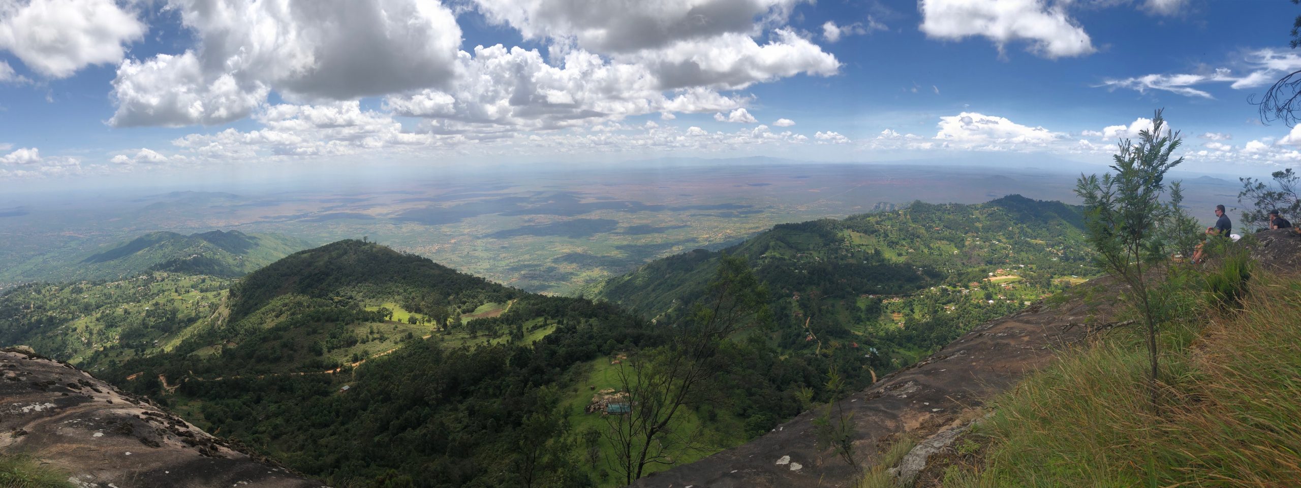
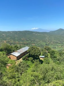
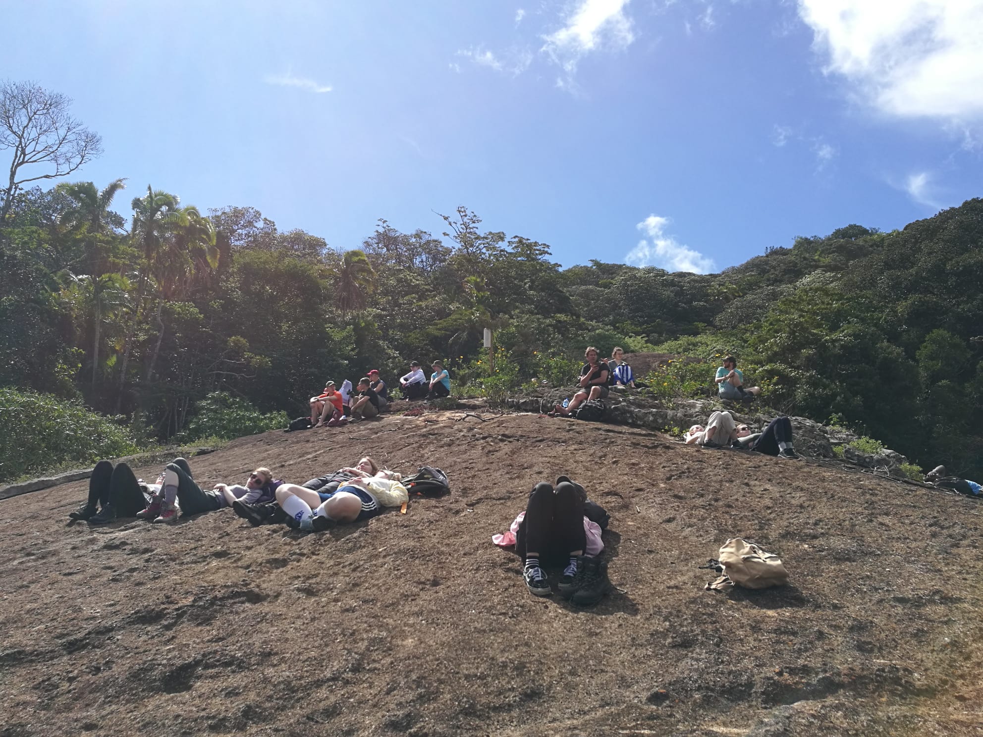
Finally, we made it to the top, where we had the most stunning view of the savanna below and had a lovely long lunch, where we could relax and enjoy the sun and the view. Unfortunately, some of us enjoyed the sun too much and got some nice sun burn whilst up there.

The view atop mount Vuria

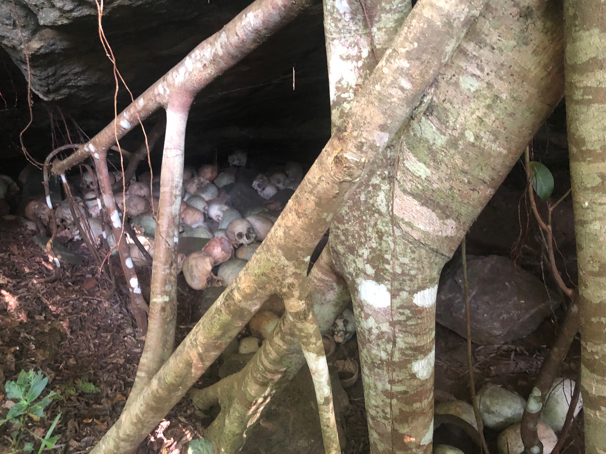
After we got back down the mountain, we rewarded ourselves for our hiking efforts by visiting a local pub for a nice beer. We then left to head towards our next destination for the day, a skull cave which is a sacred burial site to the local people. Here all the important members of the local clan have their skulls are laid to rest. These are laid out in a particular order based on generation so that clan members can later recognise their loved ones. Whislt there, Mwadime told us more about the caves and their importance, mentioning that it is very dangerous to remove any of the skulls. He then told us a story of a local school teacher who took one of the skulls for his science class, only for the school children to become uncontrollable until the skulls were given back to the elders and the appropriate rituals were preformed.

A picture from the skull cave we visited. The skulls were under a massive boulder which had a tree growing on the top, with its roots protecting the skulls from the elements.

Overall we had a very interesting day filled with lots of different activities, with special thanks to Mwadime for being a wonderful guide for the day!

Field day in the farms

On the fifth day of the course, we had an exercise about apiculture. The task was to find out suitable places for beehives within given areas by using Participatory GIS. Because of the covid situation we could not interview people outside our ‘’covid bubble’’ so we concluded the interviews with the research station’s local staff.

We were lucky to visit Granton’s farm


Living area of the bees is decreasing and bees are very important for pollination. Bees also work as income generating activity for the farmers as the price of honey is high. Beehives are also used at Taita Hills as a mitigation method to human-elephant conflict as elephants tend to be scared of bees’ stings. Even though elephants’ skin is thick, the bees can sting them inside the trunk or behind the years where the skin is softer.

Land use, vegetation and flora type among other things are variables for bees’ ideological environment. Bees also are affected by altitude, distance to water, terrain and distance to roads and urban areas. In the exercise we were supposed to interview farmers about these variables and find a suitable place in their farm for the beehives.


Kilimanjaro on the background


First, we were divided into five groups and each group travelled to the staff members’ farm. Some of them were as close as 300meters from the station and some were further away in the lowlands. My group travelled to Granton’s farm, which was located about 15km away from the station but within the Taita Hills. On our way to the farm, we had a beautiful view to Mount Kilimanjaro in Tanzania.

When we arrived to the farm, we learned that Granton was already skilled in beekeeping. He had in total 4 modern and 4 traditional beehives. From experience he told us that the modern beehives are better and showed us a few plants like musisiha and murimbawasi (names in Kitaita language) that are good for the bees. Granton also told us that he inspects the hives once a month and that he cuts the grasses around the hives regularly so that they do not burn the hives in case there is a fire.


Traditional beehive


After having tour around the farm we interviewed Granton about the variables that affect beehive productivity. After the interview we marked possible best places for the beehives at the farm. After the exercise we noticed that according to our variables Granton’s farm was very perfect spot for the hives and the best spots were already occupied by his hives! Later we learned that Granton’s farm scored the best points from our variables from all the farms that were visited by the students. In the video below Granton shows how to clean (empty!) modern beehive.


On the way back we learned some Kitaita:

Thank you = Chawucha

Good day = Kwasina mana

Good night = Lale mana

Good morning = Kabuka mana


Thank you Granton for a nice day! Asante sana Granton kwa siku nzuri!

Swimming in sweat

Our third day in Kenya started as usual with delicious breakfast by Phenny and Jonathan. As we were eating we got informed that our teachers had arranged us a pleasant surprise: they told us that we would go swimming after field work! This news got us super excited and ready to roll, so after breakfast we headed back to the lowlands and savanna to continue with Ilja’s Heliotropium locating and measurements in Lumo sanctuary. When entering Lumo we got to see many lovely animals again. “Giraffe alert” and “cow accident” were yelled inside the bus when encountering animals which indicated that this time it felt more casual to see these animals around. It was fantastic to spot these animals as we were heading to “work”.  Quite different commute than back home!

Locating Heliotropiums with Trimble

Heliotropium field work went smoothly after yesterday’s practice. Some of us also started measuring and researching one water pan for Lumo’s animals. The water pan was quite dry, with only one lonely cow hanging around.

Notes from water pan

When field work was done for the day, we went to see an active termite mound which was also located in Lumo. Interesting fact: the area around termite mounds has lots of nitrogen because different animals use the mounds as vantage and relieve themselves there. 😀

Active termite mound

It was a blistering hot day in savanna, even more than yesterday. The forecast predicted something around 30 degrees but in lowlands it felt at least 40 degrees… Couple of us got some heat damage and I think we all got sense of the typically scorching hot savanna day. All respect to the cattle herders who wander all day long across the savanna!

Cattle highway

After dusty and sweaty day, we were excited to go freshen up and swim in this beautiful hotel. And man, it felt nice to dip into that pool. After couple of refreshments by the pool we were back on our feet again. We headed back to the research station, ate dinner, and went to sleep. The day was exhausting because of the heat and all but I think we all felt happy when we went to sleep. It was eventful and great day all in all! 🙂

We stopped to see elephants in Taita Hills and Salt Lick Wildlife Resort water pan.
Rangers update this board regularly so tourists can easily locate their favourite animals.

Fun facts learned in third day:

🪳 Termites have approximately 40-day lifespan

📊 It’s believed that termites produce 5 percent of global emissions

🔥 To avoid sunburns one must apply sunscreen multiple times to wrists, they sweat a lot!

🥲     If you have too much fun by the pool you might forget your hiking shoes under your sunbed and lose them…

📸     Elephants fear flashes

One lucky day!


On the second day at Taita we were ready to begin our proper field works. The plan of the day was to go to Lumo Community Wildlife Conservatory to locate and measure invasive plant species for Ilja’s PhD thesis.  But before starting the field works, we would go to a hill called Lion’s Rock inside the conservatory to observe the scenery and familiarizing ourselves with what kind of landscape we are dealing with. Little did we know what would be waiting for us.

Once we got inside the conservatory an started heading towards Lion’s Rock we sighted many zebras, gazelles, a few giraffes and a lot of cows. Like A LOT OF COWS. The animals grazed peacefully among each other and didn’t mind about us so much. Once we got to Lion’s Rock we got of the bus and headed to the top of the hill. The park ranger who companied us instructed us to stay silent and look around for lions. We didn’t get further than 50 meters from the bus before we spotted some cubs about 20 meters from us. Not long after their mother appeared from the bushes and came a few meters closer to us, growled and showed her teeth. That was the moment we started moving back to the bus, none of us had plans to be the lions’ lunch. From the safety of our bus we observed the majestic cats. The male of the family showed up to keep an eye on us from a top of a ridge with another female with him. In total we sighted nine lions, but the task of observing the scenery and landscape failed badly in the fuss. There is no doubt where Lion’s Rock got its name.

The gate to the Lumo Community Wildlife Conservatory.
Six of the nine lions we saw. The male and one female on top of the ridge, while another female close to the cubs. The three cubs are on the left close a rock. Picture taken from the safety of the bus.

When we had made some decent distance between us and the lions we got of the bus and started to do our field work. We were divided into three groups. Two were tasked to locate and calculate the number of Indian heliotrope plants with precise GNSS locating device Trimble inside a 10x10m area. In the same area we also inspected the ground coverage and average height of grass and shrubs. The third team measured soil moisture in the study plots.

Measuring the precise location of the Indian heliotrope with Trimble GNSS receiver.

After long day of working at the field we had the chance to go to a night hike to Ngangao forest companied by Hanna Rosti. The goal for the hike was to try to see very rare tree hyraxes and galagoes that Hanna has been studying. We were once again on the Ngangao trail, familiar to us from day before yesterday, but this time we only had the lights of our torches and the Moon. It did not take long for us to start hearing callings of the tree hyraxes and some of us were even lucky enough to see their torch-lit eyes in the trees or heat signatures in thermal scope. Hanna emphasized multiple times how rare it is to spot these koala-like creatures, so we were truly fortunate.

Afterwards we split into two groups: one group headed up to the first peak of the mountain to look for the beautiful night sky while the other group stayed down looking for opportunities to spot tree hyraxes. We in the night sky group sighted a sengi, a little rodent with a snout like and elephant has, just few meters from us. The view from up top was just as amazing as we imagined it would be, and it was also amazing to hear that sengi is incredibly rare sighting as well. Unbelievable luck. The other group was able to spot some more tree hyraxes so their time waiting for us was pretty nice as well. 🙂

Stars, street lights and lights from houses created a beautiful view in the dark.

Into the Wild

Our day started great with mercifully delayed and delicious breakfast that powered us up for hitting the cloud forest of Ngangao. At the station, we took the Great Group picture with all the students and staff and got the instructions for the coming day and its tasks. We were divided into groups of three or four, with the task of marking some GPS points through our oncoming hike. Unlike during earlier years when different groups marked different points, we all did the same tasks.

Students and staff at the station, preparing for the first day of the field course.

Busride with our freshly fixed bus went as smooth as a butter on a bumby pan and we found ourselves at the start of a walk measured short one by distance and a longish one by the hours. The battle between the indigenous and exotic trees on the area was plain on sight on our way to to the area on the area. Much of the original forests were almost completely gone by human influence, and replaced by crops, housing and more valuable (in the $ sense) tree species.

Green green green.

Ngangao cloud forest is one of two largest remaining patches of the Taita hills indigenous forests, the other one being Mbololo. It’s trees capture much water, being essential for both the forest, its habitants, and the area’s people. Shadowy forest was also great for the sweaty persons and personalities such as myself, as the high temperatures felt much more bearable underneath the trees.

The path on the way to Ngangao, right before digging in the forest. The forest is being protected and we needed (and got, obviously) a permission to pass through.
We learned to look out for the safari ants, they don’t bark but they do bite.

At the beginning of the route, we rehearsed calculating the height of a tree by using hypsometer. After that on we used our GNSS devices to mark the points of the path where tree had fallen and where there were saw pits.

Collected GPS points and the walked route, as presented by our very own, extremely talented and very much appreciated, Jouko Lappalainen.
This giant tree is a piece of art on itself.

During journey different sports where we got to see and hear about the area’s plants and animals, with lots of difficult names that I hope to hear again and learn about again for I am a pretty forgetful person.

Hanna rosti was one of the quides on our journey and she told us about her research that she has conducted on Taita with the help of mr. Benson. She studies the tree hyraxes, specifically the population of Ngangao Forest, which is almost extinct with apparently no more than 10 individuals remaining. The work on protecting this species depends on getting a good DNA sample of them to prove their endangered position, which is a lot more difficult than one would think, because it is rare to get a sighting on them.

Some weary students enjoying the post lunch siesta under the Kenya Sun.

Our schedule ran a little late, so by the time we got back to the station there were time just for the scrumptious dinner and cold-ish shower (which is very healthy and refreshing btw).  The day was as fulfilling as the station’s food and the promise of the coming days let us fall asleep with excitement in our hearts and minds.

Even the neighbourhood dog couldn’t resist the dinner call and a great company.

Little miracles: I lost my glasses twice and found them twice during one day. The latter couldn’t have happened without the great help and support from my peers and the amazing staff of the station. Asante sana, babes. xoxo

Taita here we come!

Waiting to get checked in on our flight in Helsinki-Vantaa

Welcome to our Taita Field Course blog site! Here you can reminisce with us our exciting adventure in Taita Hills (and other places), Kenya.

Our trip to Kenya started from the cold  Helsinki-Vantaa Airport on Sunday afternoon in the beginning of January. Before the trip even really started we got many praises on our perfect document piles – for this trip we needed more than many documents because of the ongoing pandemic.

Finally in Nairobi!

After a couple of sleepless flights we arrived to Kenya and warm Nairobi welcomed us with beautiful morning sun. A “little” wait at the airport and then we got to see some familiar faces; Aura, Jouko and Jussi were waiting for the rest of us with our professor Petri and drivers Ken and Robert. We sat down on our mighty vehicle for the next couple of week – a white stallion (bus) and the trip to “home” started.

Our first elephant

On our way to Taita Hills we already saw our first animals (of course one of the main things we expected from this course hehe). Animals seen: dromedary (camel with one hump, in Finnish also known as “ymeli”), elephant, giraffe, donkey and a lot of cows and goats.

Aside from animals we got to eat lunch at beautiful Sikh temple and see Kenyan gas station life when waiting for our bus to get fixed. I’m not sure what happened but our “turbo gear” was lost and fixed three times. This all was fine, since we got to ponder on why the moon here is in different angle (not sure if we have figured it out even after two weeks of pondering) and to buy some of our first fruits and spatulas. As the day turned into night, we arrived to the Taita Research Station and had our first dinner prepared by our amazing chef. The first day was full of events but this was only the start of our journey!

Some Monopoly Deal while waiting for our bus to get fixed
Changing vehichles at Voi since the turbo gear could not be fixed

The Prologue – Mount Kenya

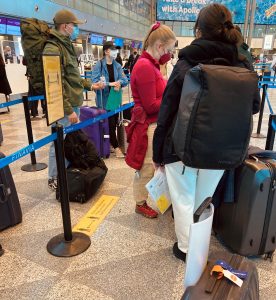
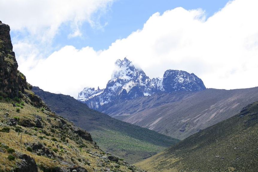
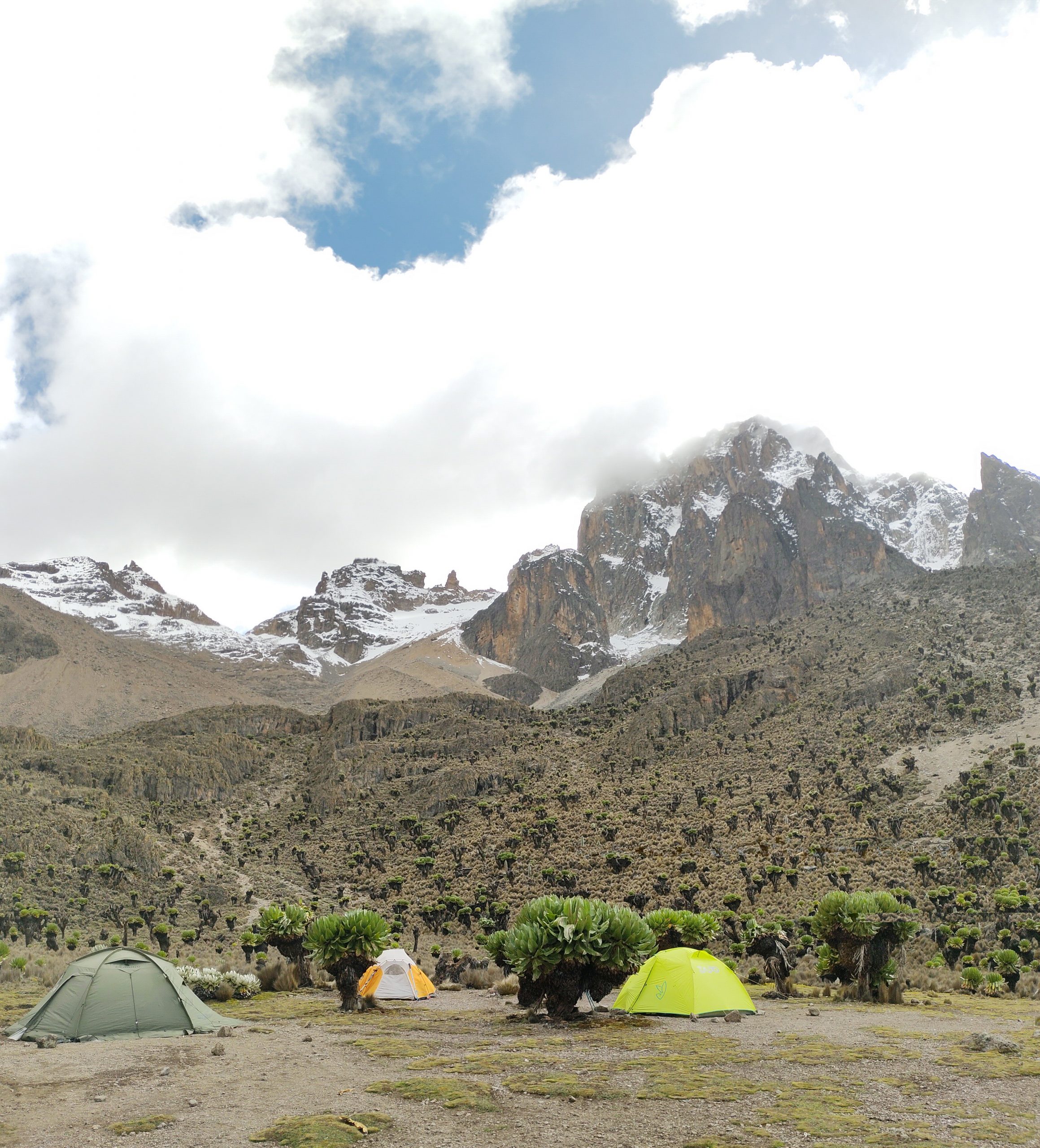
As soon as we heard about the opportunity to travel to Kenya, we started to plan a way to fully benefit of the trip to the equator. We, me and Jussi, booked our flights to arrive to Jomo Kenyatta International Airport a week before the course start and headed to the highest mountain in Kenya and the second highest peak in all Africa – Mount Kenya.

Mount Kenya is an ancient volcano located 150 km north from Nairobi, which has given a name to the whole country (originally Kĩ-Nyaa after the black and white patterns of the snowy peak). The highest peak Batian rises to 5 199 meters above sea level, but as it requires technical rock-climbing gear, we set our goal to the third highest peak, Point Lenana (4 985 m).

On the airport we met the driver and handyman of the Taita Research Station Ken, who organized the whole tour to as. With Ken we drove to the western slope of the Mount Kenya to a city of Nanyuki, where we spend our first night acclimatizing to the thin air in 2000 meters above sea level. During the day we also visited an animal orphanage, which offered a home to injured and abandoned wild animals.

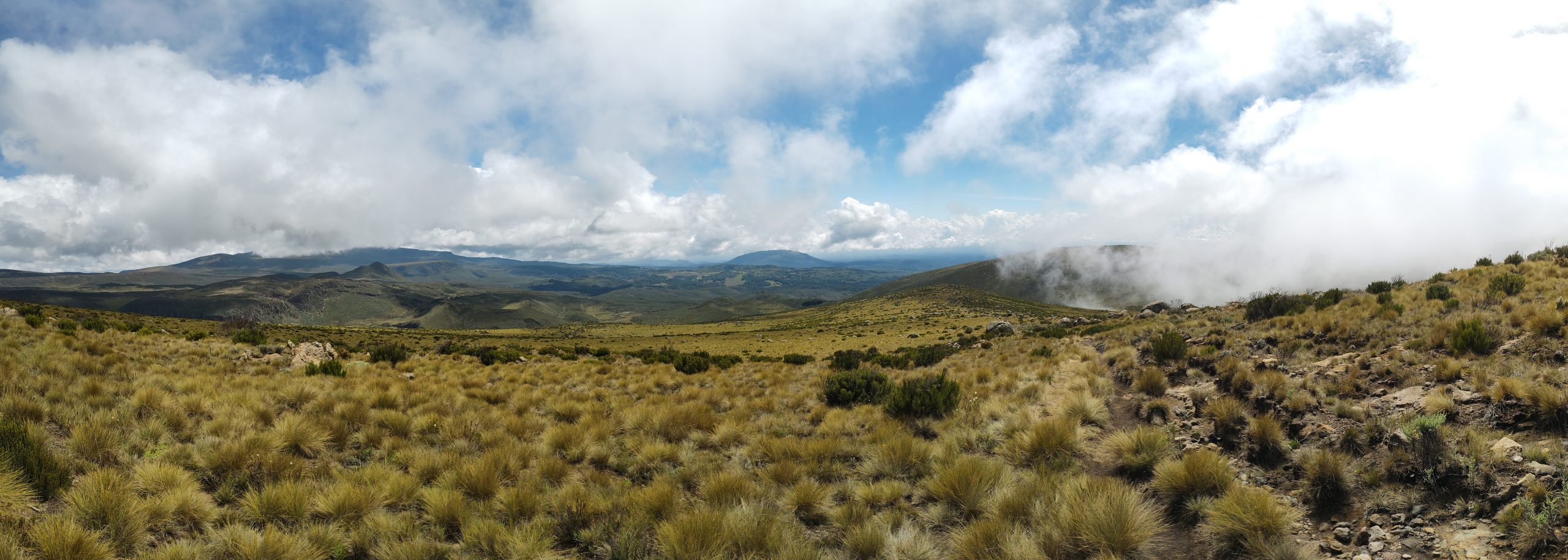
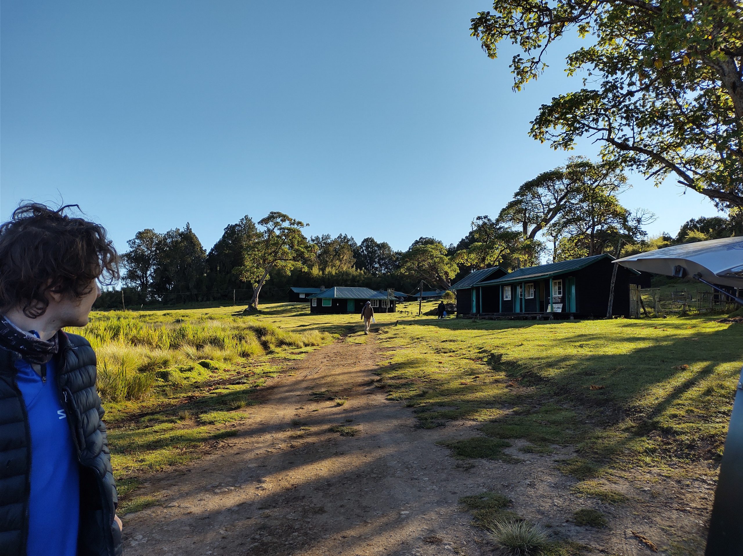
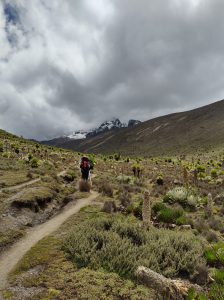
Next day we drove with our guide Patrick, cook Peter and ported David and Ken we to
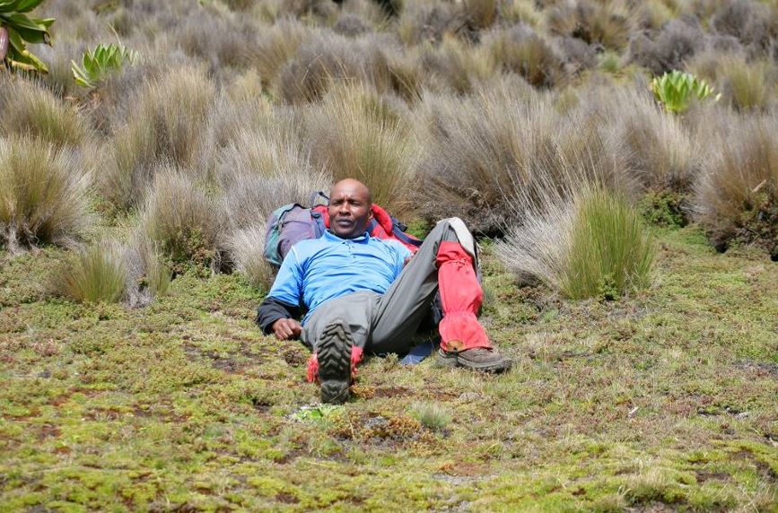
 the gate of Mount Kenya National Park. From the gate we started our tour to the first banda hut Old Moses to spend our first night at the true mountain atmosphere in 3300 meters. Banda hosted also many other travelers ascending or descending from the mountain. Most of those expedition parties were at our company almost the whole tour.

Patrick, our guide.

On the second day we continued ascending to the mountain peak. Cold temperatures and high atmosphere made sleeping uneasy. The flora and terrain started to look more and more like the ones in northern Scandinavia, which felt strange in the middle of Africa. At the end of the day, we reached Shipton banda, which was located just under the peak. The altitude started to make its tricks and we both felt a bit headache and dizziness, but nothing serious that could jeopardize the expedition.
A view from Shipton banda.

The summiting to the peak started at 2.00 am on the next morning. After 3-4 hours of slow but steady climbing in the rocky and snowy terrain we finally reached Point Lenana as the first rays of the sun touched our faces. Unpleasantly the fog and clouds blurred our view, and we barely saw anything from the beautiful landscapes. Also -10 degrees and storm-like winds made staying on the top unpleasant.


At the peak!

Descending was a lot quicker than ascending, but gravel and steep slope made it risky. On the eastern side of the mountain the terrain was quite different since the rain shadow effect made the environment wetter. Last night at the slopes of Mount Kenya we spend at the Chogoria banda near the eastern gate of the national park.


Last looks to the Chogoria banda.

The expedition wouldn’t be possible without our guide, cook and porter. They made the biggest physical effort, as they carried our food and sleeping equipment, and prepared delicious and nutritious meals every day. Many thanks to them!