
Authors: Tuuli Toivonen, Christoph Fink, Elias Willberg
For the past 2.5 years, the Digital Geography Lab has participated in the international H2020 consortium URBANAGE that is coming to its end now in January 2024.
Europe’s rapidly aging population and the rise of disruptive technology in urban planning were at the pivot point of the URBANAGE project. Urban planning needs to better take into account the needs of a growing older population, and advances in technologies make more evidence-based urban policy come into reach. The project focused on how Digital Urban Twin technology could be used to assist planning for age-friendly cities. It was carried out at three pilot sites across the European Union, namely the cities of Helsinki and Santander, and the region of Flanders. The main partners in Helsinki were Forum Virium Helsinki and the University of Helsinki. Postdoctoral researcher Christoph Fink has been our key researcher in the project, while Elias Willberg worked in more targeted tasks.
The project informed its research in a co-creation effort that aimed to learn from lived experience. Most relevantly, we inquired what factors are important for improving the accessibility and mobility of older adults in future cities. The project then developed a dashboard to collect spatial information on the age friendliness and to expand and advance the toolbox planners need for improved solutions, for example with accessibility or green comfort in mind.
The Digital Geography Lab contributed to the project in a variety of ways. Our biggest contribution was to explore the mobility environment of older people at the scale of urban areas. We employed both a conceptual and an analytical perspective, and critically examined the role of technology in doing so.
In one of our studies, we empirically examined the impact of winter conditions on older adults’ mobility landscapes. We produced valuable information for age-sensitive routing, and challenged the simplicity of the “15-minute city” concept, suggesting to better consider the varying realities of urban residents (Willberg, Fink & Toivonen, 2023).
Together with an international team, Christoph developed a new routing tool, a Python package called r5py. The new tool allows an efficient estimation of door-to-door travel times for various travel modes. Among other things, it was used to expand standard travel time computations to provide information not only on the ‘average person’, but to also integrate the requirements, preferences and restrictions of older people we identified earlier.
We also applied this novel routing tool to continue the development on a Digital Geography Lab data classic: the Travel Time Matrix, of which we provided an updated 2023 version. Using this data resource, planners, researchers, and interested laypeople can explore travel times depending on transport mode, time of day and walking or cycling speed, across the Helsinki Metropolitan Area. We integrated the data set and technology into the URBANAGE dashboard.
Finally, we took a step back and took a more conceptual look at the aspects of sustainable accessibility and inclusive planning practices. In Willberg et al. (2023), we proposed integrating the sustainability framework into spatial accessibility analyses, to be increasingly mindful on the environmental burden of improved accessibilities and the social inequities potentially caused by decreasing accessibilities. In Tupasela et al. (2023), we discussed the data ethics smart city initiatives are confronted with, from the perspective of older people, inclusiveness and a rights-based privacy approach.
On top of research outputs, the project contributed to research careers at the Digital Geography Lab: Christoph Fink had a successful first postdoctoral period, during which he successfully applied for a competitive Marie Skłodowska-Curie Action (MSCA) Postdoctoral Fellowship that allows him to continue urban research at the University of Vienna. Elias Willberg completed and defended his PhD thesis during the last year of the project, and continues as a postdoctoral researcher in the new ERC Consolidator Grant project GREENTRAVEL that Tuuli Toivonen received during the project. Eemil Haapanen and Eero Perola finished their MSc theses with topics related to the project. These future projects allow us to continue our research and to stay mindful of the varying realities of people of different ages.
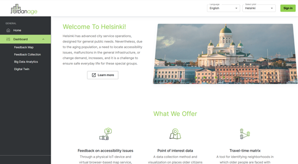 The URBANAGE Dashboard and ecosystem provides access to age friendly data and reporting resources (https://ui.ecosystem-urbanage.eu/).
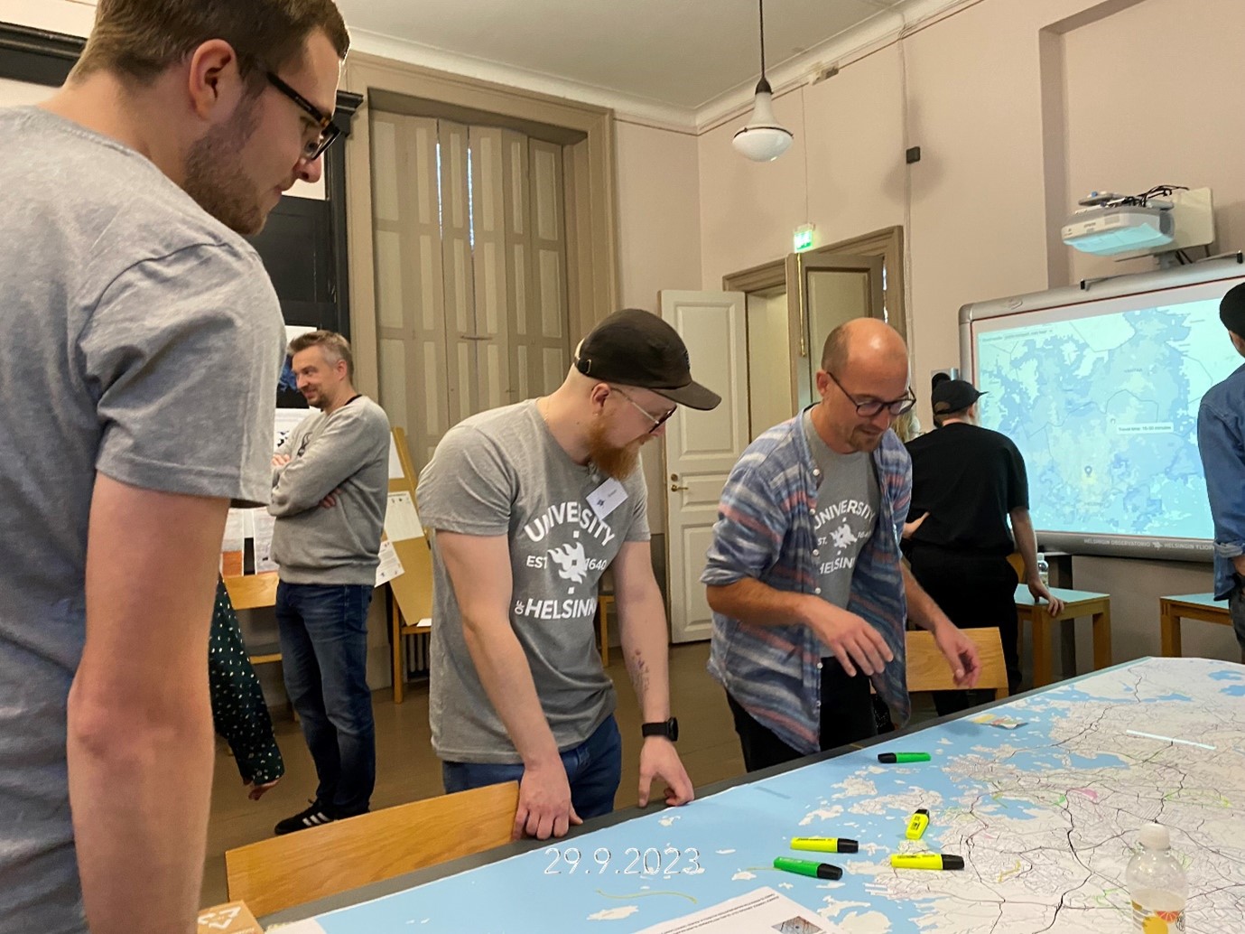 Christoph Fink (facing front on the right), Roope Heinonen, Robert Klein and Eemil Haapanen preparing for a citizen discussion about travel times and evaluating age friendliness on the scale of the urban region, as part of the Night of Science event 29.9.2023.
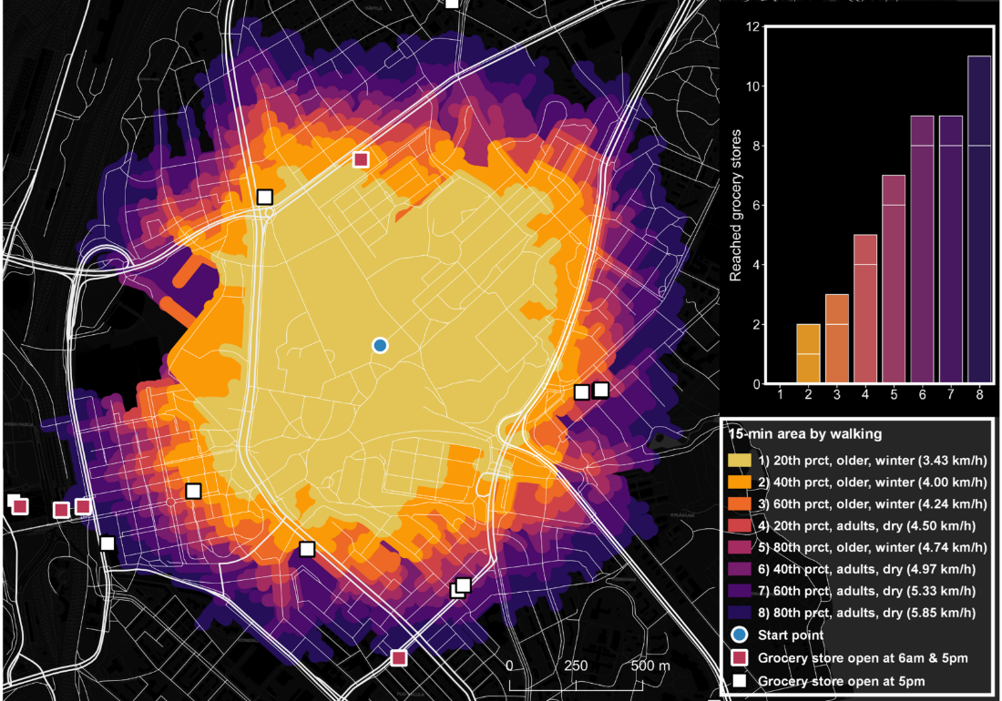 Depending on their walking speed, the time of the day, and the time of the year, a Helsinki resident living at the blue marker in the centre of the map can access up to 11 supermarkets or grocery stores (square markers), or not a single one, within 15 minutes of walking. This shows that, when planning service networks, planners should be aware of the strong impact small changes to their assumptions can make.
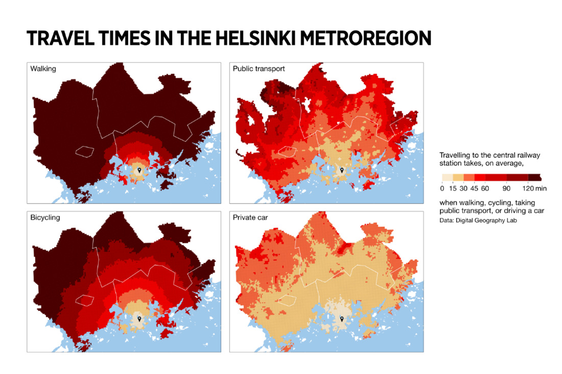 Map: travel times in the Helsinki metropolitan area vary depending on the mode of transport.
Research outputs of the project:
Fink, C., Willberg, E., & Toivonen, T. (2023). Sujuvaa, helppoa, hidasta vai epäekologista? Avoimesta matka-aikamatriisista ymmärrystä pääkaupunkiseudun liikenneyhteyksiin ja saavutettavuuteen. Kvartti : Helsingin kaupungin tietokeskuksen neljännesvuosijulkaisu. https://kaupunkitieto.hel.fi/fi/sujuvaa-helppoa-hidasta-vai-epaekologista-avoimesta-matka-aikamatriisista-ymmarrysta
Tupasela, A., Devis Clavijo, J., Salokannel, M., & Fink, C. (2023). Older people and the smart city – Developing inclusive practices to protect and serve a vulnerable population. Internet policy review, 12(1), 45-45. https://doi.org/10.14763/2023.1.1700
Willberg, E., Fink, C., & Toivonen, T. (2023). The 15-minute city for all? – Measuring individual and temporal variations in walking accessibility. Journal of Transport Geography, 106, Article 1032521. https://doi.org/10.1016/j.jtrangeo.2022.103521
Willberg, E., Fink, C., & Toivonen, T. (2023). Towards equitable 20-minute neighbourhoods. Town & country planning, 92(3), 191-194. https://www.tcpa.org.uk/wp-content/uploads/2023/06/TCP_May-Jun23_R.pdf
Willberg, E., Tenkanen, H., Miller, H. J., Pereira, R. H. M., & Toivonen, T. (2023). Measuring just accessibility within planetary boundaries. Transport Reviews. https://doi.org/10.1080/01441647.2023.2240958
– – – – –
The Digital Geography Lab is an interdisciplinary research team focusing on spatial Big Data analytics for fair and sustainable societies at the University of Helsinki.