New Travel Time Matrix 2023 and GREENTRAVEL project

Digital Geography Lab presented a new travel time matrix 2023 and a new big project GREENTRAVEL in a seminar held in Think Corner.

Helsinki region travel time matrix was published now for the fourth time. The matrix is an interactive open access dataset that allows investigation of travel times for different travel modes in Helsinki region. Professor Tuuli Toivonen gave an insight to the history of the matrix which was first published already ten years ago in 2013.

Since the first matrix was computed, the technology has improved and enabled the use of new methods. Christoph Fink explained how the new matrix was calculated and showed how it works.  Current accessibility prospects and changes in the regional structures of accessibility in Helsinki region were described by Elias Willberg. We also had two guest speekers, Miikka Haimila and Iiris Karvinen, from the city of Helsinki. Haimila reflected the importance of matrix for the city and its open data activities. Karvinen took the angle of a planner and demonstrated how the matrix has been serving the planning needs of the city.

In the end Tuuli Toivonen presented our new big project GREENTRAVEL which aims to explore the availability and quality of green urban travel environments and their impacts on wellbeing through the prism of urban informatics. We continued the discussions right after the seminar in a GREENTRAVEL workshop where we focused on the role of greenery in urban travel environments and how greenery can be better incorporated in current green infrastructure and travel and mobility planning.

Tuuli Toivonen telling about the history of Travel time matrix
Christoph Fink presenting the details of the new matrix
Elias Willberg showing how the accessibility has changed in Helsinki region during the last ten years
Presenters answering to the questions from the audience

Presentations from the event

Click on the image to open the presentation.


– – – – –

The Digital Geography Lab is an interdisciplinary research team focusing on spatial Big Data analytics for fair and sustainable societies at the University of Helsinki.

Uusi matka-aikamatriisi 2023 ja GREENTRAVEL-projekti (available in English as separate post)

Digital Geography Lab esitteli uuden pääkaupunkiseudun matka-aika-aineiston 2023 ja juuri käynnistyneen GREENTRAVEL-tutkimushankkeen Tidekulmassa järjestetyssä julkaisutapahtumassa.

Pääkaupunkiseudun matka-aikamatriisi julkaistiin nyt jo neljättä kertaa. Matriisi on avoin paikkatietoaineisto, joka mahdollistaa matka-aikojen vertailun eri kulkutavoilla pääkaupunkiseudulla. Professori Tuuli Toivonen kertoi matriisin historiaa valaisseessa puheenvuorossaan ensimmäisen matriisin julkaisusta kuluneen jo 10 vuotta.

Teknologian kehittyminen ensimmäisten matriisien tuottamisen jälkeen on mahdollistanut uusien menetelmien käytön laskennassa. Christoph Fink esitteli miten uusi matriisi on laskettu ja miten se toimii. Elias Willberg valotti pääkaupunkiseudun nykyistä saavutettavuusmaisemaa sekä muutoksia saavutettavuuden alueellisissa rakenteissa kuluneiden 10 vuoden aikana. Mukana olivat myös vierailevat puhujamme Miikka Haimila ja Iiris Karvinen Helsingin kaupungilta. Haimila kertoi matriisin merkityksestä kaupungille ja sen avoimen datan toiminnalle. Karvinen osoitti suunnittelijan näkökulmasta miten matriisi on palvellut kaupungin suunnittelutarpeita.

Lopuksi Tuuli Toivonen esitteli uuden viisivuotisen GREENTRAVEL-tutkimushankkeen, jossa selvitetään liikkumisympäristöjen laatuun ja vihreyteen liittyviä mieltymyksiä sekä niihin kytkeytyviä hyvinvointivaikutuksia ja näiden alueellista, vuodenaikaista ja yhdenvertaista saatavuutta. Jatkoimme keskustelua aiheesta seminaarin jälkeen pidetyssä GREENTRAVEL-työpajassa, jossa keskityimme vehreyden rooliin kaupunkien liikkumisympäristöissä sekä tapoihin tuoda vehreys näkyvämmin osaksi liikkumisympäristöjen suunnittelua.

Tuuli Toivonen raottaa matka-aikamatriisin historiaa
Christoph Fink esittelee uuden matka-aika-aineiston yksityiskohtia
Elias Willberg kertoo miten saavutettavuus on muuttunut pääkaupunkiseudulla kuluneiden kymmenen vuoden aikana
Esiintyjät vastaamassa yleisön kysymyksiin

Esitykset

Klikkaa kuvaa avataksesi esityksen.

– – – – –

The Digital Geography Lab is an interdisciplinary research team focusing on spatial Big Data analytics for fair and sustainable societies at the University of Helsinki.

Vuokko’s lectio 9.12.2020

User-generated Geographic Information for Understanding Human Activities in Nature

Lectio Praecursoria, in the public examination of MSc Vuokko Heikinheimo’s doctoral dissertation
the 9th of December 2020


Nature contributes to human well-being in countless ways. Many of us enjoy spending time in nature, going for a walk or a picnic and observing species and seasons. Nature-based tourism and outdoor recreation are evident examples of direct benefits of nature to people.

National parks are protected areas that are dedicated to safeguarding biodiversity and providing people the opportunity to enjoy nature.

Urban green spaces include the network of parks, forests and other green areas in the urban structure. Green spaces in cities offer opportunities for contact to nature in our everyday lives while protecting urban biodiversity.

We are also willing to travel far in order to experience and enjoy nature. In many places, visitors of protected areas – both domestic and international – are a significant source of income for park management and local communities. Information about protected area visitors is important for planning and management on regional, national and international scales.

The ongoing pandemic has emphasized the importance of access to green spaces in everyday life.

Continue reading “Vuokko’s lectio 9.12.2020”

Inaugural lecture by Professor Toivonen

Tuuli Toivonen is now a full professor in geoinformatics at the Faculty of Science!

Newly appointed  professors at the University of Helsinki are celebrated twice a year. As part of these celebrations, the professors hold an inaugural lecture.  This autumn, all festivities were (understandably) held online which allowed everyone interested to watch these lessons online.You can watch Tuuli’s lecture in here (Finnish audio, Finnish and English subtitles available):

Congrats once more to Tuuli!

Joelin lektio 27.11.2020

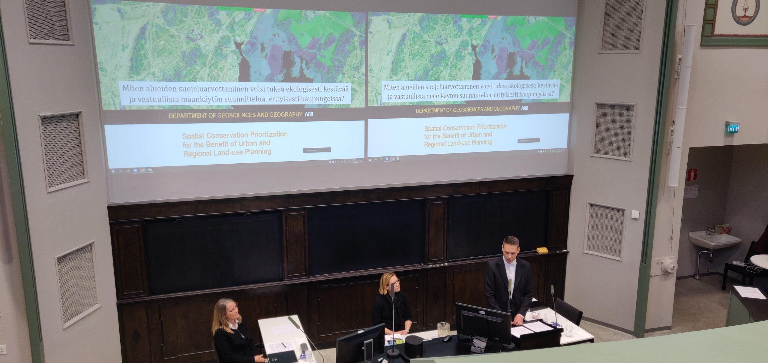
Alueiden suojeluarvottaminen kaupunki- ja maakuntatason maankäytön suunnittelun tueksi

FM Joel Jalkasen Lectio praecursoria -puhe 27.11.2020
Public defence of Joel Jalkanen's PhD thesis
The opponent (Professor Niina Käyhkö), the custos (Professor Tuuli Toivonen) and the doctoral candidate (MSc Joel Jalkanen) in Athena hall 107 on 27th of November 2020

Arvoisa kustos, arvoisa vastaväittäjä, hyvät kuulijat

Me ihmiset aiheutamme toimillamme paraikaa massasukupuuttoa, joka uhkaa suurta osaa maailman elämästä. Tällä hetkellä selkeästi suurin uhka maapallon lajistolle on se, että ihmiskuntamme tuhoaa elinympäristöjä omien tarpeidensa alta.

Eri lähteistä toistuva viesti on selkeä ja kiistaton: tapamme käyttää maata on kestämätön.

Kuvaamani ongelma kilpistyy hyvin oheiseen kuvaan. Luonto esiintyy paikassa, ja samoin ihmisten intressit esimerkiksi ruuantuotantoon tai kaupunkien rakentamiseen kohdistuvat usein paikkaan. Siellä, missä toinen haluaisi perustaa luonnon puolesta suojelualueen, näkee toinen hyvän paikan uudelle asuinalueelle.

Tätä ristiriitaa ratkotaan maankäytön suunnittelulla. Siinä sovitellaan erilaisia paikkoihin kohdistuvia tarpeita ja intressejä ja tarkastellaan, miten niitä voidaan saavuttaa rajallisen fyysisen tilan puitteissa.

Continue reading “Joelin lektio 27.11.2020”

NoRSA 2019 Keynote: Tuuli Toivonen

We will also start sharing our presentations in the Digital Geography Lab blog!

To start out, we will share Tuuli’s Keynote presentation at NoRSA 2019 Conference Seinäjoki, Finland, 19th June 2019 that summarizes much of our ongoing work related to socio-spatial interactions and Big Data: