New article out! Geographical and linguistic perspectives on developing geoparsers with generic resources

Our new article Geographical and linguistic perspectives on developing geoparsers with generic resources is now published in the International Journal of Geographical Information Science!

We explore what it takes to create a “geoparser”, a system for locating place names from texts, for a morphologically complex language, such as Finnish. We touch upon how the language of choice affects geoparsing and how those hurdles might be overcome by using generic tools, such as the NLP library spaCy. Measuring the performance of geoparsers is crucial for knowing what works, what needs improvement and comparing geoparsers – we contribute to this aspect by sharing a Tweet and a news corpus of annotated Finnish texts, and by proposing a new evaluation metric.

As an outcome of the study, we also publish a Python library and a pretrained language model for geoparsing Finnish texts. You can find Finger (the FINnish GeoparsER) with installation and use instructions in this GitHub repository.

This work was carried out in the MOBICON project, funded by the Kone foundation.

Abstract:

Geoparsers aim to find place names in unstructured texts and locate them geographically. This process produces georeferenced data usable for spatial analyses or visualisations. Much geoparsing research and development has thus far focused on the English language, yet languages are not alike. Geoparsing them may necessitate language-specific processing steps or data for training geoparsing systems. In this article, we applied generic language and GIS resources to geoparsing Finnish texts. We argue that using generic resources can ease the development of geoparsers, and free up resources to other tasks, such as annotating evaluation corpora. A quantitative evaluation on new human-annotated news and tweet corpora indicates robust overall performance. A systematic analysis of the geoparser output reveals errors and their causes at each processing step. Some of the causes are specific to Finnish, and offer insights to geoparsing other morphologically complex languages as well. Our results highlight how the language of the input text affects geoparsing. Additionally, we argue that toponym resolution metrics based on error distance have limitations, and proposed metrics based on spatial intersection with ground-truth polygons.

Citation:

Leppämäki, T., Toivonen, T., & Hiippala, T. (2024). Geographical and linguistic perspectives on developing geoparsers with generic resources. International Journal of Geographical Information Science, 1–22. https://doi.org/10.1080/13658816.2024.2369539


Tourism and thoughtlessness threaten the nature of the Canary Islands – report from an expert workshop out now!

Sun setting on a green valley, with a man looking at it in the forefront with his back to the camera.
The Canary Islands are a hotspot of biodiversity and tourism.


The Canary Islands are a familiar travel destination for many Europeans. The destination is often associated with images of pleasant climate, long beaches or lively nightlife. However, the Canary Islands are also the home for many endemic species that are found nowhere else in the world. The climatic and geological diversity of the islands makes them a hotspot of biodiversity in the middle of the Atlantic. 

The MOBICON project explores the recreational use of nature and nature tourism based on Mobile Big Data. Recently, MOBICON researchers have mapped local actors’ perceptions of major changes related to nature-based tourism and future information needs in several study areas. The second workshop (see our report from a workshop in Helsinki) was organized in Las Palmas in March 2024, in collaboration with researchers from the University of Las Palmas de Gran Canaria. 

The workshop brought together 20 experts of the environmental and tourism sectors across the islands to discuss the future of nature conservation in the islands. Discussions in the workshop underlined the conflicts between mass tourism and nature conservation in the Canary Islands, but also identified ways forward. These discussions and the results of a pre-workshop survey are now published in a working report in English and Spanish.

Link to the report in English: https://doi.org/10.31885/2024.062702  

Link to the report in Spanish: https://doi.org/10.31885/2024.062701 

A press release in English

A press release in Finnish

The report may be cited as follows: 

Hästbacka, M., Brias Guinart, A., Eklund, J., González Hernández, M. M., Leppämäki, T., Morales González, S. C., Pulido Hernández, M., Ramirez Cabrera, A. S., Santana Suárez, A., and Toivonen, T. (2024). Changes in nature-based tourism and outdoor recreation in the Canary Island: Observations, information needs and ways forward. Helsinki: Digital Geography Lab, University of Helsinki. doi:10.31885/2024.062702. 

– – – – –

The Digital Geography Lab is an interdisciplinary research team focusing on spatial Big Data analytics for fair and sustainable societies at the University of Helsinki.

Big data, big changes: Project MOBICON in the Canary Islands for a workshop and presentations

The Canary Islands are a biodiversity, geodiversity and tourism hotspot, boasting one of the most visited national parks in Europe (Teide in Tenerife). Tourism is the backbone of the local economy, but the growing masses of visitors put an unsustainable strain on the islands’ beautiful nature.

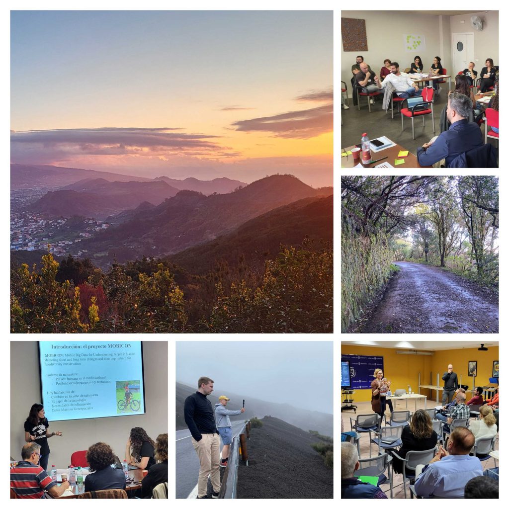
A collage of six photos: three of them of workshops and lecture halls, three from nature.

The islands are also acutely impacted by climate change and other megatrends including aging of population in Europe or digitalisation changing work life. On top of the traditional tourists, the islands are now receiving masses of long-term visitors seeking warm wintering grounds on the islands.  

These factors make the Canary Islands an interesting study area for the MOBICON project, where we study changes in nature visitation and their impacts on biodiversity conservation as well as the applicability of mobile big data sources for extracting visitor information.  

We (team Mobicon: Aina, Matti, Tatu and Tuuli) visited the islands of Gran Canaria and Tenerife in March 2024 for establishing collaboration with local universities and to collect research data through stakeholder discussions. Some highlights of the trip below.

Continue reading “Big data, big changes: Project MOBICON in the Canary Islands for a workshop and presentations”

Changes in nature visitation and the potential of mobile big data for visitor monitoring – Report from an expert workshop out now!

Aina Brias Guinart introducing a workshop task to the participants.

The importance of natural areas for recreation and conservation alike is critical, yet we often don’t know how many people visit them and why. Such information is necessary for the management and development of natural areas, which is why research by our lab and others have considered mobile big data sources (think data from mobile phones, social media etc.) as a way to monitor outdoor recreation. Yet, translating scientific research into actionable information for management is not straightforward – is it even wise? What kind of information do managers of natural areas need? What sort of changes do they managers see, how do these affect their information needs, and what sort of larger trends drive these changes? 

Researchers in project Mobicon called together experts from Finnish nature organizations to reflect on these questions in September 2023. The aim of the workshop was to collect expert opinions related to the changes in the recreational use of nature, the monitoring needs related to the changing visitations, and to discuss the possibilities of various new data sources to meet managerial information needs. 

This workshop was the first of a series repeated in March 2024 in the Canary Islands. We have now released a report on the outcome of the Helsinki workshop. Check it out! 

In English: https://doi.org/10.31885/2024.030501 

Suomeksi: https://doi.org/10.31885/2024.030502 

If you wish to cite the reports, you may use:

Toivonen, T., Brias Guinart, A., Eklund, J., Hästbacka, M., Leppämäki, T. and Torkko, J. (2023). Potential of mobile big data for visitor monitoring: Report of the MOBICON workshop held in Helsinki 28.9.2023. Helsinki: Digital Geography Lab, University of Helsinki. doi:10.31885/2024.030501

– – – – –

The Digital Geography Lab is an interdisciplinary research team focusing on spatial Big Data analytics for fair and sustainable societies at the University of Helsinki.

DGL’s map gallery for #30DayMapChallenge 2023

November came and went, and with it the fifth annual map challenge. The concept is simple: every day has a theme, which is interpreted more or less freely and refined into beautiful cartographic visualizations.

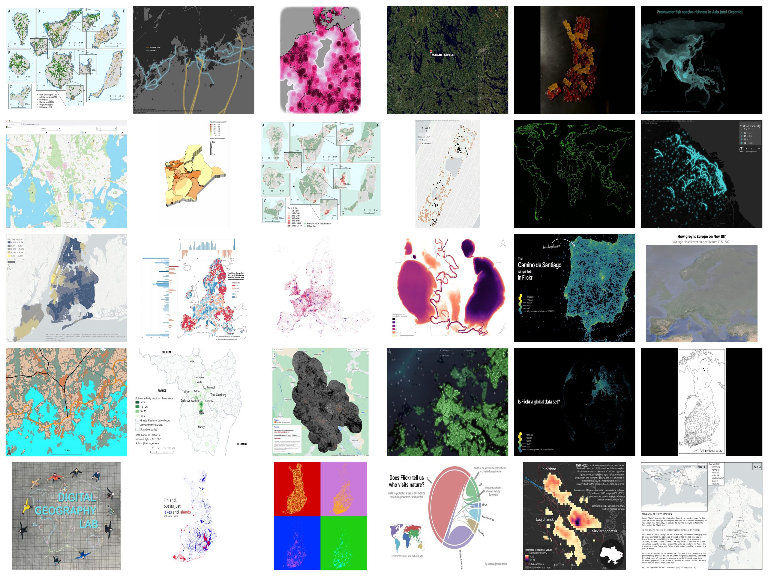
The Digital Geography Lab partook this year with a whopping 29 contributions by 10 lab members. These maps are a globetrotting travel through five continents and cover a range of themes, datasets, and methods from population and dogs to – gummy bear cartography?? Mapmaking was spearheaded by our PhD student Matti Hästbacka, who posted the maps X and Mastodon and created half of them!

See our map gallery for this year is below. Also check out our maps for the year 2022.

Continue reading “DGL’s map gallery for #30DayMapChallenge 2023”