Adventures in Vuria and the Skull Cave

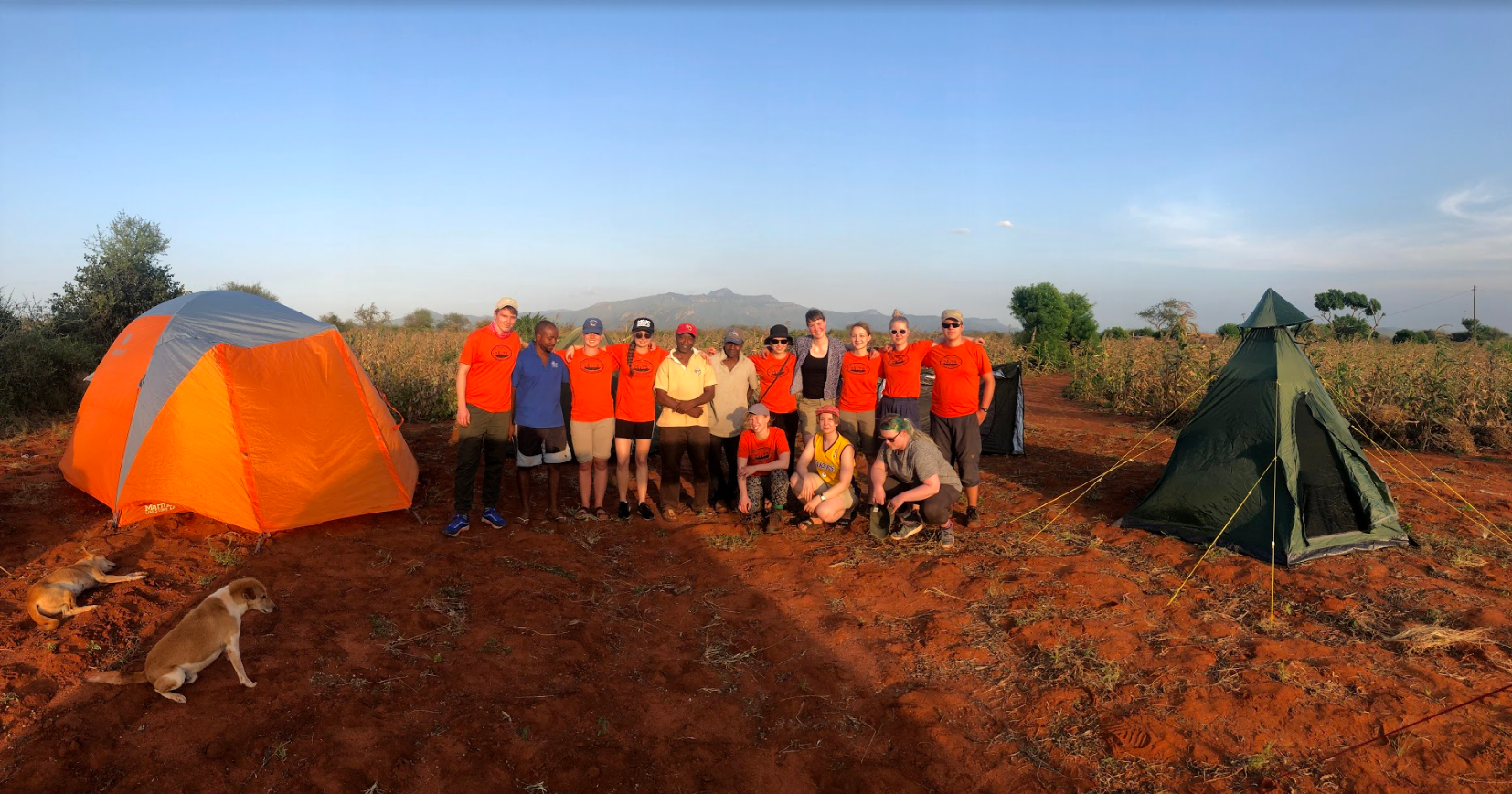
On Thursday morning we prepared ourselves for an ‘easy’ hike to Vuria, the highest peak in Taita Hills.

Thick fog surrounded us as we started hiking

One of the lovely staff members who was supposed to guide us through the forest, unfortunately couldn’t join us and thus students’ task for the day was to help navigating through the forest to the top.

Map of our route

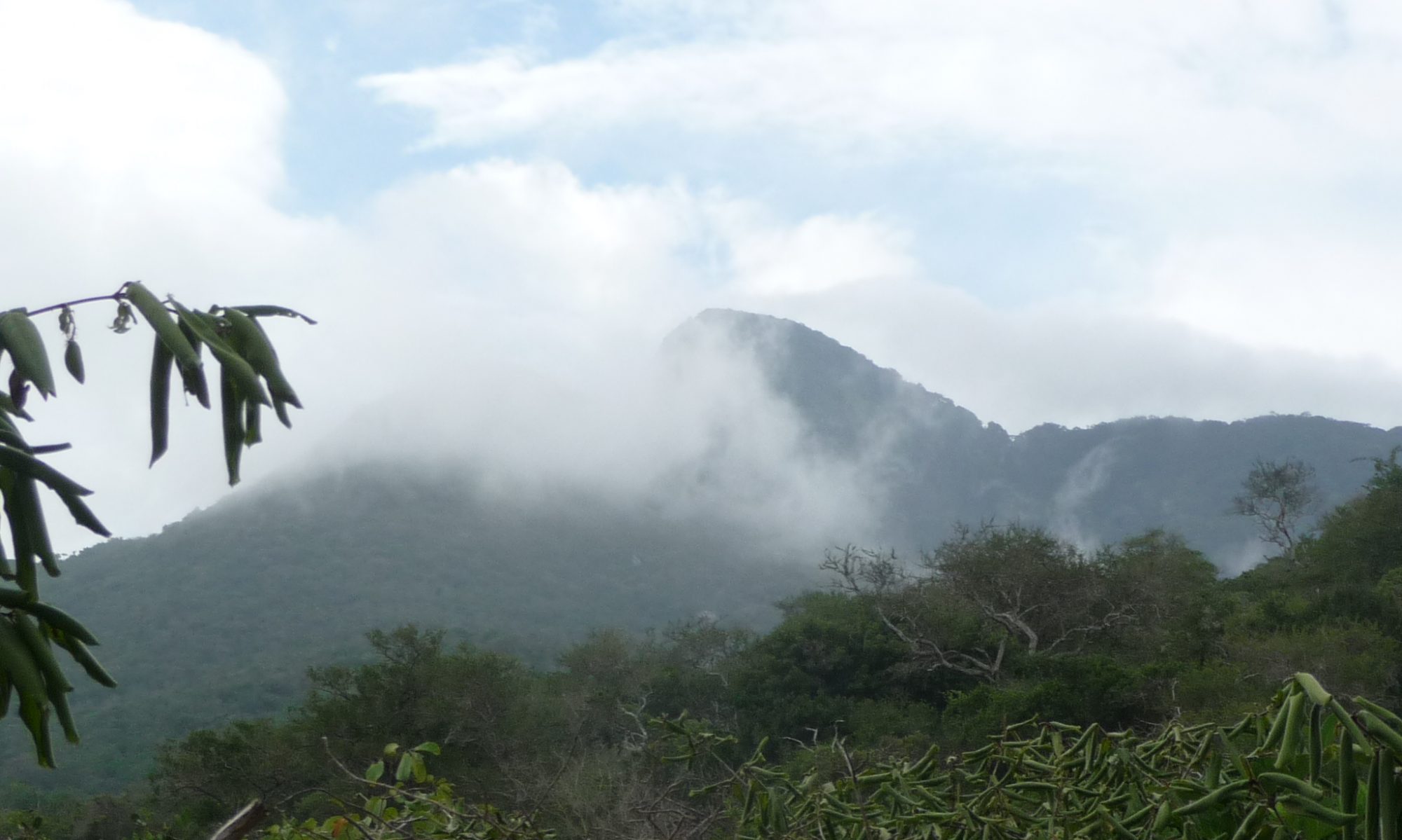
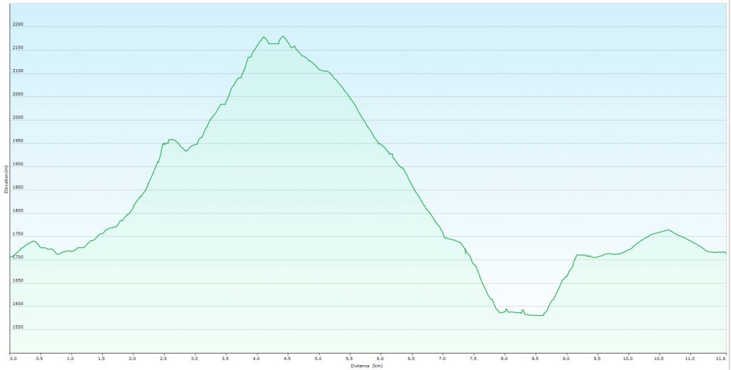
Our route went through forest and cropland around Vuria Hill to the 2257 meters high peak. Forest in Vuria is gazetted which means it is formally conserved forest managed by Kenya Forest Service. However, it is not a national park as Ngangao forest and thus is not as highly conserved.

Elevation profile of our route to the top of Vuria and down to the Skull Caves

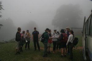
A few Finns at the front decided to take the ‘shorter and steeper’ path, ignoring the advises of our local companion, and it didn’t take long after we noticed that part of the group has already got lost in the forest. Luckily the mobile signal from the tower on the top was strong and soon we managed to get the group together. Using Prof. Pellikka’s umbrella as a machete we managed to get through the jungle. Suddenly the fog disappeared and we found ourselves above the clouds, looking down to surrounding idyllic African savanna opening below the moving clouds.

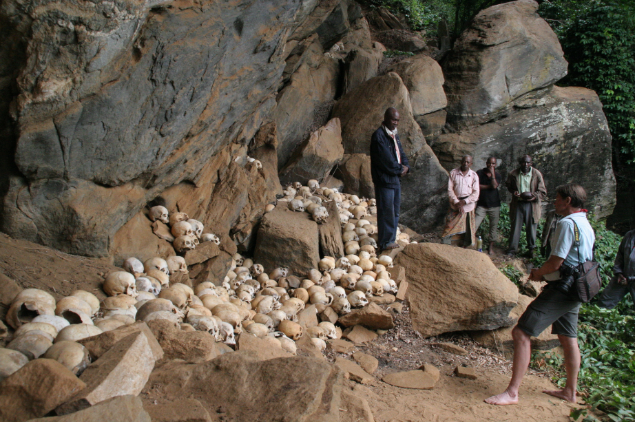
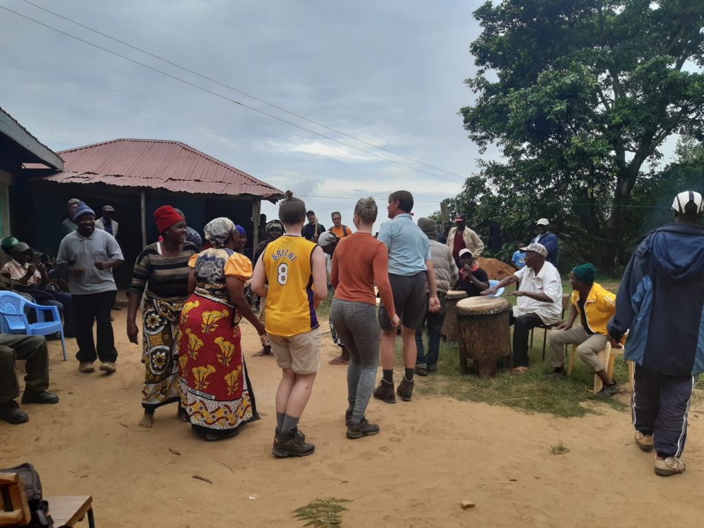
Our adventure continued in more cultural way, as we visited Taita peoples’ sacred site, the Skull Cave. We were honored to have the opportunity to visit the cave and to take part in rituals and a feast after the visit. Our evening with Taita people continued in cheerful party where Prof. Pellikka and some other students joined in the traditional dances.

Participatory GIS Wundanyi and field work preparations

On third day students got in touch with the local people at the town of Wundanyi, the home of Helsinki research station. The idea was to harness local knowledge and perceptions services in the town. This PGIS (participatory geoinformatics) practical started with an introduction from Dr. Tino Johansson, after which students headed to the town to do interviews and draw maps with the people of Wundanyi, trying to include all the age and gender groups for an inclusive perspective of local services.

r

The practical turned out well with students learning about both possibilities and challenges of the method. Local people’s perspectives of Wundanyi services varied among interviewees and both positive and negative perceptions were observed.

While students spent their afternoon at the town, teachers and assistants remained at the station to prepare for the next day’s field campaign in Maktau. This included checking and packing all the measurement devices, as well as five big tents since the next night was going to be spend at a farmyard. So once everyone got back together it was once again time to jump into a bus, this time destination being Maktau.

In Maktau the group was heartwarmingly welcomed to research station manager Mwadime Mjomba’s farm by the whole family. After students set up the tents next to a maize field, the dinner was served inside the house in traditional Kenyan manner. Later in the evening, while the course assistants were setting up temperature and moisture sensors in cassava and cowpea fields, the students enjoyed watching the breathtaking night sky by the tents. To keep the unwanted guests, such as lions and elephants away from the camp, lanterns were set up and it was time for a rest.