We started off our safari day with an early 6 AM breakfast. Finally, all of us on sick leave could attend this laid-back activity, yay! We drove to Sarova Taita Hills Game Lodge where Robert the ranger hopped on our bus and so our safari begun. We drove through the privately own Taita Hills Wildlife Sanctuary and continued to the community based LUMO Community Wildlife Sanctuary which is much larger. We could see that LUMO had less undergrowth than the private sanctuary due to the amount of grazing that is being practiced by the community.
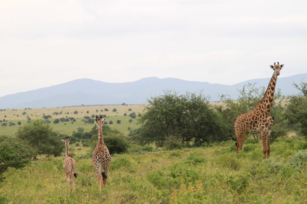
A giraffe family having lunch. Photo by Kiia Eerikäinen.
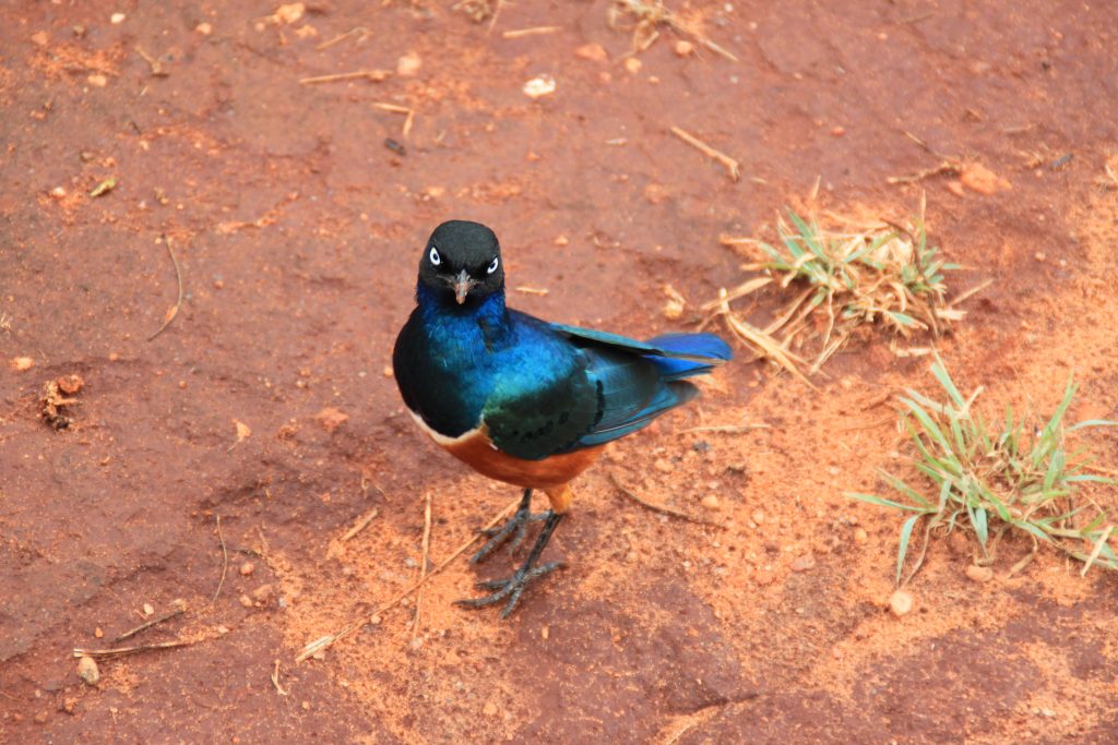
We saw many exotic birds (such as secretarybird and superb starling) which were especially exciting for the bird enthusiasts of our crew. We saw giraffes eating leaves, baboons crossing the road with cute baby baboons on their backs and a huge buffalo herd staring at us in the eye. We also saw many other animals, e.g. kongonis, impalas, an ostrich and a 40-50 year old elephant, according to Robert. Unfortunately, we didn’t manage to see any big cats. We saw quite a few termite mounds, active and non-active ones. Prof. Pellikka explained that the active mounds indicate a healthy environment and that their numbers have been declining in the region.
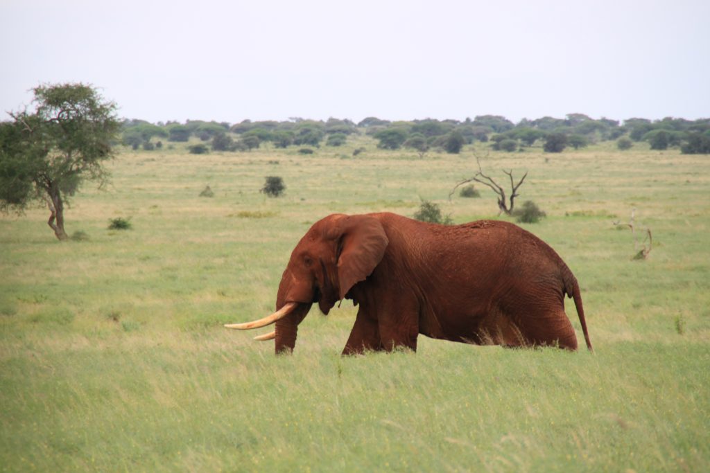
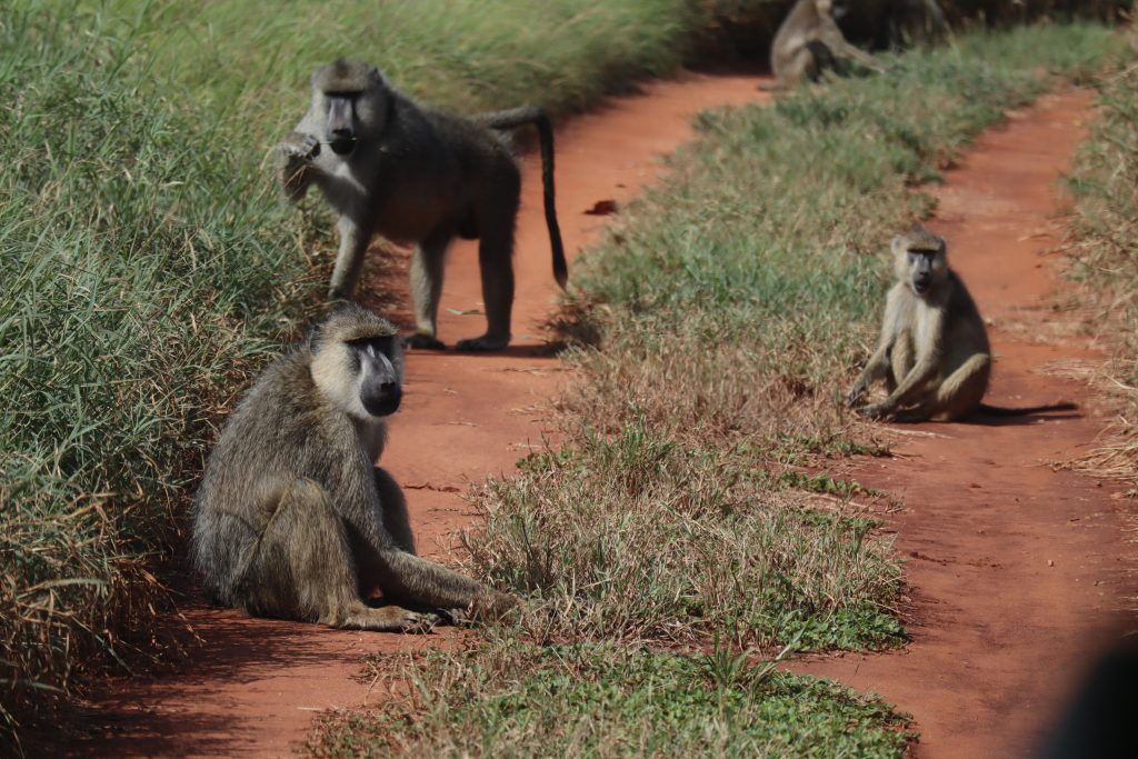
Red elephants get their color from the red laterite soil. Photo by Kiia Eerikäinen.Baboons checking us out. Photo by Toni Ruikkala.
The ride to Lions bluff was a pretty bumpy one. When we got to the top, a beautiful view of the great surrounding savanna opened up. We then ate lunch at the buffet and even got pasta after a long time of eating only local traditional food. After lunch we continued our safari and stopped by a biodiversity recovery project which focuses on planting trees at the sanctuary.
Superb starling. Photo by Kiia Eerikäinen.
After a “rough” day on safari, we had a pool party at the sanctuary hotel where we enjoyed some drinks and played water polo. Not too shabby!
Holy moly what a hike we had! Our original plan was to go up and down by the easy way to Mt. Kasigau but it changed during our breakfast to an interesting and not so easy climb up and slightly easier way down. Even though the way up was long and hard, it was all worth it.
During our hike we learned a lot about nature of Kasigau, its rich vegetation and animals. We even saw a python (at least most of us saw, the ones who weren’t too scared to go and look to the bushes). On the way up we were able to see how the different forrest zones changed and we marked them up to our GPS. One memorable moment for all of us was to climb up on a waterfall while trying to get rid of the safari ants. Clearing up to you, if safari ant bites you, you do not want to experience the same thing again. So when you hear someone yelling “ANTS”, you know what to do: RUN!
To get to the highest peak of Kasigau it took us 5 hours and to climb down 3,5 hours. The day was cloudy but luckily at the top the sky cleared up for us and showed the Kenian safaris beauty at its best!
If the way up was hard, it was also hard to get down due to slippery muddy paths! We were lucky to only get some minor wounds. Our guide, Emmanuel, told us stories from the World War I and described how Kasigau played an important role on war between Germans and Britons. He showed us couple of trenches. And yes, we blessed the rains down in Africa when it was pouring rain the last 10 minutes of our hike that cleaned us up! When we arrived to the bus, there was a small sisal basket market made just for us by local women. Souvenirs check and hop on to matatu (bus).
Like I told earlier, it was raining. Well, you have never experienced a fear if you haven’t been on a Mombasa highway during a thunderstorm. Thunders were lighting the sky while everyone was holding on their seats when the streets were flooding and horns were honking due to not so safe passes by trucks, Luckily we had Robert the driver, who took us home safely! (Asante Robert)
Hike was an amazing experience so here is a short clip of our amazing day in Kasigau!
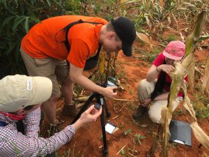
The total sickness rate of our field course is reaching 50 %. Luckily, we are not getting sick at the same time and there were still more or less healty students ready for today’s exercise. We had prepared maps about human-wildlife conflict in Taita area and we were supposed to interview people who know about the subject and after that, go to city of Voi. However, the day didn’t go entirely as planned.
The morning started with a drive to Voi and to the gate of Tsavo national park. Research center of the park is located inside the park and we were supposed to have a meeting with park staff there. We had to wait for two hours before all the byrocracy was done and we had got the permission to visit the research center. While waiting, we saw a climps of the park’s wildlife including baboons, a squirrel, colourfull lizards and birds. We got the permission to interview a park official in the research center but also got a chance to visit the whole Tsavo park for free. So in addition to the interview and conversations in the research center, we were able to experience Tsavo park with our own eyes on a safari.
Sentence of the day was ” a sandstorm in the eye balls” by Arttu. Driving through the dry sandy savannah by car with windows open means sand everywhere, also in the eyes. Luckily, sun glasses protected our eyes from the worst sandstorm.
The day was very succesfull despite of the long waiting in the morning. Interview was helpfull and we learned for example that the amount of wildlife conflict varies between years depending on environmental conditions. Our data that we had used when preparing the maps for the exercise didn’t include things such as illegal farming. To get better results about wildlife conflict using GIS analysis, better data would be needed but the results that we had got were still quite close to the reality.
The safari part was also exiting. We saw dikdiks, a secretary bird, zepras, jackals, elephants and many more. After about 70 km driving in the dry savannah we were covered by the red sand as if we had all got a spray tan. When we finally arrived to the park gate there was nobody to open the gate for us. After a short waiting we got out of the park and head back towards the research station. Driving in the dark Mombasa highway is not our favorite thing since the traffic and the style of driving is not something we have got used to. Interesting and exciting day!
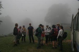
On Thursday morning we prepared ourselves for an ‘easy’ hike to Vuria, the highest peak in Taita Hills.
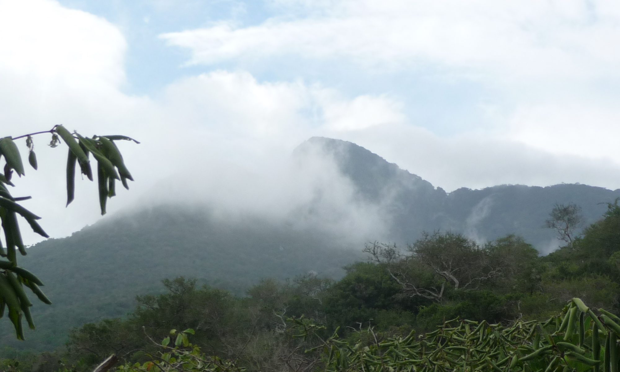
Thick fog surrounded us as we started hiking
One of the lovely staff members who was supposed to guide us through the forest, unfortunately couldn’t join us and thus students’ task for the day was to help navigating through the forest to the top.
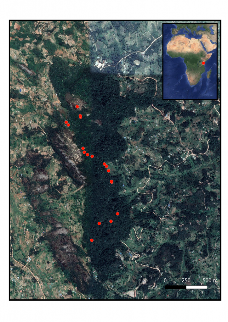
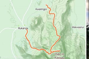
Map of our route
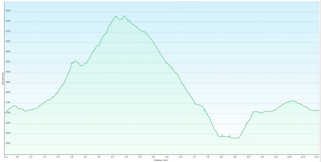
Our route went through forest and cropland around Vuria Hill to the 2257 meters high peak. Forest in Vuria is gazetted which means it is formally conserved forest managed by Kenya Forest Service. However, it is not a national park as Ngangao forest and thus is not as highly conserved.
Elevation profile of our route to the top of Vuria and down to the Skull Caves
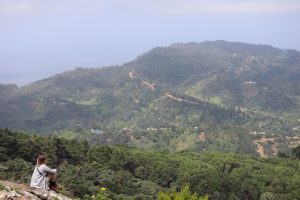
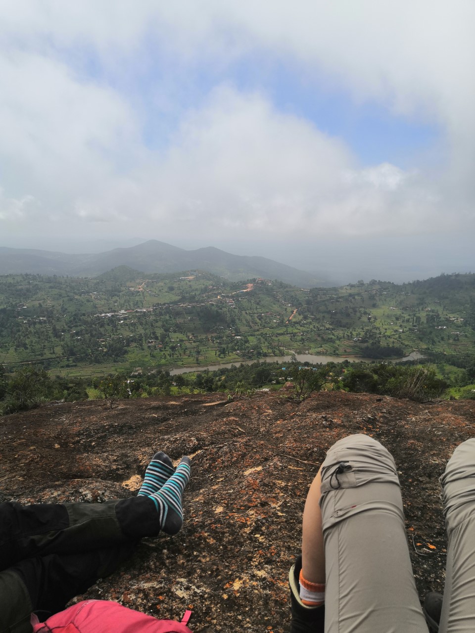
A few Finns at the front decided to take the ‘shorter and steeper’ path, ignoring the advises of our local companion, and it didn’t take long after we noticed that part of the group has already got lost in the forest. Luckily the mobile signal from the tower on the top was strong and soon we managed to get the group together. Using Prof. Pellikka’s umbrella as a machete we managed to get through the jungle. Suddenly the fog disappeared and we found ourselves above the clouds, looking down to surrounding idyllic African savanna opening below the moving clouds.
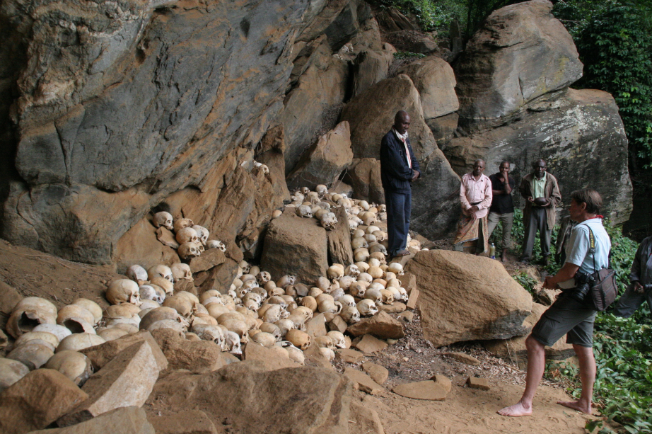
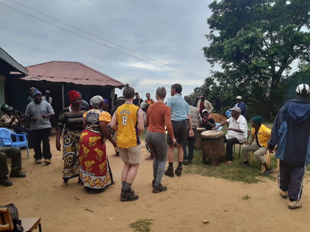
Our adventure continued in more cultural way, as we visited Taita peoples’ sacred site, the Skull Cave. We were honored to have the opportunity to visit the cave and to take part in rituals and a feast after the visit. Our evening with Taita people continued in cheerful party where Prof. Pellikka and some other students joined in the traditional dances.
After a bit short and not too refreshing night in tents under the starry African sky we woke up before sunrise to be ready for the first measurements on the Maktau fields. In the morning dusk the students manned the three study plots with the FLIR thermal camera and Licor, the leaf area index calculator. With FLIR we pointed on cassava leaves to measure their temperature, and Licor was used to measure how much the leaves prevent the sunshine from prenetrating into the ground level. As the devices were only two and we had three plots, the morning was quite peaceful as there was no hurry with the measurements and we could enjoy the savannah’s bird symphony.
When the groups were done with first set of measurements, it was time to enjoy a delicious breakfast at Mwadime’s house with plenty of cooked eggs, oatmeal and local bakery products. After breakfast we had a small break for taking a nap, watching birds and so on, to be ready for the next set of experiments: chlorophyll and infiltration measurements and taking pictures of leaves with a hyperspectral camera. A more thorough report of the measurement results will be published in the course blog later.
One group practices using the hyperspectral camera.
Between measurement tasks, Mwadime walked with idle groups to tell interesting details about local farming practices, flora and fauna and the Kenyan society. We quickly fixed his fence broken by a hungry elephant rushing through towards his maize fields, and learnt how the farmers can upgrade the soil quality by leaving the after harvest biomass onto the fields instead of burning it.
One of the infiltration measurement plots was at the bottom of a huge, 6 meters deep water pit a local farmer had mostly dug without any machinery in order to collect enough irrigation water for his crops during the rainy seasons. As a reward for being allowed to conduct research on the farm, University of Helsinki has provided a plastic cover for the bottom to prevent water from infiltrating into the soil.
The pit a local farmer had dug to store rainwater for irrigating his crops.
The day on the lowlands was hot despite remarkable cloud cover, especially out on the open fields without any shadows, which is why everyone was happy to leave the farms behind and head back to the cooler mountains and research station. On the way to Taita Hills, we had a brief stop at Mwatate to support local kiosk keeper by emptying his refrigerator of cold soft drinks.
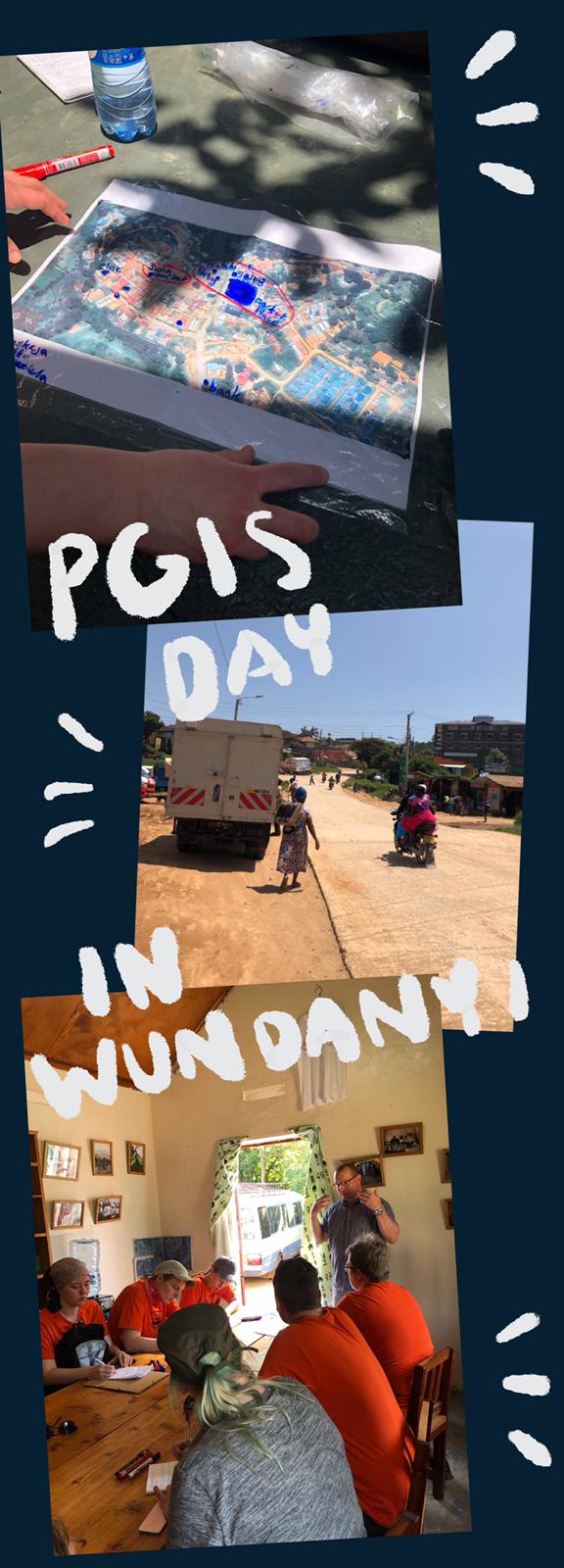
On third day students got in touch with the local people at the town of Wundanyi, the home of Helsinki research station. The idea was to harness local knowledge and perceptions services in the town. This PGIS (participatory geoinformatics) practical started with an introduction from Dr. Tino Johansson, after which students headed to the town to do interviews and draw maps with the people of Wundanyi, trying to include all the age and gender groups for an inclusive perspective of local services.
r
The practical turned out well with students learning about both possibilities and challenges of the method. Local people’s perspectives of Wundanyi services varied among interviewees and both positive and negative perceptions were observed.
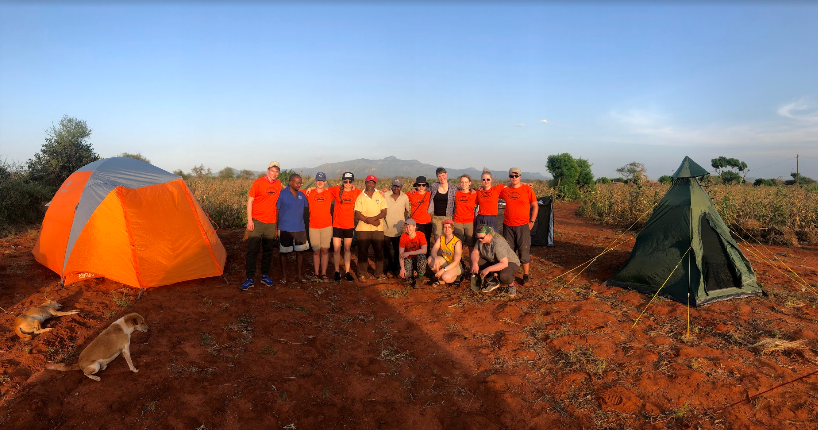
While students spent their afternoon at the town, teachers and assistants remained at the station to prepare for the next day’s field campaign in Maktau. This included checking and packing all the measurement devices, as well as five big tents since the next night was going to be spend at a farmyard. So once everyone got back together it was once again time to jump into a bus, this time destination being Maktau.
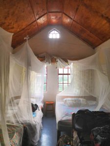
In Maktau the group was heartwarmingly welcomed to research station manager Mwadime Mjomba’s farm by the whole family. After students set up the tents next to a maize field, the dinner was served inside the house in traditional Kenyan manner. Later in the evening, while the course assistants were setting up temperature and moisture sensors in cassava and cowpea fields, the students enjoyed watching the breathtaking night sky by the tents. To keep the unwanted guests, such as lions and elephants away from the camp, lanterns were set up and it was time for a rest.
Monday started of nicely with the power of oatmeal and bread with delicious Blueband-spread. We traveled with bus from Taita Research Station to Ngangao cloud forest. Along the way, we saw landslides that had occurred during the November-December rainy season. Luckily, the roads had been fixed. The weather was quite pleasant during the hike up the hill to the peak of Ngangao forest. Generally, it rains more on the east side of the forest compared to the right side.
The hills are called the “Switzerland” of Kenya because of the large local height differences and good prosperity.
Approximately 90% of the tree cover in Ngangao forest are indigenous species and 10% exotics like cypress, eucalyptus and pine. Grevilleas are planted to the outskirts of Ngangao in the fields as their leaves are good for fertilizing agricultural land. The trees itself are great as carbon stocks, to catch fog and for biodiversity. Also an indigenous tree, Albizia gummifera traps rain since its leaves are suitable for that purpose, unlike Eucalyptus trees, for example. It has been estimated that the fog deposits increase the amount of water available about 20% in the area.
Since Ngangao is a conserved forest, Kenya Forest Service supervises the use of the forest. For example, firewood collecting and trespassing without permission are illegal activities. Forest fires are common in the region since fires are set out on purpose at the end of the dry season to induce rain, which is a misunderstanding unfortunately.
Deep in the Ngangao forest…
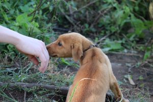
People grow maize, sweet potato, banana trees, vegetables and beans in the hills. The average farm size is only about 0,4 ha in the area. Dracaena and sisal are used as border posts between the estates in the hills and Napier grass is used for soil erosion prevention and fodder. Monkeys, rodents and birds can destroy the crops, so people keep dogs close to the fields for protection against the pests. They also use lights, fires and even human guards with slingshots to protect their crops. According to research, the larger the community is, the safer individual farm estates are from human-primate conflicts.
Size doesn’t matter, since monkeys are afraid of all dogs.
Before entering the forest, we were divided into four groups to perform a GPS-exercise in the Ngangao-forest: Lion-group mapped the locations of big boulders, Ostrich-group kept an eye on fallen down trees, Impala-group mapped the locations of saw pits and Giraffe-group saved the locations of big trees. Saw pits form when people cut trees on the spot, because tree trunks are too heavy to carry. We mapped the points while we climbed up the hill to the peak.
GPS waypoints along the hiking route in Ngangao forest.
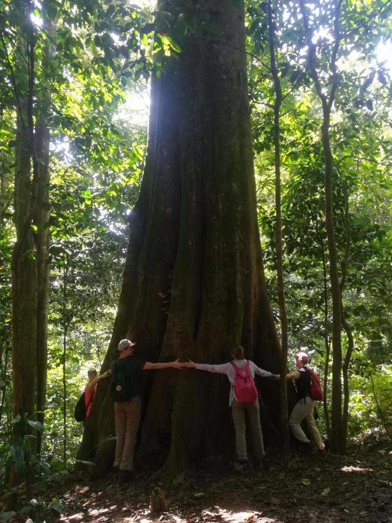
Newtonia buchananii, the largest tree in the forest. Some people have even tried to cut it down, but luckily they have failed.
We started our hike at 1750 m a.s.l. and hiked all the way up to a peak at 1956 m a.s.l. The hike was definitely worth it, even though mosquitoes and ants bothered us. The view from the top was unbelievable!
On the way back, we visited Mr. Bobson’s farm. He uses drip irrigation on his farm, which is a great method especially during the dry season. It takes less water since the whole field doesn’t need to be watered. In addition, drip irrigation takes less labor and less weeding. Mr. Bobson doesn’t have to use so much gas either, since the water comes down the hill due to gravity. The method isn’t as suitable for low land areas because of flooding and silt that can block the system.
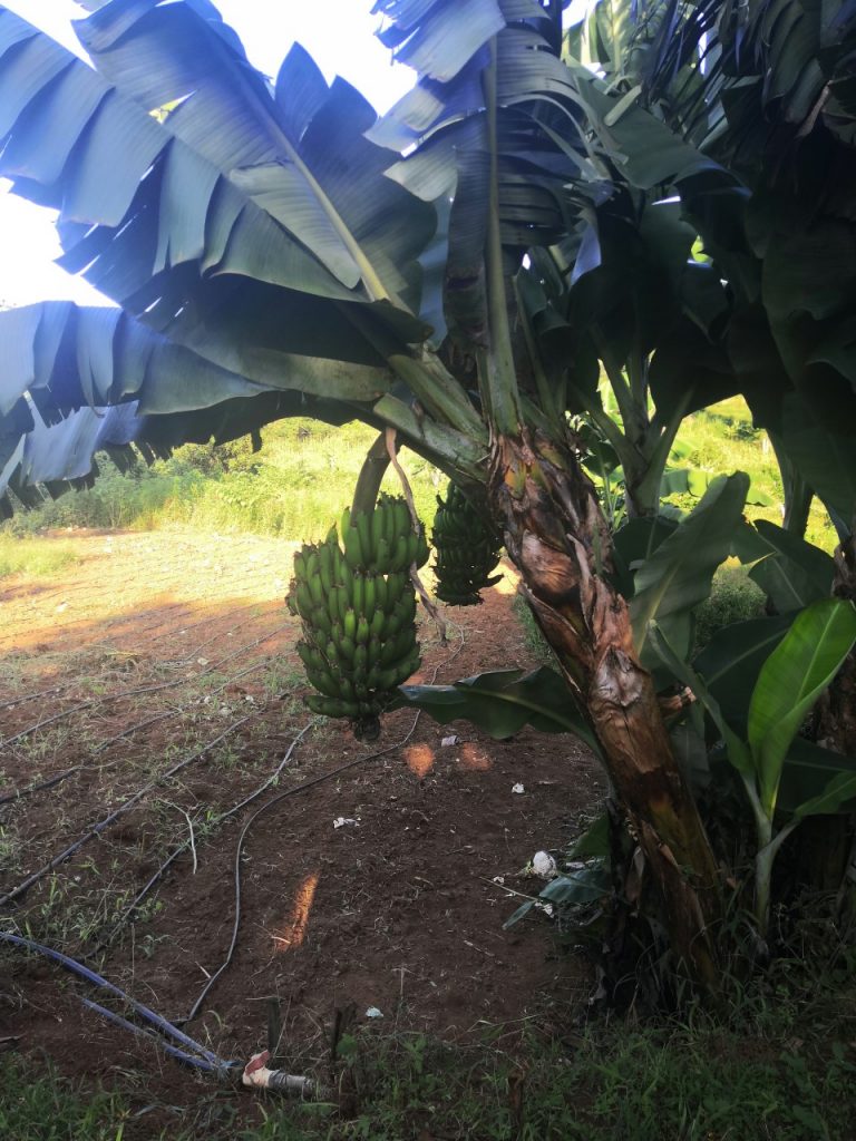
Mr. Bobson is planning to plant Spinach seedlings on the field. He also grows banana trees next to the field.
We spent our first night in Kenya in ACK (Anglican Church of Kenya) guesthouse in Nairobi before our buss ride to Taita. The hotel was welcoming and comfortable with artistically folded towels and everything. After breakfast in the hotel we backed our bags in the roof of a minibus that we are going to be using through our whole journey and hit the road with our driver Robert. The ride to Taita Hills from Nairobi is approximately 350 km and takes about 7 hours.
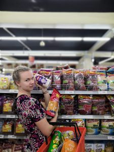
After a short drive we stopped in a supermarket to buy snacks and water for the whole trip. Before entering the supermarket, security guards performed a body check for all of us which was new experience for me at least. The Kenyan ban for plastic bags was visible in the supermarket: fruit and all our other purchases were not packed in plastic bags. Instead plastic reducing or completely alternative packaging were used.
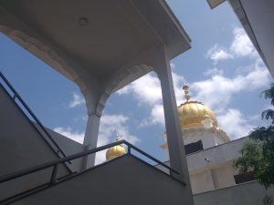
After few hours of driving we stopped to eat lunch in a Sikhi temple in Makindu. The temple was build over 100 years ago so that the Indian railroad builders would have a place to practice their religion. Lunch was delicious and free but it was custom to leave small donation (around 200-300 Ksh aka. few euros) as a way of thanking the temple for their hospitality.
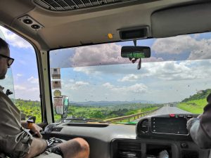
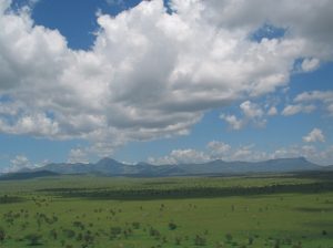
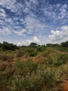
Our road trip included nerve-racking moments in the traffic as the style of driving differs from Finnish one greatly. We passed many small villages that are located next to the road. We got our first sightings of the great wildlife of Kenya. We saw the vegetation types changing as the climatic conditions vary along the leg. And Africa really looks like the Africa from nature documentaries!
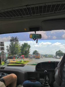
Closer to the end of our drive we stopped to buy some sauna beers at a village called Voi.
At 6 pm we made it to the Taita research station after a long day of sitting in the minibus, surrounded by amazing scenery though. We met staff of the station who welcomed us here warmly. Then we finished the day with a nice dinner that the station chefs had made for us.
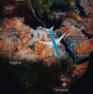
Our trip towards Taita hills started with a long journey of over 10 000 km from Helsinki to Amsterdam (or Doha) and then to Nairobi. But aside from physically traveling to Taita we had been preparing for the fieldcourse by attending seminar for few months and some of us took a course called ”Geography of megatrends”. I feel like there was a lot more to prepare for this adventure compared to other travels I have done. We had to consider different vaccinations and possibly buy new gear for different situations (hiking shoes etc.). But packing was only the beginning.
Half of the group took KLM connecting flight through Schiphol airport and other half went through Qatar. KLM flight was the one I took so I’ll be writing about that, pretty uneventfult, trip here. Most of us arrived to the airport between 5 and 6am. We had seats around the plane and avoided everyone else for reasons truly finnish or just unknown. Most of us felt exhausted and got hungry by the time we reached Amsterdam, where we would have around 3 hour layover. I left others to find a sandwich place and took off to see the art museum at the airport. It was quite small but it did have small Rembrant on display which excited an art geek like me. Aside from visiting few shops we just hungaround and took it easy since we would still have 8 hour flight to Nairobi ahead.
On the Nairobi flight we were again seated around the place and didn’t get to bother each other too much. I watched the award winning Korean movie ”Paracite” and few action movies. Nothing really that interesting or mention worthy happened during the flight. Food was normal airplane quality and people traveling by the plane were quiet and respectful.
By the time we got to Nairobi we had been traveling for what seemed like an eternity. We still needed to go through the customs and apply for a visa, but our group had people that had visited Kenya already and they knew which forms to fill. The customs officer was asking me about the group and my profession but all of us got through without too many troubles, and no one lost a luggage, which meant clean socks to everyone. We had a driver to pick us up with (unfortunately uncustomised) Matatu, which is a small minubus we would get accustomed to during the up coming days in Kenya. It felt bit surreal to watch people on the streets of Nairobi late on Saturday evening, we are really in Africa and our field course was about to start
This blog belongs to Taita field course (18.1 – 29.1.2020), part of University of Helsinki’s MSc programme. The purpose of this blog is to share our activities and coursework.
Please find more information on this blog and the course here.


 r
r