
Last week, the Digital Geography Lab organised a workshop for the European Researchers’ Night (Tutkijöiden Yö), one of only five to be hosted by the University of Helsinki’s evening programme at the Helsinki Observatory in the city centre.
At our workshop, we engaged visitors with concepts around urban accessibility, such as multimodal travel times in the Helsinki metropolitan area, one’s personal 15-minute city, and mobility justice between different groups of residents and between different neighbourhoods.
Together with a fantastic team of students, we prepared three interactive tasks for the visitors of the event, that targeted the general public, and was met with ample interest.
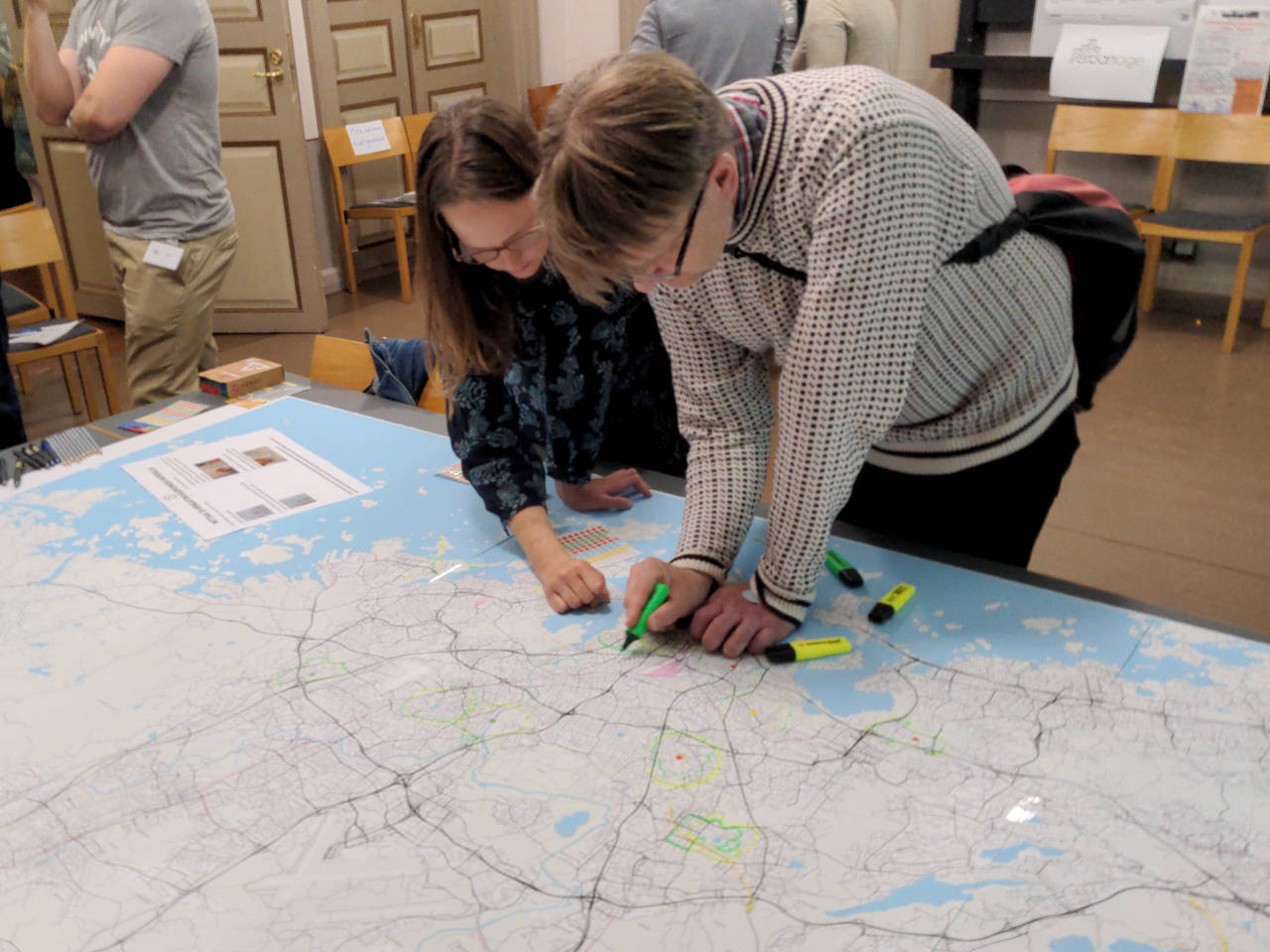
At one station, visitors were asked to locate a place important in their everyday lives on a large printed map, and mark it with a small sticker. Next, they would draw their estimate of how far they would reach around this point within 15 minutes, walking. For the next step, we prepared a piece of string that we measured and cut to represent the exact distance an average healthy adult would walk in those 15 minutes. Laying it along the streets and paths in the map, the visitor could then draw the area they can reach precisely into the map, adding to the personal accounts of numerous other visitors before them. Finally, we asked visitors to reflect whether or not the identified area contained all services they needed to access in their everyday lives, such as grocers, libraries, pharmacies, and public transport stops.
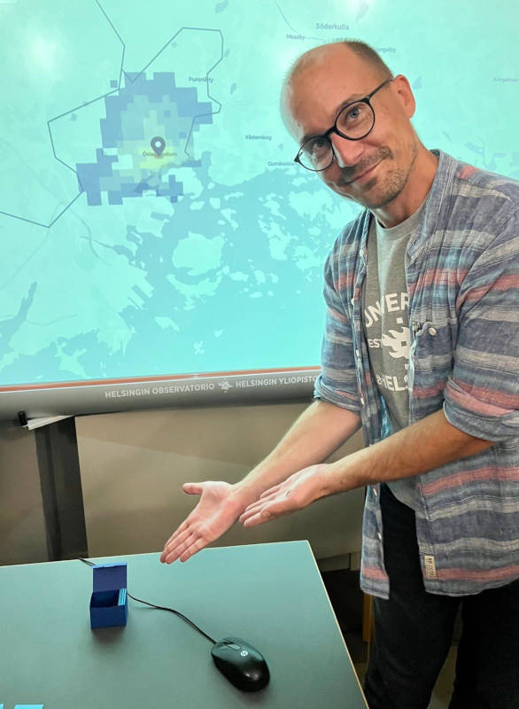
At another station, visitors could demonstrate their knowledge and intuition of accessibility in different neighbourhoods of the Helsinki metropolitan region, and compete against each other: Picking two neighbourhoods from a stack of cards, and rolling dice to determine the mode of transport, visitors guessed from which of the two neighbourhoods a larger area could be reached within 30 minutes. To verify the guess and gain points in the game, visitors used an interactive map interface designed by MSc student Eemil Haapanen to visualise and explore travel times across the city region.
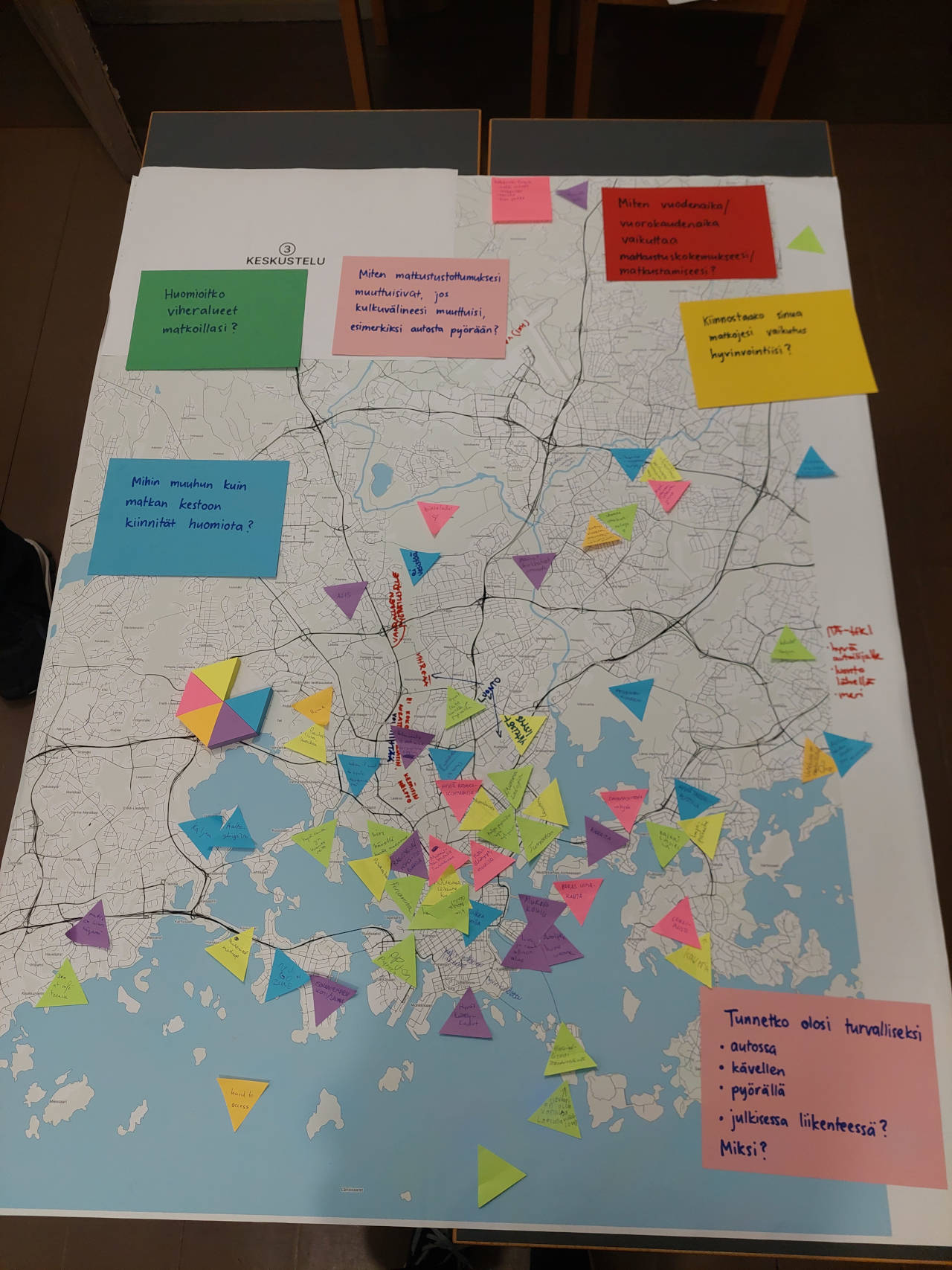
At a third table, we encouraged visitors to express their experience when travelling through the city: which types of places do we perceive as pleasant to walk, cycle or drive through, which places as unpleasant? How important is a green environment on our daily trips? Where does the city work exceptionally well, and where would be room for improvement? What should the mobility and accessibility researchers at the Digital Geography Lab research in the future?
The workshop was organised by researchers involved in the URBANAGE and GREENTRAVEL projects. The former looks into how older residents of cities could be considered better in urban planning when using Digital Urban Twin technologies. The latter looks into the importance of healthy and green travel environments on the well-being of city residents.
One Reply to “URBANAGE workshop as part of the European Researchers’ Night”
Comments are closed.