
November came and went, and with it the fifth annual map challenge. The concept is simple: every day has a theme, which is interpreted more or less freely and refined into beautiful cartographic visualizations.
The Digital Geography Lab partook this year with a whopping 29 contributions by 10 lab members. These maps are a globetrotting travel through five continents and cover a range of themes, datasets, and methods from population and dogs to – gummy bear cartography?? Mapmaking was spearheaded by our PhD student Matti Hästbacka, who posted the maps X and Mastodon and created half of them!
See our map gallery for this year is below. Also check out our maps for the year 2022.
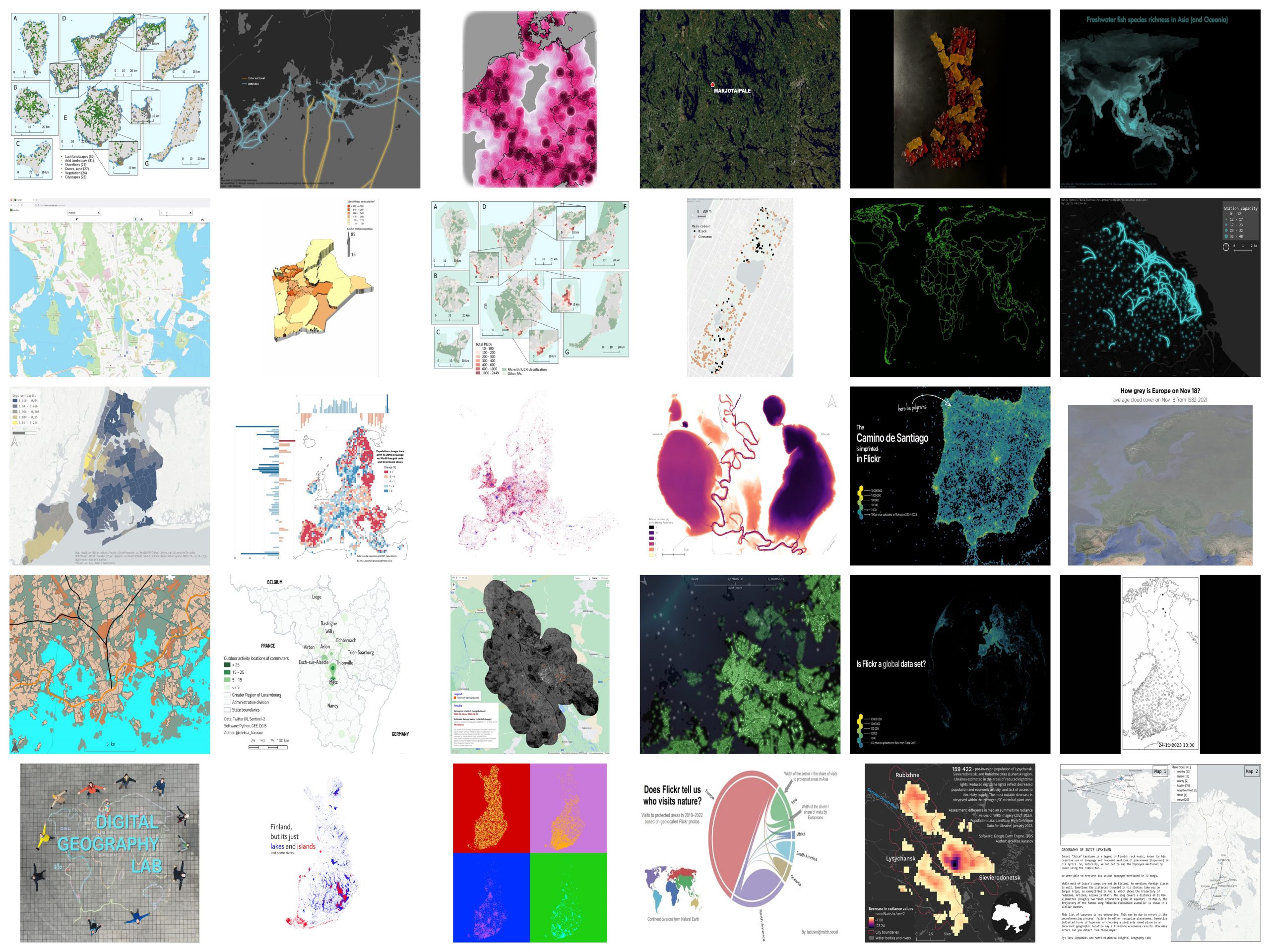
Day 1: Points – Flickr photographs and landscapes in the Canaries
By: Matti Hästbacka
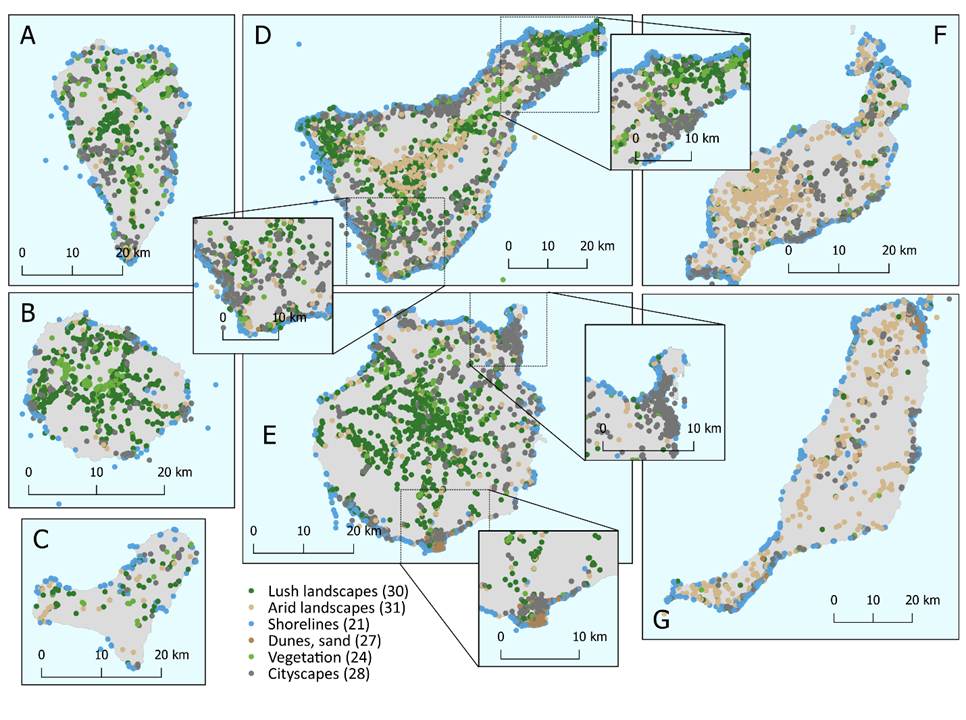
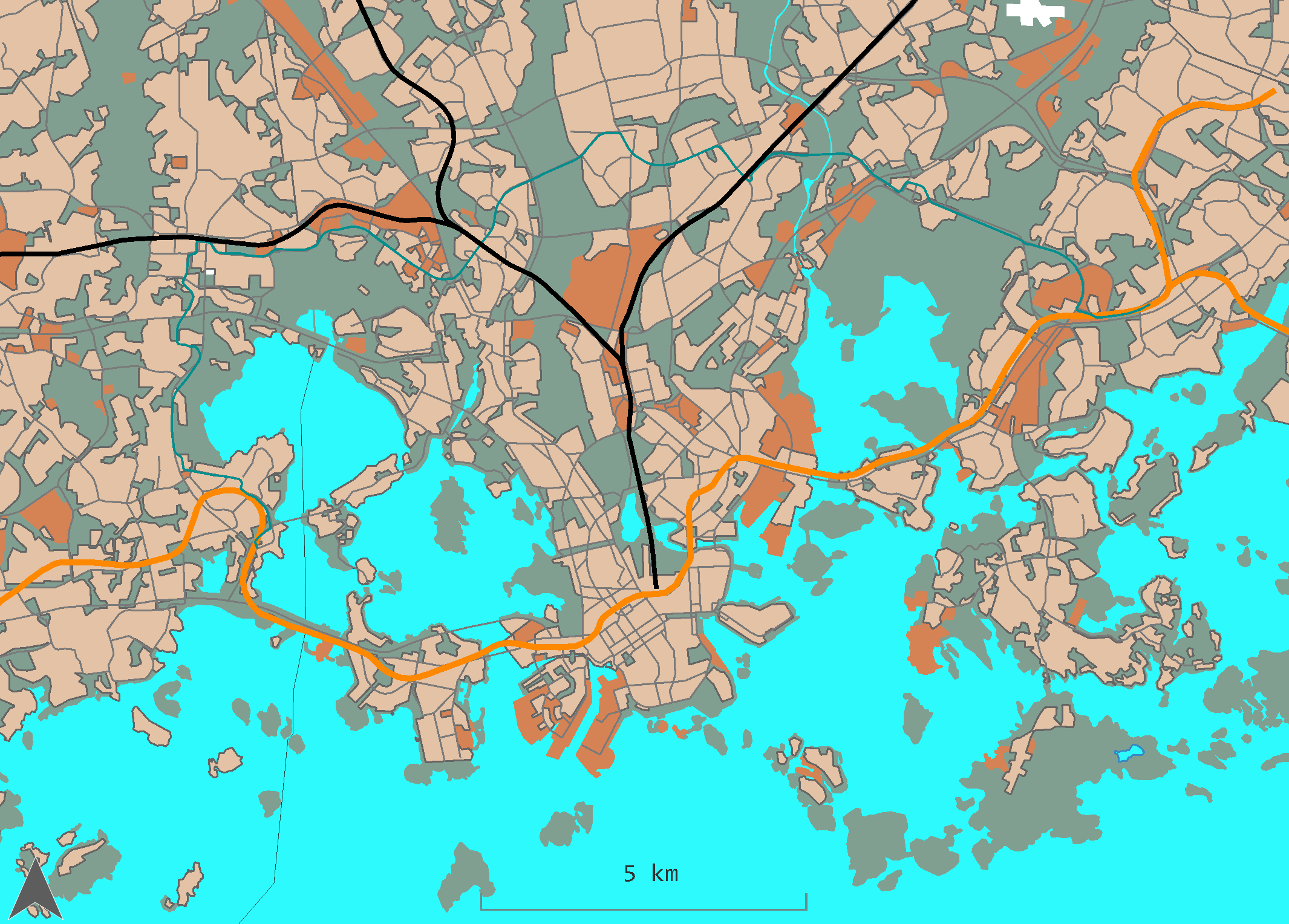
Day 2: Lines – Ferries in Helsinki
By: Matti Hästbacka
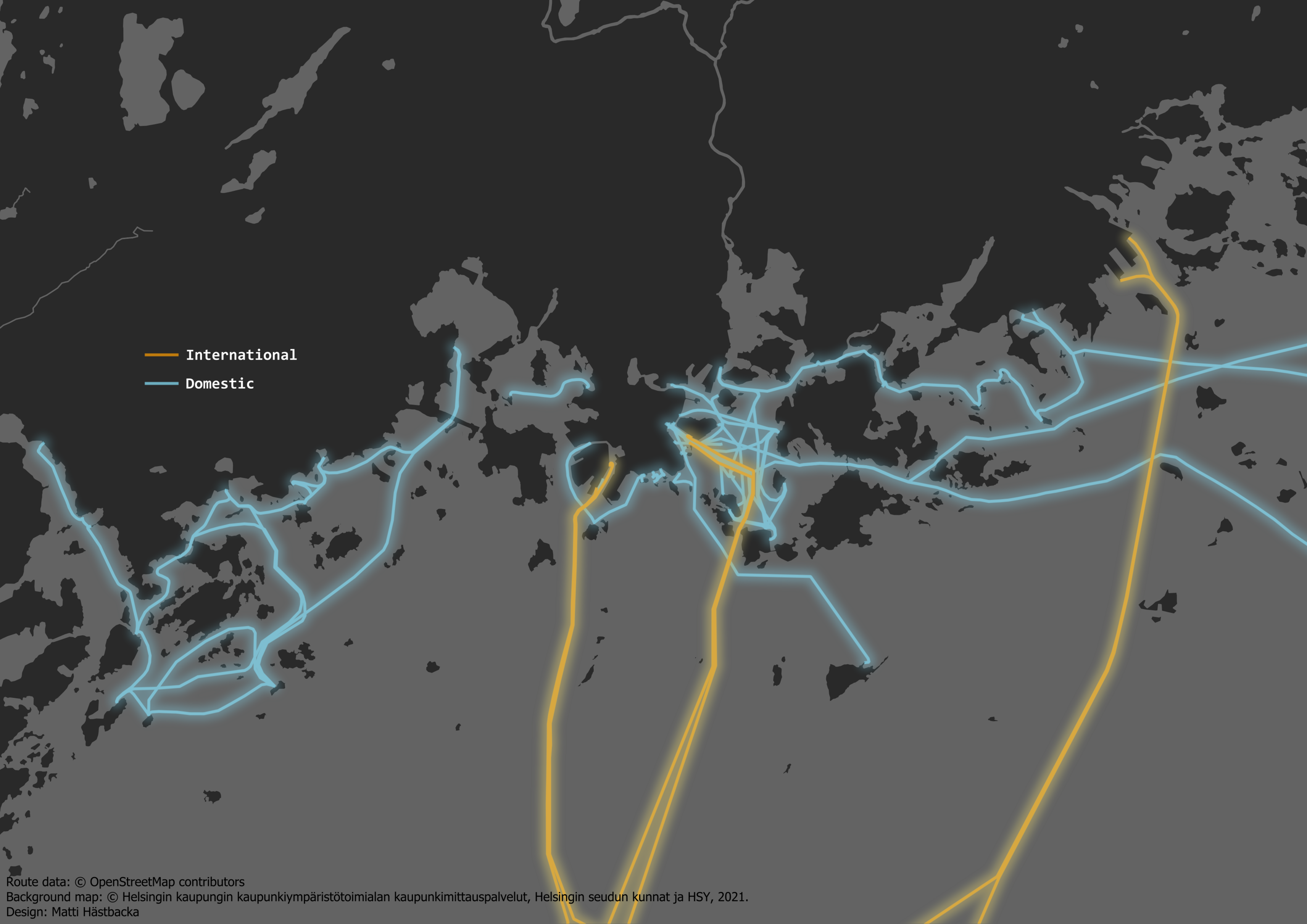
Day 3: Polygons – Cross-border spaces
By: Olle Järv
Day 4: A bad map – An ordinary news map
By: Matti Hästbacka
Day 5: Analog Map – Gummy bear Finland
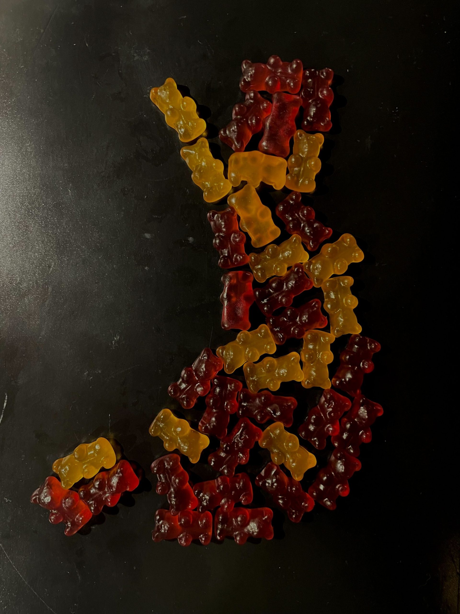
By: Matti Hästbacka
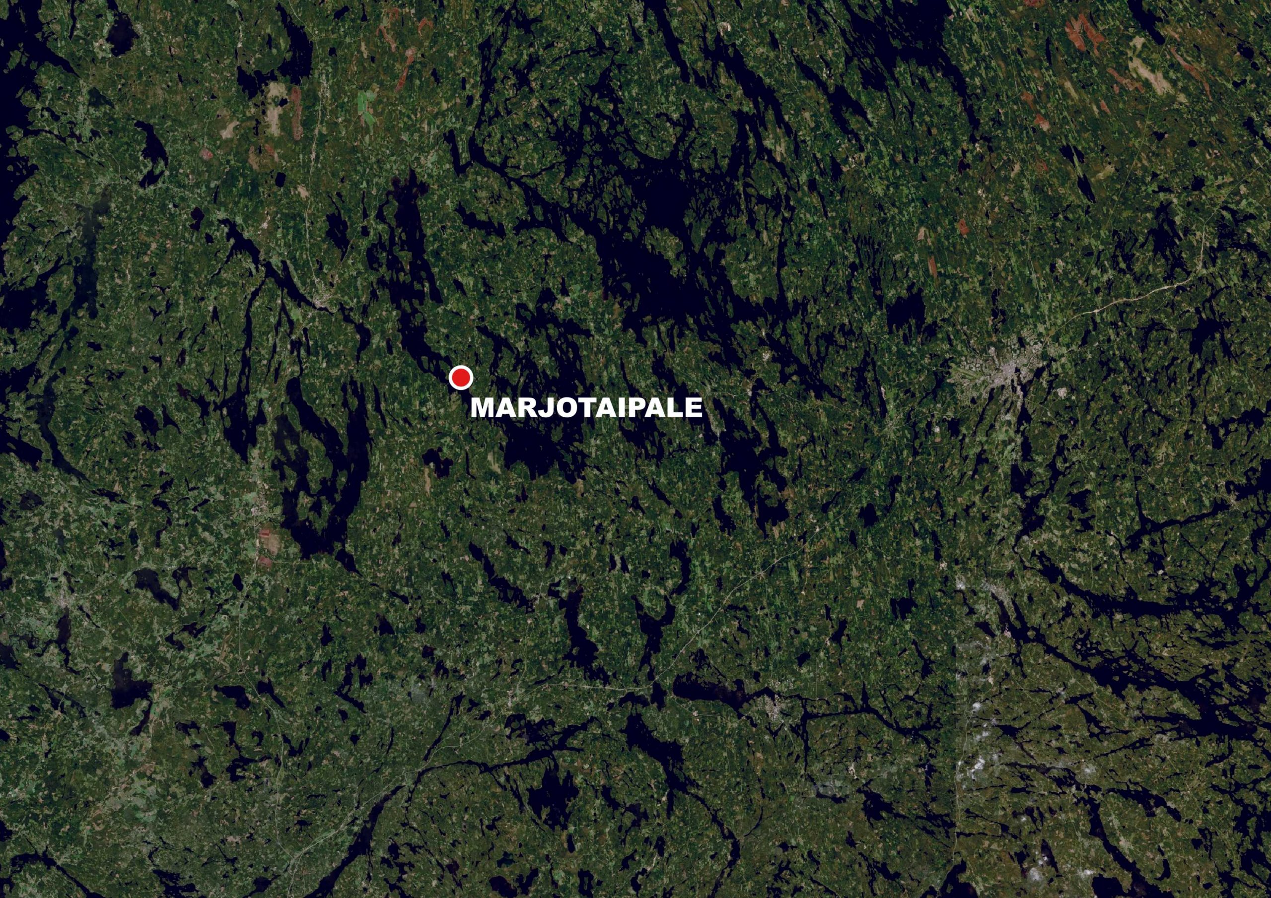
Day 6: Asia – Fish species richness
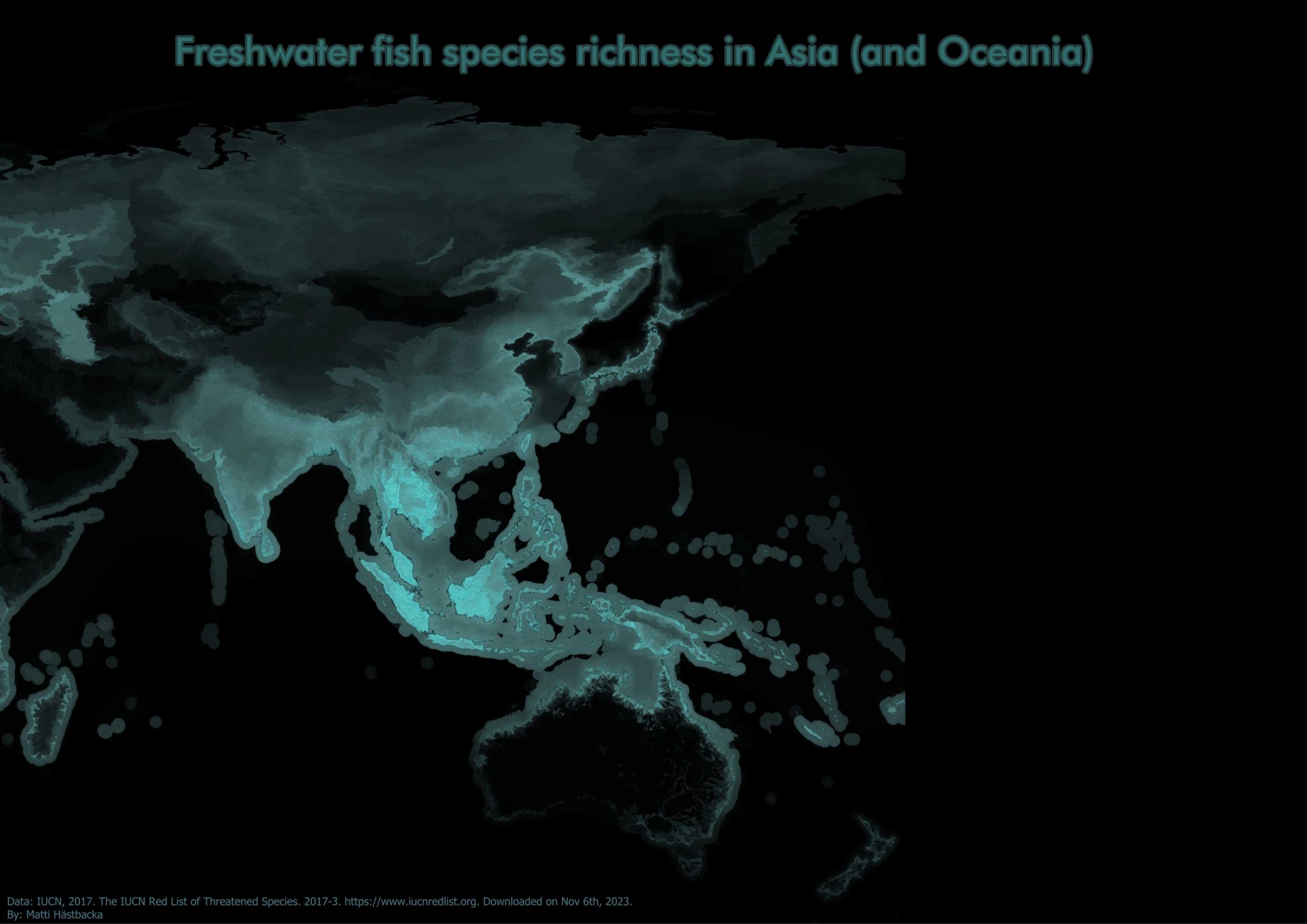
By: Matti Hästbacka
Day 7: Navigation – Pleasant routes with GreenPaths
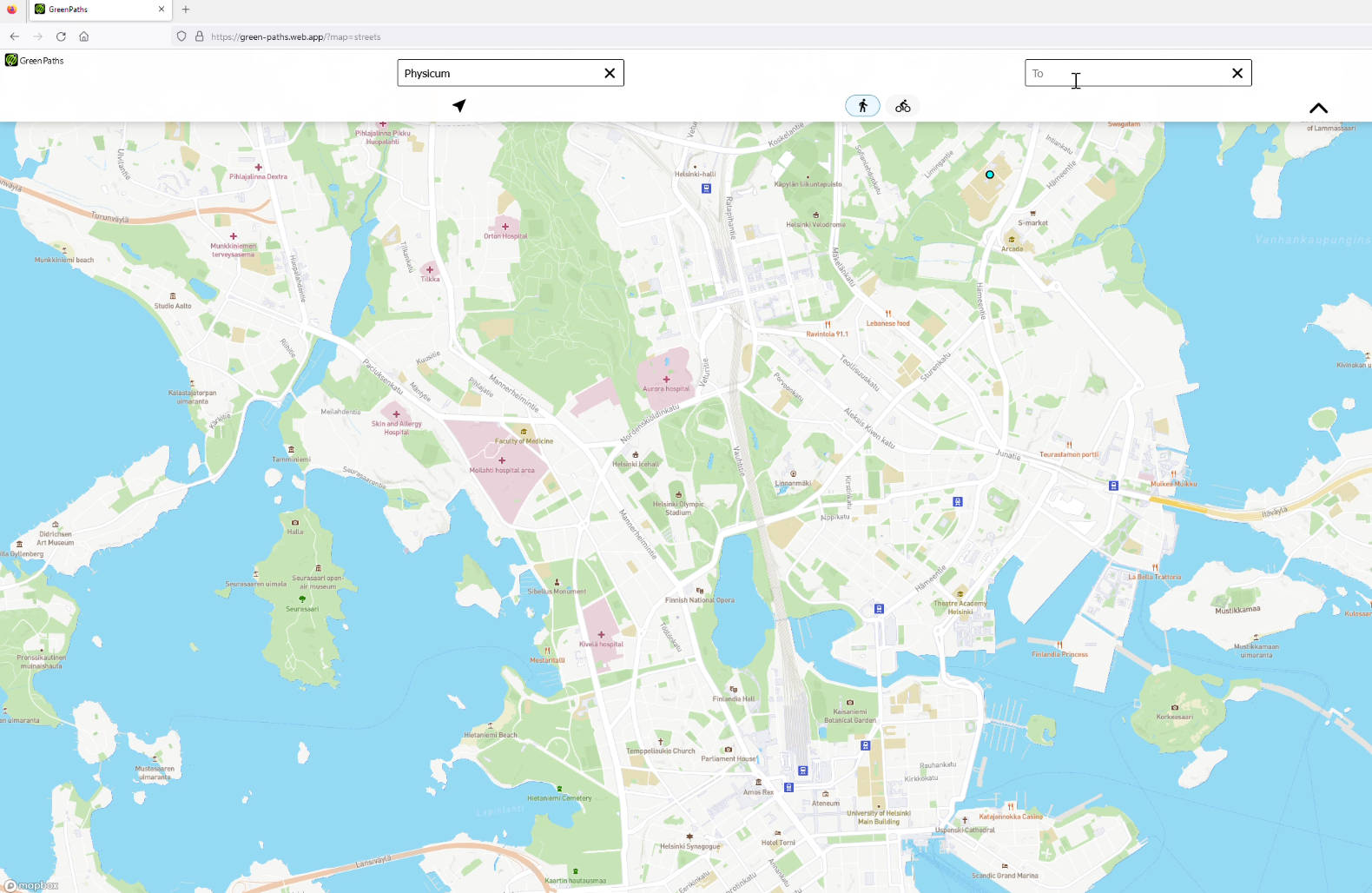
By: Matti Hästbacka
Day 8: Africa – Population density and pupils in Kenya
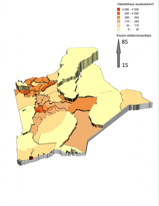
By: Jussi Torkko
Day 9: Hexagons – Protected area visits in the Canaries

By: Matti Hästbacka
Day 10: North America – Squirrel sightings in New York’s Central Park
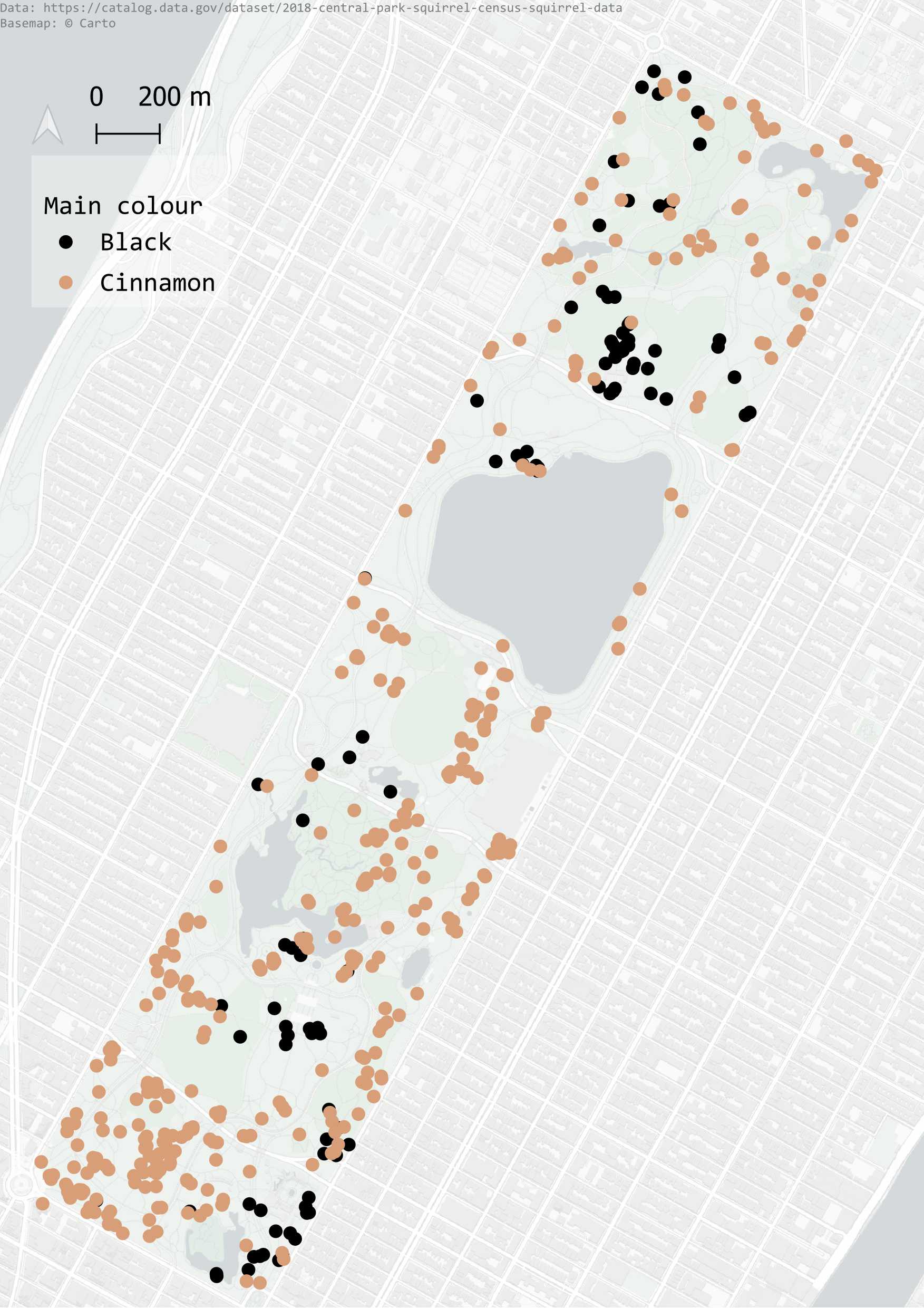
By: Matti Hästbacka
Day 11: Retro – Birthplaces and years of table tennis players
By: Matti Hästbacka
Day 12: South America – Bike sharing in Buenos Aires
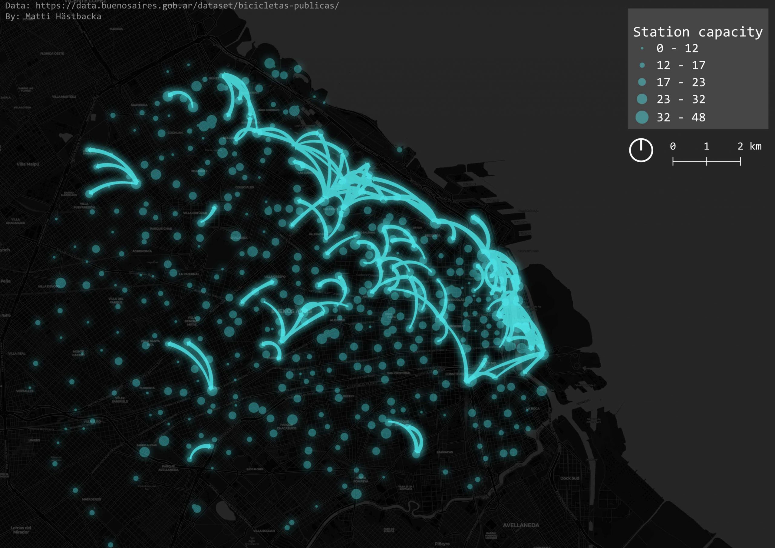
By: Matti Hästbacka
Day 13: Choropleth – Dogs in New York
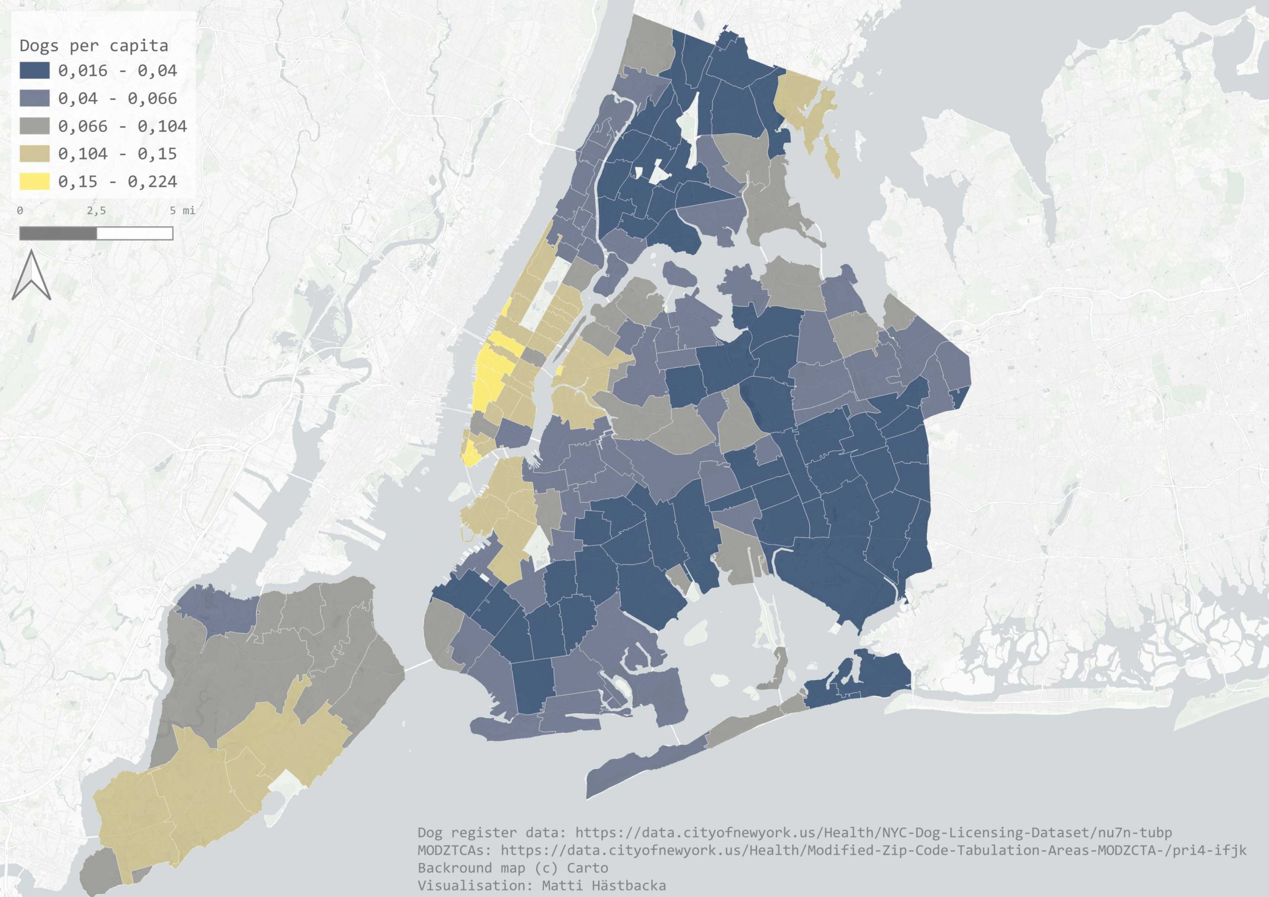
By: Matti Hästbacka
Day 14: Europe – Population change across lonlat
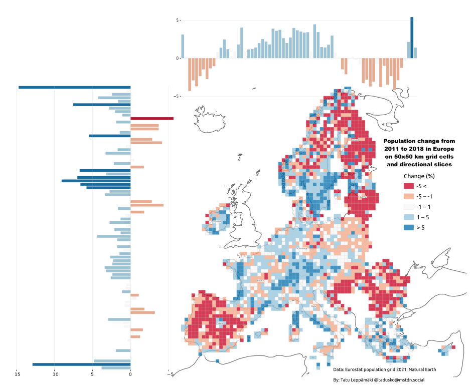
By: Tatu Leppämäki
Day 15: OpenStreetMap – Mystery schools across Europe
By: Elias Willberg
Day 16: Oceania – River and LIDAR art
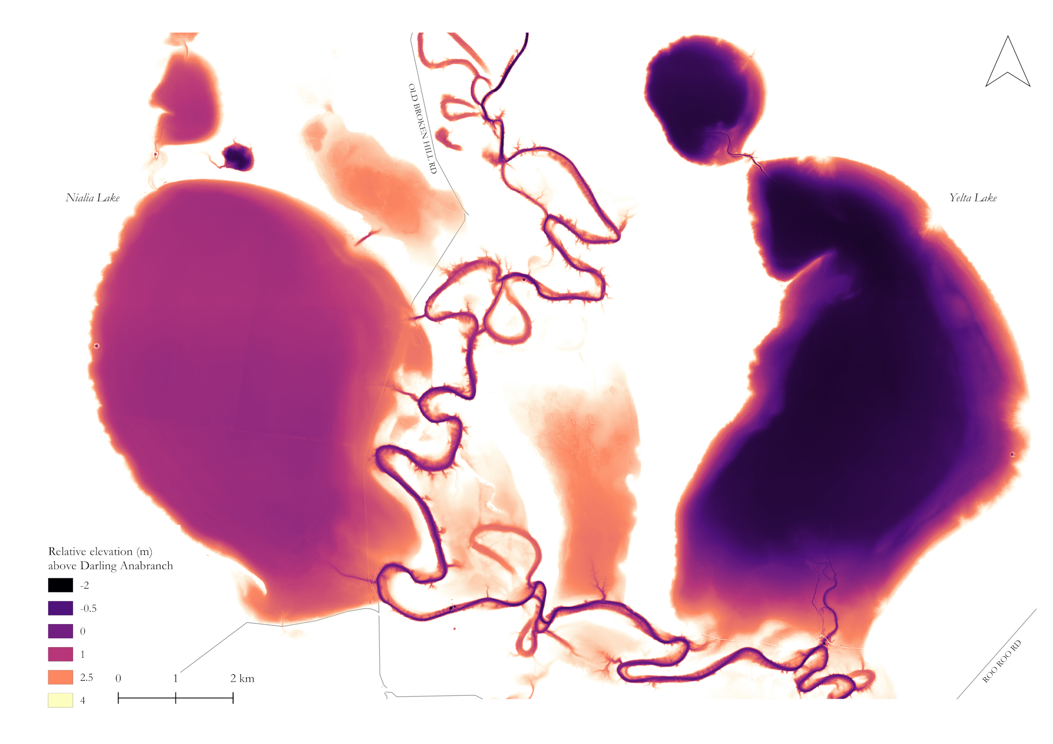
By: Rory Taylor
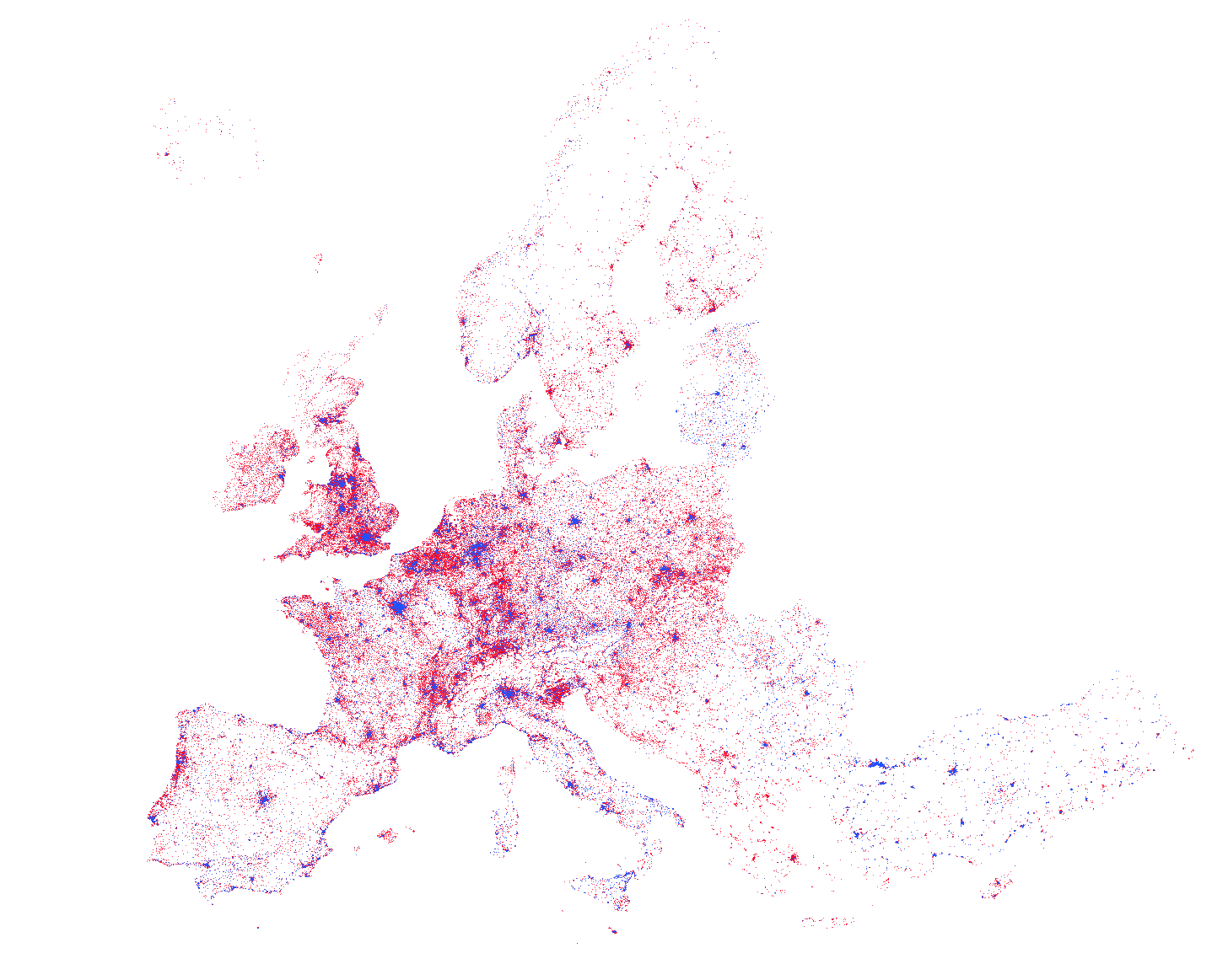
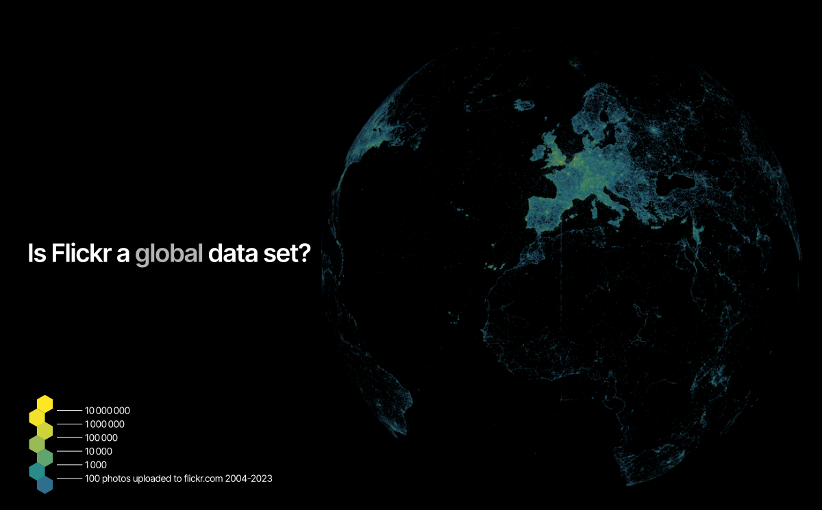
Day 17: Flow – Flickr pilgrimage
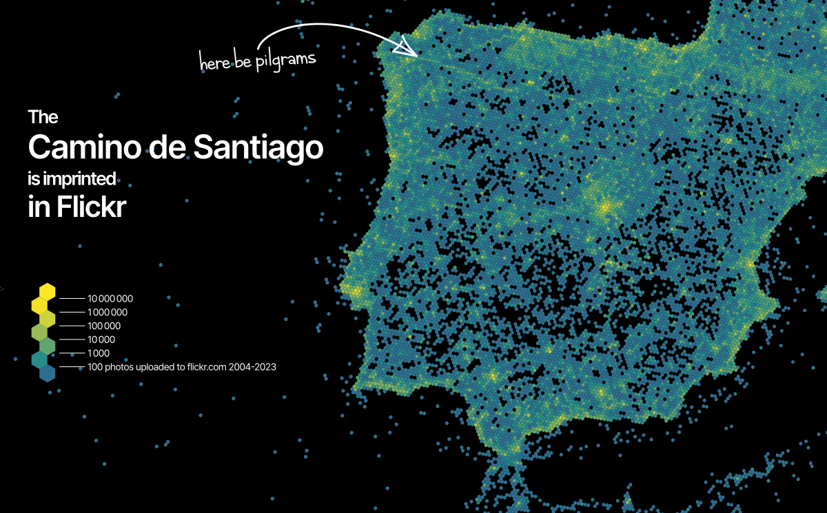
By: Christoph Fink
Day 18: Atmosphere – Greyest day in Finland?
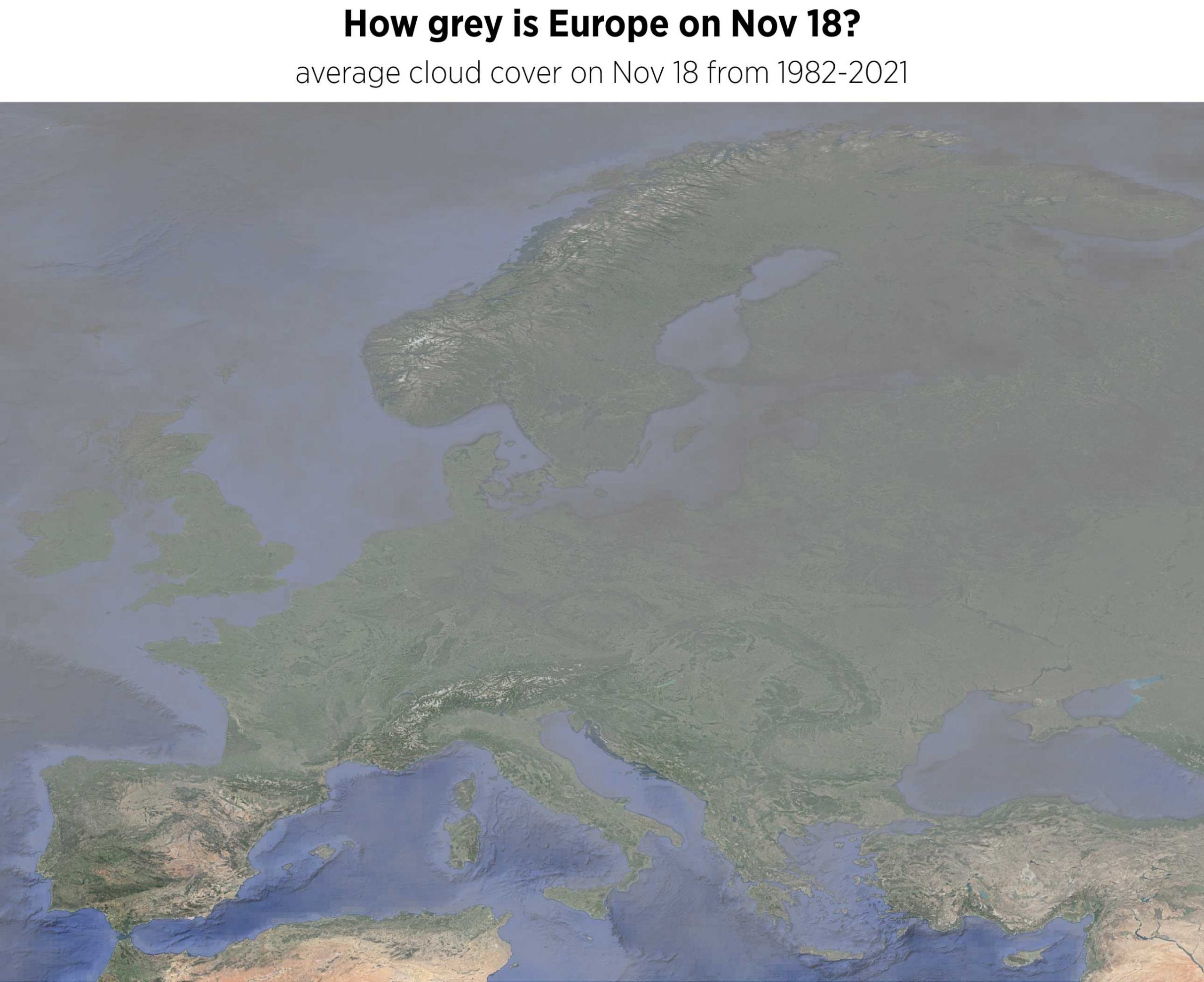
By: Robert Klein
Day 19: 5-minute map – Helsinki in 5ish minutes
By: Matti Hästbacka
Day 20: Outdoors – Cross-border visitors in the great outdoors
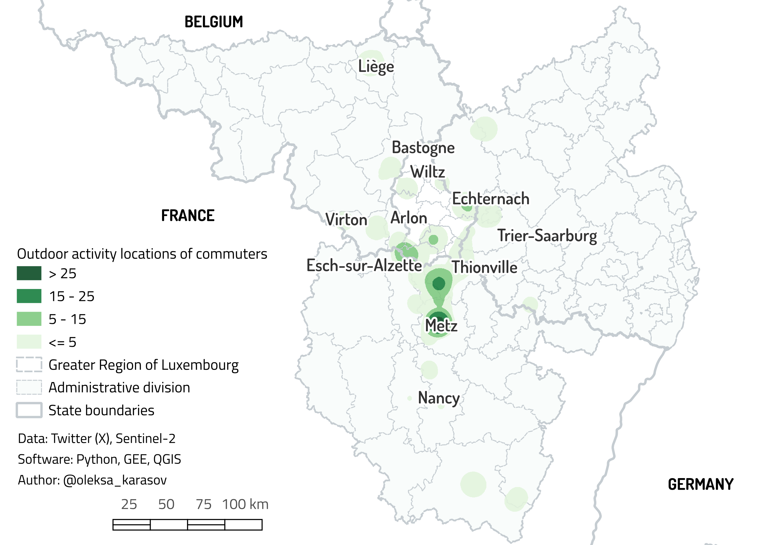
By: Oleksandr Karasov
Day 21: Raster – Mapping damages in Lysychansk with remote sensing imagery
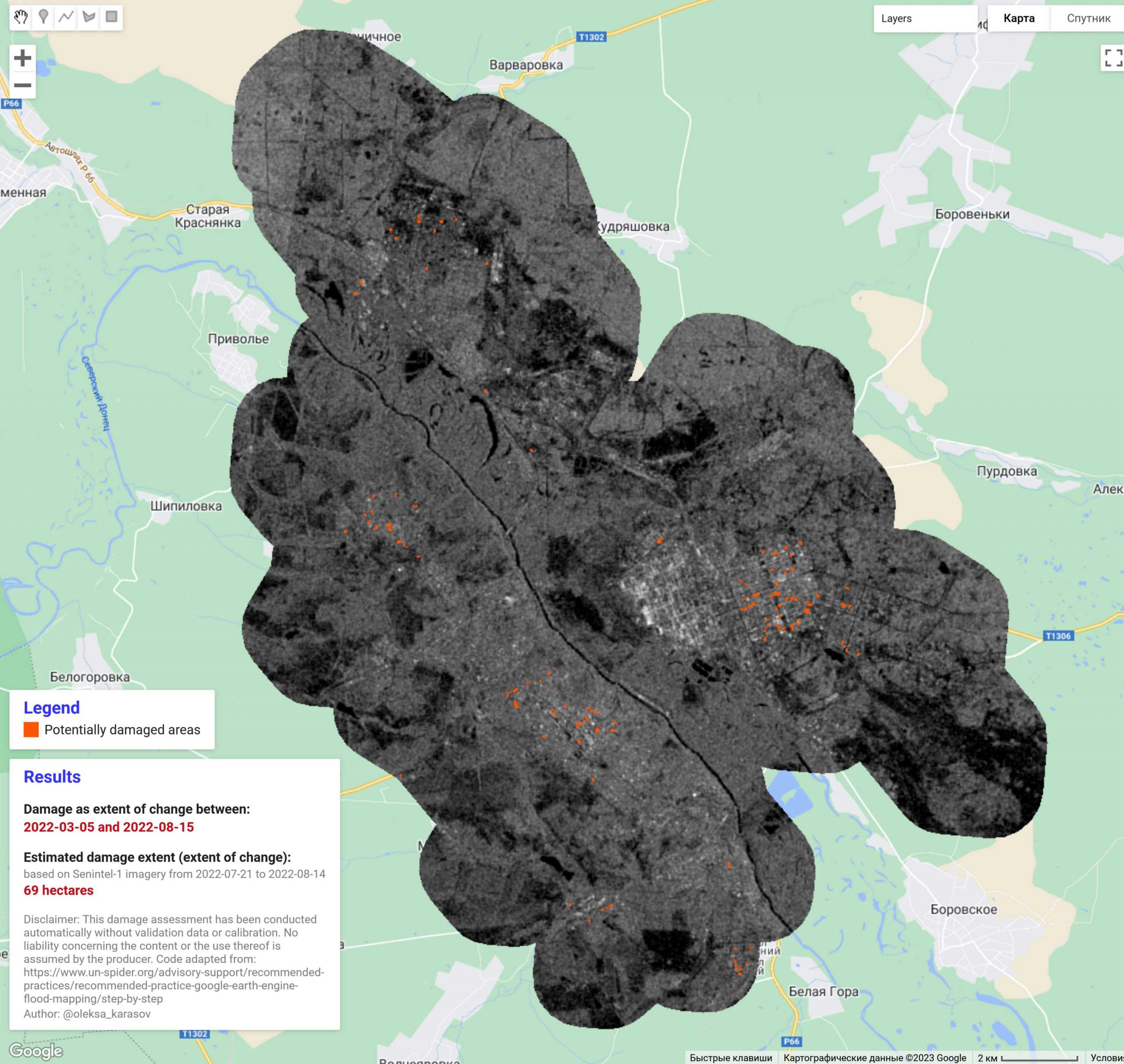
By: Oleksandr Karasov
Day 22: North is not always up – No up in space
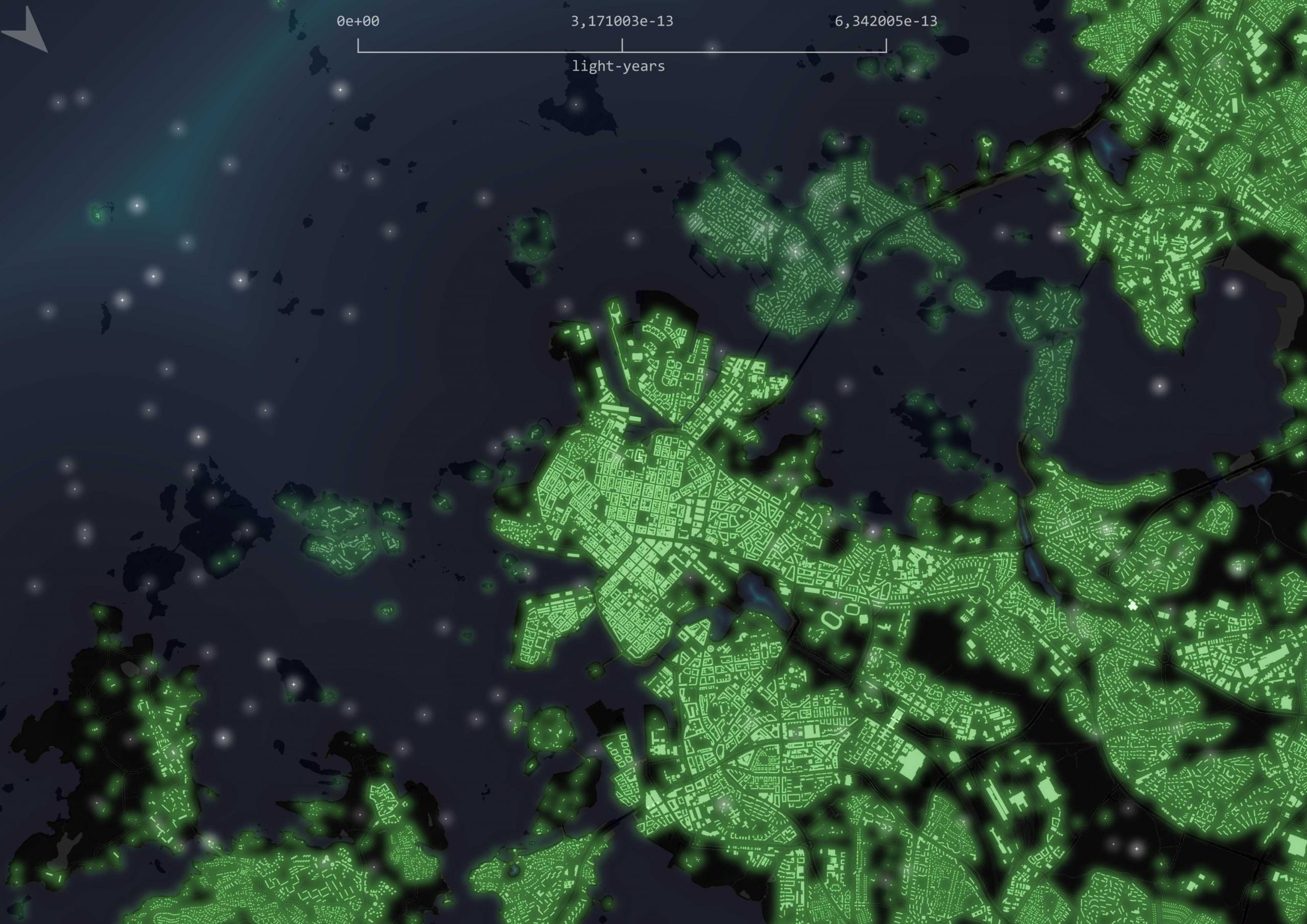
By: Matti Hästbacka
Day 23: 3D – Flickr photos on a globe
By: Christoph Fink
Day 24: Black & white – Sunset falling over Finland
By: Roope Heinonen
Day 25: Antarctica
Can’t do them all. We skipped this day!
Day 26: Minimal – Finland as lakes and islands
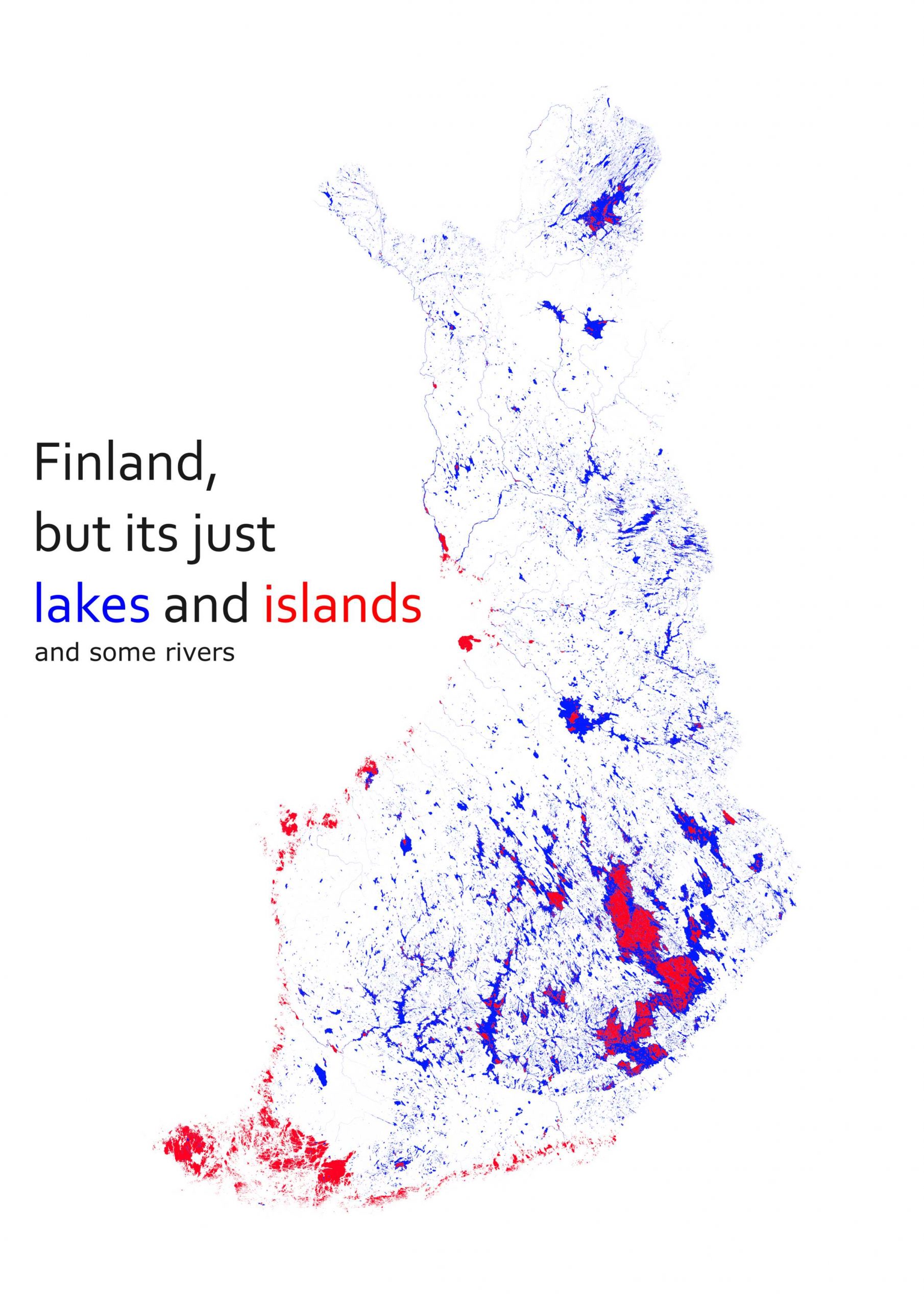
By: Jussi Torkko
Day 27: Dot – Pop(ulation) art distributions
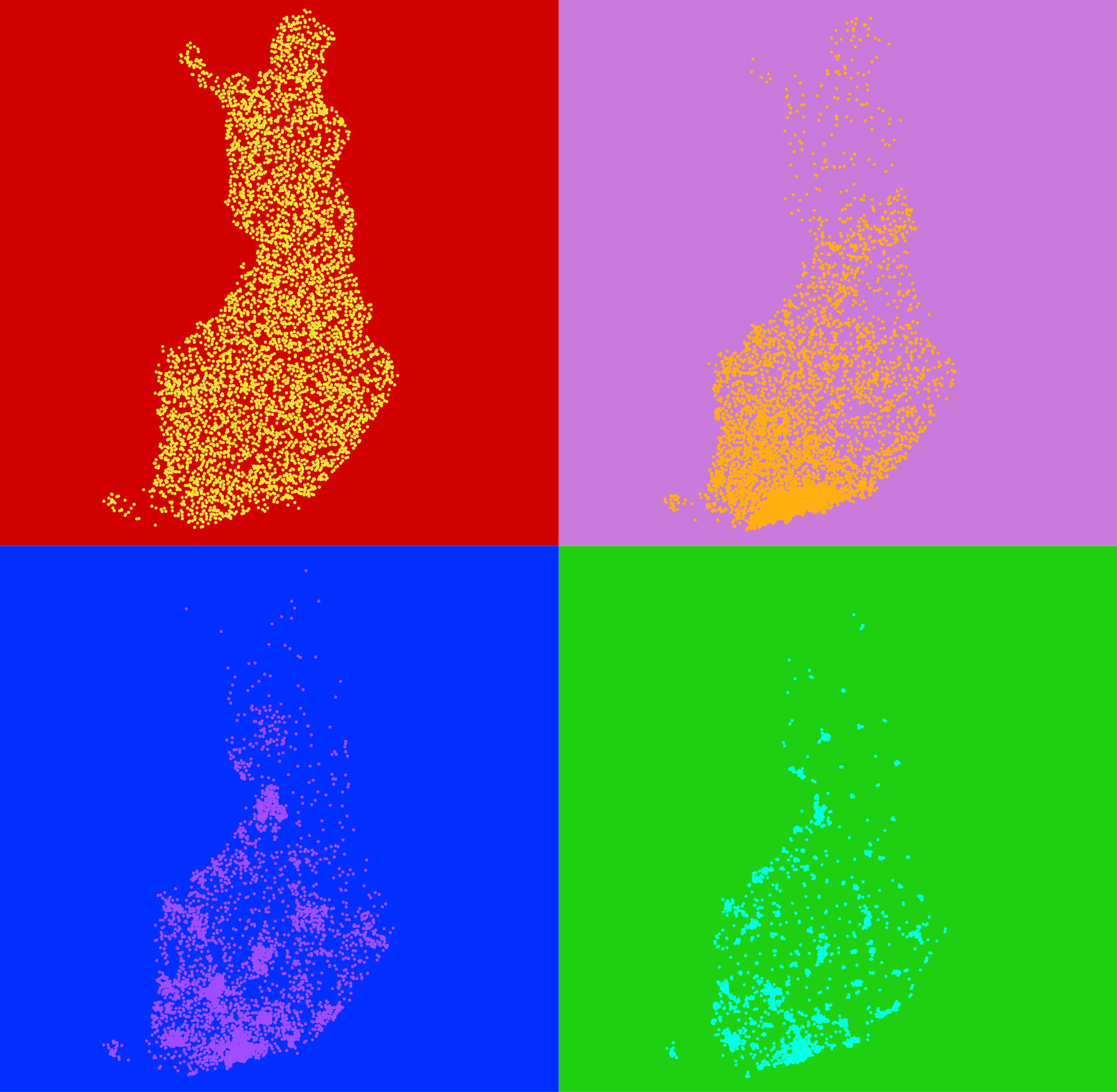
By: Matti Hästbacka
Day 28: Is this a chart or a map? – Visits and visitor origins to protected areas
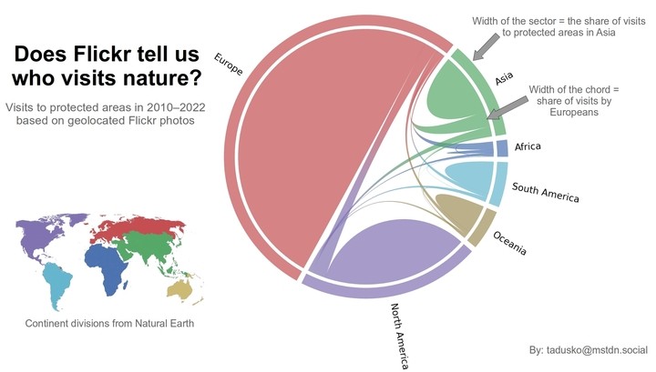
By: Tatu Leppämäki
Day 29: Population – Mapping humanitarian crisis in Ukraine with nighttime lights
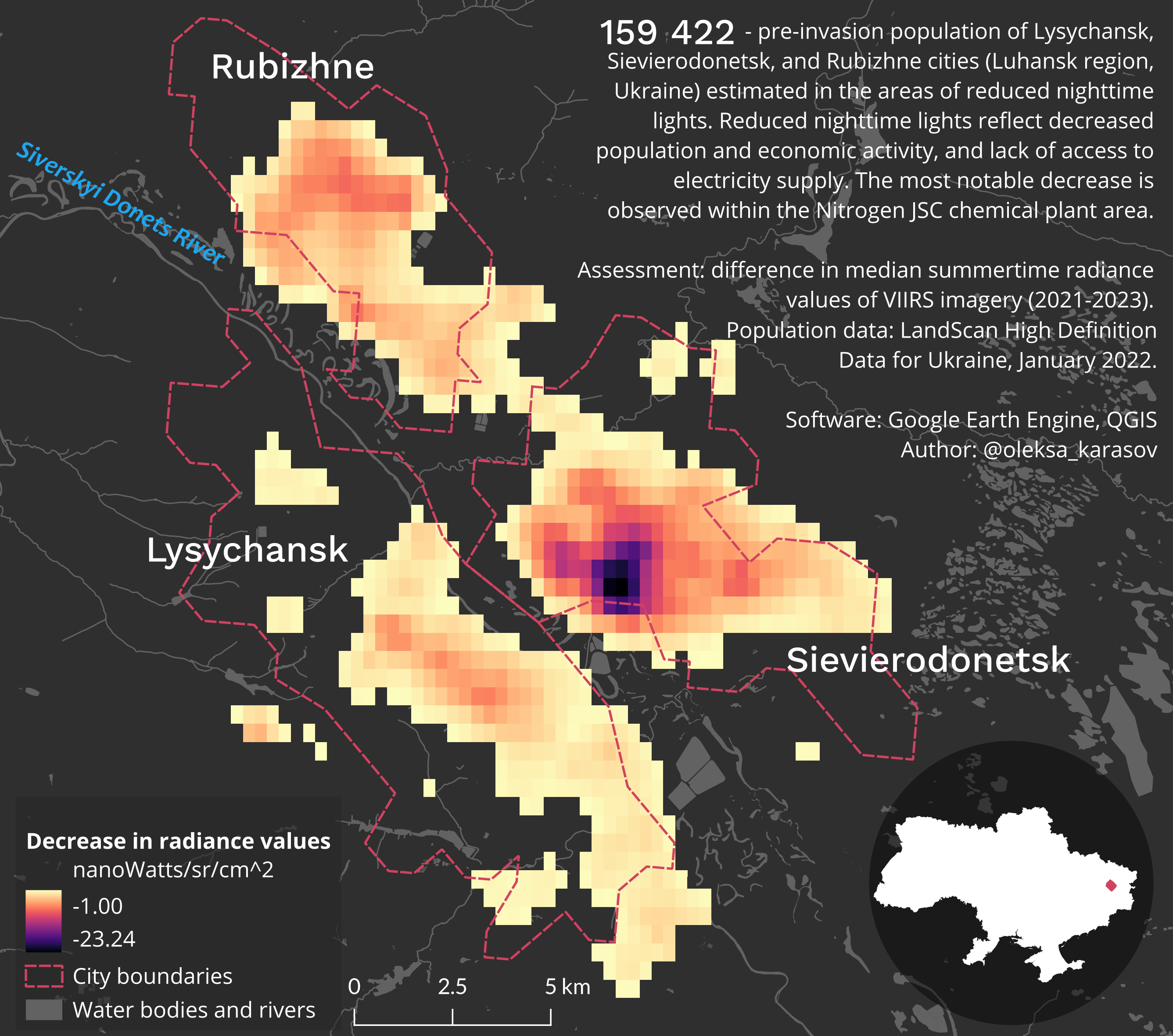
By: Oleksandr Karasov
Day 30: “My favorite..” – The geography of Juice Leskinen
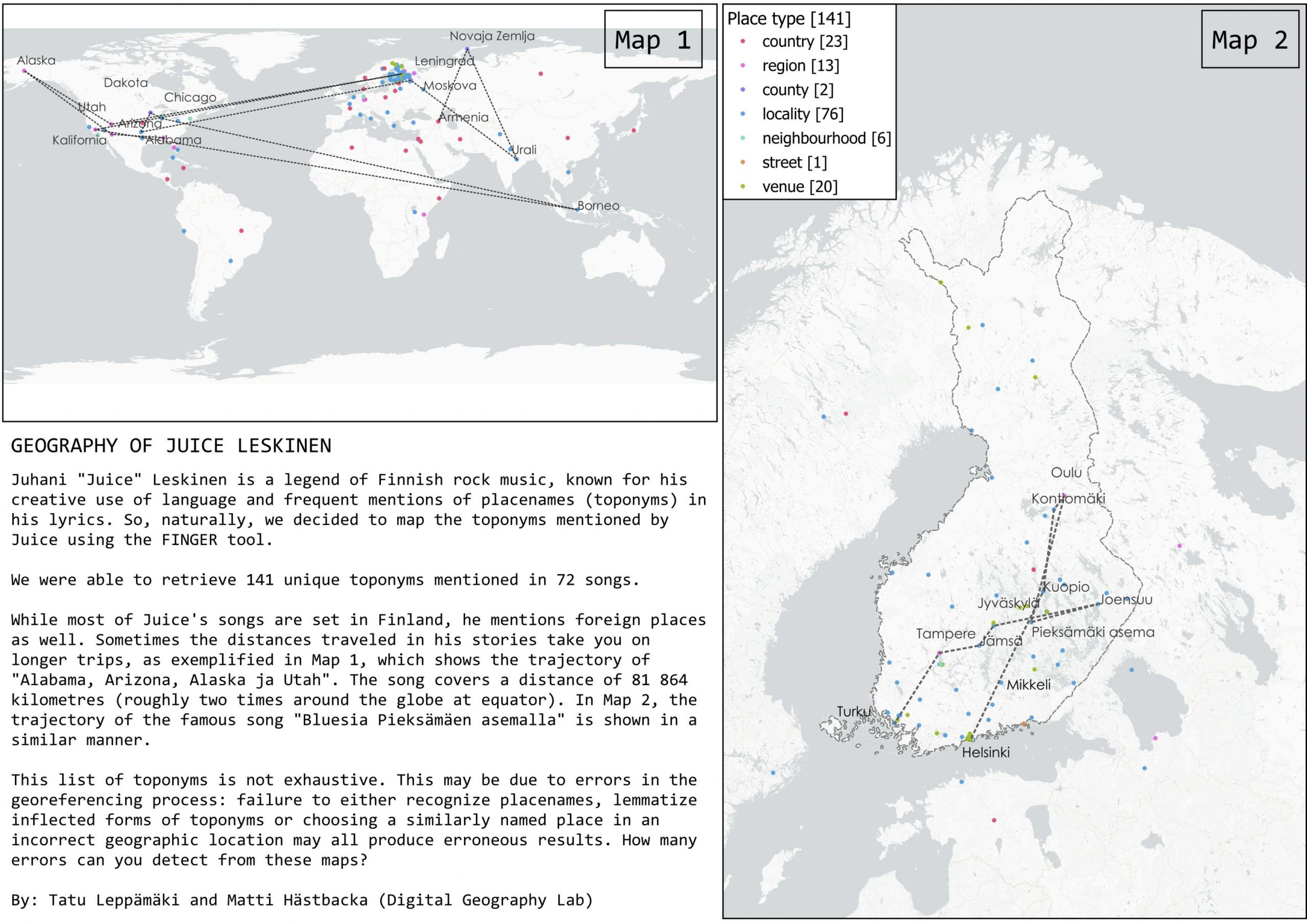
By: Matti Hästbacka & Tatu Leppämäki
– – – – –
Digital Geography Lab is an interdisciplinary research team focusing on spatial Big Data analytics for fair and sustainable societies.
One Reply to “DGL’s map gallery for #30DayMapChallenge 2023”
Comments are closed.