Ludovic Chastenet defended successfully his master’s thesis!

Ludovic, a Master student from the Civil Engineering French National School (ENTPE) and University of Lyon joined our Digital Geography Lab for five months as an intern to carry out his final year project in Helsinki.

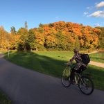
Ludovic defended successfully his thesis titled “Cycling as a part of sustainable urban transport in Helsinki: Assessing the influence of weather on cycling activity” back in Lyon, France on 14th September 2017. He’s research aimed at assessing how weather influences bicycle use, and thus empirically examined Helsinki as a case sample for a one year study period using both automatic bicycle counter system and bike sharing system (BSS) data sets, in addition to a detailed weather observation data from the Finnish Meteorological Institute. Ludovic showed i) how the influence of weather conditions depends on different time periods, ii) how different weather attributes influence cycling, and iii) to compare strengths and weaknesses of both cycling data sources in studying weather impact on cycling.

Results shows that weather conditions influence bicycle use more on weekends than during working days whereas weather influences cycling the least during peak hours (work-related cycling). The strongest influencing weather attribute is air temperature, yet also other attributes (e.g. wind, precipitation, humidity, snow) affect bicycle use. Statistical analyses showed similar weather influences on cycling for both data source regardless of differences between automatic counter and BSS data sources in case of counting locations (counting places vs BSS stations), bicycle users (own bikes vs part of public transport) and study period (all year vs summer period).

In conclusion, Ludovic’s work clearly indicates that weather conditions matter in using bicycles and is an excellent starting point for considering the influence of weather more in planning and developing urban cycling in Finland. Moreover, it revealed several promising research avenues and ways to develop methodology for obtaining more accurate assessments of weather influence on cycling.

Ludovic’s thesis is available here.

Minisymposium on Accessibility modelling 9th November

Welcome to a minisymposium on urban accessibility modelling on 9th November in Kumpula CampusThe symposium aims to bring together researchers and planners working with urban accessibility and mobility from Finland and abroad. 

The symposium is part of the Science workshops on novel and open data sources and approaches to study urban accessibility and mobility project funded by Finnish Cultural Foundation. It also links to the PhD defense of Henrikki Tenkanen, who defends his thesis  “Capturing time in space – Dynamic analyses of accessibility and mobility to support spatial planning with open data and tools” on 17th November.

See the program and register here!

Kalle Numminen’s and Joona Repo’s master’s theses are done!

Our project members Kalle Numminen ja Joona Repo have both finished their theses, which have now been examined.

KALLE’S EXCELLENT WORK, which title was “The effect of transport pricing on retail accessibility – examining public transport fare reform” examined accessibility of the major shopping centers in the Helsinki region from the cost perspective. He compared the cost-accessibility between car and public transport and analyzed the effect of the coming public transport fare reform.

According to the results, there are clear differences by travel mode in cost-accessibility in the Helsinki region. The shopping centers in the city center have poor accessibility by car encouraging to out-of-town shopping. The fare reform will change cost-accessibility particularly near municipality borders but taken all together the reform will not have a dramatic effect on the balance of modal accessibility in the region.

Link to the work: https://helda.helsinki.fi/handle/10138/175829

JOONA’S LIKEWISE EXCELLENT WORK titled “Long-Term Accessibility Change of Services: Public Library Network in Helsinki Region as a Case Study” studied long term accessibility by travel mode in the Helsinki region taking into account changes in the urban structure. The study focused on accessibility of library services and modelled how it will change by 2050.

The results show that the accessibility of the library services is relatively good in the region and the effect of the changes in the urban structure that were modelled in the study will have a rather small effect. The forecasted change in population would increase the number of people accessing the nearest library in half an hour, but the proportion of this group to the total population in the area would be smaller than before. Even though excluding some of the smallest libraries from the service network would have relatively small effects on accessibility in the aggregate, could the effects be on the individual level and for sustainable accessibility significant. Based on the study results more significant than the changes in the transport system or the attraction of the facilities seem to be how the population and the services are linked.

Link to the work: https://helda.helsinki.fi/handle/10138/221337

Congratulations for both once again!

NECTAR conference in Helsinki in 2019 as part of the “Science workshops”-project!

The Digital Geography Lab research group will host the international NECTAR (Network on European Communications and Transport Activities Research) conference in June 2019 in Helsinki!  The previous NECTAR-conference was held in Madrid this June and Tuuli was there to welcome all to Finland in two years’ time. Though there is still time before the conference, we are starting gradually to organize the event this autumn.

The conference will be a part of the “Science workshops on novel and open data sources and approaches to study urban accessibility and mobility” project funded by Finnish Cultural Foundation. The project started this year and our group’s new member, Elias Willberg, will take care of the it’s practical realization together with the other group.

As part of this project we will also organize several smaller accessibility and mobility related workshops both national and international during the next year. These workshops aim to bring together researchers working with these topics in different places and thus enhance networks and collaboration between these people.

See the NECTAR Conference 2019 website here: https://www.helsinki.fi/en/conferences/towards-human-scale-cities-open-and-happy

Introducing the Digital Geography Lab (new webpages out!)

Our interdisciplinary research group has established new webpages at helsinki.fi/digital-geography. This blog (blogs.helsinki.fi/accessibility) will continue to serve as a channel for distributing news about our mobility & accessibility research and the tools and data developed in the MetropAccess projects.

The Digital Geography Lab, based at the Faculty of Science, University of Helsinki, includes researchers working around the themes of mobility, accessibility, nature conservation and the development of novel data and methods for spatio-temporal analysis. Read more from helsinki.fi/digital-geography and @digigeolab Twitter account!

New paper out!

Enhancing spatial accuracy of mobile phone data using multi-temporal dasymetric interpolation paper by Olle Järv, Henrikki Tenkanen and Tuuli Toivonen has been published in the International Journal of Geographical Information Science. Check it out!

This is how Olle summarized the paper:

In brief, the paper highlights the need to give more attention to the uneven spatial resolution of mobile phone data which is one potential source of bias influencing research findings. To solve this, we are the first ones to apply an advanced dasymetric interpolation approach. Thus, we propose a generic multi-temporal function-based dasymetric interpolation method for mobile phone data, and demonstrate how it improves the spatial accuracy of mobile phone data as a proxy for people. The proposed method contributes also to the development of population modelling, at large.

Conceptual framework of the interpolation method for enhancing the accuracy of mobile phone data (Fig 2, Järv et al 2017)

Interactive travel-time map Mapple!

The Helsinki Region Travel Time Matrix can now be observed via an interactive web map http://www.mapple.fi !

The interface allows you to inspect travel times in different modes of transport (public transport, car and walking) at different times of the day (rush-hour, noon) to and from locations of your own choise within the Helsinki Region.

The application was developed by Joona Repo, Rami Piiroinen and Henrikki Tenkanen, good job guys!

New course starting: Analysing accessibility and mobility using novel data sources

We are organizing a special course on accessibility and mobility issues, staring on November 1st. The course is entitled: “Analysing accessibility and mobility using novel data sources” and it will familiarize the students with current theory of accessibility and mobility research, as well as practical tools and data developed by our group. Looking forward to meeting the students and hearing their thoughts on these topics!

Henrikki and Maria in NECTAR-workshop in Warsaw

We participated in a NECTAR worshop (Network on European Communications and Transport Activities Research) in Warsaw between 20.-21.10.2016. The workshop was entitled “Transport Infrastructures for better Accessibility, Equity and Territorial Cohesion” and there were nearly 30 interesting and inspiring accessibility-related presentations from all over Europe. Henrikki presented our recent paper on grocery store accessibility (published in International Journal of Health Geographics) and Maria presented our ongoing work on dynamic accessibility modelling.