—————————
DATA DESCRIPTION
—————————–
MetropAccess-Digiroad 2015 is a street network dataset of Helsinki Region,
which is modified by taking account intersection movement delays to represent more realistic travel times by private car. MetropAccess-Digiroad 2015 is based on the following source data:
- Digiroad K – A National Road and Street Database (Copyright© Liikennevirasto/Digiroad 2015). Datasets: ’01_Uusimaa_1′ , ’01_Uusimaa_2′ and ’20_ita-Uusimaa’.
- Floating car data from Helsinki metropolitan region (City Planning Department of Helsinki & Helsinki Region Transport)
You can read more information about the data and methods on the MetropAccess-Digiroad frontpage, Timo Jaakkola’s MSc thesis and in the data description article published in Terra (full text only in Finnish).
—————————————————————————————————–
DOWNLOAD THE DATA
—————————————————————————————————–
Download MetropAccess-Digiroad dataset in ArcGIS File Geodatabase format (171 MB): MetropAccess_Digiroad_2015_GEODATABASE.zip
—————————————————————————————————–
CONTENTS OF THE DOWNLOAD FILE
—————————————————————————————————
MetropAccess-Digiroad 2015 is delivered as a zip-package which contains:
1. Metadata_MetropAccess_Digiroad_2015.txt – Metadata and license information.
2. MetropAccess_Digiroad_2015.gdb – ESRI File Geodatabase containing the modified road network data. More information on the concents of the Geodatabase in the metadata-document.
—————————————————————————————————
ATTRIBUTES
—————————————————————————————————
The MetropAccess-Digiroad 2015 contains the following attributes in addition to the standard attributes that come with the Digiroad-data:
| Digiroa_aa | Drive time (in minutes) that it takes to pass street element based on speed limit. |
| Kokopva_aa | Drive time (in minutes) that it takes to pass street element taking into account intersection delays. The whole day average: 07:00-17:00. |
| Keskpva_aa | Drive time (in minutes) that it takes to pass street element taking into account intersection delays. Midday: 09:00-14:59. |
| Ruuhka_aa | Drive time (in minutes) that it takes to pass street element taking into account intersection delays. Rush-hour: 07:00-08:59 & 15:00-16:59. |
| Pituus | The length of street element in meters. |
| KmH | Speed limit associated to the street element. |
—————————————————————————————————
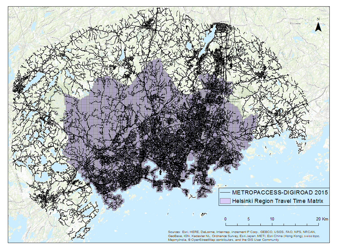
SPATIAL EXTENT
—————————————————————————————————
—————————————————————————————————–
CITATION PRACTICES
—————————————————————————————————–
If you use MetropAccess-Digiroad dataset or related tools in your work, we encourage you to cite properly to our work. Description of the MetropAccess-Digiroad tool is included in the following works:
Toivonen, T., M. Salonen, H. Tenkanen, P. Saarsalmi, T. Jaakkola & J. Järvi (2014). Joukkoliikenteellä, autolla ja kävellen: Avoin saavutettavuusaineisto pääkaupunkiseudulla. Terra 126: 3, 127-136.
Jaakkola, T. (2013). GIS-based method for modeling drive and travel times – example of the Helsinki Metropolitan Area. Master’s Thesis. University of Helsinki. The Department of Geosciences and Geography.
—————————————————————————————————–
LICENSE
—————————————————————————————————–
MetropAccess-Digiroad by MetropAccess-project/ Accessibility Research Group (University of Helsinki) is licensed under a Creative Commons Attribution 4.0 International License.
More information about license: http://creativecommons.org/licenses/by/4.0/
The data may be used freely. We do not take any responsibility for any mistakes, errors or other deficiencies in the data.