
Authors: Age Poom, Joose Helle, Tuuli Toivonen
The new Green Paths routing tool helps pedestrians and cyclists to choose urban commuting routes with less air and noise pollution. The tool is a proof of concept of exposure-optimised routing. It functions in the Helsinki capital region where the necessary environmental data is available.
This novel routing tool suggests a set of routes to the user-defined destination that are less polluted than the shortest, often busy main road. This is different from the traditional routing concept that considers only distance or travel time for route choices.
The users of the Green Paths routing tool can follow their own preferences in making the final route choice that is quieter, has fresher air and feels more pleasant. As such, the user becomes an active decision-maker, empowered to choose the most appealing route with only a modest increase in travel time. The new Green Paths routing tool indeed aims to improve travel satisfaction. A pleasant travel experience makes commuters more likely to walk or cycle regularly. In this way, commuters using the Green Paths tool contribute to a more sustainable city with cleaner air.
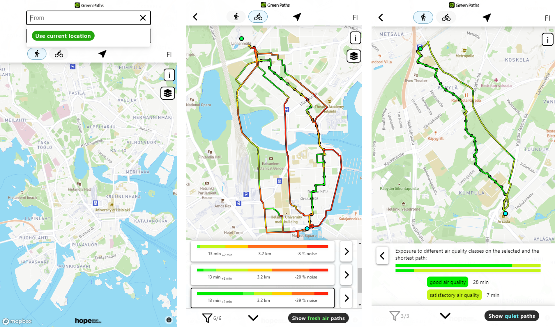
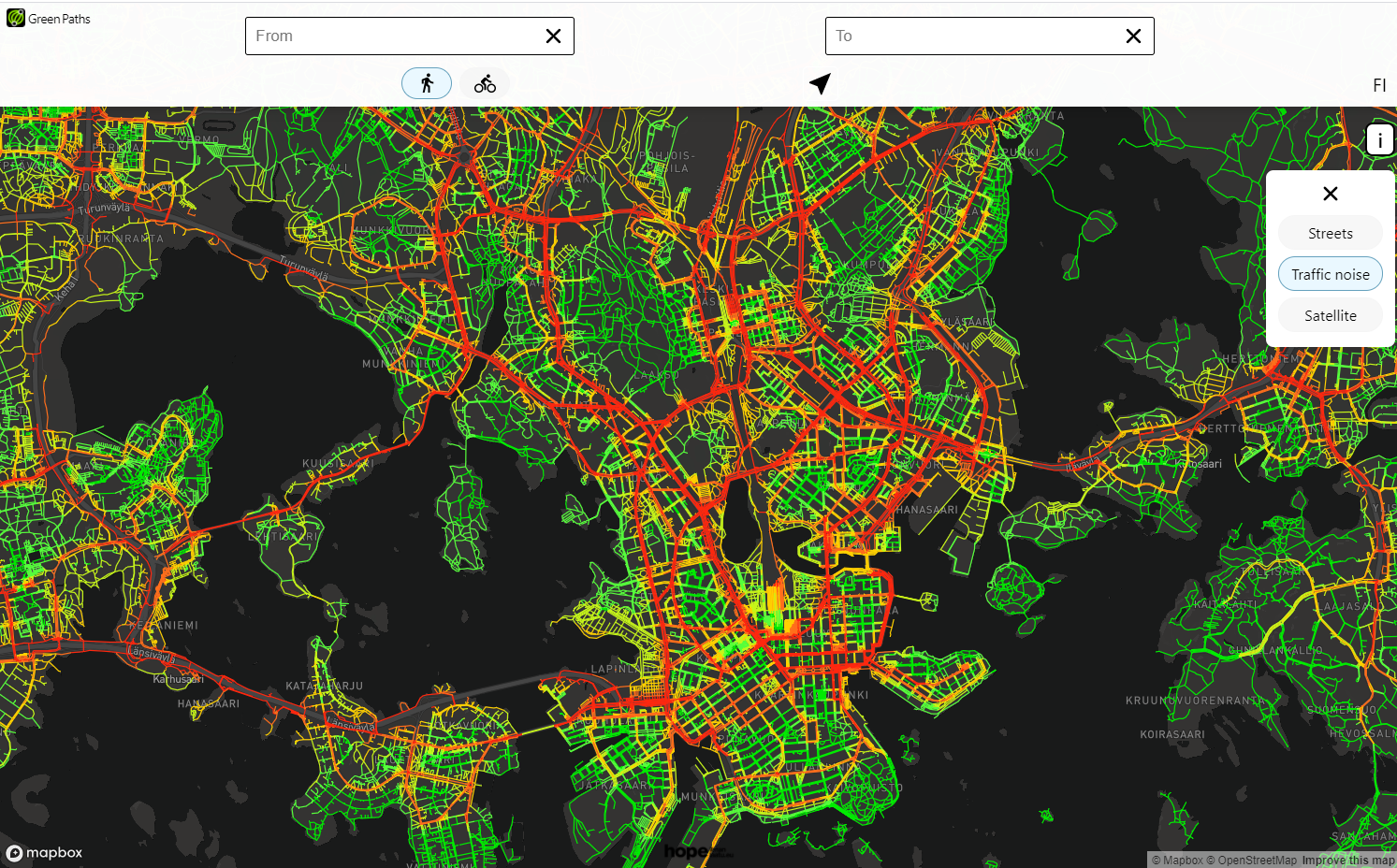
The Green Paths routing tool leans on the concept of travel-time environmental exposure assessment. It optimises route choice based on both environmental exposure and trip duration, separately for air pollution and noise. For that, it deploys open-source environmental data. The tool applies real-time and spatially explicit air quality information from the ENFUSER modelling system that is being developed by the Finnish Meteorological Institute. In particular, Green Paths tool utilises Air Quality Index, which reflects the state of air pollution in the Helsinki capital region on an hourly level. For noise data, the tool applies average noise levels from road, rail and air traffic. The modelled data is provided by the Finnish Environmental Institute and local municipalities. Data for the underlying street and path network originates from OpenStreetMap, which is a collaborative open-source geodata project. The user can change the underlying map style by choosing either the street network or satellite image display option.
To ensure transparency and support the advancement of related methods and tools, the Green Paths routing tool is an open-source development (check the repositories in GitHub). The platform provides also an API that enables the export of environmentally optimised routing results to other applications. By providing the open code, the team encourages other developers to consider environmental cost factors in their active travel-oriented applications.
As an end-user application, Green Paths routing tool is publicly available via a mobile-friendly website https://green-paths.web.app/, in both Finnish and English. The user can pre-check suitable routes from a computer or then navigate in real travel situations with the help of a smartphone interface. To grant a smooth daily use, the user can add the browser link of the tool to his/her smartphone home screen that enables the use of the tool similarly to any other smartphone application. All users are encouraged to give feedback on the usability of the tool via a link found in the information modal of the tool.
For now, the Green Paths tool is developed as a proof of concept with advancements of the features and functionalities in time. It should be considered as a demonstration of exposure-optimised routing based on spatially explicit and advancing open access data sets, and it is not guaranteed to work smoothly at all times. In the future, the tool will incorporate routing based on green views the users experience in the travel environment. The works in progress involve, among others, showing street-level maps on air and noise pollution.
Start using the Green Path tool on your next trip in Helsinki region! More information about the tool is available at https://www.helsinki.fi/en/researchgroups/digital-geography-lab/green-paths.
The software and user interface is developed by Joose Helle. The Green Paths team involves Joose Helle, Age Poom, Tuomas Väisänen and Tuuli Toivonen from the Digital Geography Lab of the University of Helsinki. The tool is developed within the framework of the Urban Innovation Action HOPE – Healthy Outdoor Premises for Everyone, and is co-financed by the European Regional Development Fund. UIA HOPE aims to produce more comprehensive air quality monitoring network that gives citizens air quality information on places where they live and they travel in the city. UIA HOPE project is led by the Economic Development Division of the City of Helsinki.
Digital Geography Lab at the University of Helsinki is an interdisciplinary research team focusing on spatial big data analytics for fair and sustainable societies. The group aims to understand spatial interactions between people, and between people and their environment, from local to global scales.