Presenting Amazonian accessibility studies in Mobile Tartu 2012

 Mobile Tartu conference aims to discuss theoretical, methodological and empirical aspects of mobile positioning based research and applications in geography and planning. Maria is presenting our work with a presentation titled:

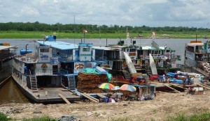
“Understanding Amazonian rivers and transportation:  New opportunities provided by mobile positioning technology”

We are hanging out a poster too:
See here!

Urban Studies Days 2012 (kaupunkitutkimuksen päivät)

The 10th Urban Studies Days were held in Helsinki on 3.-4.5.2012. This year the theme of the days was urban images and visions. Our research group participated on two sessions; open data and maps of everyday life. You can find our abstracts from the below (in Finnish).

The fastest mode of transportation in Helsinki Region is…

Accessibility analysis made by MetropAccess research group was published in Vihreä Lanka as a part of story about a playful race between the travel modes. In the race, competitors traveled from Espoo to Kamppi to see which mode of transportation is fastest in the Helsinki Region. Results of the race was then compared to the accessibility analysis made by MetropAccess research group. Read the whole story from here.

Is this the fastest mode of transportation in Helsinki Region?

Projects’ work on display in University of Helsinki’s magazines

Our work has recently been on display in several University of Helsinki’s publications. Our accessibility research of riverine Amazonia were dealt both in Yliopisto and in Helsinki University Bulletin. Our work on accessibility issues in Helsinki Metropolitan Area was presented with an example of Kumpula Campus in Yliopistolainen.

Check out the stories:

Data collection in Loreto, Peru

During August and September we started to gather long-term data on river navigation routes and speeds in the Peruvian Amazonia. A few river boat companies are collaborating with us and together with them we established a pilot system of tracking devices that send real-time location information from river boats to our server.

This information is  made available for the local actors trough an sms service. The long-term monitoring data will be used to analyze the spatio-temporal changes in river navigation and accessibility patterns. More information regarding this project will soon be available on this site.

Masusa harbour in September