How long does it take to park a private car in Helsinki Capital Region? Is there variation in parking times in different districts of the Capital Region? How can we explain the hypothetical variation?
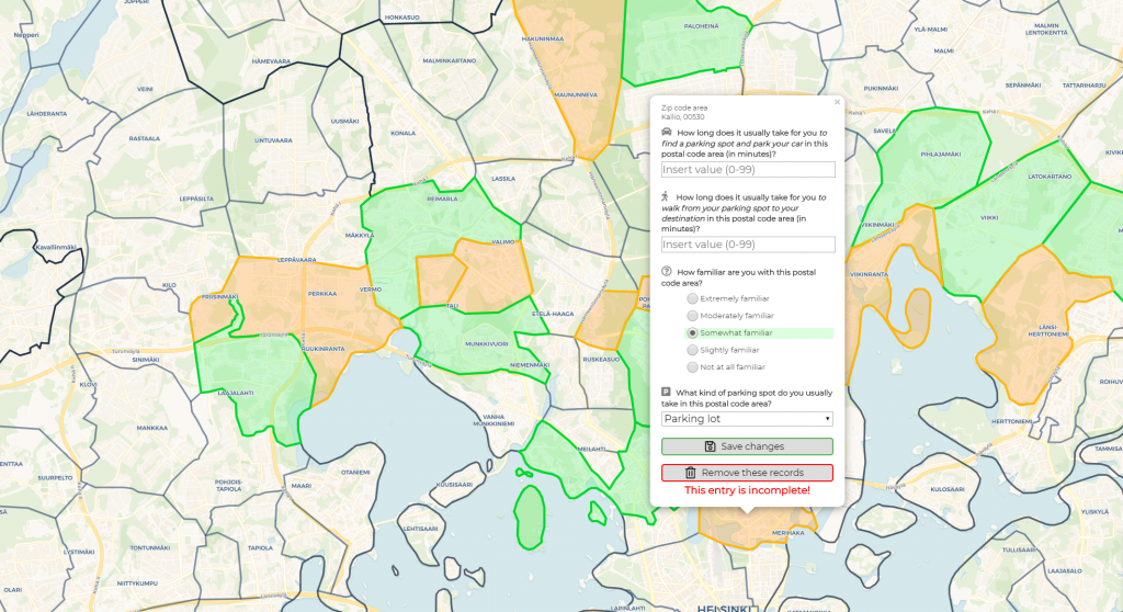
We are now researching how long does it take for a private car to find a parking spot, park and walk to one’s final destination in different areas of Helsinki Capital Region using a map based survey. In the survey linked below the user chooses postal code areas where they remember having parked in the last two years. For each postal code area user is asked to fill a short form how their parking experience usually is in that area. The survey is created in such a way that data can be sent from as many postal code areas as the user wants – all in one session.
Please find the map based web application survey here. We ask you to answer to the survey latest at 30th June 2019. The survey starts up by default in English. If you wish to fill out the survey in Finnish, you can change the language by clicking the EN/FI button located in the upper left corner of the screen.
About the research
This survey research is a part of the Master’s thesis of Sampo Vesanen. The work is connected to the Helsinki Region Travel Time Matrix, a tool created by Digital Geography Lab which represents travel time distances between statistical grid cells in Helsinki Region by public transport, walking and bicycling. The values in the travel time matrix are calculated using the door-to-door approach. For private cars this means that searching for parking, the parking proper and walking to one’s destination is a part of the travel time. Up until now the time it takes to carry out this process has been a singular estimation deployed to the entire Helsinki Capital Region. This does not represent reality well enough.
The data collected from this survey are used to answer the following questions: what is the variation in parking times between postal code areas in Helsinki Capital Region, what could cause the variation and what is the significance of the parking time in the context of the total travel time of a private car in Helsinki Capital Region. The finalised results of the Master’s thesis will be used to supplement the private car parking process data in the Helsinki Region Travel Time Matrix.
Filling the survey
In the survey the user is asked to estimate how their parking experience usually is in each postal code area. Please answer to each question using your best judgement and answer to each postal code area only once. We seek responses not older than two years because the urban structure of Helsinki Capital Region experiences constant change and possibilities for private car parking change with it. If you require additional information about the questions in the survey, please refer to the information dialog window in the survey. This window will appear on the screen of your device at survey start-up.
You can use a desktop computer, a laptop or a mobile device to fill out the survey. It requires 1-10 minutes of your time. On desktop or laptop it is important you use the latest browser software, recommendations being Chrome or Firefox. On mobile devices it is recommended to use a device that runs Android with Chrome being the browser software. If you wish to fill out the survey using your mobile device (especially if using an Apple device), please read the mobile usage instructions in the information dialog window.
Usage of gathered data
The data gathered in this survey do not reveal any personal information about respondents because of the general scope of the questions used. The web application running the survey will save your IP address for tracking user activity. In the analysis phase of the thesis all collected IP addresses will be altered into random and anonymous string of characters and all the IP addresses will be deleted. The survey web application uses cookies to save user preferences. If you do not delete the cookies manually, they will expire 90 days from their creation.
Further information
In any inquiries regarding the survey or the research, please contact Sampo by email: sampo.vesanen(at)helsinki.fi.


