Awet Berhe: Erosion hazard assessment using GIS and remote sensing: Case of Mai-Mislam Catchment, Eritrea.
Abstract
Soil erosion is a widespread problem in Mai-Mislam catchment causing soil and organic matter losses and hence loss of fertility and reduction in productivity. In addition to these on-site problems, it also produces important off-site effects, like downstream sediment depositions in fields, floodplains and water bodies, water pollution, eutrophication and reservoir siltation.
This study has been carried out to evaluate soil erosion risk in the catchment.
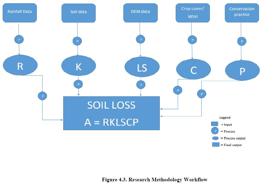
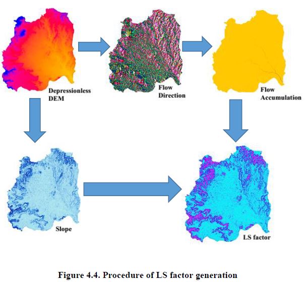
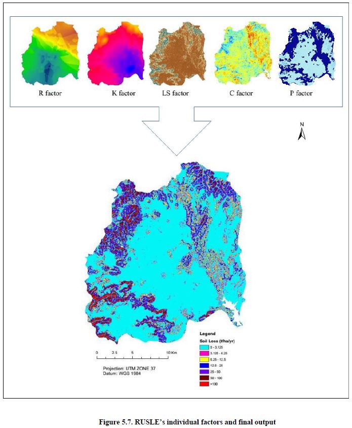
The research integrates the Revised Universal Soil Loss Equation (RUSLE) with Geographic Information System (GIS) to quantify the potential soil erosion risk. Rainfall data, soil data, DEM data and satellite image were used as input data sets to generate RUSLE factor values. The raster calculator tool in the Spatial Analyst extension of ArcGIS 10.3 was used to interactively calculate potential soil loss and prepare soil erosion risk map.
The result showed that the potential annual soil loss of the watershed ranges from 0.00 to 294.56 ton/ha/year and the mean annual soil loss rate is 9.42 ton/ha/year. The total potential soil movement in the study area was 396,629.25 tons per year from 42,108 hectares. The result shows that about 80% of the catchment experiences very low to moderate erosion rates, 18% experiences high to extreme erosion rates and 1% experiences exceptional erosion rates that is greater than 100 tons/ha/year.
For prioritization purpose the study area was classified into 21 sub-catchments based on their drainage pattern. Out of the 21 sub-catchments 3 were found to be severely and exceptionally affected, and the remaining were slightly to moderately affected.
Key words: RULSE model, Soil erosion, Geographic Information System, Mai-Mislam catchment, ArcGIS 10.3, Spatial Analyst.