Teaching for the first round of the programme was conducted in 2016-2017. Teachers included three from Finland and five from Eritrea.
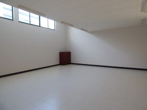
A separate Geoinformatics laboratory class room, with enough space for 20 MSc students, was allocated. The lab was fully refurbished with furniture and new hardware, including modern desktop computers, printers, scanners, GNSS receivers, uninterrupted power back-up systems, and the like. All students were also provided with laptops for personal learning and research not confined to the lab.
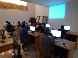
In addition to curriculum development, GIERI experts from Finland and Eritrea also developed course materials for the eight courses. These included tailor-made lecture materials, practical hands-on exercises and supporting learning material (books, articles, datasets). In the practical exercises, we only used free open-source software; QGIS, GRASS, SAGA, and R, because of their superiority in ease of access, ease of learning and high flexibility.

To make the exercises more meaningful and interesting, we utilized local geospatial data when ever possible, kindly provided to us by our partner, Eritrean Mapping and Information Centre.
One limiting factor in delivering the teaching was lack of internet connectivity, spiced with frequent power cuts. All materials, including lectures, practicals, software, data – had to be designed to work offline. This also made it impossible to use distance learning methods, and seriously limited the ability of the students to independently search for information and data.