Segen Maekele: Identification of Mineralized Altered Bodies (Gossans) Using Remote Sensing Techniques in Asmara Mineralized Belt.
Abstract
Mineral resources play an important role for sustainable economic development of countries. In Eritrea, mineral exploration and geological mapping has been, and is being conducted using the conventional methods of mapping and exploration. These techniques are however, expensive and time consuming and in some inaccessible areas, almost impossible to undertake exploration. Since the advent of remote sensing ample works have been done in geological mapping and mineral exploration. This research aims on the use of multispectral imagery (Landsat-8 and Sentinel-2) for both identification of volcanogenic massive sulphide deposits (VMS) and for lithologic mapping in an arid area, making use of known mineralized bodies (gossans) in the so called Asmara mineralized belt, located around Asmara area.
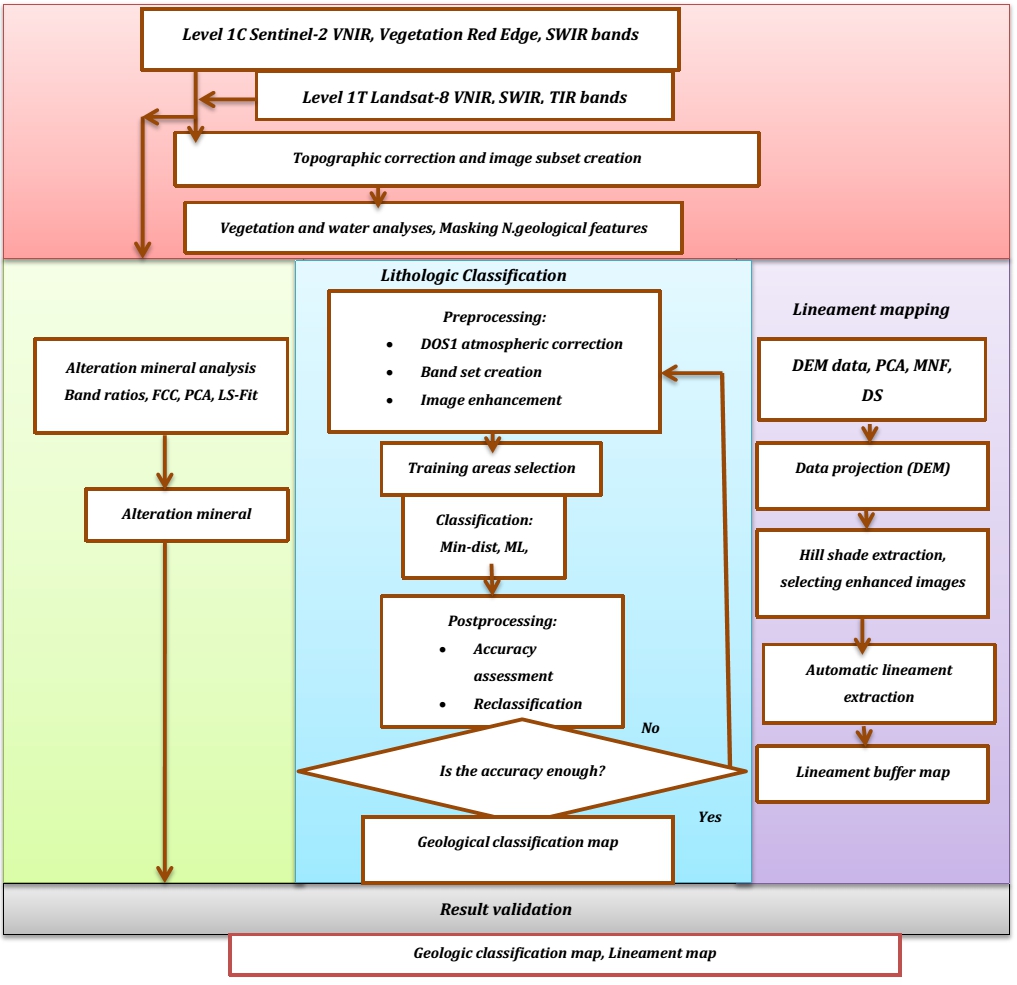
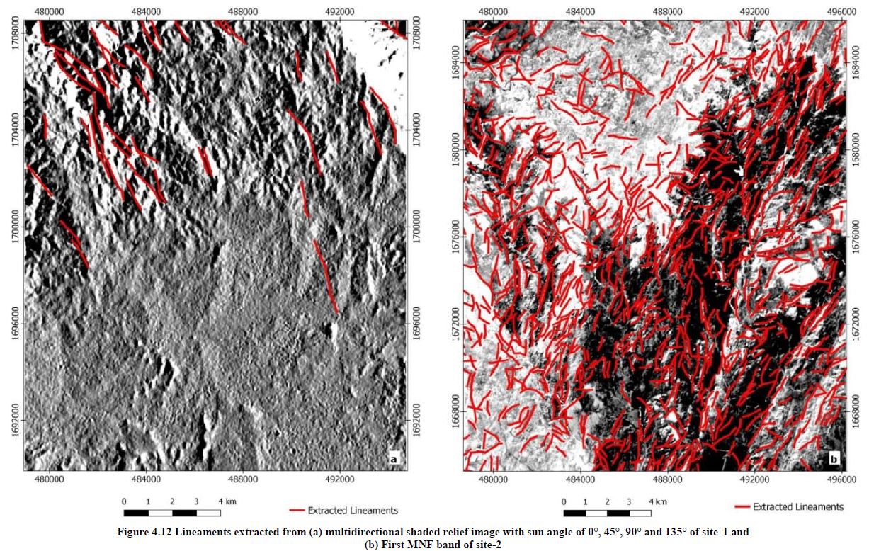
Various image processing techniques were applied to map alteration minerals including false color composite (FCC), band ratios, Principal Components Analysis (PCA), and Least Square Fit Method (LS-Fit). Three different classification algorithms were used to map the lithologies, including Maximum Likelihood Classification (ML), Spectral Angle Mapper (SAM) and Minimum distance (Min-dist). Collecting and recording rock samples and GPS locations of known VMS deposits from field enabled for thin-section analysis and evaluate effectiveness of remote sensing techniques for both mineral identification and lithologic mapping. Lineaments were extracted automatically from enhanced images using the LINE module in PCI GEOMATICA software. The proximity of the lineaments to the known location of VMS deposits was tested.
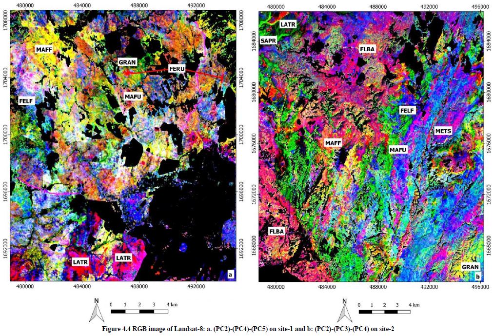
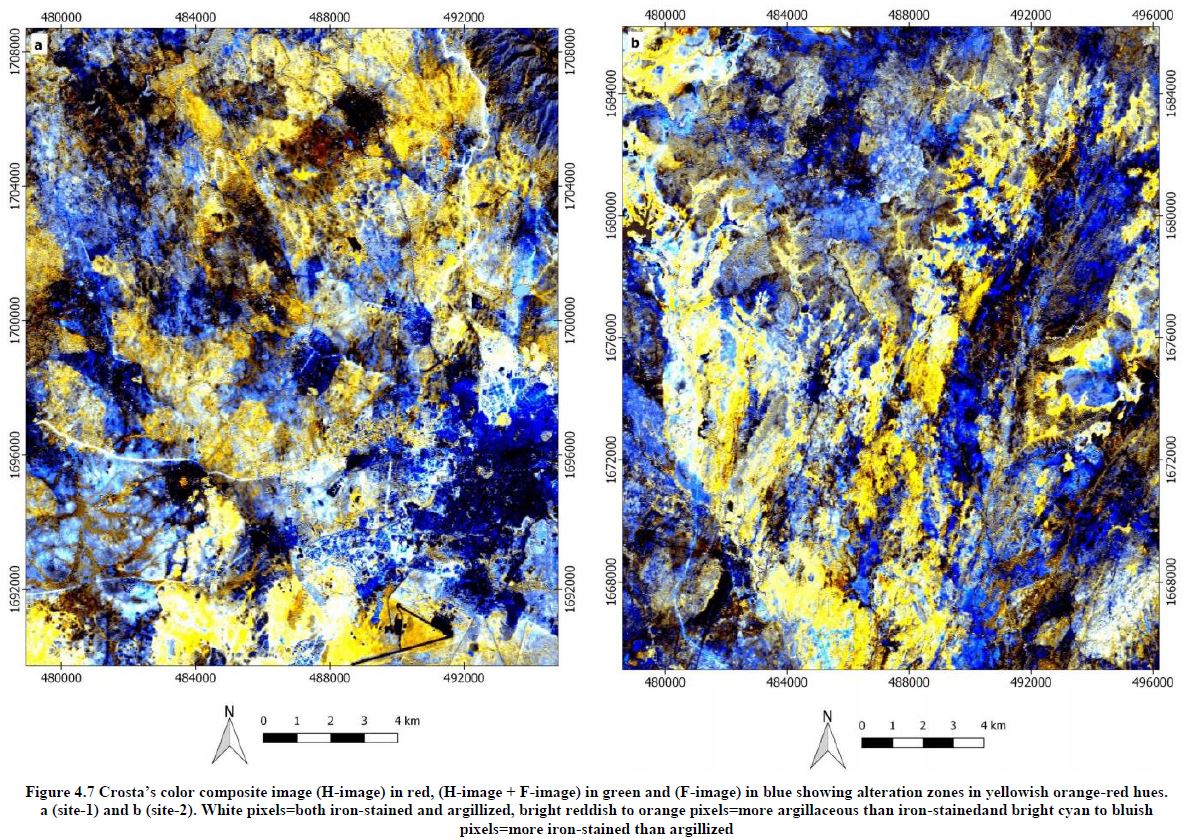
The results indicate that the hydrothermal alteration zones associated to the VMS deposits and exposed on the surface as oxidized bodies or gossans were easily identified and differentiated from laterites which are similar and widespread but unmineralized hematitic bodies, using Chica-Olma ratio and least square fit method. The standard color composite images and color composite images derived from PCA were also helpful in discriminating different lithologies and geologic structures.
Lithologic maps and VMS mineralized gossans identified by image processing techniques are in strong agreement with geological map, regional gravity map, assay data and location of known VMS deposits.
Keywords: Landsat-8, Sentinel-2, Volcanogenic massive sulphide, Gossan, Lithology, Image Analysis.