Tsinat Yemane: Impact of School Distance to Student Dropout Using GIS: Case Study of Adi-Keih Sub-Zone.
Abstract
One of the overriding policies of the Government of Eritrea is increasing the number of schools and it tries to address the barriers which keep students away from school. Like in many African countries, access to education is not yet fully achieved in Eritrea. This study aims at investigating and identifying accessibility in terms of the impact that long home-to-school distance has on dropout using Geographical Information System (GIS), through a case study of Adi-Keih Sub-Zone in Eritrea. It estimates the influence of school distance to dropout and highlights the location, distribution and category of schools on a map.
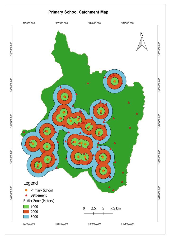
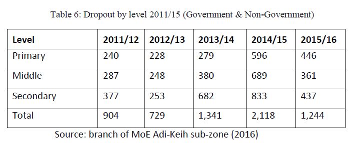
This paper depended on the application of GIS as a decision support system in education. The data for the study draws from systematic review of documents, reports and through field visits. The present study seeks to address the problems of home-to-school distance on dropout through inventory mapping, geographical analysis and statistical methods. The National standard for walking distance set by the Eritrean Ministry of Education (MoE) is used to assess the accessibility level of settlement in the study area. According to the MoE, the maximum standards of walking distance for elementary, middle and secondary schools are 3km, 5km and 7km Euclidean distance (areal distance) respectively.
The spatial accessibility result reveals 15.4% of villages and 1,658 school-age populations (6-18 ages) are inaccessible within 3 km of Euclidean distance from primary school. 18.2% of villages and 1,704 school-age populations (6-18 ages) are located in inaccessible areas within 5 km of Euclidean distance from middle school and 35.6% of all villages and 6,159 school-age populations are found beyond 7km of Euclidean distance from a closest secondary school.
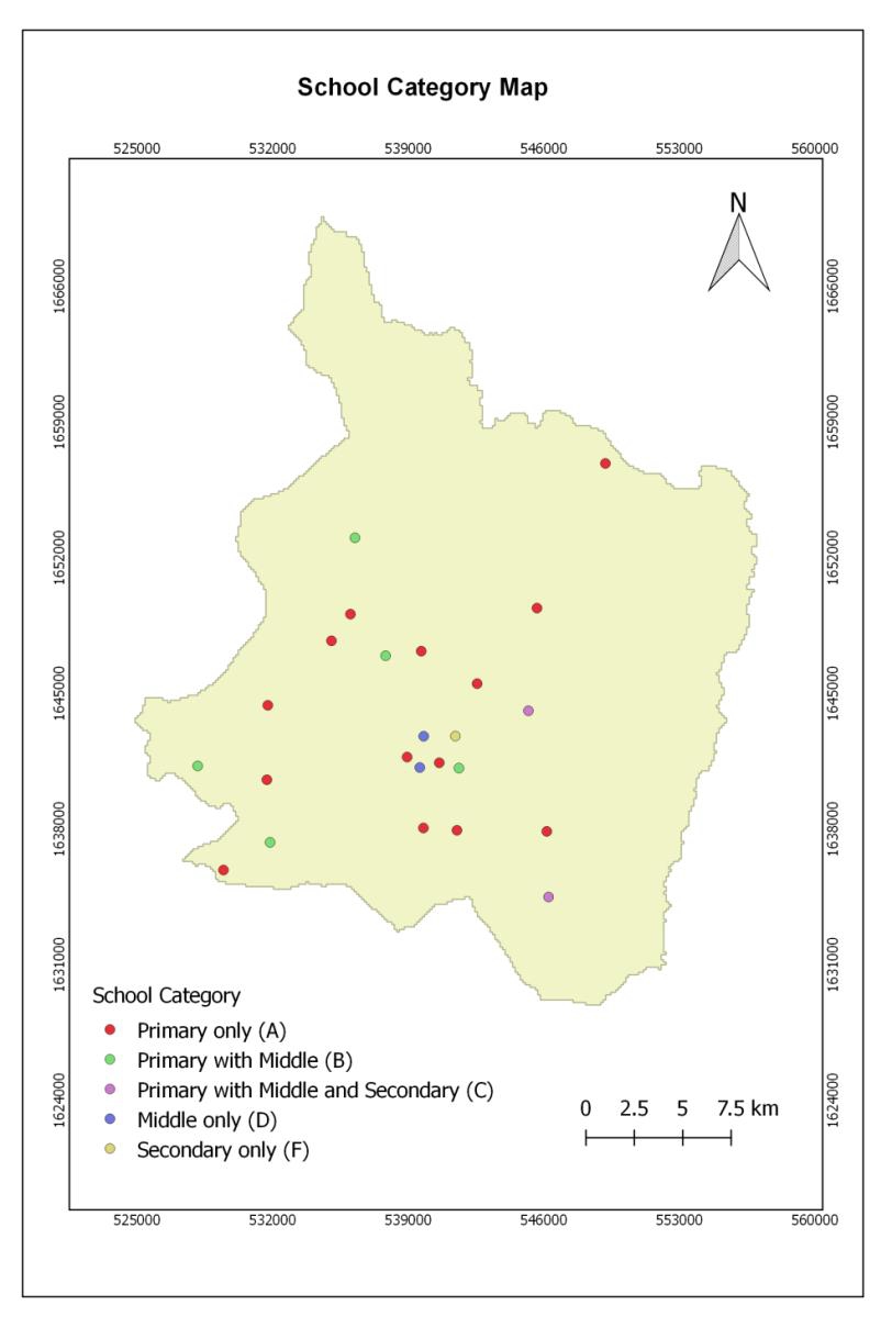
This study also confirms that there is a high concentration of schools in the south-central part and this matches with the distribution of settlements and school-age population of the area. Interestingly, a spatial proximity of settlements to the nearest education centers reveals that, 53.3% of villages are found within the range of 3 km of topography weighted distance while 30.4% and 16.3% of the settlements are between 3.1km to 7km and greater than 7 km of topography weighted distance respectively.
Finally, the result from regression model supports the result of Chi-square and shows that distance from village to school affects student drop out, and the relationship is statistically significant at P<0.05. This study includes relevant recommendation. Among other things, the study strongly recommends the application of GIS to improve, maintain, and expand the access and equity of education.