Mohammed Mohammed Ali Mussa: Assessment of Land Use / Land Cover Changes in Hamelmalo Sub-zone
Abstract
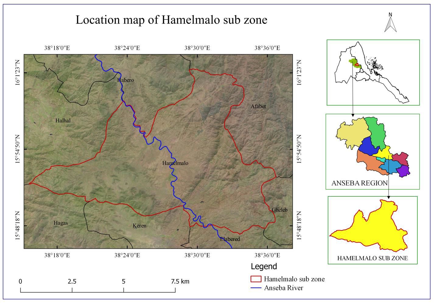
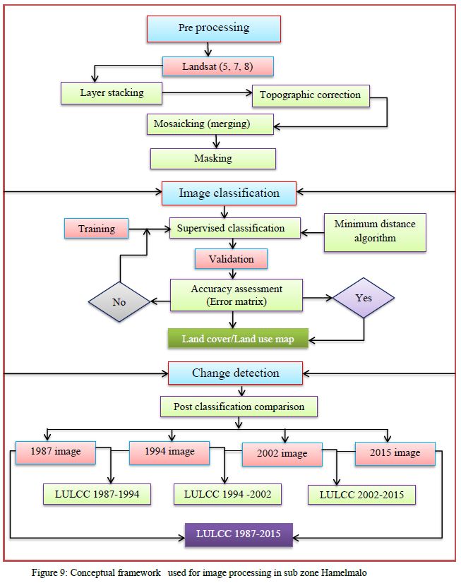
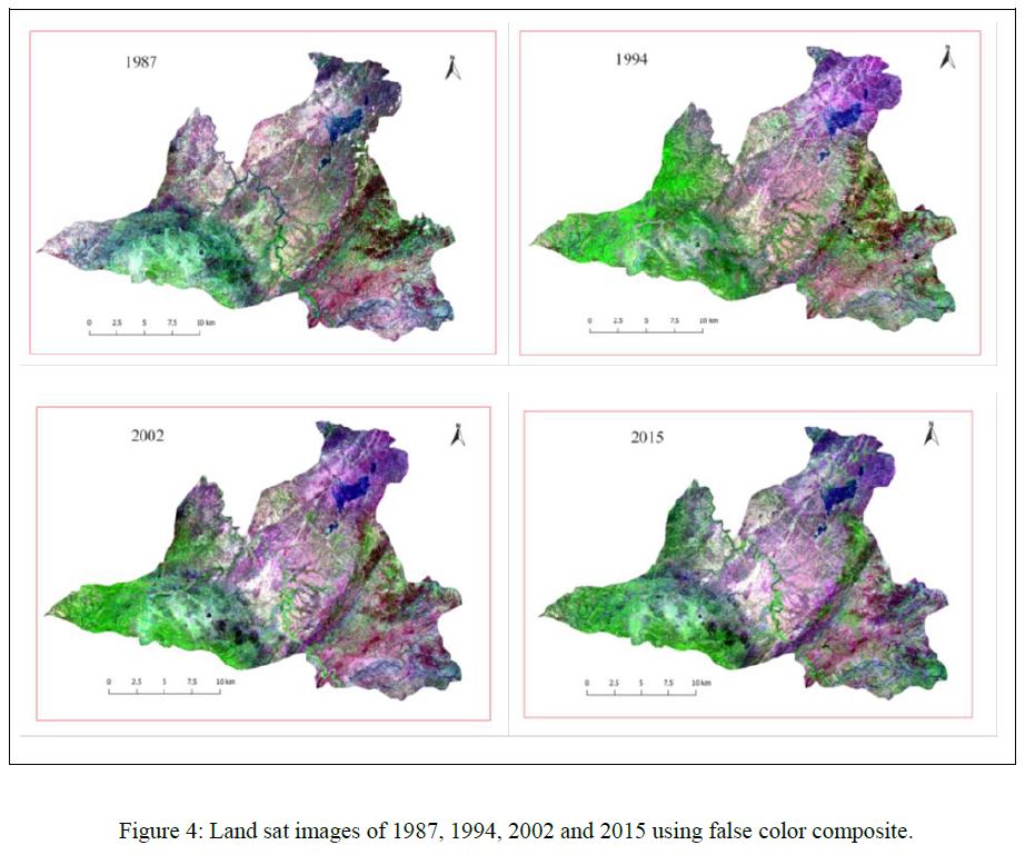
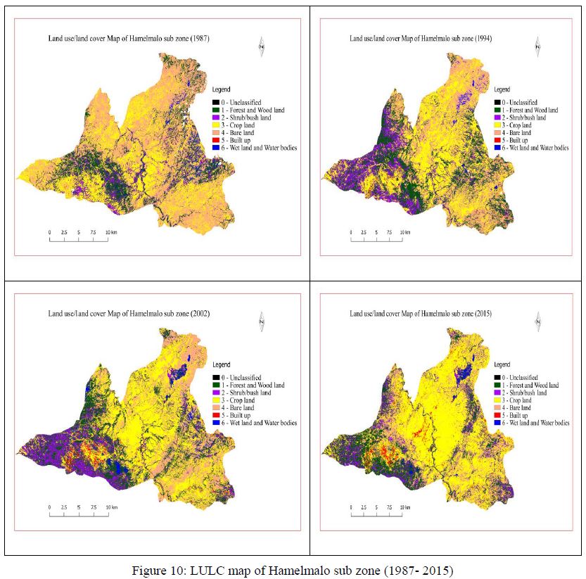
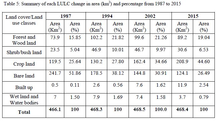
The use of satellite remote sensing in conjunction with Geographic Information System (GIS) enables Land use/Land cover (LULC) changes to be monitored, mapped and analyzed in a timely and cost effective manner. Therefore, this study has been carried out by mapping and characterizing the past and present conditions and extent of LULC in Hamelmalo sub zone using temporal Landsat Thematic Mapper (TM), Enhanced Thematic Mapper Plus (ETM+) and Operational Land Imager (OLI) of 1987, 1994, 2002 and 2015. Landsat 5 (TM) of 1987 and 1994, Landsat 7 (ETM+) of 2002, and Landsat 8 (OLI) of 2015 with 30 meter spatial resolution were used for land use and land cover (LULC) classification and time series change analysis in the sub zone. The images were first preprocessed and then classified in to forest and woodland, shrub/bush land, crop land, bare land, built up and wet land and water bodies with the help of supervised classification technique and minimum distance algorithm. Error matrices as cross-tabulations of the mapped class vs. the reference class were used to assess classification accuracy. Overall, user’s and producer’s accuracies and the Kappa statistics were then derived from the error matrices. The results indicated that the overall accuracy of the image classification was 83.3%, 84.4%, 86.8% and 88.4% with kappa of 0.77, 0.79, 0.82 and 0.83 for the images of 1987, 1994, 2002 and 2015, respectively. Post-classification comparison change detection algorithm was used to determine changes in land use/land cover in four intervals, 1987-1994, 1994-2002, 2002-2015 and 1987-2015. In 2015 vegetation cover such as forest and woodland and shrub/bush lands represented 25.57% of the total land use/land cover in the sub zone. Crop land predominantly covers 44.6% of the total area which was 25.64% in 1987. On the other hand bare land decreased from 51.86% in 1987 to 26.49% in 2015. The remaining 3.33% of land cover is characterized by built up (2.54%) and, wet land and water bodies (0.79%) in the most recent year (2015). The main transitions were observed mainly from bare land, shrub/bush land and forest and woodlands to crop land. Thus this paper may significantly help decision makers and researchers who are interested in remote sensing for LULC management, monitoring and planning development at local, regional and global scales.
Key words: Eritrea, Anseba, Hamelmalo, Land use, Land cover, Land sat, change detection.