Erilaista tiedeviestintää: YLLI-hanke mukana Urheilumuseo TAHDON näyttelyn ideoinnissa

Yhteiskunnallisen vaikuttamisen kanavia on erilaisia, ja uudet ideat ja yhteistyöt tuovat tutkijan työhön uusia tuuli ja uusia näkökulmia. Kun YLLI-hankkeemme (Yhdenvertainen liikunnallinen lähiö) kiinnosti Urheilumuseo TAHDON henkilökuntaa, pääsimme jakamaan osaamistamme ja auttamaan heitä näyttelyn “Menneen talven lumet” suunnittelussa.

Keväällä 2022 Urheilumuseo TAHDON henkilökunta otti yhteyttä meihin YLLI-hankkeen tutkijoihin ja pääsimme ideoimaan heidän tulevaa näyttelyään heidän kanssaan ja kertomaan heille uusimpia tuloksiamme YLLI-hankkeesta sekä muista tutkimuksista, joita on tehty Helsingin yliopiston Digital Geography Lab:ssä. Urheilumuseo TAHDOSSA oli suunnitteilla uusi näyttely Menneen talven lumet siitä miten ympäristömuutokset (mm. ilmastonmuutos) vaikuttaa urheiluun ja liikkumiseen sekä niiden edellytyksiin – ja päin vastoin millaisia ympäristövaikutuksia (voimistajina ja hillitsijöinä) urheilulla ja liikunnalla sekä eri tahojen toimilla on. Keskeisiä teemoja TAHDON erikoisnäyttelyssä on, että ilmastonmuutoksen myötä heikkenevät ja harvinaistuvat hyvät talviliikuntaolosuhteet vaikuttavat suomalaiseen liikkumiskulttuuriin ja huippu-urheulun edellytyksiin. Ja toisaalta liikunnalla ja urheilulla on omat ympäristöjälkensä. Näihin teemoihin meillä YLLI-hankkeen tutkijoilla oli paljon kerrottavaa.

Continue reading “Erilaista tiedeviestintää: YLLI-hanke mukana Urheilumuseo TAHDON näyttelyn ideoinnissa”

New study on 15-minute cities and walking accessibility

Title: The 15-minute city for all? – Measuring individual and temporal variations in walking accessibility

Published in Journal of Transport Geography

Authors: Elias Willberg, Christoph Fink, Tuuli Toivonen

© Christoph Fink

The share of walking in cities should increase, but challenges remain. A recent study by the Digital Geography Lab group reveals what effect age, winter conditions and the service network have on the 15-minute city.

Continue reading “New study on 15-minute cities and walking accessibility”

Wrapping up a successful year at Digital Geography Lab

The year 2022 has been difficult for us Europeans. Therefore, it seems particularly important to search for good things from close by. From the perspective of Digital Geography Lab, it’s a pleasure to wrap up the successful year 2022.

Our group members: present, previous and future

We’ve had 15-17 researchers working in the Lab during the year 2022 . The team has been relatively stable, but of course changes take place. Tatu Leppämäki joined as a PhD researcher in MOBICON project and Oleksandr Karasov as a post-doc in BORDERSPACE project. Håvard Aagesen officially moved to Norway, but for real remains in close collaboration with us. At the end of the year, Charlotte van der Lijn, Emil Ehnström, and Marisofia Nurmi will move forward as YLLI project ends at the end of the year. They all have exciting workplaces waiting for them from January onward! While some are moving on, the recruitment for future positions has started, and at least four new researchers will joint the Lab early next year. We are already able to welcome Silviya Korpilo as a postdoctoral researcher in GREENTRAVEL and Aina Brias Guinart for MOBICON project!

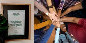
On top of the researchers, we’ve had many wonderful MSc students working in our projects. Out of the earlier students, MSc Jussi Torkko won the price of the best thesis by the City of Helsinki with his work in our Lab!

Also the connections have been tight with many of the former lab members, and we have been happy to work together with our lovely collaborators close and further away.

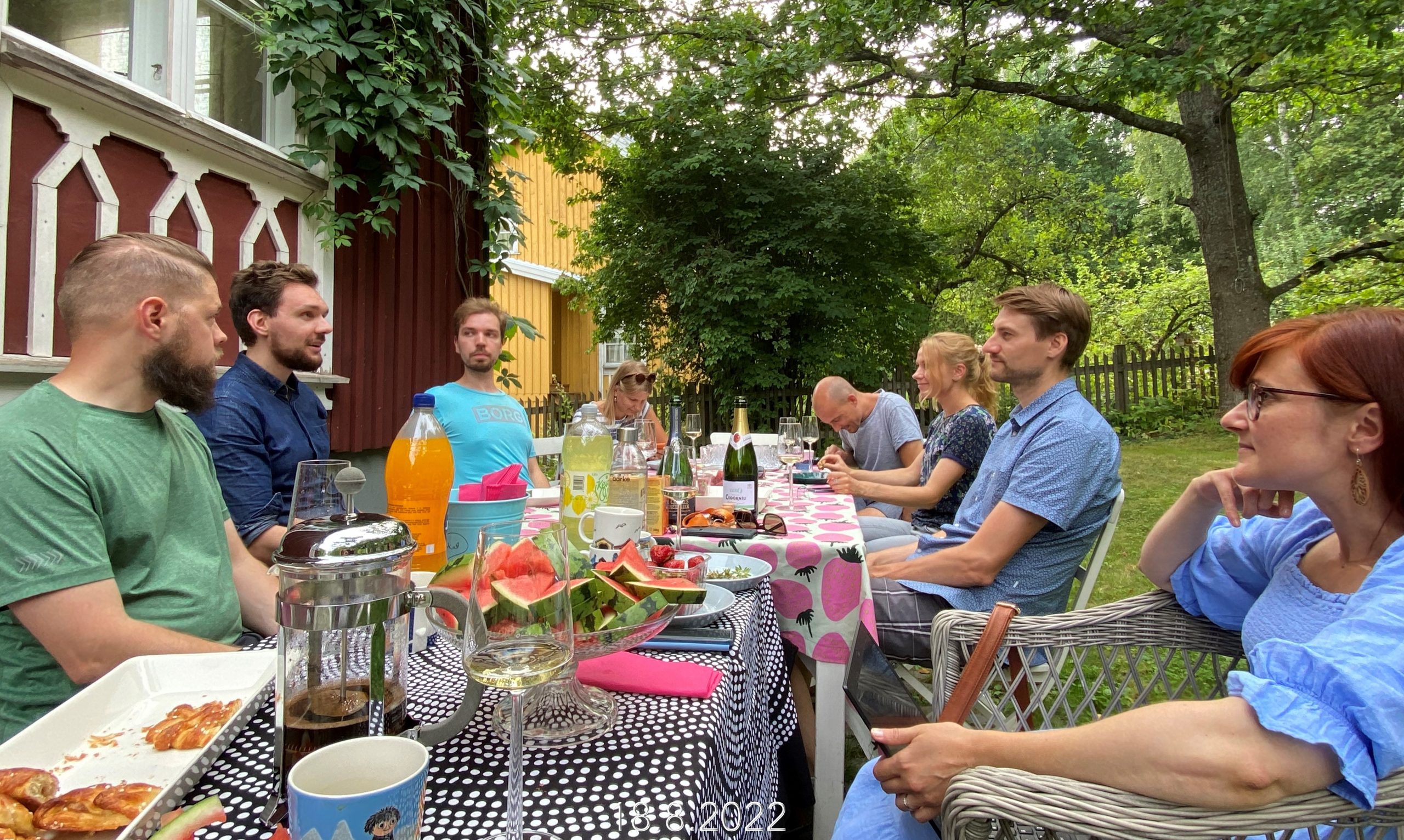
Our first lab meeting after summer holidays. From left Tuomas Väisänen, Elias Willberg, Tatu Leppämäki, Janika Raun, Christoph Fink, Kerli Müürisepp, Olle Järv and Johanna Eklund celebrating the summer and the start of the new academic year. All of these lovely peeps continue in DGL also in 2023!

Scientific successes: new projects and plenty of papers

We have been productive scientifically by many measures. We’ve made scientific contributions in advancing knowledge and methods on using big spatial data for advancing environmental sustainability, wellbeing and socio-spatial equities. The results have been published in  more than 20 refereed empirical or review papers in respected scientific journals. We started a new, long-term project MOBICON and smaller project MATRIX. We received positive funding results for Tuuli Toivonen‘s ERC Consolidator Grant project GREENTRAVEL and H2020 project MOBITWIN. Johanna Eklund continued successfully with her Sustainable conservation outcomes project, Tuomo Hiippala with MAPHEL and Olle Järv with BORDERSPACE and its sister projects. Tuuli’s URBANAGE advanced well with the efforts of Christoph Fink and Elias Willberg. YLLI and MOPA projects were successfully finished. Also academic careers were advanced: Johanna Eklund and Henrikki Tenkanen received the Title of Docent linked to our Lab.

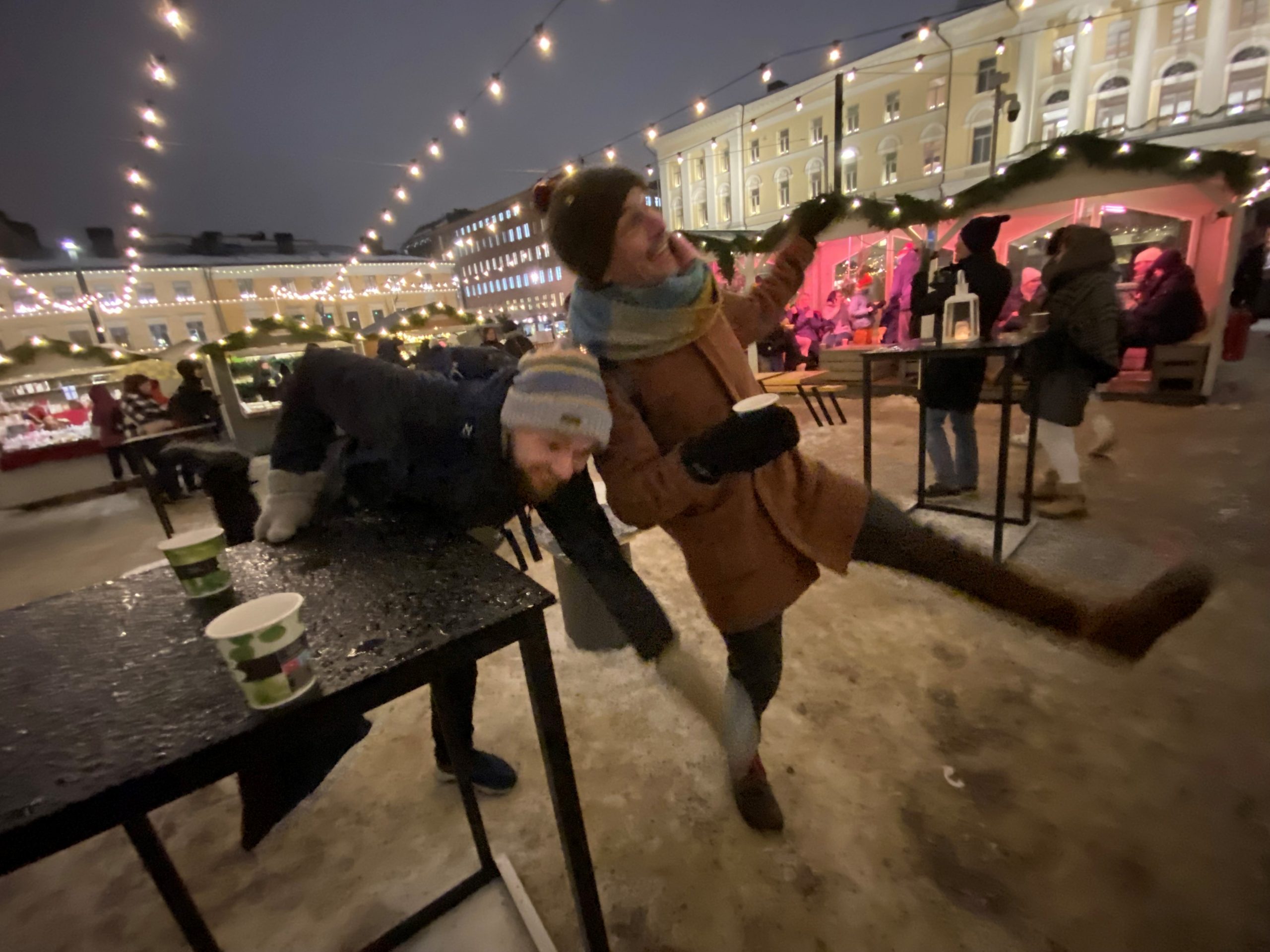
The last scientific paper of the year was accepted just before holidays. It deals with accessibility and 15-minute city, considering also the slippery conditions – demonstrated here by the authors Willberg & Fink!

Reaching out through collaborations, conferences and keen teaching

Our lab has been taking part in teaching. We’ve been responsible for highly popular courses Introduction to Advanced Geoinformatics, Geopython, Automating GIS processes, Advanced Seminar in Geoinformatics and Analysing Accessibility and Mobility. Particular thanks to Tuomas Väisänen, Christoph Fink and Olle Järv for your contributions!  Tuuli acted as the Director of the Degree Programmes of Geography until August and lead the process of renewing the MSc curriculum. Petteri Muukkonen continues as the Director of the Urban Studies and Planning Programme.


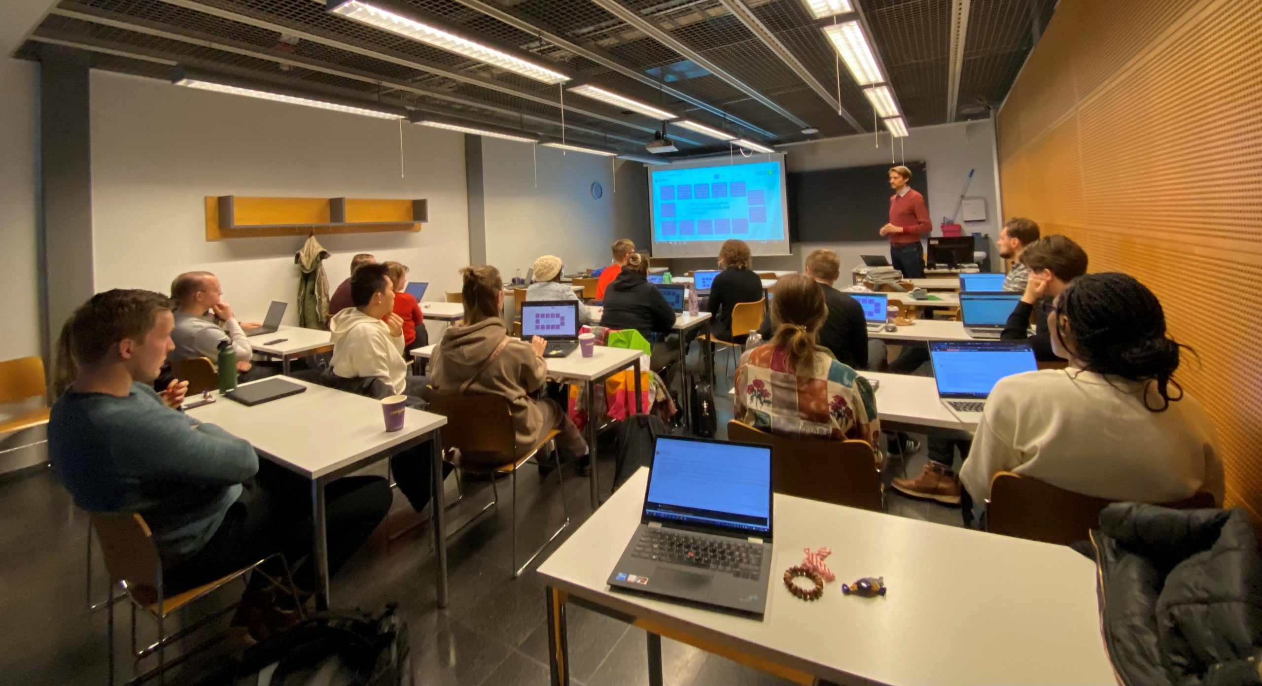
Wrapping up the Analysing Accessibility and Mobility -course with a student seminar. Olle leads the way!

We reached out to the scientific community in many ways. We had a large representation in Mobile Tartu Conference in the summer and some participated the Conference of Location Based Services, ECCB, Monitoring and Management of Visitors and Urban Transitions 2022. We used Twitter actively (particularly Oleksandr during the #30DayMapChallenge!) and were actively blogging. We spent time productive with collaborators in Cambridge, Luxemburg, Munich, Tartu and Uppsala. Closer by, we were happy to work with collaborators e.g. at Aalto University, Elisa Oyj, SYKE, FMI, LUKE, the City of Helsinki and Metsähallitus.


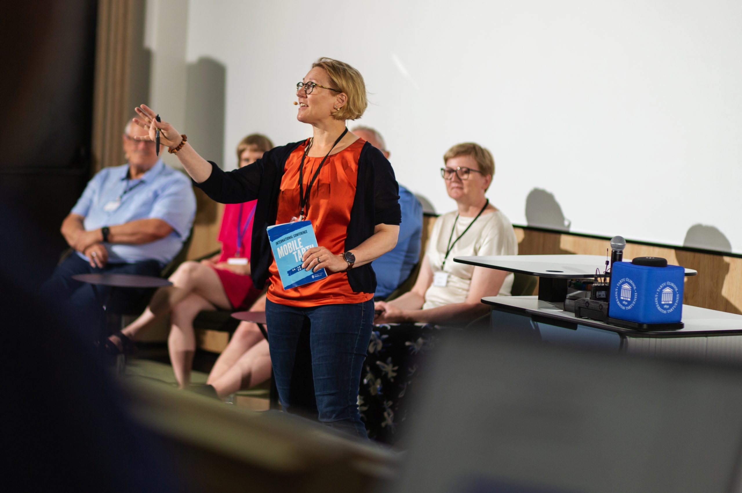
We had many presentations in Mobile Tartu conference, e.g. by Kerli Müürisepp, Janika Raun, Olle Järv, Christoph Fink and Elias Willberg. Tuuli (in pic) chaired a panel discussion.
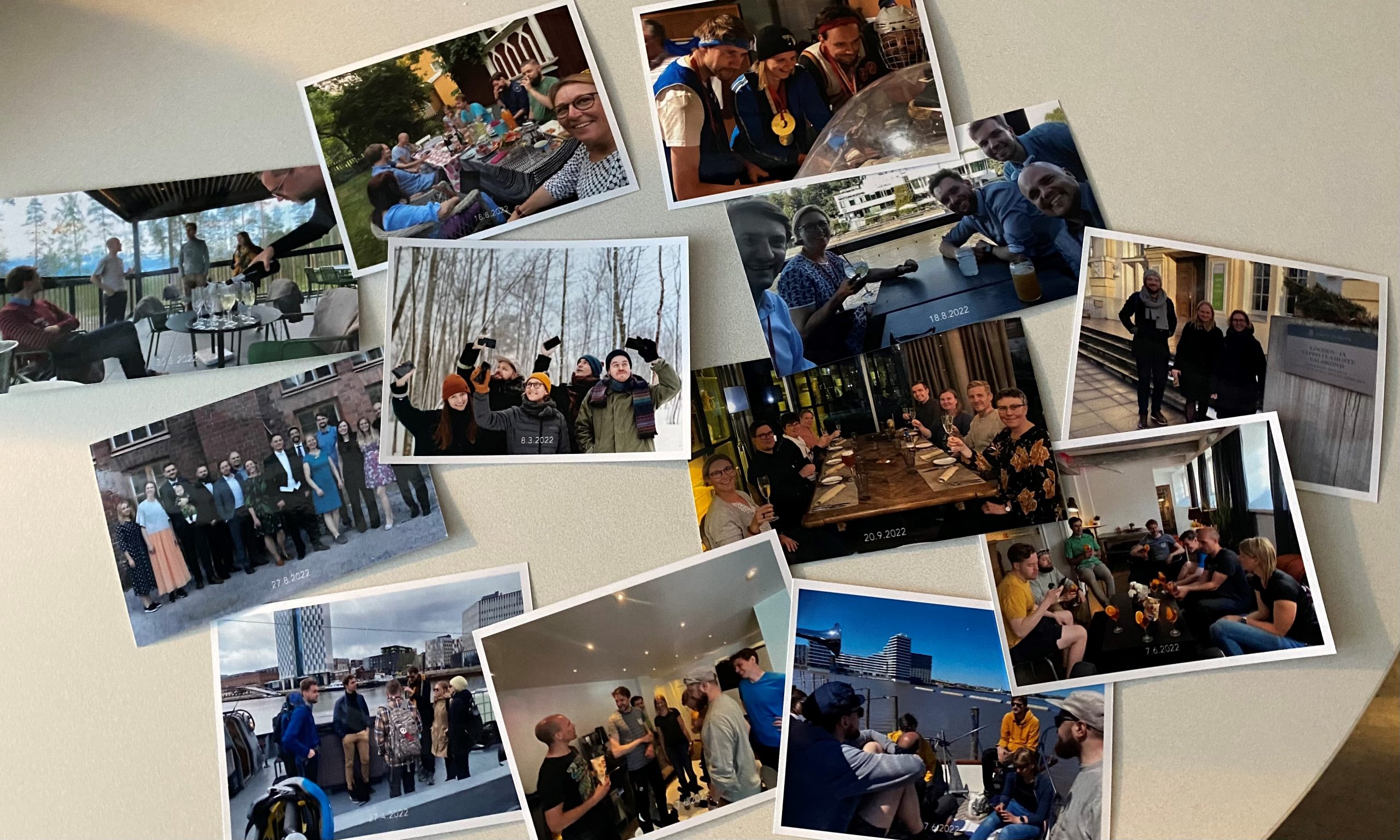
Enjoying life!

We’ve respected the principle of celebrating every step when preparing articles or submitting applications. Considering the amount of activities in 2022, this has been often. And, as some of the important parties (like Doctors2020/2021!) were not organised during covid times, we have been catching up even with these celebrations.

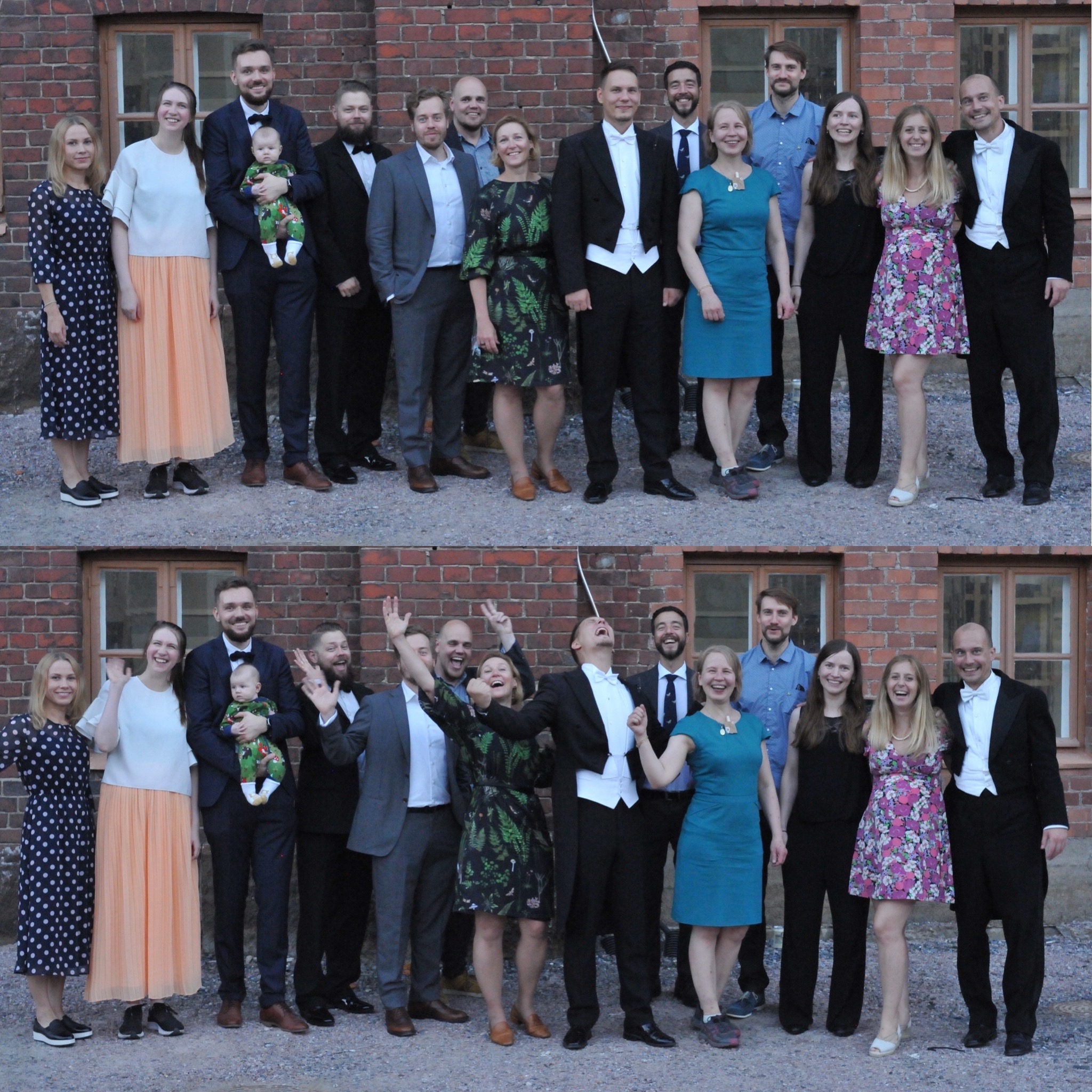
Joel Jalkanen‘s mega-karonkka, 1.5 years after the doctoral defense, was a clear festive highlight of the year! Here former and present Digital Geography Lab members pictured with the star of the day. Note also three other #doctors2020 in picture: Gonza Cortés Capano, Vuokko Heikinheimo and Christoph Fink, and the former or future  lab members Claudia Bergroth, Henna Fabritius and Anna Hausmann.

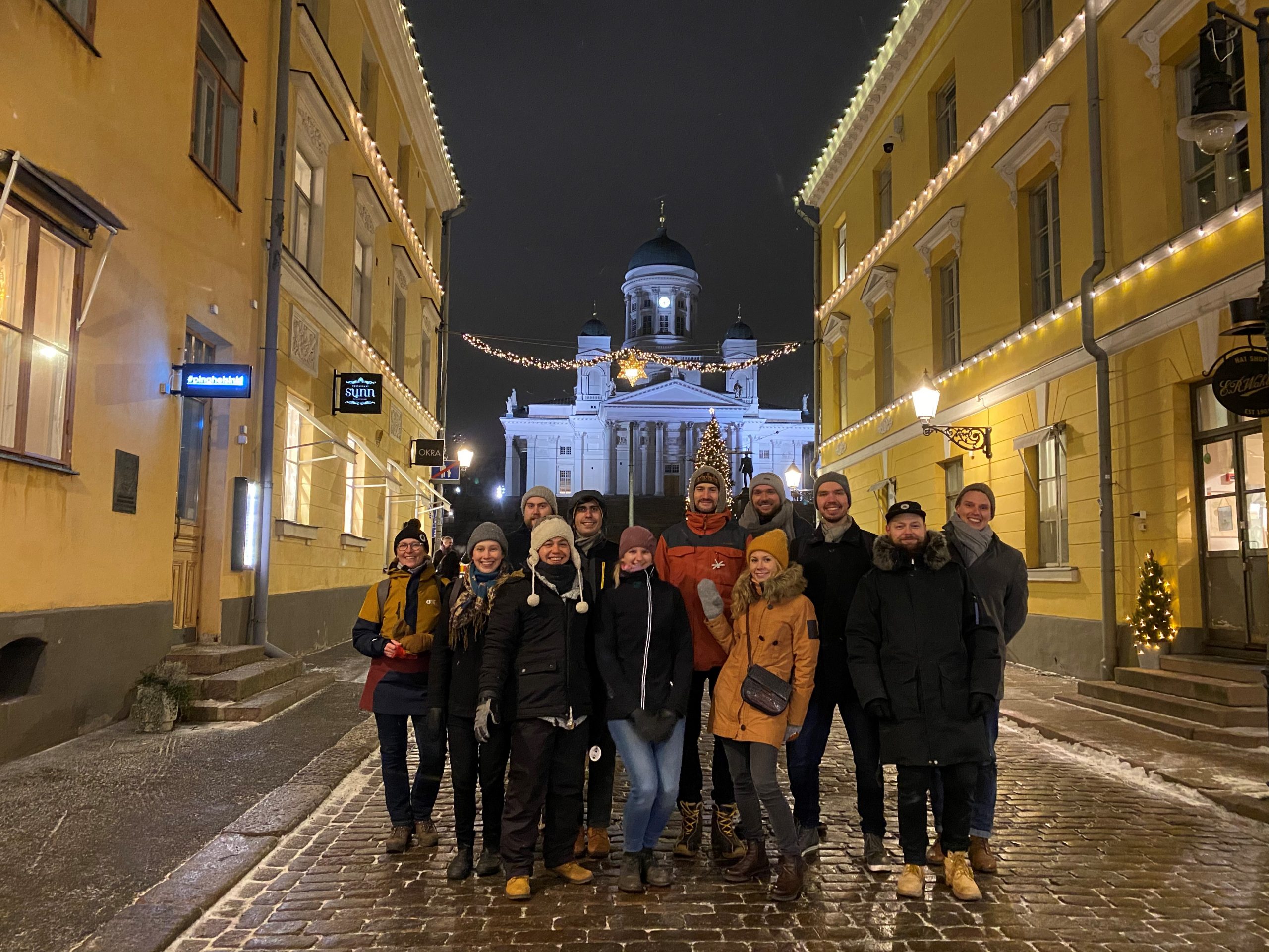
On top of festivities, we’ve spent time together by brainstorming together or after office hours climbing, boating, dining, and bathing in sauna. We have also been lucky for good things in people’s personal lives: We welcomed new  family members and celebrated new homes for many ❤️
Now it’s time to rest a bit and enjoy the holidays!

Merry Christmas and Happy and Peaceful New Year to all! Looking forward to joint scientific adventures in 2023!

Looking for a research assistant

Are you interested in geoinformatics, big data and social media analytics? Are you curious about the phenomena of human mobility, tourism, transnationalism, regional planning and development?         I’m currently looking for a master’s student to work as a research assistant in my project BORDERSPACE at the Digital Geography Lab.

In short, the project studies cross-border mobility flows within the EU and daily practices of cross-border commuters (mobilities and activities across state borders). For this, we are using social media data such as Twitter data (Aagesen et al. 2022; Järv et al. 2022); smartphone tracking data (Järv et al. 2021), and questionnaire survey data. The project seeks to reveal functional cross-border regions based on cross-border practices of people, and how these are influenced by external factors (e.g., COVID-19, war in Ukraine). Also, the topics of transnationalism and multi-local living are in the focus of the project. Geographically, the project focuses preliminarily on the Nordic countries (incl. Finland-Estonia) and the Greater Region of Luxembourg.

The hired assistant would help with various tasks depending on skills and interests: processing and querying (social media) data, managing and developing the database, data analysis and report writing. In general, a successful candidate has fluency in programming (Python or R) and knowledge in automating (spatial) data analysis. Prior experience in handling databases (SQL, PostgreSQL + PostGIS), working with social media data and/or GPS tracking data is an asset.

For those interested, please send me (olle.jarv@helsinki.fi) an email including: 1) your CV; and 2) a one-page cover letter to introduce yourself, your skills and motivation, and whether you would potentially be interested to link this with your Master’s thesis study. The working period can be from January until the end of August 2023, so please indicate when you can start working, during what time period and at which workload (approximate work hours/week). Apply by 22.12.2022 at the latest.

Feel free to ask any further details, and to forward this email to potentially interested candidates at the University of Helsinki.

– – – – –

The BORDERSPACE project is carried out at the Digital Geography Lab — an interdisciplinary research team focusing on spatial Big Data analytics for fair and sustainable societies at the Department of Geosciences and Geography, University of Helsinki.

MOPA project successfully completed! We showed the potential of electricity consumption data in multi-local living and second home research

Authors: Janika Raun, Olle Järv

MOPA (Monipaikkaisen asumisen rytmit, paikat ja asiakasryhmät) project revealing multi-local living patterns in South Savo based on electricity data analysis has reached its end. The project was led by the researchers from Ruralia Institute (Torsti Hyyryläinen, Manu Rantanen, Toni Ryynänen) and was done in collaboration with the Digital Geography Lab researchers Janika Raun, Olle Järv and Tuuli Toivonen.

AIM OF THE PROJECT

We started the project by thinking more broadly about how different big data sources could be utilised in second home research. We first provided an overview on the potential use cases in Finnish (Raun & Järv 2022), which then finally resulted in a coherent perspective paper, “New avenues for second home tourism research using big data: prospects and challenges”, published in the Current Issues in Tourism Research (Raun et al., 2022). The article is available open access here: https://doi.org/10.1080/13683500.2022.2138282.

Our literature analysis for the article revealed that so far utility consumption data has been used relatively little in second home and multi-locality research. However, it has a high potential to uncover where second homes are located and when they are actually used and visited. Thanks to the fruitful collaboration between Ruralia Institute and the local electricity company Suur-Savon Sähkö Oy we were able to use monthly-level electricity consumption data of second homes and analyse what it can tell us about the multi-local living practises in South Savo. Our aim was to understand the spatiotemporal rhythms, variations, and trends in second home usage patterns and identify different user groups. Read more about the start and aims of the project from one of our previous blog posts.

WHAT WERE THE MAIN RESULTS?

Electricity consumption in second homes increased during the COVID-19 pandemic.

Our results reveal that the electricity consumption in second homes has increased, especially during the years 2020 and 2021, indicating the intensified usage of second homes during the pandemic. The increase was biggest in areas with the highest relative share of free-time residences, such as Hirvensalmi, Mäntyharju, and Puumala municipalities. This finding is in line with the results of a previous study made in Finland using mobile phone data, which indicated that people escaped from cities when the pandemic started, and the increase of people was biggest in municipalities with the highest relative share of second homes (Willberg et al., 2021; and DGL blog posts here). The increase in electricity consumption was highest during the spring and autumn months, indicating that people extended their summer season and spent more time in their second homes also late spring and early autumn (Figure 1).

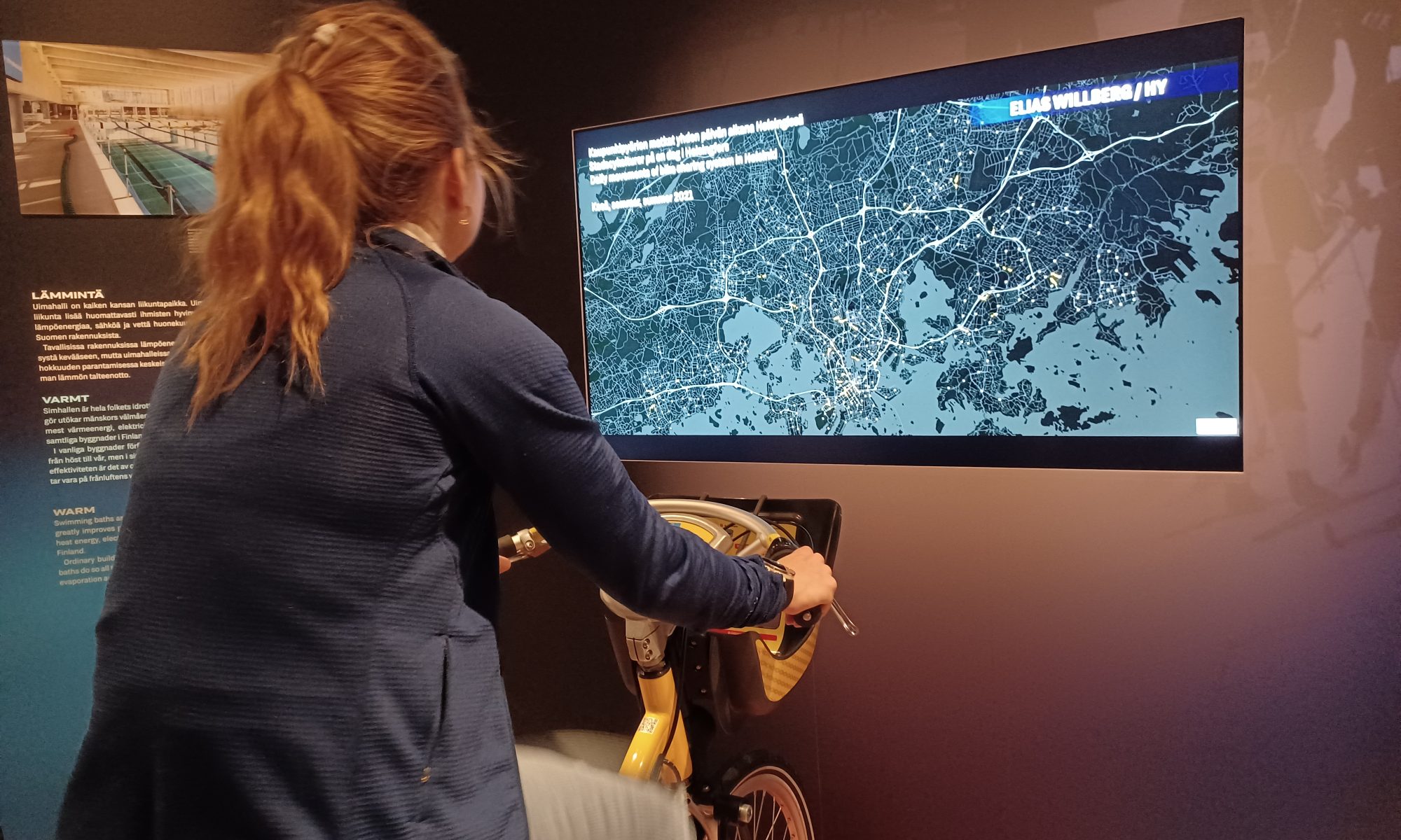
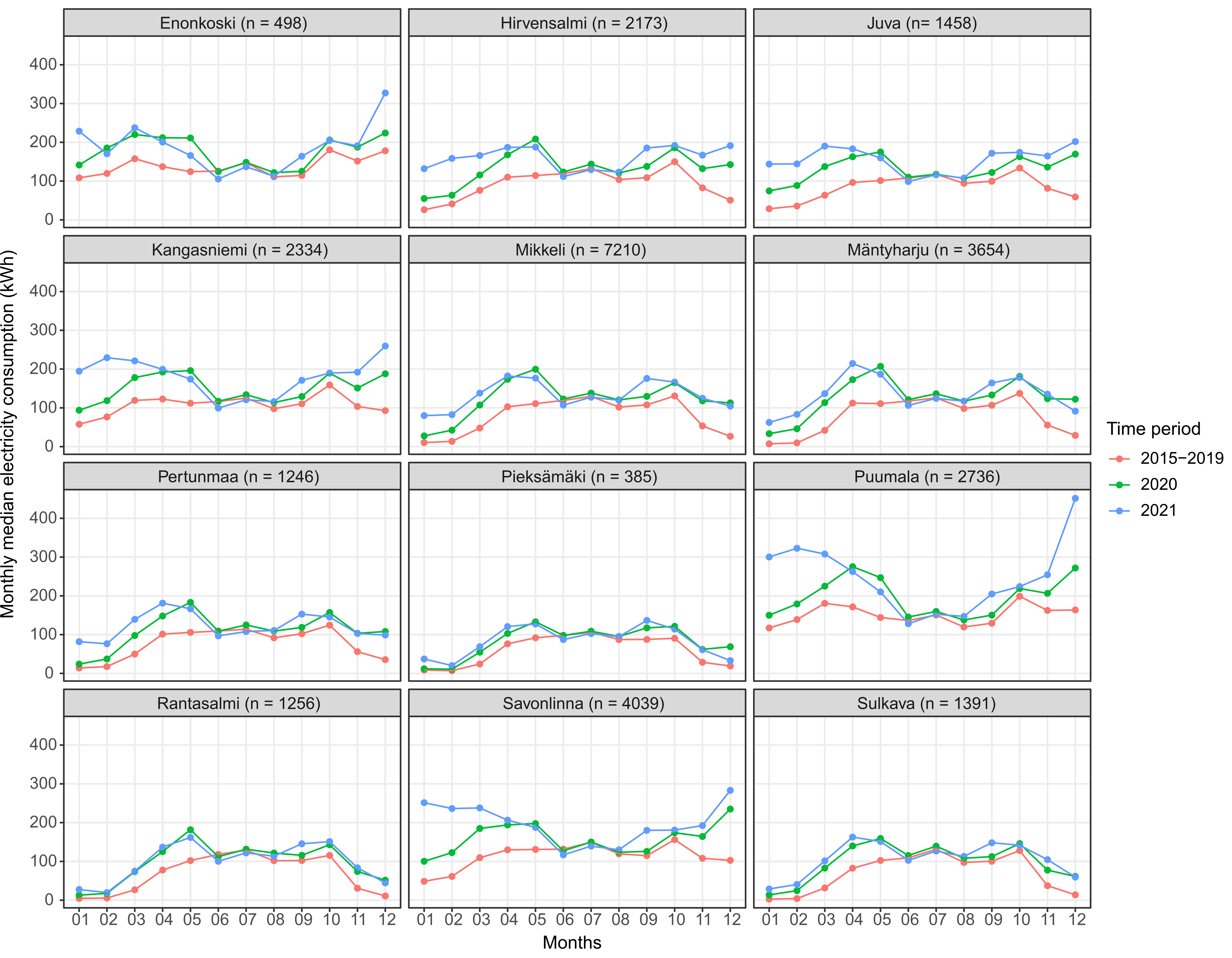
Figure 1. Monthly median electricity consumption (kWh) in municipalities during three periods: average for 2015-2019, 2020 and 2021. N represents the number of free-time residences in January 2021. Continue reading “MOPA project successfully completed! We showed the potential of electricity consumption data in multi-local living and second home research”

Digital Geography Lab is recruiting! Three positions now open!

We are opening three positions in the upcoming ERC-funded project GREENTRAVEL: Greener Travel Environments for Everyone – from measured wellbeing impacts to Big Data analytics (2023-2027). The project studies the equitable availability of green travel environments for urban populations, and their potential wellbeing impacts. The project applies a mix of novel approaches from Virtual Reality experimentation to computer vision and from big data mining to spatial analysis. The project starts from the Helsinki region and then expands to several other European cities including London and Berlin. The aim is to produce knowledge that can be used to advance the quality and sustainability of urban environments, for all.

 The following positions are now open:

Doctoral Researcher in Spatial Modelling of Greenery Exposure:
The doctoral researcher will focus on analysing people’s everyday mobilities in urban environments and their exposure to greenery during these travels. During the PhD process, the researchers will grow to be an expert of travel-related greenery exposure modelling using mobile big data and seasonally sensitive greenery information, from the perspective of wellbeing and spatial and social equality.  More information: https://jobs.helsinki.fi/job/Helsinki/756838602/?feedId=350602&utm_source=CareerSite_UniversityOfHelsinki

Postdoctoral Researcher in Health and Wellbeing Impacts of Green Travel Environments:
The postdoctoral researcher will focus on the wellbeing and health impacts of green travel environments. The research aims at finding out if and how varying types of greenery or other natural elements influence travel experience and wellbeing during daily urban travels, and if seasonal variation and geographical context matters. These questions will be studied through extensive surveys and controlled experimentation in VR and in real environments. The postdoctoral researcher will be offered up to 3-year contract.  More information: https://jobs.helsinki.fi/job/Helsinki/756842702/?feedId=350602&utm_source=CareerSite_UniversityOfHelsinki

Postdoctoral Researcher in Designing Virtual Reality Environments for Green Travel Experiments:
The postdoctoral researcher focuses on designing realistic virtual reality (VR) environments with varying greenery features and seasons, to be used for controlled experiments of greenery exposure during travel. These experimentations will be a group effort of the GREENTRAVEL project team and the postdoctoral researcher will have a key role in developing the realistic VR environments with varying levels of urban greenery and other nature elements, and studying their usability in controlled scientific experimentations.  More information: https://jobs.helsinki.fi/job/Helsinki/756839202/?feedId=350602&utm_source=CareerSite_UniversityOfHelsinki


– – – – –

The Digital Geography Lab is an interdisciplinary research team focusing on spatial Big Data analytics for fair and sustainable societies. Go to the main site here. 


MSc thesis on studying multi-local living in Finland using mobile phone data and electricity consumption data

Author: Iivari Laaksonen

Why is the study relevant?

Multi-local living can be defined by individuals or families having access to more than one residence in their everyday lives. It is a complex social phenomenon causing weekly and seasonal changes in population numbers as people move between regions. This means that the phenomenon is tightly connected to human mobility. In prior research, multi-locality has been mainly studied using official statistics that fail to capture the dynamic nature of people’s mobilities and dwelling. To address this in my thesis, I utilized spatially and temporally accurate big data sources − mobile phone and electricity consumption data − to capture people’s presence and mobility. More accurate information about multi-local living can be useful for local businesses and regional planning in rural areas.

How was the research done?

In my thesis, multi-local living was studied in Finland and in the county of South Savo, which has the highest proportion of second homes/free-time residences in the country. The study was done by analyzing spatiotemporal changes in people’s presence (mobile phone data from Telia Crowd Insights) and by examining how the changes relate to the number of second homes (official statistics) in different areas with correlation analyses. In addition to monthly comparisons, analyses were conducted separately for workdays and weekends to assess how people’s multi-local practices differ between weekdays. The study period of the thesis was from November 2018 to August 2019.

Mobile phone data also contains information about people’s origins (previous night location). This allowed to assess the proportions of origin counties of people visiting South Savo. Moreover, mobile phone data was used to assess the results of second home occupancy in South Savo gained from electricity consumption data which had been previously calculated in the MOPA research project.

Continue reading “MSc thesis on studying multi-local living in Finland using mobile phone data and electricity consumption data”

Digital Geography Lab presented the latest research at Mobile Tartu 2022

It was our honour and pleasure to attend the 8th Mobile Tartu conference organized by the Mobility Lab of the University of Tartu, Estonia. The event was once again scientifically fruitful and socially rewarding exactly the way how the founder of the conference, the late professor Rein Ahas had envisioned it!

The members of the Digital Geography Lab were well represented in organising PhD workshops, presenting latest research from various projects, chairing sessions and moderating a panel discussion.


Olle Järv and Oleksandr Karasov organized a PhD workshop on “Social media sources as a tool to monitor cross-border mobility”, and Christoph Fink and Tuuli Toivonen together with our former group member Age Poom organized a PhD workshop on “Data and tools for environmental exposure assessment during urban mobility”.

Continue reading “Digital Geography Lab presented the latest research at Mobile Tartu 2022”

Two new studies on revealing cross-border mobility and border regions

One of the goals of the BORDERSPACE project at the Digital Geography Lab is to examine whether and how social media data such as geo-located Twitter data can reveal cross-border mobility of people and provide new insights for understanding border regions. We demonstrate the feasibility of using Twitter data in two different recently published studies – the first study from the Greater Region of Luxembourg and the second study from the Nordic countries.


Study #1: Revealing mobilities of people to understand cross-border regions: insights from Luxembourg using social media data”

Published in European Planning Studies

Authors: Olle Järv, Håvard W. Aagesen, Tuomas Väisänen & Samuli Massinen

Conceptually, our approach was to make big data small and meaningful by: 1) using a bottom-up concept of activity space (e.g. Järv et al., 2014); 2) using mobility as a tool to capture individual activity spaces; and 3) contextualizing mobility from the border perspective.

Figure 1. The conceptual framework of data collection and data enrichment using the activity space approach to reveal cross-border mobilities and its motives from an individual perspective.

Continue reading “Two new studies on revealing cross-border mobility and border regions”

Vuoden avoin oppimateriaali -palkinto 2022 CRITICAL-hankkeen maantieteilijöille

Teksti: Petteri Muukkonen

CRITICAL-hankkeen maantieteilijöiden tiimi Helsingin yliopistosta palkittiin kautta aikain ensimmäisellä kansallisella Vuoden avoin oppimateriaali -palkinnolla. Palkinnon myönsi Avoimen tieteen ja tutkimuksen kansallisen koordinaation sihteeristö, joka toimii osana Tieteellisten seurain valtuuskuntaa. Aiemmin on jaettu vain avoimen tieteen edistämisestä palkintoja, mutta nyt ensimmäistä kertaa palkittiin myös avoimen oppimisen edistäjiä. Palkinto jaettiin Avoimen tieteen kesäpäivien yhteydessä 31.5.2022. Työpaketin vetäjä Petteri Muukkonen on yhdessä muiden CRITICAL-hankkeen maantieteen tutkijoiden sekä opettamansa projektikurssin opiskelijaryhmän kanssa laatinut avoimia oppimateriaaleja paikkatiedon ja geomedian opetukseen käytettäväksi eri koulutustasoilla – esimerkiksi maantieteen lukio-opetuksessa tai yliopistossa kandivaiheen opiskelijoiden kanssa.

TSV:n Petteri Muukkoselle, CRITICAL-hankkeelle sekä GIS project work -kurssin opiskelijoille myöntämä diplomi. (Oikeanpuoleinen kuva: TAUSTA 123RTF, Diplomikuva Ilmari Jauhiainen)

Continue reading “Vuoden avoin oppimateriaali -palkinto 2022 CRITICAL-hankkeen maantieteilijöille”