Elias’ Lectio Praecursoria

Measuring sustainable accessibility: geospatial approaches toward integrating people and the environment

Lectio Praecursoria in the public examination of Elias Willberg doctoral dissertation on 2nd June 2023

Photo by Christoph Fink

Sustainability means meeting the needs of the present without compromising the ability of future generations to meet their own needs.

Currently, we are compromising that ability. We have exceeded several planetary boundaries, which mark the safe limits for humanity. We are consuming environmental resources at a rate, which would require several planets to sustain. And we, are still on a path where our environmental burden continues to increase.

At the same time, our social challenges remain persistent. In a world of overconsumption, no country has been able to meet the basic social needs of its citizens at a sustainable level of resource use. Inequalities between people are increasing again and growing environmental stresses, like climate change and biodiversity loss only make it harder to achieve social goals.

What we ultimately want, is to reach that safe and just space in the middle, between the ecological ceiling and social foundation where we don’t consume more than what we have, but where we also leave no one behind. Guaranteeing a good life for everyone, without compromising the planet, represents the ultimate goal for our societies.

Continue reading “Elias’ Lectio Praecursoria”

Elias Willberg successfully defended his PhD thesis – Trisalyn Nelson as opponent

Elias Willberg successfully defended his PhD thesis last Friday!

The defence took place on Friday, 2nd June 2023, with Professor Trisalyn Nelson from the University of California, Santa Barbara as the opponent. The defence started with Elias Lectio Praecursoria, and continued with a lively discussion with the opponent about Elias’ thesis

See Elias’ thesis here: ”Measuring sustainable accessibility : geospatial approaches toward integrating people and the environment”. Elias’ work was supervised by Prof Tuuli Toivonen, Prof Henrikki Tenkanen and Prof Age Poom and funded by the Amer Cultural Foundation (Sporttia Stadiin) and EU (URBANAGE and HOPE projects).

On the week before the defence, we had the honour of hosting the opponent, Professor Trisalyn Nelson, at the University of Helsinki. She gave an exciting talk for a broad audience on-site and online, with the title “Crowdsourced Data for Active Transportation Planning“.

The busy days culminated in the cheerful Karonkka party on Saturday evening, with a long and bright summer evening. On Monday, Elias switched to a new life chapter by starting a three-month paternity leave with their small daughter.

Hooray & hugs to Elias! 🥳🤗

Many thanks also to the opponent, Prof Trisalyn Nelson, for visiting us and leading the discussion with academic expertise and curiosity, in a cheerful spirit! 🤗

Continue reading “Elias Willberg successfully defended his PhD thesis – Trisalyn Nelson as opponent”

New Travel Time Matrix 2023 and GREENTRAVEL project

Digital Geography Lab presented a new travel time matrix 2023 and a new big project GREENTRAVEL in a seminar held in Think Corner.

Helsinki region travel time matrix was published now for the fourth time. The matrix is an interactive open access dataset that allows investigation of travel times for different travel modes in Helsinki region. Professor Tuuli Toivonen gave an insight to the history of the matrix which was first published already ten years ago in 2013.

Since the first matrix was computed, the technology has improved and enabled the use of new methods. Christoph Fink explained how the new matrix was calculated and showed how it works.  Current accessibility prospects and changes in the regional structures of accessibility in Helsinki region were described by Elias Willberg. We also had two guest speekers, Miikka Haimila and Iiris Karvinen, from the city of Helsinki. Haimila reflected the importance of matrix for the city and its open data activities. Karvinen took the angle of a planner and demonstrated how the matrix has been serving the planning needs of the city.

In the end Tuuli Toivonen presented our new big project GREENTRAVEL which aims to explore the availability and quality of green urban travel environments and their impacts on wellbeing through the prism of urban informatics. We continued the discussions right after the seminar in a GREENTRAVEL workshop where we focused on the role of greenery in urban travel environments and how greenery can be better incorporated in current green infrastructure and travel and mobility planning.

Continue reading “New Travel Time Matrix 2023 and GREENTRAVEL project”

Uusi matka-aikamatriisi 2023 ja GREENTRAVEL-projekti (available in English as separate post)

Digital Geography Lab esitteli uuden pääkaupunkiseudun matka-aika-aineiston 2023 ja juuri käynnistyneen GREENTRAVEL-tutkimushankkeen Tidekulmassa järjestetyssä julkaisutapahtumassa.

Pääkaupunkiseudun matka-aikamatriisi julkaistiin nyt jo neljättä kertaa. Matriisi on avoin paikkatietoaineisto, joka mahdollistaa matka-aikojen vertailun eri kulkutavoilla pääkaupunkiseudulla. Professori Tuuli Toivonen kertoi matriisin historiaa valaisseessa puheenvuorossaan ensimmäisen matriisin julkaisusta kuluneen jo 10 vuotta.

Teknologian kehittyminen ensimmäisten matriisien tuottamisen jälkeen on mahdollistanut uusien menetelmien käytön laskennassa. Christoph Fink esitteli miten uusi matriisi on laskettu ja miten se toimii. Elias Willberg valotti pääkaupunkiseudun nykyistä saavutettavuusmaisemaa sekä muutoksia saavutettavuuden alueellisissa rakenteissa kuluneiden 10 vuoden aikana. Mukana olivat myös vierailevat puhujamme Miikka Haimila ja Iiris Karvinen Helsingin kaupungilta. Haimila kertoi matriisin merkityksestä kaupungille ja sen avoimen datan toiminnalle. Karvinen osoitti suunnittelijan näkökulmasta miten matriisi on palvellut kaupungin suunnittelutarpeita.

Lopuksi Tuuli Toivonen esitteli uuden viisivuotisen GREENTRAVEL-tutkimushankkeen, jossa selvitetään liikkumisympäristöjen laatuun ja vihreyteen liittyviä mieltymyksiä sekä niihin kytkeytyviä hyvinvointivaikutuksia ja näiden alueellista, vuodenaikaista ja yhdenvertaista saatavuutta. Jatkoimme keskustelua aiheesta seminaarin jälkeen pidetyssä GREENTRAVEL-työpajassa, jossa keskityimme vehreyden rooliin kaupunkien liikkumisympäristöissä sekä tapoihin tuoda vehreys näkyvämmin osaksi liikkumisympäristöjen suunnittelua.

Continue reading “Uusi matka-aikamatriisi 2023 ja GREENTRAVEL-projekti (available in English as separate post)”

The case for the societal benefit of user-generated big data research – DGL responds to EU on research data access

Authors: Tatu Leppämäki, Tuuli Toivonen, Olle Järv together with other Digital Geography Lab members

The Digital Services Act (DSA) is legislation by the European Union that aims at protecting the users of and mitigating risks caused by online platforms, covering anything from social media sites to search engines and online retailers. It does this by obligating the platforms to, for example, be transparent about content recommendation systems, and effectively tackling content manipulation and spreading of disinformation. Due to their significant effect on our societies, the legislation sets more obligations for very large online platforms (VLOP): this class of platforms include social media giants, such as Facebook, Youtube, Instagram, Twitter, and Tiktok.

As a research group that has successfully applied user-generated data to study multitude of topics, our interest in the legislation stems from its sections that obligate VLOPs to give means to access data uploaded on their platform for appropriate research purposes (Article 40 of the act). While these purposes are limited for scrutinizing the systemic risks caused by the platforms in the legislation, we believe there is much potential for social good through responsible research employing public user-generated data.

The European Commission recently asked for feedback on the implementation of researcher data access under the DSA. Drawing from a decade of big data research, our response argues for the benefits of researcher data access beyond studying systemic risks. The response is split into a short opinion text and direct responses to some of the questions posed by the Commission (find the guiding questions here). You can read our response below or via the feedback service. If you’re a researcher using or curious about data from online platforms, or just an interested citizen in Europe or elsewhere, you may give feedback until the midnight of Wednesday, 31st of May 2023. Continue reading “The case for the societal benefit of user-generated big data research – DGL responds to EU on research data access”

Elias Willberg defending June 2nd

Yay! Elias Willberg will defend his PhD thesis “Measuring sustainable accessibility: Geospatial approaches toward integrating people and the environment”

Opponent professor Trisalyn Nelson, Jack and Laura Dangermond Endowed Chair of Geography, University of California, Santa Barbara, custos Tuuli Toivonen

Time: Friday 2nd June, 12 o’clock noon
Place: Suomen Laki- sali, Porthania, Yliopistonkatu 3
Stream: https://video.helsinki.fi/unitube/live-stream.html?room=l62

Abstract of the thesis

The central challenge of our societies is how to satisfy people’s basic needs and guarantee a good life for everyone, while staying within the safe planetary limits. Spatial accessibility, meaning the potential of opportunities to interact with other people, activities, and places, is essential for social and environmental sustainability. During recent decades, measures of accessibility have become an everyday tool for urban and transport researchers. By examining the satisfaction of basic needs, accessibility strongly links to social well-being and equity. Accessibility-oriented planning can at best enable environmentally sustainable solutions, which do not increase travel demand but support shorter distances and thus the increase of walking and cycling. In reality, improving accessibility is often based on improving the conditions of motorised transport, and the results can be environmentally harmful. Such contradictions remain sparsely studied in accessibility research due to the lack of holistic approaches. Most often, social and environmental concerns are addressed separately, even if the integration of perspectives would be central to promoting sustainability.

Continue reading “Elias Willberg defending June 2nd”

New paper out: How to best map greenery from a human perspective? Comparing computational measurements with human perception

Fresh from the press, Jussi Torkko’s MSc thesis has been turned to an article, and it’s out in Frontiers in Sustainable Cities!

Torkko, J., Poom, A. Willberg, E. & Toivonen T. (2023) How to best map greenery from a human perspective? Comparing computational measurements with human perception, Frontiers in Sustainable Cities, 5, https://doi.org/10.3389/frsc.2023.1160995

Urban greenery has been shown to impact the quality of life in our urbanizing societies. While greenery is traditionally mapped top-down, alternative computational approaches have emerged for mapping greenery from the street level to mimic human sight. Despite the variety of these novel mapping approaches, it has remained unclear how well they reflect human perception in reality. We compared a range of both novel and traditional mapping methods with the self-reported perception of urban greenery at randomly selected study sites across Helsinki, the capital of Finland.

The mapping methods included both image segmentation and point cloud-based methods to capture human perspective as well as traditional approaches taking the top-down perspective, i.e., land cover and remote sensing-based mapping methods. The results suggest that all the methods tested are strongly associated with the human perception of greenery at the street-level. However, mapped greenery values were consistently lower than the perceived values.

Continue reading “New paper out: How to best map greenery from a human perspective? Comparing computational measurements with human perception”

How is our research related to Sustainable Development Goals (SDGs)?

Authors: Janika Raun with all Digital Geography Lab members

In 2015, all United Nations member states adopted the 2030 Agenda for Sustainable Development that includes 17 Sustainable Development Goals (SDGs), each with their own set of associated targets (169 in total). The goals address social, economic, and environmental development aspects and call for urgent action, e.g., to end poverty, reduce inequalities and tackle climate change (Fig. 1). The SDGs are increasingly used by different actors of the society to structure and communicate their actions around sustainability.
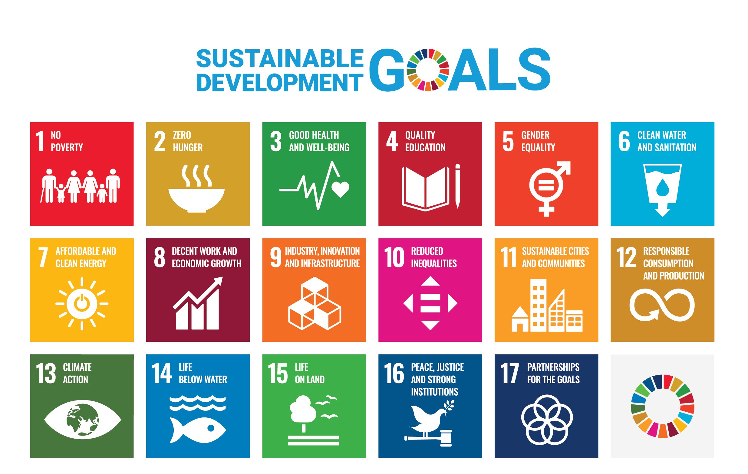
Figure 1. 17 Sustainable Development Goals. Source: https://sdgs.un.org/goals

Why the SDGs matter for us in DGL?

Universities play a crucial role in the achievement of SDGs as knowledge, innovation, evidence-based solutions, and good quality education are the basis for reaching the targets. As an interdisciplinary research group focusing on spatial Big Data analytics for fair and sustainable societies, we have always worked towards advancing sustainability. As SDGs, despite critique towards them (Arora-Jonsson, 2023), are increasingly used to communicate the sustainability actions in the society, we decided to map also our research activities at the Digital Geography Lab against the SDGs.

Continue reading “How is our research related to Sustainable Development Goals (SDGs)?”

Releasing the new Travel Time Matrix and GREENTRAVEL project 17th May 2023!

Howwell-connected is the Helsinki region for drivers, cyclists or public transport users? Does greenery support health and wellbeing during travel? How to plan for equal travel access and environmental sustainability? How are equal travel access and environmental sustainability related?

If you want to hear and discuss more about these topics, join us on 17 Mayin Think Corner (9.30-11.00) and Porthania Urbarium (11.30-13.00). The event is organized by the University of Helsinki’s Digital Geography Lab.

The event consists of two sessions. In the first morning session  ( 9.30-11.00), we will launch the new Travel Time Matrix 2023 for Helsinki region. The matrix is an interactive open access dataset that allows investigation of travel times for different travel modes in the Helsinki region. This widely used dataset has been published since 2013. It is now published for the fourth time, allowing for examining  changes in accessibility structures over an even longer period of time. During this session, there will be a presentation of the purpose and development of the matrix by the researchers. The stakeholders from the cities will also tell about their uses and experiences with the Matrix.

After launching the matrix, we will present our next big project GREENTRAVEL (2023 –2028). The goal of the project is to better understand the importance of urban greenery during people’s travel, its impacts on human well-being and health, and the equality of green travel environments. The event will be both in Finnish and English.

The second session of the event (11.30-13.00) is the GREENTRAVEL project workshop. The workshop aims to encourage cross-sectional discussion on how greenery is understood from a travel perspective, what wellbeing benefits it is expected to produce and how it can be better incorporated in current green infrastructure and travel and mobility planning.

Coffee will be served after the first part of the event. We also offer coffee and snacks for those who participate in the workshop.

Please register to participate by 12 May by filling the registration form.

Welcome!


Pääkaupunkiseudun uusi matka-aikamatriisi julki 17.5.2023!

Miten saavutettava pääkaupunkiseutu on autoilijalle, pyöräilijälle tai joukkoliikenteen matkustajalle? Tukeeko kaupunkiympäristön vihreys miellyttävää ja terveellistä liikkumista? Miten on liikkumismahdollisuuksien tasa-arvon ja ympäristöllisen kestävyyden laita? 

 Tervetuloa kuulemaan ja keskustelemaan näistä teemoista Helsingin yliopiston 17.5 Tiedekulmaan (9.30-11.00) ja Porthanian Urbariumiin (11.30-13.00). Digital Geography Lab-tutkimusryhmän järjestämään tilaisuuteen.

Tilaisuuden ensimmäisessä osassa (klo 9.30-11.00) julkaistaan pääkaupunkiseudun uusi matka-aikamatriisi 2023. Matka-aikamatriisi on avoin paikkatietoaineisto, joka mahdollistaa matka-aikojen vertailun eri kulkutavoilla pääkaupunkiseudulla. Paljon käytetty tietoaineisto on ollut saatavilla vuodesta 2013 lähtien. Se julkaistaan nyt neljättä kertaa, mikä sallii saavutettavuudessa tapahtuneiden muutosten tarkastelun entistä pidemmältä ajalta. Tilaisuudessa esitellään Matka-aikamatriisin tuottamisen taustaa, käyttömahdollisuuksia sekä kuullaan kommentteja käyttäjiltä.

Matka-aikamatriisin julkaisun jälkeen suuntaamme katseen tulevaan. Esittelemme Digital Geography Labissa juuri käynnistetyn viisivuotisen GREENTRAVEL-tutkimushankkeen, jossa selvitetään matkustusympäristöjen laatuun ja vihreyteen liittyviä mieltymyksiä sekä niihin kytkeytyviä hyvinvointivaikutuksia ja näiden alueellista, vuodenaikaista ja yhdenvertaista saatavuutta.

Tilaisuuden toinen osa (klo 11.30-13.00) koostuu GREENTRAVEL-hanketyöpajasta. Työpajan tavoitteena on kerätä näkemyksiä kaupunki- ja liikennesuunnittelun tietotarpeista liikkumisympäristöjen laadun osalta, pohtia liikkumisympäristön laadun hyvinvointivaikutuksia, oppia kaupunkien käynnissä olevista strategia- tai suunnitteluprosesseista sekä pyrkiä edistämään kaupunkien ja tutkijoiden yhteistyötä hankkeen aikana.

Tilaisuuden ensimmäisen osan jälkeen on kahvitarjoilu. Työpajaan osallistuville tarjoamme myös pientä purtavaa.

Rekisteröidy mukaan 12.5. mennessä täyttämällä ilmoittautumislomake.

Tervetuloa!